TETE IRON ORE PROJECT TERRESTRIAL FAUNA BASELINE REPORT Tete Iron Ore ENGLISH CB127_180115... ·...
25
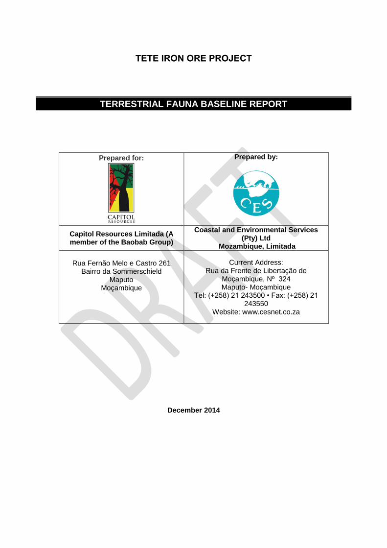
1 TETE IRON ORE PROJECT TERRESTRIAL FAUNA BASELINE REPORT Prepared for: Prepared by: Capitol Resources Limitada (A member of the Baobab Group) Coastal and Environmental Services (Pty) Ltd Mozambique, Limitada Rua Fernão Melo e Castro 261 Bairro da Sommerschield Maputo Moçambique Current Address: Rua da Frente de Libertação de Moçambique, Nº 324 Maputo- Moçambique Tel: (+258) 21 243500 • Fax: (+258) 21 243550 Website: www.cesnet.co.za December 2014
Transcript of TETE IRON ORE PROJECT TERRESTRIAL FAUNA BASELINE REPORT Tete Iron Ore ENGLISH CB127_180115... ·...
1
TETE IRON ORE PROJECT
TERRESTRIAL FAUNA BASELINE REPORT
Prepared for:
Prepared by:
Capitol Resources Limitada (A member of the Baobab Group)
Coastal and Environmental Services (Pty) Ltd
Mozambique, Limitada
Rua Fernão Melo e Castro 261
Bairro da Sommerschield Maputo
Moçambique
Current Address: Rua da Frente de Libertação de
Moçambique, Nº 324 Maputo- Moçambique
Tel: (+258) 21 243500 • Fax: (+258) 21 243550
Website: www.cesnet.co.za
December 2014


Coastal & 3
This Report should be cited as follows: Coastal & Environmental Services Ltd, December 2014: Baobab Resources Terrestrial Fauna Baseline Report, CES, Grahamstown.
CES Report Revision and Tracking Schedule Document Title
Tete Iron ore Project, Tete, Mozambique: Terrestrial Fauna Baseline Report
Client Name & Address
Capitol Resources Lda Rua Fernão Melo e Castro 261 Bairro da Sommerschield Maputo Moçambique
Document Reference
Status
Draft
Issue Date
Lead Author
Mr Michael Bailey
Reviewer
Dr Ted Avis
Study Leader or Registered Environmental Assessment Practitioner Approval
Dr Ted Avis
Report Distribution Circulated to No. of hard copies
No. electronic copies
This document has been prepared in accordance with the scope of Coastal & Environmental Services (CES) appointment and contains intellectual property and proprietary information that is protected by copyright in favour of CES. The document may therefore not be reproduced, used or distributed to any third party without the prior written consent of Coastal & Environmental Services. This document is prepared exclusively for use by CES’s client. CES accepts no liability for any use of this document other than by its client and only for the purposes for which it was prepared. No person other than the client may copy (in whole or in part) use or rely on the contents of this document, without the prior written permission of CES. The document is subject to all confidentiality, copyright and trade secrets rules, intellectual property law and practices of South Africa.
Coastal& Environmental Services 67 African Street
Grahamstown 6140
[email protected] www.cesnet.co.za
Also in Maputo

Terrestrial Fauna Baseline Report –December 2014
Coastal & Environmental Services (Pty) Ltd Baobab Resources (Pty) Ltd i
AUTHORS Michael Bailey Principal Environmental Consultant Michael holds an MSc in Quantitative Conservation Biology from the University of the Witwatersrand Johannesburg), and a BSc in Biology and Ecology from the University of Ulster, and is a Principal Environmental Consultant at CES in Grahamstown. His professional interests include ecological and wildlife conservation, wildlife population surveys and monitoring, project management, ecological planning and mitigation for major development projects, particularly in the mining and renewable energy sectors. Prior to joining CES he was an ecological consultant in the UK and Ireland responsible for consulting on and managing numerous ecological projects for private development clients and Government departments. He has also been involved with environmental business development in UK, Ireland and Africa having owned his own safari business in Zambia. Michael has been involved in designing and conducting various research projects which range from field-based surveys and population monitoring programs to laboratory-based genetic research initiatives. In the last six years Michael has had experience working on the environmental aspects of major development projects in numerous African countries including, South Africa, Zambia, Mozambique, Liberia, Botswana, Uganda and Zimbabwe, as well as extensive project management experience in the UK and Ireland. Nic Davenport, Senior Environmental Consultant. Nic holds a BSc (Env Sci and Zoology), BSc (Hons) and MSc (with distinction) in Environmental Science from Rhodes University. His MSc dealt with valuing the tangible contributions of natural resources to urban households’ livelihoods from the surrounding municipal commonage of three different towns in South Africa. Nic’s experience in the consulting field relates to ecological and land use studies throughout southern Africa, but also incorporates facilitating sustainable development, public participation and budget management. He is also competent with GIS particularly with ArcGIS 9. His interests include natural resource management, ecological studies dealing with indigenous fauna and flora, particularly terrestrial, wetland, and avifaunal studies. Bill Branch, Terrestrial Vertebrate Faunal Consultant Bill Branch obtained B.Sc. and Ph.D. degrees at Southampton University, UK. He was employed for 31 years as the herpetologist at the Port Elizabeth Museum, and now retired holds the honorary post of Curator Emeritus. He has published over 260 scientific articles, as well as numerous popular articles and books. The latter include the Red Data Book for endangered South African reptiles and amphibians (1988), and co-editing its most recent upgrade – the Atlas and Red Data Book of the Reptiles of South Africa, Lesotho and Swaziland (2013). He has also published guides to the reptiles of both Southern and Eastern Africa. He has chaired the IUCN SSC African Reptile Group. He has served as an Honorary Research Professor at the University of Witwatersrand (Johannesburg), and has recently been appointed as a Research Associate at the Nelson Mandela Metropolitan University, Port Elizabeth. His research concentrates on the taxonomy, biogeography and conservation of African reptiles, and he has described over 30 new species. He has extensive field work experience, having worked in over 16 African countries, including Gabon, Ivory Coast, DRC, Zambia, Mozambique, Malawi, Madagascar, Namibia, Angola and Tanzania. His African bird list exceeds 1100 species. Mr Werner Conradie, Herpetologist Port Elizabeth Museum (Bayworld) Werner holds a Masters in Environmental Science (M.Env.Sc), specialising in Herpetology and Zoology in general with 8 years of experience in southern African herpetofauna. Main research interests focus on the taxonomy, conservation and ecology of amphibians and reptiles of southern Africa. Co-author of ‘Field Guide to the Frogs and Toads of the Vredefort Dome World Heritage Site’ and numerous scientific papers. Research expeditions include countries like Namibia, Botswana, Zimbabwe, Mozambique, Angola and Malawi.

Terrestrial Fauna Baseline Report –December 2014
Coastal & Environmental Services (Pty) Ltd Baobab Resources (Pty) Ltd ii
TABLE OF CONTENTS
AUTHORS ....................................................................................................................................... I TABLE OF CONTENTS ................................................................................................................. II LIST OF TABLES .......................................................................................................................... IV LIST OF FIGURES ........................................................................................................................ IV LIST OF PLATES .......................................................................................................................... IV ACRONYMS ................................................................................................................................... V 1. INTRODUCTION ..................................................................................................................... 1
1.1 Objective ......................................................................................................................... 1 1.2 Terms of reference .......................................................................................................... 2 1.3 Assumptions and Limitations ........................................................................................... 2
2. METHODS .............................................................................................................................. 6 2.1 The assessment .............................................................................................................. 6 2.2 Faunal Diversity ............................................................................................................... 6 2.3 Detailed description of sampling methods........................................................................ 7
2.3.1 Site visit ....................................................................................................................... 7 2.3.2 Species of Conservation Concern ................................................................................ 7 2.3.3 Habitat mapping .......................................................................................................... 8
3. BIOPHYSICAL DESCRIPTION OF THE STUDY AREA ......................................................... 9 3.1 Location and general description of the site ..................................................................... 9 3.2 Regional Overview .......................................................................................................... 9
3.2.1 Geology and soils ........................................................................................................ 9 3.2.2 Climate ...................................................................................................................... 11 3.2.3 Topography ............................................................................................................... 11 3.2.4 Hydrology .................................................................................................................. 12 3.2.5 Vegetation ................................................................................................................. 12 3.2.6 Fauna ........................................................................................................................ 14 3.2.7 Land use and human influence .................................................................................. 15
3.3 Protected Areas ............................................................................................................. 16 4. RESULT OF THE VERTEBRATE FAUNAL SURVEYS ....................................................... 18
4.1 Introduction .................................................................................................................... 18 4.2 Amphibians .................................................................................................................... 18
4.2.1 Regional overview of Amphibians .............................................................................. 18 4.2.2 Recorded Amphibians species from the project area ................................................. 19 4.2.3 Amphibian SCC ......................................................................................................... 20 4.2.4 Threats to Amphibians ............................................................................................... 21
4.3 Reptiles ......................................................................................................................... 21 4.3.1 Regional overview of Reptiles .................................................................................... 21 4.3.2 Recorded Reptile species from the project area ........................................................ 21 4.3.3 Reptile SCC ............................................................................................................... 22 4.3.4 Threats to Reptiles ..................................................................................................... 24
4.4 Birds .............................................................................................................................. 25 4.4.1 Regional overview ..................................................................................................... 25 4.4.2 Recorded Bird species from the project area ............................................................. 26 4.4.3 Birds SCC .................................................................................................................. 27 4.4.4 Threats to Birds ......................................................................................................... 29
4.5 Mammals ....................................................................................................................... 29 4.5.1 Regional overview of Mammals ................................................................................. 29 4.5.2 Recorded Mammal species from the project area ...................................................... 30 4.5.3 Mammal SCC ............................................................................................................ 31 4.5.4 Threats to Mammals .................................................................................................. 33
5. HABITAT TYPES IN THE PROJECT AREA ........................................................................ 34 5.1 Vegetation Habitats ....................................................................................................... 34
6. SENSITIVITY ........................................................................................................................ 42 6.2.1 Rivers and drainage lines .......................................................................................... 42 Rocky ridges and outcrops .................................................................................................... 43

Terrestrial Fauna Baseline Report – December 2014
Coastal & Environmental Services (Pty) Ltd Baobab Resources (Pty) Ltd iii
7. KEY FAUNAL ISSUES AND IMPACT STATEMENT ........................................................... 47 7.1 Issue 1 - Loss and fragmentation of sensitive habitats ................................................... 47
7.1.1 Impact 1.1: Loss and fragmentation of Zambezian and mopane woodland habitat .... 48 7.1.2 Impact 1.2: Loss of and fragmentation of Dambo and Riparian habitats .................... 49 7.1.3 Impact 1.3: Loss of hills and associated rocky outcrops ............................................. 51
7.2 Issue 2:Loss of Faunal Diversity .................................................................................... 52 7.2.1 Impact 2.1: Loss of Amphibian Diversity .................................................................... 53 7.2.2 Impact 2.2: Loss of Reptile Diversity .......................................................................... 54 7.2.3 Impact 2.3: Loss of Bird Diversity ............................................................................... 56 7.2.4 Impact 2.4: Loss of Mammal Diversity ....................................................................... 57
7.3 Issue 3: Loss of Species of Conservation Concern ........................................................ 59 7.3.1 Impact 3.1: Loss of Amphibian SCC .......................................................................... 59 7.3.2 Impact 3.2: Loss of Reptile SCC ................................................................................ 59 7.3.3 Impact 3.3: Loss of Bird SCC ..................................................................................... 61 7.3.4 Impact 3.4: Loss of Mammal SCC ............................................................................. 62
7.4 Issue 4: Disruption to faunal movements ....................................................................... 64 7.4.1 Impact 4.1: Disruption of faunal movements .............................................................. 64
7.5 Issue 5: Invasion of Alien Fauna .................................................................................... 65 7.5.1 Impact 5.1: Invasion of alien species ......................................................................... 65
7.6 Issue 6: Increased Fire Risk .......................................................................................... 66 7.6.1 Impact 6.1: Faunal impact from increased fire risk ..................................................... 67
7.7 Issue 7: Pollution ........................................................................................................... 68 7.7.1 Impact 7.1: Chemical pollution ................................................................................... 68 7.7.2 Impact 7.2: Dust pollution .......................................................................................... 70 7.7.3 Impact 7.3: Noise pollution ......................................................................................... 71
7.8 Issue 8: Dangerous Animals .......................................................................................... 72 7.8.1 Impact 8.1: Venomous snakebite ............................................................................... 72 7.8.2 Impact 8.2: Crocodile and Elephant attacks ............................................................... 73
7.2 Issue 9: Faunal Impacts of Power Lines ........................................................................ 74 Impact 9.1: Loss of faunal habitats from power lines ............................................................. 75 Impact 9.2: Increased mortality to birds due to collision with powers lines ............................. 76 Impact 9.3: Increased bird mortality due to electrocution on powers lines ............................. 79 Impact 9.4: Increased faunal mortality (non-bird) on powers lines. ........................................ 81 Impact 9.5: Avoidance of the area by faunal groups due to Coronal discharge...................... 82
8. CONCLUSIONS AND RECOMMENDATIONS ..................................................................... 84 9. REFERENCES...................................................................................................................... 86 APPENDIX 1: LIST OF AMPHIBIAN SPECIES............................................................................ 91 APPENDIX 3: LIST OF BIRD SPECIES ....................................................................................... 98 APPENDIX 4: LIST OF MAMMAL SPECIES ............................................................................. 115

Terrestrial Fauna Baseline Report – December 2014
Coastal & Environmental Services (Pty) Ltd Baobab Resources (Pty) Ltd iv
LIST OF TABLES Table 4.1 All possible and recorded bird SCC for the project area. 27 Table 4.2: Mammals SCC which are likely to occur or have occurred within the project area. 31
LIST OF FIGURES Figure 1.1: Location of the Tete Iron Project .......................................................................................................... 3 Figure 1.2: Conceptual mine layout of the Tete Iron Project. ................................................................................ 4 Figure 3.1: Geology of the Tete Iron Project area................................................................................................ 10 Figure 3.2: Historical mean monthly rainfall in Tete between 1978 and 2013 (Data from National Institute of
Meteorology Provincial Delegation of Meteorology of Tete) ....................................................................... 11 Figure 3.3: General topography and hydrology of the greater Project area. ..................................................... 13 Figure 3.4: WWF Ecoregions highlighting the Zambezian and Mopane Woodlands ........................................ 15 Figure 3.5: Protected areas within Mozambique .................................................................................................. 17 Figure 5-1: Vegetation (habitat) of the Project Area ............................................................................................ 35 Figure 5-2: Vegetation (habitat) of the northern sections of Haul Roads 1, 2, 4, 5, 6 and 7. ........................... 36 Figure 5-3: Vegetation (habitat) of the southern sections of Haul Roads 1, 2, 4 and 5. ................................... 36 Figure 5-4: Vegetation (habitat) of the northern section of Haul Road 3............................................................ 37 Figure 5-5: Vegetation (habitat) of the southern section of Haul Road 3. .......................................................... 37 Figure 6-1: Sensitivity map of the project area ..................................................................................................... 44 Figure 6-2: Sensitivity map of the northern sections of Haul Roads 1, 2, 4, 5, 6 and 7. ................................... 45 Figure 6-3: Sensitivity map of the southern sections of Haul Roads 1, 2, 4, 5,6 and 7. ................................... 45 Figure 6-4: Sensitivity map of the northern section of Haul Road 3. .................................................................. 46 Figure 6-5: Sensitivity map of the southern section of Haul Road 3. ................................................................. 46
LIST OF PLATES Plate 4.1: An array of amphibians which were recorded during the wet season site visit (Photos: W.R.
Branch) 19 Plate 4.2: An array of amphibians which were recorded during the dry season site visit (Photos: W. Conradie)
20 Plate 4.3: An array of reptiles which were recorded during the wet season site visit (Photos: W.R. Branch) 22 Plate 4.4: An array of reptiles which were recorded during the dry season site visit (Photos: W. Conradie) 23 Plate 5.1: Open Zambezian Undifferentiated Woodland 34 Plate 5.2: Ruoni north with Closed Zambezian Undifferentiated Woodland on its summit 38 Plate 5.3: Closed Zambezian Undifferentiated Woodland 38 Plate 5.4: Mopane woodland 39 Plate 5.5: Revuboe River and riparian zone 39 Plate 5.6 Typical reed beds found on site 40 Plate 5.7: Rocky outcrops typically occur on ridges amongst Closed Zambezian Undifferentiated Woodland
40

Terrestrial Fauna Baseline Report – December 2014
Coastal & Environmental Services (Pty) Ltd Baobab Resources (Pty) Ltd v
ACRONYMS
CES Coastal & Environmental Services
CITES Convention on International Trade in Endangered Species
EIA Environmental Impact Assessment
GIS Global Information System
GPS Global Positioning System
IUCN International Union for the Conservation of Nature
SCC Species of Conservation Concern
AIM Alternative Investment Market
PFS Pre-feasibility Study
CR Critically Endangered
EN Endangered
VU Vulnerable
NT Near Threatened
DEM Digital Elevation Model
asl Above sea level
IBA Important Bird Area
LC Least Concern

Terrestrial Fauna Baseline Report –December 2014
Coastal & Environmental Services (Pty) Ltd Baobab Resources (Pty) Ltd 1
1. INTRODUCTION Capitol Resources Limitada (Capitol Resources) is proposing to develop the Tete Iron Project in the Tete Province of Mozambique and is in the process of undertaking a definitive feasibility study (DFS). Capitol Resources is a wholly owned subsidiary of Baobab Resources Plc (Baobab), a Mozambique-focused iron ore, base and precious metal explorer. Baobab has been listed on the Alternative Investment Market (AIM) of London’s Stock Exchange since February 2007. Capitol Resources is a Mozambican company that has assembled a portfolio of 13 exploration licences (two of which are in joint venture with OmegaCorp), covering an area of 220,926 ha throughout the country. The Tete Iron Project is emerging as Capitol Resources’ flagship project. The Capitol Resources Tete Iron Project is located north of the provincial capital of Tete, in the Chiúta and Moatize districts. Mining licences are held for three areas – 1032L, 1033L and 1035L (Figure 1.1) – all of which are 100% owned by Capitol Resources. The first phase of mining activity will occur in the 1035L licence area, and this report relates only to this area. Initially, the focus of the Capitol Resources Tete Iron Project will be an area of magnetite-titanium-vanadium mineralisation known as the Massamba Group, located approximately 45 km north-northeast of Tete. The Tenge-Ruoni deposits are comprised of four areas, Ruoni Flats, Ruoni North, Ruoni South and Tenge, of which the Tenge option is the preferred area to be mined for the next 25 years and is the focus of this report and the subsequent Environmental Social & Health Impact Assessment (ESHIA). Ruoni Flats, Ruoni North, and Ruoni South will remain as expansion areas for future developments. The current Tenge-Ruoni project area is shown in Figure 1.2 and is indicative of the maximum likely extent of direct disturbance, outside of which infrastructure is unlikely to be located. The Revuboe River flows through the mining site and CES understands that no river diversions will be required for the mining of area 1035L but a diversion may be necessary for future developments. The project will require the construction of associated infrastructure such as access roads (haul roads), water course crossing, power lines, processing facilities and workshops, water supply pipelines and accommodation camps. The project area may also extend beyond the existing licence boundaries in terms of access roads and haul route options (see Figure 1.3), and Capitol Resources will aim to require additional land should this be necessary to extend the licence boundaries.
1.1 Objective
To provide a general description of the natural terrestrial fauna of the specific area to be mined, and adjacent areas that will be impacted by the associated mining infrastructure. Two specific areas were assessed: 1. The mining project area 2. The alternative haul-road route options. In addition, the objective of this terrestrial fauna survey is to determine the presence and distribution of species of conservation concern (SCC), as well as determine the likely habitat availability on site for these species.

Terrestrial Fauna Baseline Report – December 2014
Coastal & Environmental Services (Pty) Ltd Baobab Resources (Pty) Ltd 2
1.2 Terms of reference
The following terms of reference were provided for the terrestrial fauna report:
Provide general details of the seasonal, breeding and migration trends for observed during both wet and dry seasons;
Identify and list all species of terrestrial vertebrates occurring in the mining area, based on the literature, published specimens or site records, and likely occurrences;
Record species of fauna identified in the mining area list by: active searching, opportunistic siting and specimen collection;
Provide details of any new species or occurrences;
Assess the habitat preference of fauna and use these habitat preferences to assess the presence and abundance of faunal species;
Identify SCC using reference to the IUCN Red Data List;
Define and map faunal habitats that are sensitive and require conservation. These may need to be defined as No-Go or Restricted Development areas;
Describe current impacts on faunal groups; and,
Identify any impacts that mining will have on the different faunal groups and specific species that would be significantly affected by the mining proposal.
1.3 Assumptions and Limitations
Study specific assumptions and limitations include:
Mozambique has no national Species of Conservation Concern (SCC) lists. Assessment of SCC is thus difficult and must rely on lists prepared in adjacent countries, or on international lists (e.g. IUCN Red Data lists and CITES appendices). The species listed in this report may not be comprehensive, and it is likely that additional SCC may be found during construction and operation of the development.
Time is a constraint in studies such as these and only a sample of the fauna of the area was taken.
Access to the entire site during the wet season survey was limited due to the presence of surface water and inaccessible roads.

Terrestrial Fauna Baseline Report – December 2014
Coastal & Environmental Services (Pty) Ltd Baobab Resources (Pty) Ltd 3
Figure 1.1: Location of the Tete Iron Project

Terrestrial Fauna Baseline Report –December 2014
Coastal & Environmental Services (Pty) Ltd Baobab Resources (Pty) Ltd 4
Figure 1.2: Conceptual mine layout of the Tete Iron Project.

Terrestrial Fauna Baseline Report –December 2014
Coastal & Environmental Services Baobab Resources 5
Figure 1.3: Haul route options for the Tete Iron Project

Terrestrial Fauna Baseline Report – December 2014
Coastal & Environmental Services (Pty) Ltd Baobab Resources (Pty) Ltd 6
2. METHODS
2.1 The assessment
The aim of this assessment is to identify areas of ecological importance and to evaluate these in terms of their conservation importance. In order to do so, the ecological sensitivity of areas is assessed as well as the SCC that may occur in habitats occurring in the area. To a large extent, the condition and sensitivity of the vegetation will also determine the presence of faunal SCC and areas with high faunal biodiversity. It is not the aim of this study to produce a complete list of all animal species occurring in the region, but rather to examine a representative sample. It is however, important to note areas of high sensitivity as well as SCC which may occur within the identified habitats. The aim of this study is to identify areas of high sensitivity and those that may be subject to significant impacts from the project. Aspects that would increase impact significance, in terms of faunal groups, include:
Presence of faunal species of conservation concern.
Faunal habitats of conservation concern.
Areas of high biodiversity.
The presence of process areas: o Ecological corridors o Wetlands (including rivers) o Complex topographical features (especially steep and rocky slopes that provide
niche habitats for both plants and animals)
2.2 Faunal Diversity
The known diversity of the terrestrial fauna in the project area was determined by a literature review. Species known from the region, or from adjacent regions whose preferred habitat(s) were known to occur within the study area, were also included. Literature sources included:
Amphibians – Channing (2001), Pickersgill (2007), Poynton & Broadley (1985-1991), Schiotz (1999), Frost (2012).
Reptiles – Broadley (2000), Branch (1998, 1999, 2008), Branch & Bayliss (2009), Branch & Ryan (2001), Branch & Tolley (2010), Pieteren et al. (2013), Spawls & Branch (1995).
Birds – Sinclair & Ryan (2010) and Lepage (2013).
Mammals – Kingdon (2004). Over and above the literature review, the field methods for compiling the species lists involved the following: Amphibians and reptiles: Visual Encounter Survey method was used for amphibians and reptiles. Visual Encounter Surveys included active searching at day and night, D-netting for tadpoles, and acoustic surveys at night. In addition, an experienced herpetologist identified suitable habitats and searched for certain herpetofauna associated with those habitats. Avifauna: The Visual Encounter Survey strategy was utilised for compiling the avifauna species list. Visual Encounter Surveys included the observations of scats, regurgitated pellets, nests, feathers, bird calls and birds in flight.

Terrestrial Fauna Baseline Report – December 2014
Coastal & Environmental Services (Pty) Ltd Baobab Resources (Pty) Ltd 7
Medium to large sized mammals: “Scats, tracks and traces” observations for terrestrial vertebrates using observations along paths and when walking through the site were noted. The recording of opportunistic sightings was also utilised. In addition, locals were interviewed about the presence or absence of mammals in the project area both currently and historically.
2.3 Detailed description of sampling methods
2.3.1 Site visit
A wet season site visit was carried out from 15-27 March 2013, a dry season survey was carried out from 12-20 September 2013 and a second wet season survey of haul road 6 was carried out from the 10-16 March 2014 During these site visits drive through surveys were made along each of the haul road options in order to establish habitat diversity and condition. An additional road was added after the initial three surveys were completed – Haul Road 7. The haul road option 7 was assessed and added to this report using a combination of a desktop analysis (the majority of this route follows the same route as haul road option 6) and photographs and descriptions collected by an aquatic ecologist who surveyed the area. The authors are confident in their assessment of this route based on the descriptions provided along with the knowledge gathered during the last three site surveys.
2.3.2 Species of Conservation Concern
Species of Conservation Concern (SCC) in terms of the project area are defined as:
Threatened species:
Species included in other international lists (e.g., 2012 IUCN Red List of Threatened Animals). Definitions include:
Critically Endangered (CR) - A taxon is Critically Endangered when the best available evidence indicates that it meets any of the criteria A to E for Critically Endangered (see Section V), and it is therefore considered to be facing an extremely high risk of extinction in the wild.
Endangered (EN) - A taxon is Endangered when the best available evidence indicates that it meets any of the criteria A to E for Endangered (see Section V), and it is therefore considered to be facing a very high risk of extinction in the wild.
Vulnerable (VU) - A taxon is Vulnerable when the best available evidence indicates that it meets any of the criteria A to E for Vulnerable, and it is therefore considered to be facing a high risk of extinction in the wild.
Near Threatened (NT) - A taxon is Near Threatened when it has been evaluated against the criteria but does not qualify for Critically Endangered, Endangered or Vulnerable now, but is close to qualifying for or is likely to qualify for a threatened category in the near future.

Terrestrial Fauna Baseline Report – December 2014
Coastal & Environmental Services (Pty) Ltd Baobab Resources (Pty) Ltd 8
Sensitive species: Species not falling in the categories above but listed in:
Appendix I or II of the Convention of International Trade in Endangered Species (CITES1).
Appendix I lists species that are the most endangered among CITES-listed animals and plants
Appendix II lists species that are not necessarily now threatened with extinction but that may become so unless trade is closely controlled.
Endemic species: Species endemic to the Tete Province or Mozambique in general.
2.3.3 Habitat mapping
Habitats were mapped using visual interpretation of patterns (and photo signatures) from a satellite image, and were related to data gathered on the ground. Ancillary data in the form of a Digital Elevation Model (DEM) and a geology map was also used in some instances to help differentiate between vegetation types.
1 http://www.cites.org/

Terrestrial Fauna Baseline Report – December 2014
Coastal & Environmental Services (Pty) Ltd Baobab Resources (Pty) Ltd 9
3. BIOPHYSICAL DESCRIPTION OF THE STUDY AREA This chapter describes the physical setting of the project area, but does not touch on the terrestrial fauna which is described in detail in the ensuing chapters.
3.1 Location and general description of the site
The study area is located in Tete Province of Mozambique, more specifically in the Chiuta and Moatize districts; approximately 45 km north-northeast of the town of Tete (refer to Figures 1.1 – 1.3). Tete Province is dominated by the upper valley of the Zambezi River and by the reservoir of the Cahora Bassa Dam. The valley is hot and supports semi-arid woodland and savanna. The land rises to a plateau in the north which supports Brachystegia woodland. The region in which the Tenge-Ruoni project is located, is sparsely populated, Tenge Makodwe is the closest human settlement in the area. The project area is situated just south of the Tete plateau, and is predominantly covered by open to dense mixed Zambezian woodlands as well as mopane (Colophospermum mopane) woodland. The Revuboe River runs through the site.
3.2 Regional Overview
Development often has an influence on the environment, which stretches beyond the boundaries of the actual footprint. These influences have the potential to lower the opportunities for other land users on both a regional and local scale, if not effectively managed or considered prior to the onset of a development. Therefore, an environmental overview is provided on a regional scale to highlight the existing environmental potential in the region of the proposed development.
3.2.1 Geology and soils
The geology of the region is characterised by rocks of the Tete Suite, which forms a 6000km2 plateau and stretches approximately 150 km from near Estima in the west, across the Zambezi River, and almost to the border with Malawi in the east. The maximum width of the plateau from north to south is 60 km. The plateau surface is covered by blocks and boulders, and the most common rock types are gabbro, leucogabbro and norite; types of igneous rocks that form when magma under the earth’s surface is trapped and cools. The project area consists mainly of plutonic type Mesoproterozoic geology which consists of Gabbros and subordinate anorthosites. Sedimentary type Paleozoic geology also occurs in the area; this consists of Sandstones, marl, argillite and coal seams (Figure 3.1). Two international soil groups are present within the study area, namely vertisols and calcisols. Vertisols covers the largest portion of the study area, the calcisols occurs along the eastern portion. Vertisols represents dark-coloured cracking and swelling clays, while calcisols represents soils with accumulation of secondary calcium carbonates. It is expected that the soils will vary in depth and texture between the plains and the hills, with the plains containing deeper, finer textured soils and the hills shallower, coarser textured soils. The hills are also sources of microclimate variation and therefore microhabitat.

Terrestrial Fauna Baseline Report – December 2014
Coastal & Environmental Services (Pty) Ltd Baobab Resources (Pty) Ltd 10
Figure 3.1: Geology of the Tete Iron Project area.

Terrestrial Fauna Baseline Report – December 2014
Coastal & Environmental Services (Pty) Ltd Baobab Resources (Pty) Ltd 11
3.2.2 Climate
(Source: http://www.climatedata.eu/climate.php?loc=mzzz0053&lang=en)
The project area is considered to have a tropical savannah climate (www.maputo.climatemps.com) receiving most of its annual 627 mm of rain in the hot summer months (November to March). April to October is typically known as the Dry season (due to the limited amounts of rainfall). Potential flooding in the area is likely to occur between December and February. Historical data shows that the average monthly rainfall is at a maximum of 167 mm in January (Figure 3.2), while rainfall levels as low as 1 mm (August) are experienced during the dry season The average number of rainy/drizzle days in a month for the period of the wet season is approximately 10.5 days (www.myweather2.com). Monthly rainfall for the year 2013 varied between 61 mm and 285 mm for the wet season and between 0 mm and 148 mm for the dry season. There are no distinctive hot and cold months in Tete as temperatures average 27 o C throughout the year. October and November are generally the warmest months with average maximum temperatures of 36o C. In contrast, the coolest months occur between June and August with an average minimum temperature of 18o C. Humidity is highest during the summer months (approximately 68%) and lowest during the cooler months (approximately 47%). The project site does not experience high wind speeds although when the wind does blow it is in a south-easterly direction.
Figure 3.2: Historical mean monthly rainfall in Tete between 1978 and 2013 (Data from National Institute of Meteorology Provincial Delegation of Meteorology of Tete)
3.2.3 Topography
The study area occurs within the 250 to 400 meter altitude range (refer to Figure 1.2 and 3.3); with most of the study area representing plains (slopes < 5°). Large hills (outcrops) are limited in their distribution within the study area. In the northern section of the project area; three hills occur, namely, Tenge (400m asl), Ruoni South (342m asl) and Ruoni North (338m asl).

Terrestrial Fauna Baseline Report – December 2014
Coastal & Environmental Services (Pty) Ltd Baobab Resources (Pty) Ltd 12
3.2.4 Hydrology
The focal river associated with the study area is that of the Revuboe River, which drains southwards through the local area of influence (refer to Figures 1.2 and 3.3Error! Reference source not found.). The Revuboe River is a large, perennial, low gradient, mature system with flood plain reaches. Two smaller drainage lines channel eastwards into the Revuboe River, with the Nhambia River being the largest of the associated drainage lines (Figure 3.3). Well drained soils, in association with heavy storms and high flood events, results in a network of seasonal tributaries flowing into the Revuboe, Nhambia and Mussumbudze rivers. The Revuboe catchment is approximately 15,540 km2 in size, rising on the north bank near Mount Domue’ on the Angonia Plateau (Beilfuss & dos Santos, 2001). This catchment falls in a high rainfall area and receives the majority of its rainfall between December and March. Heavy rainfall events may generate flood peaks of more than 2000 m3/s during wet years (Beilfuss & dos Santos, 2001). The estimated mean annual runoff from the Revuboe catchment is 95 m3/s, with the maximum mean monthly flows occurring during February and March, following the period of peak rainfall over the catchment (Beilfuss, 2005). The average maximum monthly flows are greater than 725 m3/s in February, with the minimum monthly flow occurring at the end of the dry season in October (Beilfuss & dos Santos, 2001). The maximum recorded flood discharge during the period of record was 2375 m3/s with the estimated 20-year return period flood being approximately 1800 m3/s (Beilfuss & dos Santos, 2001).
3.2.5 Vegetation
The provisional checklist of the vascular plants of Mozambique, records 3 932 indigenous plant taxa, of which 177 are endemic and 300 are listed as Red Data species (Da Silva et al. 2004). The study area occurs within the Zambezian and Mopane woodlands (Figure 3.4), which transect tropical and subtropical Grassland, Savanna and Shrubland biomes. It represents one of the World Wide Fund for Nature’s terrestrial ecoregions. This ecoregion is described as follows: ”Zambezian and Mopane Woodlands are dispersed throughout southern Africa, bounded by the Luangwa River in the north and the Pongola River in the south. Mopane tree (Colophospermum mopane) woodlands mix with Zambezian woodlands in lower-elevation areas, often along major river valleys.” The flora of the Zambezian and Mopane Woodlands ecoregion is not characterized by high species diversity throughout its range. While greater plant diversity may occur in the Zambezian woodland component of the ecoregion, the mopane tree characterizes the entire ecoregion, and in many places dominates to the exclusion of other species, particularly trees (White 1983). Other important taxa in the ecoregion are the families Combretaceae and Mimosaceae, which are represented by 34 and 56 tree and shrub species respectively (Coates-Palgrave 1983). Refer to Chapter 5 of this document for more information on vegetation and habitats of the study area.

Terrestrial Fauna Baseline Report – December 2014
Coastal & Environmental Services (Pty) Ltd Baobab Resources (Pty) Ltd 13
Figure 3.3: General topography and hydrology of the greater Project area.

Terrestrial Fauna Baseline Report – December 2014
Coastal & Environmental Services (Pty) Ltd Baobab Resources (Pty) Ltd 14
3.2.6 Fauna
The Zambezian and Mopane Woodlands ecoregion is one of the most important areas for vertebrate diversity in southern Africa, particularly for mammals (The Peace Parks Foundation 2000a, Turpie and Crowe 1994). This includes some of the most significant remaining populations of the critically endangered black rhino, the vulnerable elephant (Hilton-Taylor 2000), as well as the near threatened white rhino (Ceratotherium simum), vulnerable hippopotamus (Hippopotamus amphibius), buffalo (Syncerus caffer), blue wildebeest (Connochaetes taurinus), giraffe (Giraffa camelopardalis), kudu (Tragelaphus strepsiceros), and nyala (Tragelaphus angasii) (Stuart et al. 1990). Although large blocks of this habitat remain, in many areas natural migration routes have been restricted by man-made obstacles. These restrictions on migration have particularly affected the blue wildebeest (White 1989, Stuart et al. 1990, Huntley 1978). The majority of the southern African populations of Lichtenstein’s hartebeest (Alcelaphus lichtensteini) are contained within the Luangwa Valley, Kruger National Park, and Gonarezhou National Park (Stuart et al. 1990). Sharpe’s grysbok (Raphicerus sharpei), a little known, probably rare antelope, is well represented in this ecoregion (East 1998), where it favours dense mopane vegetation (Mills and Hess 1997). Predators are also abundant, and the full assemblage of lion (Panthera leo), cheetah (Acinonyx jubatus), spotted hyena (Crocuta crocuta), and leopard (Panthera pardus) is found in a number of the ecoregion’s large protected areas. The endangered wild dog (Lycaon pictus) is found in significant numbers within the protected areas of the ecoregion (Stuart et al. 1990). Elephant browsing activity and fire are the two major natural factors shaping the vegetation and associated fauna within the Zambezian and Mopane Woodlands (White 1983, Trollope et al. 1998). Elephants crop the larger trees in savannas and woodlands, creating openings exploited by grasses, thus increasing fire frequency and intensity (Smith 1998, White 1983, Trollope et al. 1998). This interplay between fire and elephants normally results in an open, two-tiered savanna, consisting of large trees interspersed with shrubs at varying stages of growth (Trollope et al. 1998).

Terrestrial Fauna Baseline Report – December 2014
Coastal & Environmental Services (Pty) Ltd Baobab Resources (Pty) Ltd 15
Figure 3.4: WWF Ecoregions highlighting the Zambezian and Mopane Woodlands
3.2.7 Land use and human influence
The poor agricultural potential of the region means that the majority of habitats are still relatively

Terrestrial Fauna Baseline Report – December 2014
Coastal & Environmental Services (Pty) Ltd Baobab Resources (Pty) Ltd 16
intact (Huntley 1978). Aside from the southeastern portion of the ecoregion in South Africa and Swaziland, the majority of Zambezian and Mopane Woodlands occur in areas of low human population density (The Peace Parks Foundation 2000a, Murphree 1990). The most widespread threat to the ecoregion is poaching and exploitation of wildlife (Stuart et al. 1990). Black rhino and wild dog are species of special concern. Black rhinos are still threatened by demands for rhino horn products and wild dogs are often destroyed by livestock farmers, who perceive them as pests (Stuart et al. 1990). In many areas of the ecoregion, poaching is rife due to poor levels of protection provided by understaffed local authorities, particularly in Zambia and Mozambique (IUCN 1992). However, great efforts have been made in the past few years to rejuvenate and expand many of Mozambique’s protected areas (The Peace Parks Foundation 2000a), so an improvement in the quality of wildlife protection is likely. Land transformation and degradation through agriculture, settlement and livestock grazing poses some threat to the Ecoregion (Els 1996) and where large-scale agricultural plans have been introduced (Peel & Stalmans 1999).The Zambezi Valley portion of the ecoregion in Mozambique may also be at risk from the steady influx of people and development as stability returns following the civil war. Illegal livestock grazing, settlement in protected areas, and uncontrolled bush fires are all threats to the ecoregion (IUCN 1992), as well as the overuse of natural resources exacerbated by declining economies (NESDA 2000). Invasive alien plants are posing an increasing threat to the ecoregion. Among the more prolific invaders are the shrub and tree species Lantana camara and Melia azederach, cactii of the genus Opuntia, and the water weeds Salvinia molesta and Eichornia crassipes. Invasive plants are supplanting indigenous vegetation and destroying faunal habitats, as well as altering hydrological and nutrient cycles (IUCN 1997/1998).
3.3 Protected Areas
The Zambezian and Mopane Woodlands enjoy a healthy conservation status. The abundance of wildlife can be largely attributed to the high level of protection in the ecoregion, in which more than 45 percent of the habitat is devoted to various forms of state and private conservation (refer to Figure 3.4 and 3.5). Two cross-border conservation efforts are set to further increase the extent of protected lands in the near future. The agricultural marginality of the Zambezian and Mopane Woodlands and the large attendant mammal populations has encouraged the establishment of an extensive protected area network in the ecoregion (Huntley 1978). Government conservation areas protect over 40 percent of the ecoregion with private game ranches, nature reserves and conservancies in South Africa, Zimbabwe, and Botswana adding a further 5 to 10 percent to the total area conserved. The most significant national parks are Kruger in South Africa, Gonarezhou in Zimbabwe, and Banhine, Gorongosa, and Zinave National Parks in Mozambique. These parks cover much of the large southeastern portion of the Ecoregion (Figure 3.4).” Figure 3.5 indicates the protected area network within Mozambique. The Tete region does not have any protected areas.

Terrestrial Fauna Baseline Report – December 2014
Coastal & Environmental Services (Pty) Ltd Baobab Resources (Pty) Ltd 17
Figure 3.5: Protected areas within Mozambique