Scientific Literacy with Webapps in Middle Schools in ...€¦ · teachers, who can use them for...
16
Scientific literacy with webapps in middle schools in Alfenas, Brazil Prof. Clibson A. Santos, Dr. UNIFAL-MG – FEDERAL UNIVERSITY OF ALFENAS (BRAZIL).
Transcript of Scientific Literacy with Webapps in Middle Schools in ...€¦ · teachers, who can use them for...
Scientific literacy with webapps in middle schools in Alfenas,
Brazil
Prof. Clibson A. Santos, Dr.
UNIFAL-MG – FEDERAL UNIVERSITY OF ALFENAS (BRAZIL).
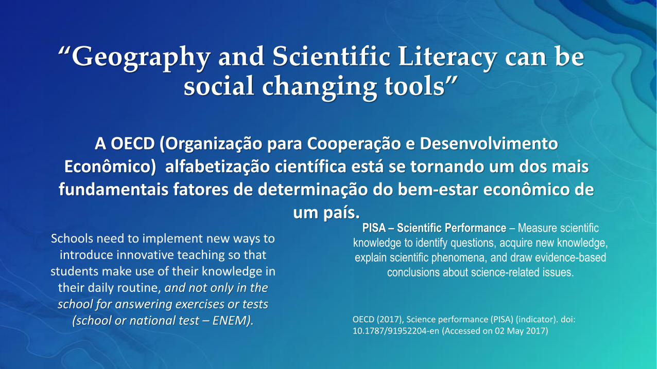
A OECD (Organização para Cooperação e Desenvolvimento Econômico) alfabetização científica está se tornando um dos mais
fundamentais fatores de determinação do bem-estar econômico de um país.
Schools need to implement new ways to introduce innovative teaching so that
students make use of their knowledge in their daily routine, and not only in the school for answering exercises or tests
(school or national test – ENEM).
“Geography and Scientific Literacy can be social changing tools”
PISA – Scientific Performance – Measure scientific
knowledge to identify questions, acquire new knowledge,
explain scientific phenomena, and draw evidence-based
conclusions about science-related issues.
OECD (2017), Science performance (PISA) (indicator). doi: 10.1787/91952204-en (Accessed on 02 May 2017)
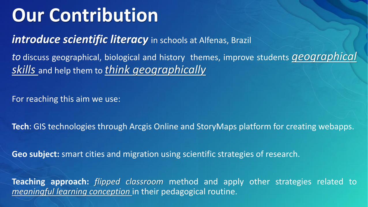
Our Contributionintroduce scientific literacy in schools at Alfenas, Brazil
to discuss geographical, biological and history themes, improve students geographicalskills and help them to think geographically
For reaching this aim we use:
Tech: GIS technologies through Arcgis Online and StoryMaps platform for creating webapps.
Geo subject: smart cities and migration using scientific strategies of research.
Teaching approach: flipped classroom method and apply other strategies related tomeaningful learning conception in their pedagogical routine.
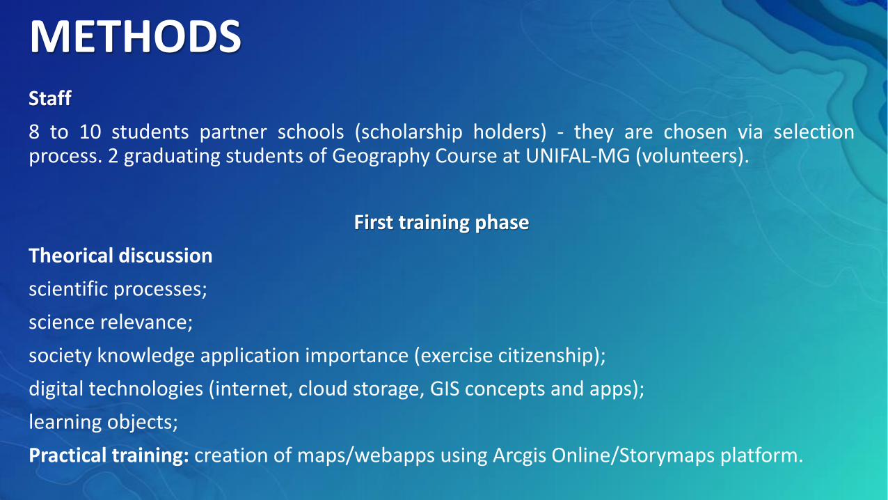
METHODSStaff
8 to 10 students partner schools (scholarship holders) - they are chosen via selectionprocess. 2 graduating students of Geography Course at UNIFAL-MG (volunteers).
First training phase
Theorical discussion
scientific processes;
science relevance;
society knowledge application importance (exercise citizenship);
digital technologies (internet, cloud storage, GIS concepts and apps);
learning objects;
Practical training: creation of maps/webapps using Arcgis Online/Storymaps platform.
METHODSWebapp creation – first stage
(I) discuss and define priorities within Geography, History and Biology subjects.
Criterion of this discussion:
Which subjects could be represented through webapps?
How these subjects could improve the understanding of the themes approached?
Could it be used via meaningful learning concepts?
METHODSWebapp creation – second stage
(II) research process: internet search on scientific basis data (scientific magazines,governmental public data, among others), libraries, fieldworks (regional context) andArcgis Online library maps.
Criterion of this search:
introduce new information and improve/increase possibilities of debates in classroom;
global to local context;
fieldwork to analyze and introduce local data into webapps.
Types of data: texts, figures, graphics, video lessons and documentaries pertaining thesubjects.
METHODSWebapp creation – third stage
(III) GIS Lab students create maps and produce webapp using Arcgis Online orStorymaps platform.
Criterion of this content:
All webapps produced must have texts, figures, videos, maps as they will supportdiscussion in the classroom through interactive features on a single digital platform.
METHODSWebapp creation – fourth stage
(IV) Finally, webapps can be shared on social media and forwarded to partner schoolteachers, who can use them for discussions in the class through flipped classroom methodor define other application methods.
Moreover, the apps are showcased in science fairs, GIS Day events and in specific lessons inthe schools.
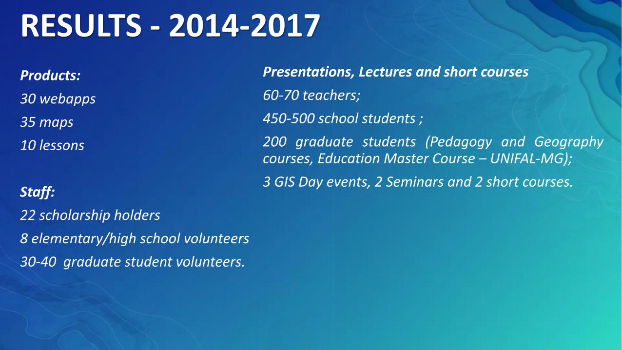
RESULTS - 2014-2017
Products:
30 webapps
35 maps
10 lessons
Staff:
22 scholarship holders
8 elementary/high school volunteers
30-40 graduate student volunteers.
Presentations, Lectures and short courses
60-70 teachers;
450-500 school students ;
200 graduate students (Pedagogy and Geographycourses, Education Master Course – UNIFAL-MG);
3 GIS Day events, 2 Seminars and 2 short courses.
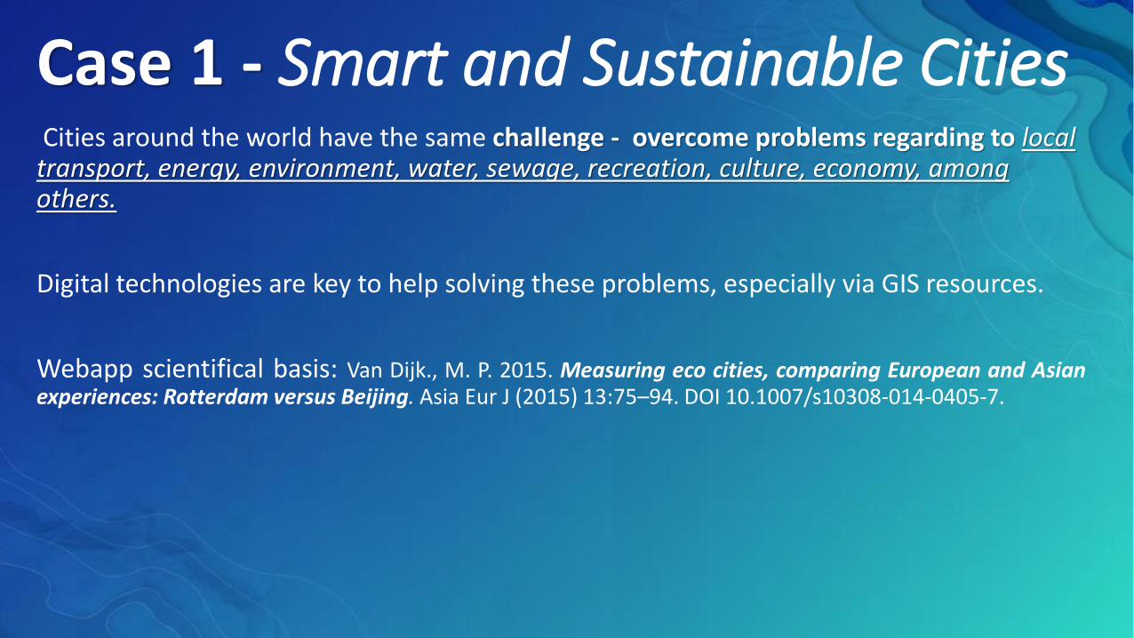
Case 1 - Smart and Sustainable CitiesCities around the world have the same challenge - overcome problems regarding to local transport, energy, environment, water, sewage, recreation, culture, economy, among others.
Digital technologies are key to help solving these problems, especially via GIS resources.
Webapp scientifical basis: Van Dijk., M. P. 2015. Measuring eco cities, comparing European and Asianexperiences: Rotterdam versus Beijing. Asia Eur J (2015) 13:75–94. DOI 10.1007/s10308-014-0405-7.
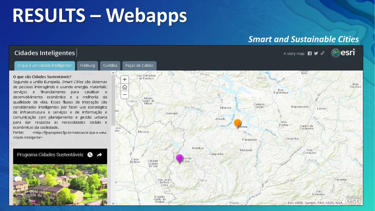
RESULTS – WebappsSmart and Sustainable Cities
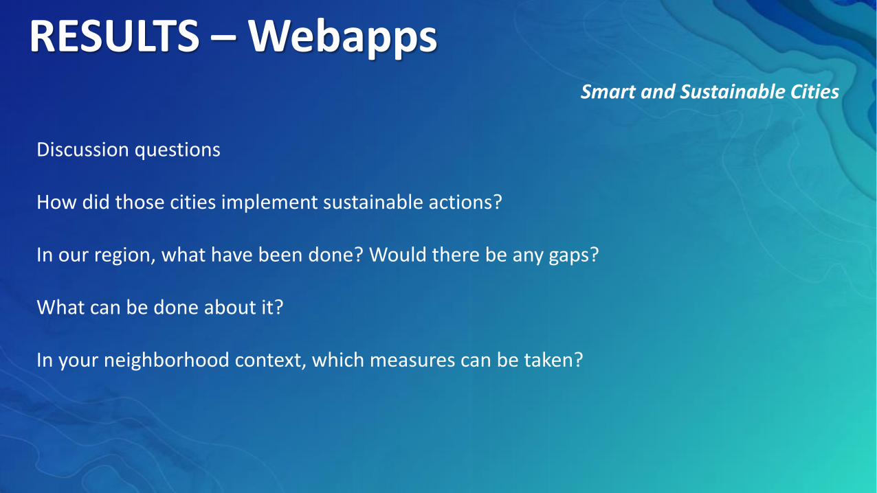
RESULTS – WebappsSmart and Sustainable Cities
Discussion questions
How did those cities implement sustainable actions?
In our region, what have been done? Would there be any gaps?
What can be done about it?
In your neighborhood context, which measures can be taken?
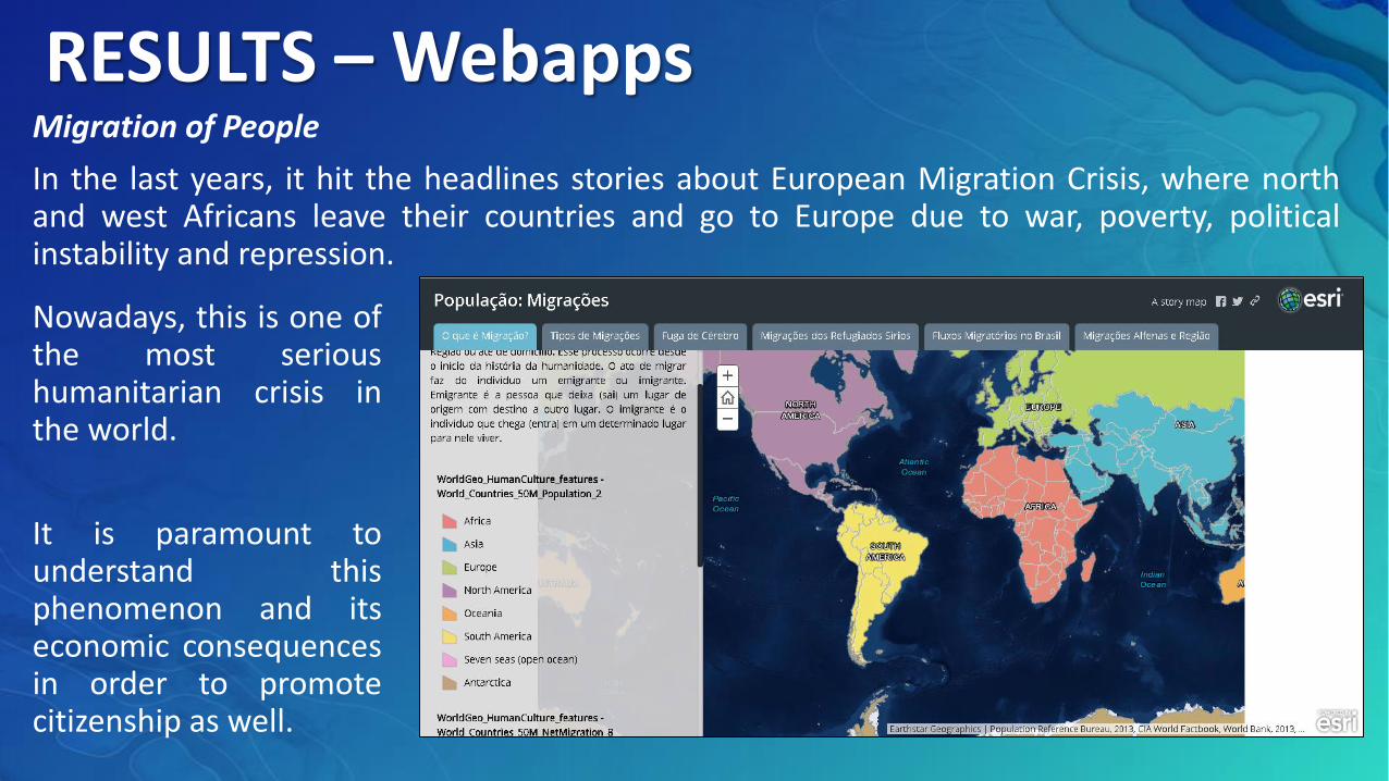
RESULTS – WebappsMigration of People
In the last years, it hit the headlines stories about European Migration Crisis, where northand west Africans leave their countries and go to Europe due to war, poverty, politicalinstability and repression.
Nowadays, this is one ofthe most serioushumanitarian crisis inthe world.
It is paramount tounderstand thisphenomenon and itseconomic consequencesin order to promotecitizenship as well.
RESULTS – WebappsMigration of People webapp
Discussion questions:
What types of migration are observed in Alfenas region?
What are the consequences?
Are these consequences positive or negative?
Which decisions do public authorities need to make?
CONCLUSION
These Initiatives aim to broaden students’ views regarding the local/regionalsituation, identifying Geography as a science that can support theirunderstanding, and troubleshooting for experienced daily situations.
The technologies used, in special Arcgis Online platform and social media,brought learning closer to the students lives.
The webapps produced have texts, figures, videos, maps as they will supportdiscussion in the classroom through interactive features on a single digitalplatform.
From this perspective, the educational process is more contextualized to thereality, more engaging, interesting as it strengthens important principles inthe learning process, such as autonomy and commitment to citizenship.
Thanks in advance!!!