PORTUGAL GUIDE Caminhos de Santiago...journey to Santiago de Com-postela on foot, a unique, larger...
195
Caminhos de Santiago Alentejo e Ribatejo GUIDE Alentejo e Ribatejo www.caminhosdesantiagoalentejoribatejo.pt www.visitalentejo.pt | www.visitribatejo.pt | www.visitportugal.com Central Way Eastern Way PORTUGAL
Transcript of PORTUGAL GUIDE Caminhos de Santiago...journey to Santiago de Com-postela on foot, a unique, larger...
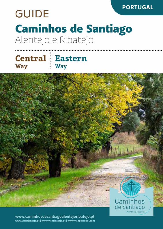
Caminhos de Santiago Alentejo e Ribatejo
GUIDE
Alentejo e Ribatejo
www.caminhosdesantiagoalentejoribatejo.ptwww.visitalentejo.pt | www.visitribatejo.pt | www.visitportugal.com
Central Way
Eastern Way
PORTUGAL
TECHNICAL FILE
© Entidade Regional de Turismo do Alentejo e Ribatejo, 2019
Texts: Guess What – Comunicação Lda., Paulo Almeida Fernandes, Paulo CavaleiroProofreading: Mariana Vaz-FreirePhotography: Miguel Proença, Paulo CavaleiroTechnical Consultancy: Upstream – Valorização do Território, Lda.Edition, graphic conception and pagination: Guess What – Comunicação Lda., Paulo MedeirosPrinting and finishing: Ondagrafe – Artes Gráficas, Lda.Circulation: 2.500 copies
All rights reserved. No part of this book may be reproduced in any form (electronic, mechanical, photocopying, etc.) without the prior written permission of Entidade Regional de Turismo do Alentejo e Ribatejo.
www.visitalentejo.pt | www.visitribatejo.pt | www.visitportugal.comwww.caminhosdesantiagoalentejoribatejo.pt
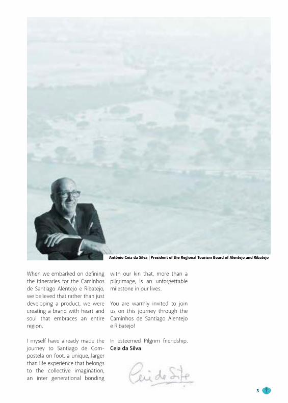
When we embarked on defining the itineraries for the Caminhos de Santiago Alentejo e Ribatejo, we believed that rather than just developing a product, we were creating a brand with heart and soul that embraces an entire region.
I myself have already made the journey to Santiago de Com-postela on foot, a unique, larger than life experience that belongs to the collective imagination, an inter generational bonding
with our kin that, more than a pilgrimage, is an unforgettable milestone in our lives.
You are warmly invited to join us on this journey through the Caminhos de Santiago Alentejo e Ribatejo!
In esteemed Pilgrim friendship. Ceia da Silva
António Ceia da Silva | President of the Regional Tourism Board of Alentejo and Ribatejo
3
Index
The Order of Santiago
Alentejo and Ribatejo
Caminhos de Santiago − Alentejo e Ribatejo
Before leaving
Central Way
Stage 1 − Ameixial (Algarve) > Santa Cruz
Stage 2 − Santa Cruz > Almodôvar
Stage 3 − Almodôvar > Castro Verde
Stage 4 − Castro Verde > Messejana
Stage 5 − Messejana > Fornalhas Velhas
Stage 6 − Fornalhas Velhas > São Domingos
Stage 7 − São Domingos > Santiago do Cacém
Stage 8 − Santiago do Cacém > Roncão
Stage 9 − Roncão > Grândola
Stage 10 − Grândola > Alcácer do Sal
Stage 11 − Alcácer do Sal > Casebres
Stage 12 − Casebres > Vendas Novas
Stage 13 − Vendas Novas > Branca
Stage 14 − Branca > Santo Estêvão
Stage 15 − Santo Estêvão > Samora Correia > Benavente
Stage 16 − Benavente > Muge
Stage 17 − Muge > Santarém
Stage 18 − Santarém > Golegã
Stage 19 − Golegã > Tomar (Center)
6
10
12
24
29
31
35
39
43
47
51
55
59
63
67
71
75
79
83
87
91
95
99
103
Central Way − via Tagus
Stage 1 − Vila Franca de Xira (Lisboa) > Azambuja
Stage 2 − Azambuja > Santarém
Eastern Way
Stage 1 − Alcoutim (Algarve) > Mesquita
Stage 2 − Mesquita > Mértola
Stage 3 − Mértola > Amendoeira da Serra
Stage 4 − Amendoeira da Serra > Cabeça Gorda
Stage 5 − Cabeça Gorda > Beja
Stage 6 − Beja > Cuba
Stage 7 − Cuba > Alvito > Viana do Alentejo
Stage 8 − Viana do Alentejo > Évora
Stage 9 − Évora > São Miguel de Machede
Stage 10 − São Miguel de Machede > Evoramonte
Stage 11 − Evoramonte > Estremoz
Stage 12 − Estremoz > Sousel
Stage 13 − Sousel > Fronteira
Stage 14 − Fronteira > Cabeço de Vide
Stage 15 − Cabeço de Vide > Alter do Chão
Stage 16 − Alter do Chão > Crato
Stage 17 − Crato > Alpalhão
Stage 18 − Alpalhão > Nisa
Stage 19 − Nisa > Vila Velha de Ródão (Center)
107
109
113
117
119
123
127
131
135
139
143
147
151
155
159
163
167
171
175
179
183
187
191
The Order of Santiago
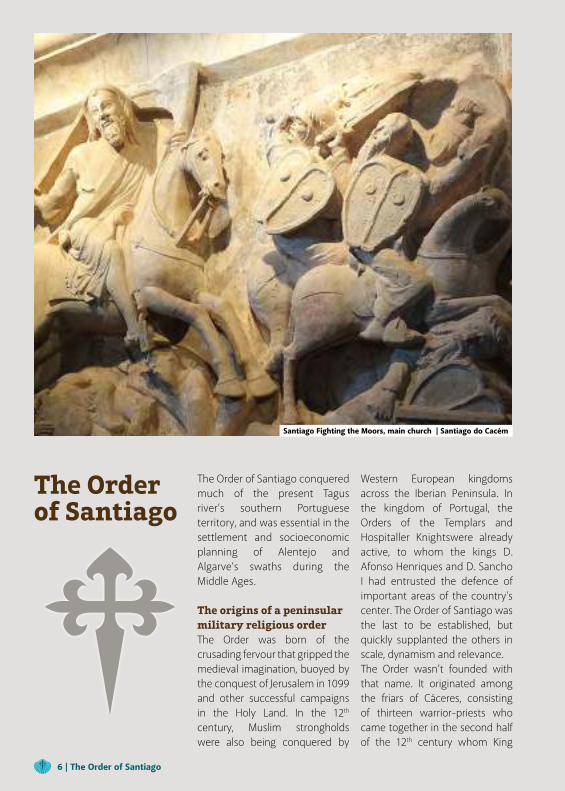
The Order of Santiago conquered much of the present Tagus river’s southern Portuguese territory, and was essential in the settlement and socioeconomic planning of Alentejo and Algarve’s swaths during the Middle Ages.
The origins of a peninsularmilitary religious orderThe Order was born of the crusading fervour that gripped the medieval imagination, buoyed by the conquest of Jerusalem in 1099 and other successful campaigns in the Holy Land. In the 12th century, Muslim strongholds were also being conquered by
Western European kingdoms across the Iberian Peninsula. In the kingdom of Portugal, the Orders of the Templars and Hospitaller Knightswere already active, to whom the kings D. Afonso Henriques and D. Sancho I had entrusted the defence of important areas of the country's center. The Order of Santiago was the last to be established, but quickly supplanted the others in scale, dynamism and relevance.The Order wasn’t founded with that name. It originated among the friars of Cáceres, consisting of thirteen warrior-priests who came together in the second half of the 12th century whom King
Santiago Fighting the Moors, main church | Santiago do Cacém
6 | The Order of Santiago
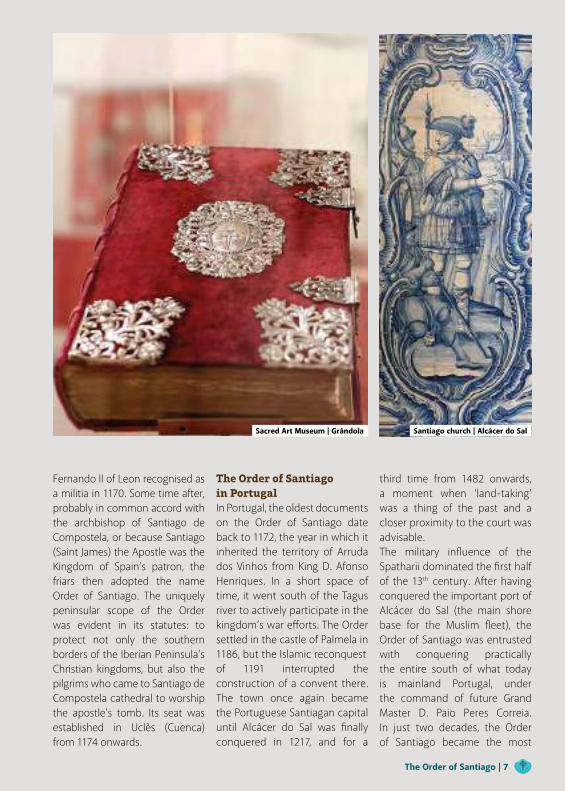
Fernando II of Leon recognised as a militia in 1170. Some time after, probably in common accord with the archbishop of Santiago de Compostela, or because Santiago (Saint James) the Apostle was the Kingdom of Spain’s patron, the friars then adopted the name Order of Santiago. The uniquely peninsular scope of the Order was evident in its statutes: to protect not only the southern borders of the Iberian Peninsula’s Christian kingdoms, but also the pilgrims who came to Santiago de Compostela cathedral to worship the apostle’s tomb. Its seat was established in Uclès (Cuenca) from 1174 onwards.
The Order of Santiagoin PortugalIn Portugal, the oldest documents on the Order of Santiago date back to 1172, the year in which it inherited the territory of Arruda dos Vinhos from King D. Afonso Henriques. In a short space of time, it went south of the Tagus river to actively participate in the kingdom’s war efforts. The Order settled in the castle of Palmela in 1186, but the Islamic reconquestof 1191 interrupted the construction of a convent there. The town once again became the Portuguese Santiagan capital until Alcácer do Sal was finally conquered in 1217, and for a
third time from 1482 onwards, a moment when ‘land-taking’ was a thing of the past and a closer proximity to the court was advisable.The military influence of the Spatharii dominated the first half of the 13th century. After having conquered the important port of Alcácer do Sal (the main shore base for the Muslim fleet), the Order of Santiago was entrusted with conquering practically the entire south of what today is mainland Portugal, under the command of future Grand Master D. Paio Peres Correia. In just two decades, the Order of Santiago became the most
Sacred Art Museum | Grândola Santiago church | Alcácer do Sal
The Order of Santiago | 7
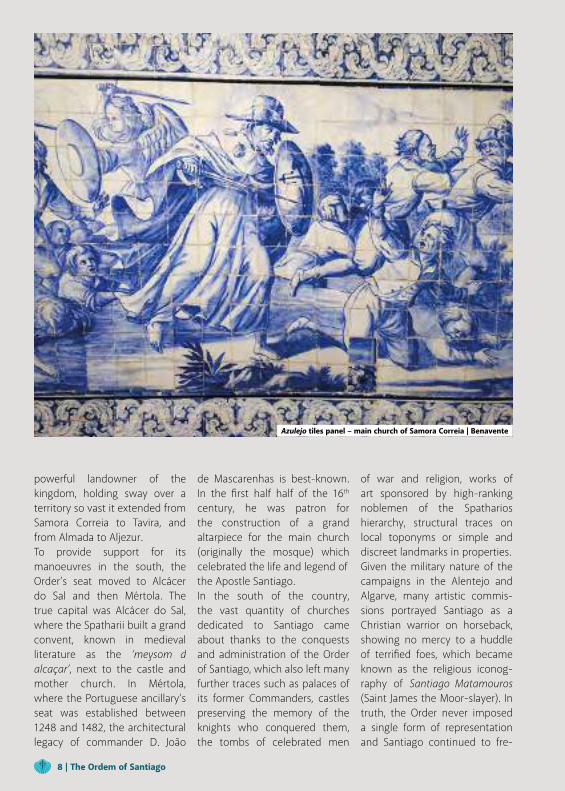
powerful landowner of the kingdom, holding sway over a territory so vast it extended from Samora Correia to Tavira, and from Almada to Aljezur.To provide support for its manoeuvres in the south, the Order’s seat moved to Alcácer do Sal and then Mértola. The true capital was Alcácer do Sal, where the Spatharii built a grand convent, known in medieval literature as the ‘meysom d alcaçar’, next to the castle and mother church. In Mértola, where the Portuguese ancillary’s seat was established between 1248 and 1482, the architectural legacy of commander D. João
de Mascarenhas is best-known. In the first half half of the 16th century, he was patron for the construction of a grand altarpiece for the main church (originally the mosque) which celebrated the life and legend ofthe Apostle Santiago.In the south of the country, the vast quantity of churches dedicated to Santiago came about thanks to the conquests and administration of the Order of Santiago, which also left many further traces such as palaces of its former Commanders, castles preserving the memory of the knights who conquered them, the tombs of celebrated men
of war and religion, works of art sponsored by high-ranking noblemen of the Spatharios hierarchy, structural traces on local toponyms or simple and discreet landmarks in properties.Given the military nature of the campaigns in the Alentejo and Algarve, many artistic commis-sions portrayed Santiago as a Christian warrior on horseback, showing no mercy to a huddle of terrified foes, which became known as the religious iconog-raphy of Santiago Matamouros (Saint James the Moor-slayer). In truth, the Order never imposed a single form of representation and Santiago continued to fre-
Azulejo tiles panel – main church of Samora Correia | Benavente
8 | The Ordem of Santiago
quently be represented as a pil-grim and apostle, with the south of the country revealing the most complete narratives on its life in azulejo (tile) panel.
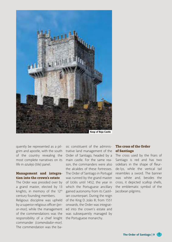
Management and integra-tion into the crown’s estateThe Order was presided over by a grand master, elected by 13 knights, in memory of the 12th century founding members.Religious discipline was upheld by a superior religious officer (pri-or-mor), while the management of the commendations was the responsibility of a chief knight commander (comendador-mor). The commendation was the ba-
sic constituent of the adminis-trative land management of the Order of Santiago, headed by a main castle. For the same rea-son, the commanders were also the alcaldes of these fortresses. The Order of Santiago in Portugal was runned by the grand master of Uclès until 1452, the year in which the Portuguese ancillary gained autonomy from its Castil-ian counterpart. During the reign of the King D. João III, from 1551 onwards, the Order was integrat-ed into the crown’s estate and was subsequently managed by the Portuguese monarchy.
The cross of the Orderof SantiagoThe cross used by the friars of Santiago is red and has two sidebars in the shape of fleur-de-lys, while the vertical tail resembles a sword. The banner was white and, besides the cross, it depicted scallop shells, the emblematic symbol of the Jacobean pilgrims.
Keep of Beja Castle
The Order of Santiago | 9
Alentejo andRibatejoEnjoy all their intimate charms at Nature’s pace.
The Caminhos de Santiago Alentejo e Ribatejo cross two very distinct territories: different in their customs and traditions, in the way their peoples live, in the colours of their landscapes and the experiences they offer. Although they may differ, they share a distinctive genuineness that makes them unique and differentiates them from all others that help define the country’s borders. To travel these Caminhos is to enjoy all their charms at nature’s pace.
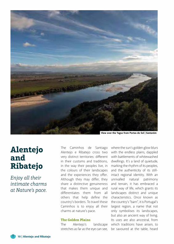
The Golden PlainsThe Alentejo’s landscape stretches as far as the eye can see,
where the sun’s golden glow blurs with the endless plains, dappled with battlements of whitewashed dwellings. It’s a land of quietude, marking the rhythm of its peoples, and the authenticity of its still-intact regional identity. With an unrivalled natural patrimony and terrain, it has embraced a rural way of life, which grants its landscapes distinct and unique characteristics. Once known as the country’s “barn”, it is Portugal’s largest region, a name that not only symbolises its landscapes, but also an ancient way of living. Its uses are also ancestral, from which traditions have arisen, to be savoured at the table, heard
View over the Tagus from Portas do Sol | Santarém
10 | Alentejo and Ribatejo
in the Cante Alentejano, seen in its monuments, its ceramics and tapestries, and celebrated in festivals and religious processions. All of which can be taken home in the form of outstanding products: the richness of the olive grove transformed into exceptional olive oils, the richness of the pastries that satisfy the gluttony, the honey, the smoked ham…
The green of the ‘Lezírias’The plains become lezírias - marshlands of the Ribatejo, expanses of green where once golds reigned. A region that many still refer to as ‘Beira do Tejo’ (Banks of the Tagus) or ‘Borda d’Água’
(River’s Edge), for having the Tagus river as its neighbour, the river that crosses and weaves through, making its lands fertile and a constant source of inspiration. Besides the marshes there are moorlands, rice fields that the Tagus bathes more thoroughly, and the neighborhoods, with their golden grains. The lushness of the meadows provide nourishment for livestock and a stage for the ‘merry dance’ of herds of wild bulls and horses. A region with a culture marked by its traditional costume and by its dances, such as the fandango, already popular on the 18th century among nobles and commoners in fairs
and festivals. In the Ribatejo version it is danced to the sound of accordions, fifes, mouthorgans, harmoniums and clarinets. The figure of the ‘Campino’ (cattle helder) reigned, dressed in a red waistcoat and green cap. Its cultural heritage includes the azulejo tile work, panels of vibrant colour that represent five centuries of history and adorn both exteriors and interiors; the rustic bread, the tomato and the rice, ingredients of a unique cuisine, the art of basketry and the coopers’ woodworking, which symbolise the union between Man and Nature.
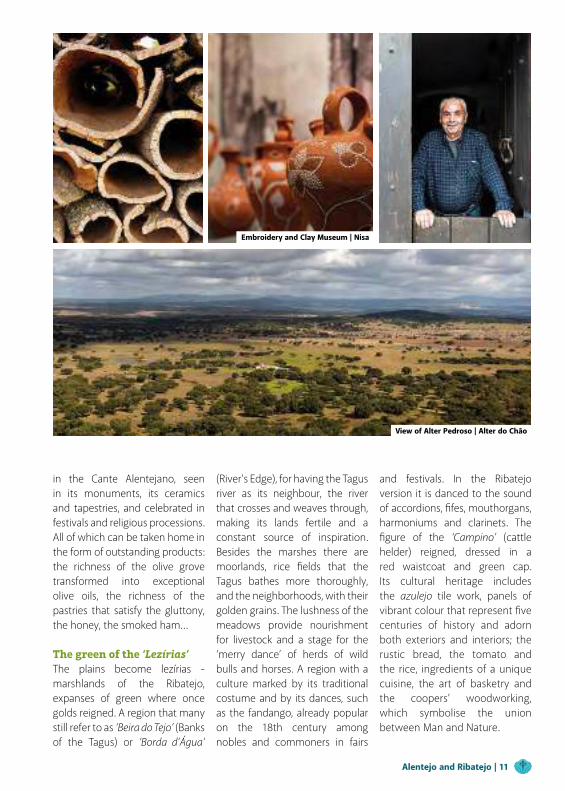
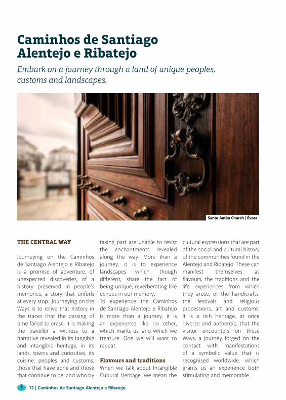
Embroidery and Clay Museum | Nisa
View of Alter Pedroso | Alter do Chão
Alentejo and Ribatejo | 11
Caminhos de SantiagoAlentejo e RibatejoEmbark on a journey through a land of unique peoples, customs and landscapes.
THE CENTRAL WAY
Journeying on the Caminhos de Santiago Alentejo e Ribatejo is a promise of adventure, of unexpected discoveries, of a history preserved in people’s memories, a story that unfurls at every stop. Journeying on the Ways is to relive that history in the traces that the passing of time failed to erase, it is making the traveller a witness to a narrative revealed in its tangible and intangible heritage, in its lands, towns and curiosities, its cuisine, peoples and customs, those that have gone and those that continue to be, and who by
taking part are unable to resist the enchantments revealed along the way. More than a journey, it is to experience landscapes which, though different, share the fact of being unique, reverberating like echoes in our memory.To experience the Caminhos de Santiago Alentejo e Ribatejo is more than a journey, it is an experience like no other, which marks us, and which we treasure. One we will want to repeat.
Flavours and traditionsWhen we talk about Intangible Cultural Heritage, we mean the
cultural expressions that are part of the social and cultural history of the communities found in the Alentejo and Ribatejo. These canmanifest themselves as flavours, the traditions and the life experiences from which they arose, or the handicrafts, the festivals and religious processions, art and customs. It is a rich heritage, at once diverse and authentic, that the visitor encounters on these Ways, a journey forged on the contact with manifestations of a symbolic value that is recognised worldwide, which grants us an experience both stimulating and memorable.
Santo Antão Church | Évora
12 | Caminhos de Santiago Alentejo e Ribatejo
The Alentejo and Ribatejo’s intangible cultural heritage has on four separate occasions been recognised by UNESCO, which included them on a comprehensive list of Intangible Cultural Heritage of Humanity, that travellers can see for themselves by taking these Ways.Such as ‘Cante Alentejano’, the traditional Alentejo song, which needs no introduction. A kind of musical expression which, more than simply music, is a sharing of feelings, from nostalgic saudade (missing something or someone) to love, where irony and humour are also present, and where voices come together in
melancholic harmony, drawing in all those who listen.Found across almost the entire Alentejo, this art form is most typical of the districts of Serpa and Beja.
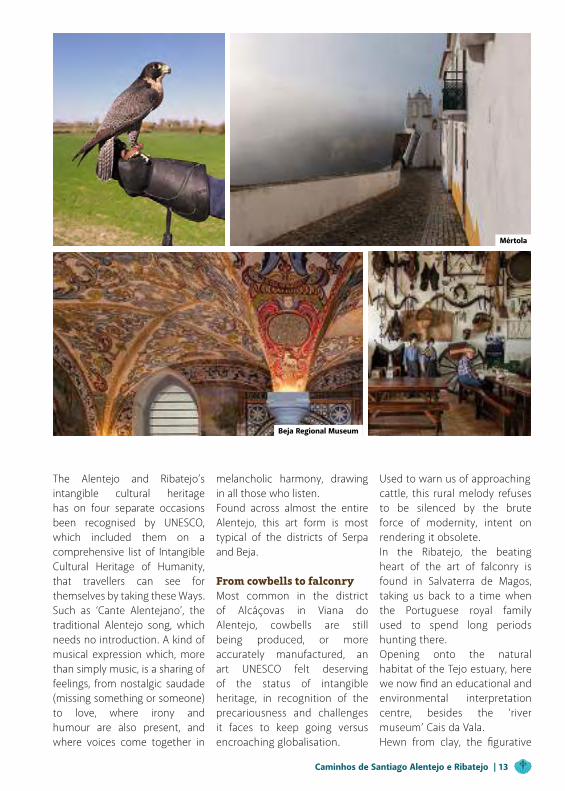
From cowbells to falconryMost common in the district of Alcáçovas in Viana do Alentejo, cowbells are still being produced, or more accurately manufactured, an art UNESCO felt deserving of the status of intangible heritage, in recognition of the precariousness and challenges it faces to keep going versus encroaching globalisation.
Used to warn us of approachingcattle, this rural melody refuses to be silenced by the brute force of modernity, intent on rendering it obsolete.In the Ribatejo, the beating heart of the art of falconry is found in Salvaterra de Magos, taking us back to a time when the Portuguese royal family used to spend long periods hunting there.Opening onto the natural habitat of the Tejo estuary, here we now find an educational and environmental interpretation centre, besides the ‘river museum’ Cais da Vala.Hewn from clay, the figurative
Mértola
Beja Regional Museum
Caminhos de Santiago Alentejo e Ribatejo | 13
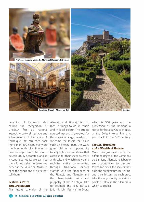
ceramics of Estremoz also earned the recognition of UNESCO first as national intangible cultural heritage and subsequently of Humanity. A technique that stretches back more than 300 years, many are the handmade clay figures to have emerged from the kiln to be colourfully decorated, and so it continues today. We can see them for ourselves in Estremoz, either at the Municipal Museum or at the shops and ateliers that sell them.
Festivals, Fairs and ProcessionsThe festive calendar of the
Alentejo and Ribatejo is rich. Rich in things to do, in music and in local colour. The streets spruced up and decorated for the occasion, stages readied to welcome the music that plays such an integral part, the Ways grant visitors an opportunity to enjoy festive traditions that astonish for their sheer diversityand scale, and which involve and mobilise entire communities, through traditional dances starting with the fandangos of the Ribatejo and Alentejo, and the characteristic skirts and puppetry of the Alentejo. Take for example the Feira de São João (St John Festival) in Évora,
which is 500 years old, the procession of the Romaria a Nossa Senhora da Graça in Nisa, or the Golegã Horse Fair that goes back to the 16th century.
Castles, Museums and a Wealth of NatureMore than just rest stops, the different stages of the Caminhos de Santiago Alentejo e Ribatejo are opportunities to discover towns and cities, the secrets they hide, the architecture, museumsand their history. At each stop, take the opportunity to visit its points of interest. The dilemma is which to choose.
Professor Joaquim Vermelho Municipal Museum, Estremoz
Santiago Church | Alcácer do Sal Marvão
14 | Caminhos de Santiago Alentejo e Ribatejo
No Alentejo The Central Way passes through Santa Cruz, where the Parish Church, built in the 16th century, is home to a rather unusual icon of Jesus in the Garden, where one can see represented the sweat turning into blood. Further ahead, in the medieval town of Almodôvar, the riverine landscape invites us to savour the crystal-clear waters of Ribeira do Vascão, stream located within the Special Protected Area of the Guadiana valley, dotted with watermills and weirs. If you pay close attention, with a little luck you may spot a few rare wildlife
specimens.In the town, the Museum of Southern Writing (Escrita do Sudoeste) reveals to us the immense archaeological richnessof the district and, in particular, the singular destiny of a people which invented its own written language between the 7th and 5th centuries BC.Because the Ways to Santiago are much more than simply hiking trips, the dam of Campilhas, built in 1954 in Santiago de Cacém, offers the chance to try out all kinds of non-motorised water sports and recreational fishing.
The Way continues, passing through Alcácer do Sal, which has one of the most important examples of Renaissance architecture in the country: Capela das Onze Mil Virgens (the Chapel of the Eleven Thousand Virgins). In white marble, with a dome covered in translucent jasper that captures the sun’s rays, colour bathes the sculptedforms, attributed to António Rodrigues, an architect during the reign of King D. Sebastião, who was influenced by the Italian master Michelangelo. A city where one can also learn about the Lenda da Costureirinha (Legend of the
Alcácer do Sal
Santa Cruz, Almodôvar Marvão
Caminhos de Santiago Alentejo e Ribatejo | 15
Little Seamstress), told over much of the Baixo (Low) Alentejo region, where many are those who claim to have heard the sound of a sewing machine that never stops. According to legend it is seamstress who sews for all eternity, after having made a wedding dress for her daughter who died before the marriage.
Journeying throughRibatejoFor nature lovers, the journey through Benavente is a chance to do some serious birdwatching and in the meadow and wheat fields see scarcer, less common
species that typically make their home in such habitats. The alluvial valleys that open onto the Tagus, Sorraia and Almansor rivers are like genuine islands interspersed among the characteristic dryness of the highlands. The shore lands that embraces the Tagus and all waterlogged areas offer far greater biodiversity, where European migrating waterfowl and others from southern climes can be spotted, such as the Black-winged stilt and reed warbler.In Santarém, Misericórdia church, built in the mid-16th century (1559) is worth a visit.
This is a perfect example of a hall church with three naves and rib-vaulted ceilings illuminated by six rectangular windows. Within is found the shallow grave of Nuno Velho Pereira, one of the most significant figures of the period of Portuguese imperial expansion, a captain of India and a patron of the almshouses of the Santa Casa da Misericórdia. There one can also see a pipe organ from 1818 that was restored in 2008.It is here in the Ribatejan capital that the gateway of Porta de Santiago is found, the main entrance to Santarém castle, where one can see a coat of
Castro Verde Windmill Santiago do Cacém Municipal Museum
Bones Chapel | Évora
16 | Caminhos de Santiago Alentejo e Ribatejo
arms of the Fernandinos of Portugal, as well as the Portas do Sol, nowadays a panoramic viewpoint built on city walls with three turrets.The Ways, just like history itself, are full of tales that are yet to be confirmed and since became legend, such as that of Torre das Cabaças tower, which tells that during the reign of King D. Manuel, since Santarém was lacking a clock tower, the monarch was asked to make this a reality. A sum was donated to pay for its construction, which eight local councilmen were nominated to ‘oversee’. But once it was complete, rather
than being satisfied with the result, the king was sorely displeased, considering the public money poorly spent. And so, at the tower’s summit on the iron structure supporting the bell, the King ordered 8 ‘cabaças’, or gourds, to be placed there, symbolising the heads of the 8 men responsible for its construction.As the Central Way draws to a close, we arrive to Golegã, a place to stop and rest ever since the nation’s early days, where once there was an inn belongingto a woman from Galicia, knownas Venda Galega, which later gave its name to the town. A
land of knights and their steeds, the Equuspolis Cultural Centre with its equestrian library is worth a look, as is the Fórum Manuel Fernandes or the Mestre Martins Correia Municipal Museum.
THE EASTERN WAY
History is also writtenon buildingsNot far from where we set off, the Eastern Way takes us to Mértola,where the castle is practically a mustsee.Founded on far more ancient
Nossa Senhora d'Aires Sanctuary | Viana do Alentejo Santa Cruz Parish Church | Pombalinho
Ancient Castle of MessejanaEscaroupim | Muge
Caminhos de Santiago Alentejo e Ribatejo | 17
structures, it was built in Christian times, its keep going up in 1292 by order of Dom João Fernandes, Master of the Order of Santiago. It is an archaeologically rich site and a prime location to look over the city and its surroundings.Further ahead, Beja reveals itself to be a wonderful place to observe nature, above all the birdlife, its county lines serving as the place of ‘pilgrimage’ for about two hundred species. The opportunities for birdwatching are substantial, species such as the osprey, scrub robin or black-bellied sandgrouse gracing the most attentive with their
presence.Through its Azulejo pannels, a legacy of five centuries of tile painting that also tells the history of the city, Beja offers us flashes of colour, indoors and out.A homage to the art of working in clay awaits the visitor in Évora, in the form of an actual village going by the name of Aldeia da Terra (Earth Village), consideredby many as the funniest in Portugal.This 3D cartoon strip is a marvel of well-observed, irreverent good humour.Not to be missed is Igreja de São Tiago (St James Church), rebuilt
in the 17th century but which still has traces of the Manueline period, such as the battlements of the south wing. With a single nave, the domed roof greets us with magnificent frescos, painted with sacred and profane decorative motifs.Évora has a lot to offer its visitors, such as Praça do Giraldo square, baptised in homage to Geraldo Geraldes the Fearless, to whom the reconquest in 1165 of Évora from the Moors is attributed.Baptised the ‘white city’ of the Alentejo, Estremoz has its own 16th century church, the Igreja de Santiago, which is known to have existed since the reign of
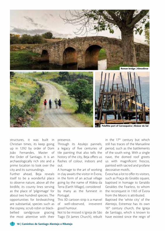
Roman bridge | Almodôvar
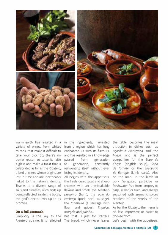
Palafitte port of Carrasqueira | Alcácer do Sal
18 | Caminhos de Santiago Alentejo e Ribatejo

D. Afonso III (1245-1279, and celebrated for its bell tower, triangular marble gable with a cross, the 18th century picture window and over the doorway, the cross of the Order of Aviz. The medieval castle in the centre of town stands out for its keep that is 27 metres high, one of the best preserved in the whole country. In 1336, this became the last resting place of Queen Santa Isabel, who died in her chambers there.In Crato, Mosteiro de Flor da Rosa monastery is one of the most original and intriguing Gothic buildings in the country, now home to a Pousada hotel.
Dating from 1356, this monument consists of three separate structures: the church-fort in the Gothic style, a Gothic castellated palace and convent priories. Meanwhile Crato, influenced in days of yore by the presence of Megalithic shepherds and their habits and culture, also reveals traces of other stories in its dolmens, or antas. As a matter of fact, in this municipality alone over 70 have been documented, most prominent of all being the dolmens found at Anta do Tapadão and Anta do Crato, designated national monuments.
As we come to the end of the Eastern Way, there’s still time to visit Nisa, with its 17th century pillory, which looks today much as it did then; the shrine of Ermida de Nossa Senhora da Graça, famous for its religious procession which takes places every Easter, or the traditional red clay ceramics, pitchers and jars decorated with small white stone flower motifs.
Along the Tagus riverWhen leaving Lisbon on the Central Way, we embark passing through Vila Nova da Rainha, the setting chosen for the wedding of the royals D. Nuno Álvares
Cante Alentejano (UNESCO) Santa Maria da Alcáçova Church | Santarém
The Almendres Cromlech | Évora Frayões Metello House | Grândola
Caminhos de Santiago Alentejo e Ribatejo | 19
Pereira with D. Leonor de Alvim, celebrated on 15 August 1376. Further ahead, in the Ribatejo town of Azambuja stands the church of the brotherhood of Senhor Jesus da Misericórdia de Azambuja, designated a monument of national interest. According to history, it was at the turn of the 18th century that the confreres of Espírito Santo (Holy Spirit) founded there a brotherhood and medieval hospice, with the aim of helpingpilgrims, passers-by and the poor patients. Or we can contemplate the small islands emerging from the river, which are home to eagles, egrets,
wild ducks, choughs and many other animals. The Way also passes through Cartaxo which has been, throughout history, an important waypoint to the interior of the country, either by river (the Tagus) or land, and opens onto the magnificent plateau of Santarém.
REGIONAL CUISINEThe culinary richness of the Alentejo and Ribatejo needs no introduction. Here, words cannot do justice to the feast that awaits, failing to adequately express the emotions it inspires in us. Our passage through these ports of call always
implies another journey, that of the taste buds. Even so, it is by using words that we shall try to explain the best these regions have to offer.
Bread and wine on thetableTraditionally, bread and wine are essential on a Portuguese table. And whether we take the Central or Eastern Ways, good wines and wonderful breads are guaranteed wherever the traveller goes in the Alentejo, in what is one of the main winemaking regions in the country. The combination of different grapes, rooted in the
Wayside cross in Viana do Alentejo castle Sulfúrea Thermal Baths | Cabeço de Vide
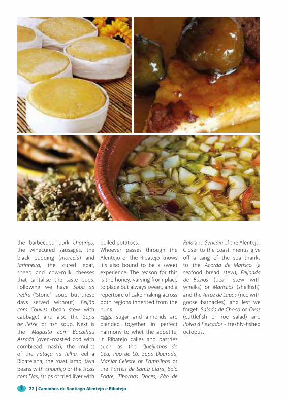
São Miguel de Machede
20 | Caminhos de Santiago Alentejo e Ribatejo
warm earth, has resulted in a variety of wines, from whites to reds, that make it difficult to take your pick. So, there’s no better reason to taste it, raise a glass and make a toast that is celebrated as far as the Ribatejo, a land of wines whose origins are lost in time and are inextricably linked to the nation’s identity. Thanks to a diverse range of soils and climates, wich ends up being reflected inside the bottle, the god’s nectar lives up to its promise.
On a full stomachSimplicity is the key to the Alentejo cuisine. It is reflected
in the ingredients, harvested from a region which has long enchanted us with its flavours, and has resulted in a knowledge passed from generation to generation, constantly reinventing itself without ever losing its identity.All begins with the appetisers, the fresh, cured goat and sheep cheeses with an unmistakable flavour and smell; the Alentejo presunto (ham), the paio do cachaço (pork neck sausage), the farinheira (a sausage with flour and spices), linguiça, morçela and painho…But that is just for starters. The bread, which never leaves
the table, becomes the main attraction in dishes such as Açorda à Alentejana and the Migas, and is the perfect companion for the Sopa de Cação (dogfish soup), Sopa de Tomate or the Ensopado de Borrego (lamb stew). Also on the menu is the lamb or pork Sarapatel, partridge or freshwater fish, from lamprey to carp, grilled or fried, and always seasoned with aromatic spices redolent of the smells of the Alentejo.As for the Ribatejo, the menu is no less impressive or easier to choose from.Let’s begin with the appetisers,
Caminhos de Santiago Alentejo e Ribatejo | 21
the barbecued pork chouriço, the winecured sausages, the black pudding (morcela) and farinheira, the cured goat, sheep and cow-milk cheeses that tantalise the taste buds. Following we have Sopa da Pedra (’Stone’ soup, but these days served without), Feijão com Couves (bean stew with cabbage) and also the Sopa de Peixe, or fish soup. Next is the Magusto com Bacalhau Assado (oven-roasted cod with cornbread mash), the mullet of the Fataça na Telha, eel à Ribatejana, the roast lamb, fava beans with chouriço or the Iscas com Elas, strips of fried liver with
boiled potatoes.Whoever passes through the Alentejo or the Ribatejo knows it’s also bound to be a sweet experience. The reason for this is the honey, varying from place to place but always sweet, and a repertoire of cake making across both regions inherited from the nuns.Eggs, sugar and almonds are blended together in perfect harmony to whet the appetite, in Ribatejo cakes and pastries such as the Queijinhos do Céu, Pão de Ló, Sopa Dourada, Manjar Celeste or Pampilhos or the Pastéis de Santa Clara, Bolo Podre, Tibornas Doces, Pão de
Rala and Sericaia of the Alentejo.Closer to the coast, menus give off a tang of the sea thanks to the Açorda de Marisco (a seafood bread stew), Feijoada de Búzios (bean stew with whelks) or Mariscos (shellfish), and the Arroz de Lapas (rice with goose barnacles), and lest we forget, Salada de Choco or Ovas (cuttlefish or roe salad) and Polvo à Pescador - freshly-fished octopus.
22 | Caminhos de Santiago Alentejo e Ribatejo
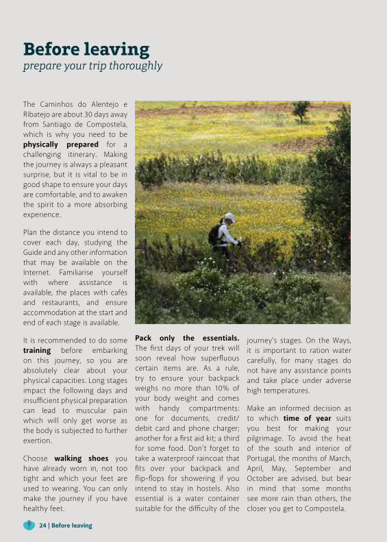
The Caminhos do Alentejo e Ribatejo are about 30 days away from Santiago de Compostela, which is why you need to be physically prepared for a challenging itinerary. Making the journey is always a pleasant surprise, but it is vital to be in good shape to ensure your days are comfortable, and to awaken the spirit to a more absorbing experience.
Plan the distance you intend to cover each day, studying the Guide and any other information that may be available on the Internet. Familiarise yourself with where assistance is available, the places with cafés and restaurants, and ensure accommodation at the start and end of each stage is available.
It is recommended to do some training before embarking on this journey, so you are absolutely clear about your physical capacities. Long stages impact the following days and insufficient physical preparation can lead to muscular pain which will only get worse as the body is subjected to further exertion.
Choose walking shoes you have already worn in, not too tight and which your feet are used to wearing. You can only make the journey if you have healthy feet.
Pack only the essentials. The first days of your trek will soon reveal how superfluous certain items are. As a rule, try to ensure your backpack weighs no more than 10% of your body weight and comes with handy compartments: one for documents, credit/debit card and phone charger; another for a first aid kit; a third for some food. Don’t forget to take a waterproof raincoat that fits over your backpack and flip-flops for showering if you intend to stay in hostels. Also essential is a water container suitable for the difficulty of the
Before leavingprepare your trip thoroughly
journey’s stages. On the Ways, it is important to ration water carefully, for many stages do not have any assistance points and take place under adverse high temperatures.
Make an informed decision as to which time of year suits you best for making your pilgrimage. To avoid the heat of the south and interior of Portugal, the months of March, April, May, September and October are advised, but bear in mind that some months see more rain than others, the closer you get to Compostela.
24 | Before leaving
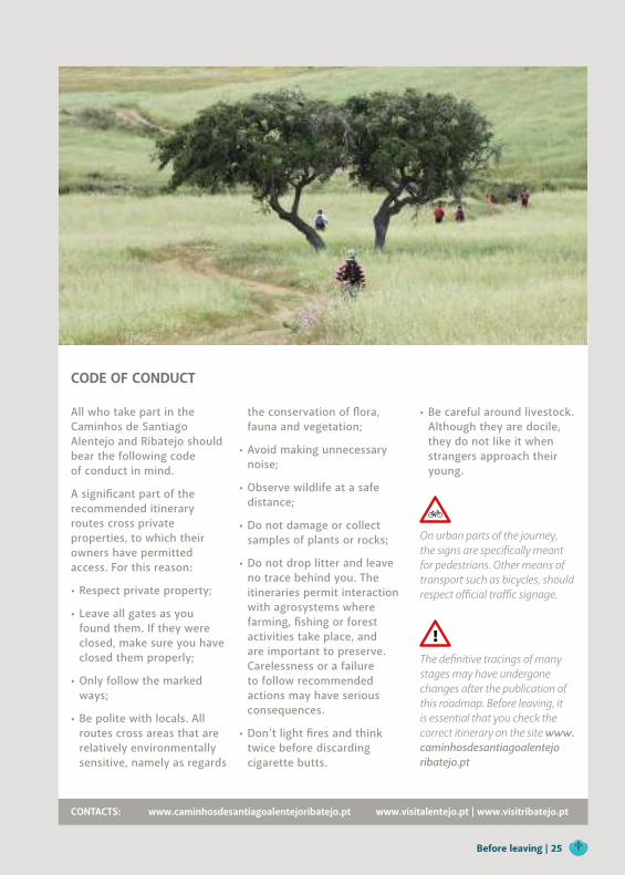
CODE OF CONDUCT
All who take part in the Caminhos de Santiago Alentejo and Ribatejo should bear the following code of conduct in mind.
A significant part of the recommended itinerary routes cross private properties, to which their owners have permitted access. For this reason:
• Respect private property;
• Leave all gates as you found them. If they were closed, make sure you have closed them properly;
• Only follow the marked ways;
• Be polite with locals. All routes cross areas that are relatively environmentally sensitive, namely as regards
the conservation of flora, fauna and vegetation;
• Avoid making unnecessary noise;
• Observe wildlife at a safe distance;
• Do not damage or collect samples of plants or rocks;
• Do not drop litter and leave no trace behind you. The itineraries permit interaction with agrosystems where farming, fishing or forest activities take place, and are important to preserve. Carelessness or a failure to follow recommended actions may have serious consequences.
• Don’t light fires and think twice before discarding cigarette butts.
• Be careful around livestock. Although they are docile, they do not like it when strangers approach their young.
On urban parts of the journey, the signs are specifically meant for pedestrians. Other means of transport such as bicycles, should respect official traffic signage.
The definitive tracings of many stages may have undergone changes after the publication of this roadmap. Before leaving, it is essential that you check the correct itinerary on the site www.caminhosdesantiagoalentejo ribatejo.pt
CONTACTS: www.caminhosdesantiagoalentejoribatejo.pt www.visitalentejo.pt | www.visitribatejo.pt
Before leaving | 25
26 | Before leaving
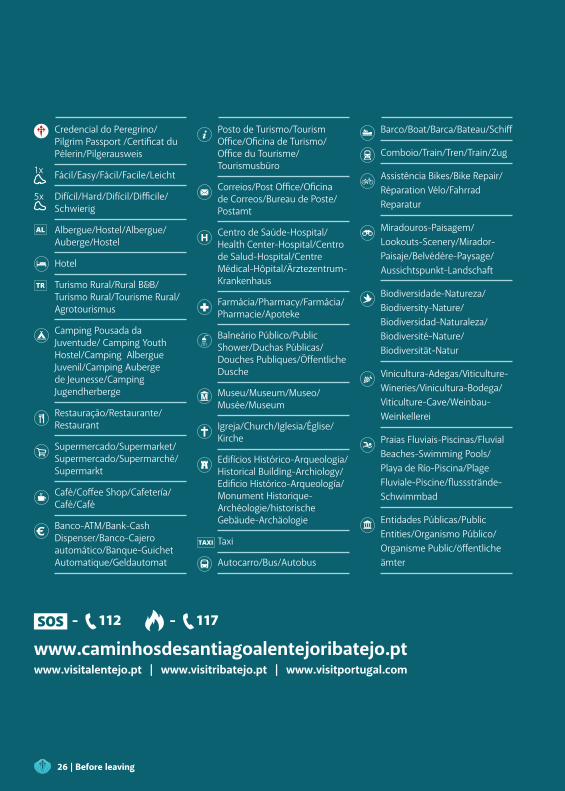
Credencial do Peregrino/ Pilgrim Passport /Certificat du Pélerin/Pilgerausweis
1x Fácil/Easy/Fácil/Facile/Leicht
5x Difícil/Hard/Difícil/Difficile/Schwierig
Albergue/Hostel/Albergue/Auberge/Hostel
Hotel
Turismo Rural/Rural B&B/Turismo Rural/Tourisme Rural/Agrotourismus
Camping Pousada da Juventude/ Camping Youth Hostel/Camping Albergue Juvenil/Camping Auberge de Jeunesse/Camping Jugendherberge
Restauração/Restaurante/Restaurant
Supermercado/Supermarket/Supermercado/Supermarché/Supermarkt
Café/Coffee Shop/Cafetería/Café/Café
Banco-ATM/Bank-Cash Dispenser/Banco-Cajero automático/Banque-Guichet Automatique/Geldautomat
Posto de Turismo/Tourism Office/Oficina de Turismo/Office du Tourisme/Tourismusbüro
Correios/Post Office/Oficina de Correos/Bureau de Poste/Postamt
Centro de Saúde-Hospital/Health Center-Hospital/Centro de Salud-Hospital/Centre Médical-Hôpital/Ärztezentrum-Krankenhaus
Farmácia/Pharmacy/Farmácia/Pharmacie/Apoteke
Balneário Público/Public Shower/Duchas Públicas/Douches Publiques/Öffentliche Dusche
Museu/Museum/Museo/Musée/Museum
Igreja/Church/Iglesia/Église/Kirche
Edifícios Histórico-Arqueologia/Historical Building-Archiology/Edificio Histórico-Arqueología/Monument Historique-Archéologie/historische Gebäude-Archäologie
Taxi
Autocarro/Bus/Autobus
Barco/Boat/Barca/Bateau/Schiff
Comboio/Train/Tren/Train/Zug
Assistência Bikes/Bike Repair/Réparation Vélo/Fahrrad Reparatur
Miradouros-Paisagem/Lookouts-Scenery/Mirador-Paisaje/Belvédère-Paysage/Aussichtspunkt-Landschaft
Biodiversidade-Natureza/Biodiversity-Nature/Biodiversidad-Naturaleza/Biodiversité-Nature/Biodiversität-Natur
Vinicultura-Adegas/Viticulture-Wineries/Vinicultura-Bodega/Viticulture-Cave/Weinbau-Weinkellerei
Praias Fluviais-Piscinas/Fluvial Beaches-Swimming Pools/Playa de Río-Piscina/Plage Fluviale-Piscine/flussstrände-Schwimmbad
Entidades Públicas/Public Entities/Organismo Público/Organisme Public/öffentliche ämter
- 112 - 117
www.caminhosdesantiagoalentejoribatejo.pt www.visitalentejo.pt | www.visitribatejo.pt | www.visitportugal.com
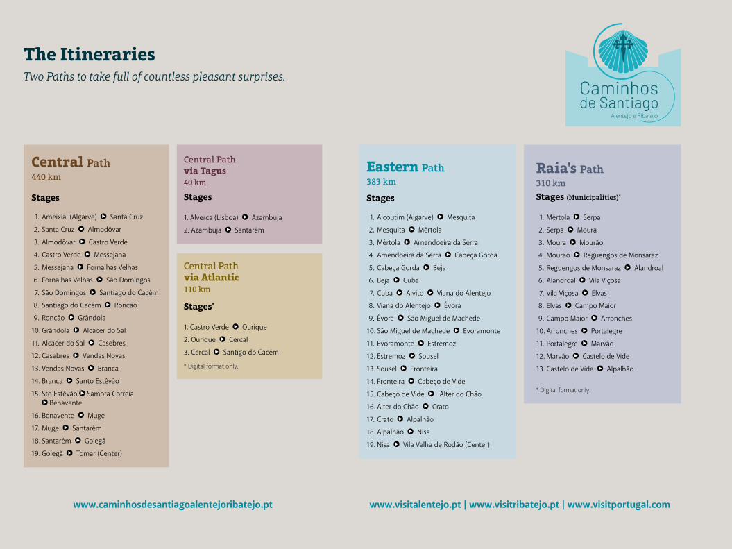
The ItinerariesTwo Paths to take full of countless pleasant surprises.
Central Path440 km
Stages
1. Ameixial (Algarve) Santa Cruz
2. Santa Cruz Almodôvar
3. Almodôvar Castro Verde
4. Castro Verde Messejana
5. Messejana Fornalhas Velhas
6. Fornalhas Velhas São Domingos
7. São Domingos Santiago do Cacém
8. Santiago do Cacém Roncão
9. Roncão Grândola
10. Grândola Alcácer do Sal
11. Alcácer do Sal Casebres
12. Casebres Vendas Novas
13. Vendas Novas Branca
14. Branca Santo Estêvão
15. Sto Estêvão Samora Correia Benavente
16. Benavente Muge
17. Muge Santarém
18. Santarém Golegã
19. Golegã Tomar (Center)
Central Pathvia Tagus40 km
Stages
1. Alverca (Lisboa) Azambuja
2. Azambuja Santarém
Central Pathvia Atlantic110 km
Stages*
1. Castro Verde Ourique
2. Ourique Cercal
3. Cercal Santigo do Cacém
* Digital format only.
Eastern Path383 km
Stages
1. Alcoutim (Algarve) Mesquita
2. Mesquita Mértola
3. Mértola Amendoeira da Serra
4. Amendoeira da Serra Cabeça Gorda
5. Cabeça Gorda Beja
6. Beja Cuba
7. Cuba Alvito Viana do Alentejo
8. Viana do Alentejo Évora
9. Évora São Miguel de Machede
10. São Miguel de Machede Evoramonte
11. Evoramonte Estremoz
12. Estremoz Sousel
13. Sousel Fronteira
14. Fronteira Cabeço de Vide
15. Cabeço de Vide Alter do Chão
16. Alter do Chão Crato
17. Crato Alpalhão
18. Alpalhão Nisa
19. Nisa Vila Velha de Rodão (Center)
Raia's Path310 km
Stages (Municipalities)*
1. Mértola Serpa
2. Serpa Moura
3. Moura Mourão
4. Mourão Reguengos de Monsaraz
5. Reguengos de Monsaraz Alandroal
6. Alandroal Vila Viçosa
7. Vila Viçosa Elvas
8. Elvas Campo Maior
9. Campo Maior Arronches
10. Arronches Portalegre
11. Portalegre Marvão
12. Marvão Castelo de Vide
13. Castelo de Vide Alpalhão
* Digital format only.
Alentejo e Ribatejo
www.visitalentejo.pt | www.visitribatejo.pt | www.visitportugal.comwww.caminhosdesantiagoalentejoribatejo.pt
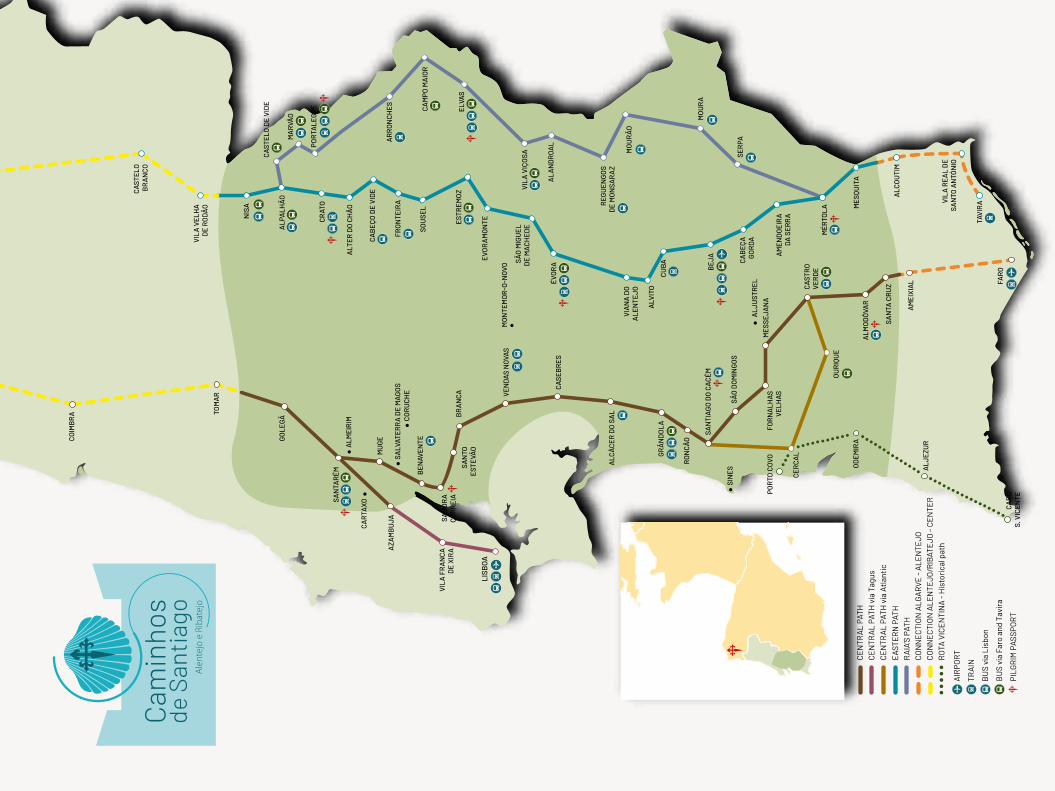
FAR
OC
AB
OS.
VIC
ENTE
TAV
IRAV
ILA
REA
L D
ESA
NTO
AN
TÓN
IO
MES
QUIT
A
ALC
OU
TIM
MÉR
TOL
A
SER
PA
MO
UR
A
MO
UR
ÃO
AL
AN
DR
OA
L
VIL
A V
IÇO
SA
BEJ
A
CU
BA
REG
UEN
GO
SD
E M
ON
SAR
AZ
ÉVO
RASÃ
O M
IGU
ELD
E M
AC
HED
E
ESTR
EMO
ZEL
VAS
CA
MPO
MA
IOR
AR
RO
NC
HES
FRO
NTE
IRA
SOU
SEL
ALT
ER D
O C
HÃ
O
CR
ATO
POR
TALE
GR
E
MA
RVÃ
OA
LPA
LHÃ
O
NIS
A
VIL
A V
ELH
AD
E R
ODÃ
O
CAS
TELO
BR
AN
CO
CO
IMB
RA
CA
BEÇ
O D
E V
IDE
EVO
RA
MO
NTE
VIA
NA
DO
ALE
NTE
JO
AM
END
OEI
RA
DA S
ERR
A
CA
BEÇ
AG
OR
DA
AM
EIX
IAL
SAN
TA C
RU
Z
ALM
OD
ÔVA
R
MES
SEJA
NA
FOR
NA
LHAS
VELH
ASSÃO
DO
MIN
GO
S
SAN
TIA
GO
DO
CA
CÉM
GR
ÂN
DO
LA
RO
NC
ÃO
ALC
ÁC
ER D
O S
AL
CAS
EBR
ES
BR
AN
CA VE
NDA
S N
OVA
S
BEN
AVEN
TE
MU
GE
SAN
TAR
ÉM
AZA
MB
UJA
VIL
A F
RA
NC
AD
E X
IRA
GO
LEGÃ
TOM
AR
SAN
TOES
TEVÃ
O
CAS
TRO
VER
DE
OU
RIQ
UE
CER
CA
L
SIN
ES
POR
TO C
OVO
OD
EMIR
A
ALJ
EZU
R
LISB
OA
MO
NTE
MO
R-O
-NO
VO
ALM
EIR
IM
CA
RTA
XO
ALJ
UST
REL
CO
RU
CH
ESA
LVAT
ERR
A D
E M
AG
OS
CAS
TELO
DE
VID
E
SAM
OR
AC
OR
REI
A
CE
NTR
AL
PATH
CE
NTR
AL
PATH
via
Atl
anti
cC
EN
TRA
L PA
TH v
ia T
agus
EAS
TER
N P
ATH
RA
IA’S
PAT
HC
ON
NE
CTI
ON
ALG
AR
VE -
ALE
NTE
JOC
ON
NE
CTI
ON
ALE
NTE
JO/R
IBAT
EJO
- C
EN
TER
TRA
IN
BU
S vi
a Li
sbon
AIR
POR
T
BU
S vi
a Fa
ro a
nd T
avir
a
PILG
RIM
PAS
SPO
RT
RO
TA V
ICE
NTI
NA
- H
isto
rica
l pat
h
ALV
ITO
Ale
ntej
o e
Riba
tejo
WAYS GUIDE
Alentejo e Ribatejo
Caminhos de Santiago Alentejo e Ribatejo
CentralWay
EasternWay

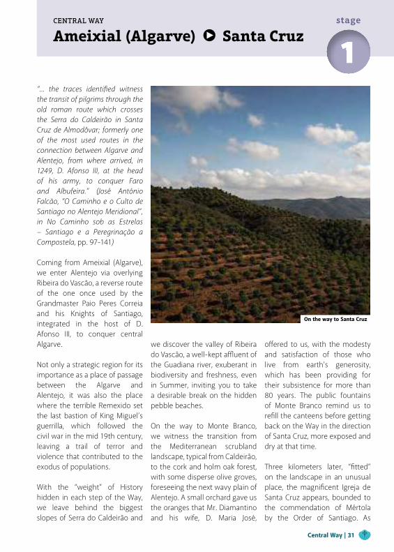
Ameixial (Algarve) Santa Cruz
“... the traces identified witness the transit of pilgrims through the old roman route which crosses the Serra do Caldeirão in Santa Cruz de Almodôvar; formerly one of the most used routes in the connection between Algarve and Alentejo, from where arrived, in 1249, D. Afonso III, at the head of his army, to conquer Faro and Albufeira.” (José António Falcão, “O Caminho e o Culto de Santiago no Alentejo Meridional”, in No Caminho sob as Estrelas – Santiago e a Peregrinação a Compostela, pp. 97-141) Coming from Ameixial (Algarve), we enter Alentejo via overlying Ribeira do Vascão, a reverse route of the one once used by the Grandmaster Paio Peres Correia and his Knights of Santiago, integrated in the host of D. Afonso III, to conquer central Algarve. Not only a strategic region for its importance as a place of passage between the Algarve and Alentejo, it was also the place where the terrible Remexido set the last bastion of King Miguel’s guerrilla, which followed the civil war in the mid 19th century, leaving a trail of terror and violence that contributed to the exodus of populations. With the “weight” of History hidden in each step of the Way, we leave behind the biggest slopes of Serra do Caldeirão and
we discover the valley of Ribeira do Vascão, a well-kept affluent of the Guadiana river, exuberant in biodiversity and freshness, even in Summer, inviting you to take a desirable break on the hidden pebble beaches.
On the way to Monte Branco, we witness the transition from the Mediterranean scrubland landscape, typical from Caldeirão, to the cork and holm oak forest, with some disperse olive groves, foreseeing the next wavy plain of Alentejo. A small orchard gave us the oranges that Mr. Diamantino and his wife, D. Maria José,
offered to us, with the modesty and satisfaction of those who live from earth’s generosity, which has been providing for their subsistence for more than 80 years. The public fountains of Monte Branco remind us to refill the canteens before getting back on the Way in the direction of Santa Cruz, more exposed and dry at that time.
Three kilometers later, “fitted” on the landscape in an unusual place, the magnificent Igreja de Santa Cruz appears, bounded to the commendation of Mértola by the Order of Santiago. As
CENTRAL WAY
1stage
On the way to Santa Cruz
Central Way | 31
32 | Central Way
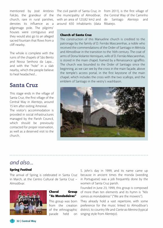
Church of Santa CruzThe construction of this Manueline church is credited to the patronage by the family of D. Fernão Mascarenhas, a noble who received the commendations of the Order of Santiago in Mértola and Almodôvar in the transition to the 16th century. The coat of arms of Dona Violante Henriques, wife of D. Fernão Mascarenhas, is stored in the main chapel, framed by a Renaissance sgraffito. The church was bounded to the Order of Santiago since the beginning, as we can see by the cross in the main façade, above the temple’s access portal, in the first keystone of the main chapel, which includes the cross with the two scallops, and the emblem of Santiago in the vestry’s washbasin.
and also...Spring FestivalThe arrival of Spring is celebrated in Santa Cruz in March, at the Centro Cultural de Santa Cruz − Almodôvar.
Choral Group “As Mondadeiras”This group was born from the creation of the ethnographic parade held on
S. John’s day in 1999, and its name came up because in ancient times the monda (weeding in Portuguese) was a job frequently done by the women of Santa Cruz parish.Founded in June 23, 1999, this group is composed of more than ten elements and its hymn is “Nós somos as mondadeiras” (“We are the mowers”).
They already hold a vast repertoire, with some preference for the music linked to Almodôvar’s district, to country life and Cante ao Menino (typical singing style from Alentejo).
mentioned by José António Falcão, the grandeur of the church, rare in rural parishes, denotes its influence as a pilgrimage pole. The pilgrims’ houses were contiguous and they would also go to an alleged sacred fountain that flows from a cliff nearby.
The whole is complete with the ruins of the chapels of São Bento and Nossa Senhora da Lapa… and with the “hole” in a slab nearby, which the people believe to heal headaches!...
Santa CruzThis stage ends in the village of Santa Cruz, the first village of the Central Way in Alentejo, around 15 km after exiting Ameixial.The visitor’s accommodation is provided in social infrastructures managed by the Parish Council, which should be previously contacted for proper reservation, as well as a deserved visit to the church.
The civil parish of Santa Cruz, in the municipality of Almodôvar, with an area of 123,82 km2 and around 650 inhabitants (data
from 2011), is the first village of the Central Way of the Caminho de Santiago Alentejo and Ribatejo.
The Alentejo begins at the Ribeira do Vascão stream, but the traveler will probably come from the Algarve, specifically from the village of Ameixial, where ends the previous stage of those who took the Path from Faro.
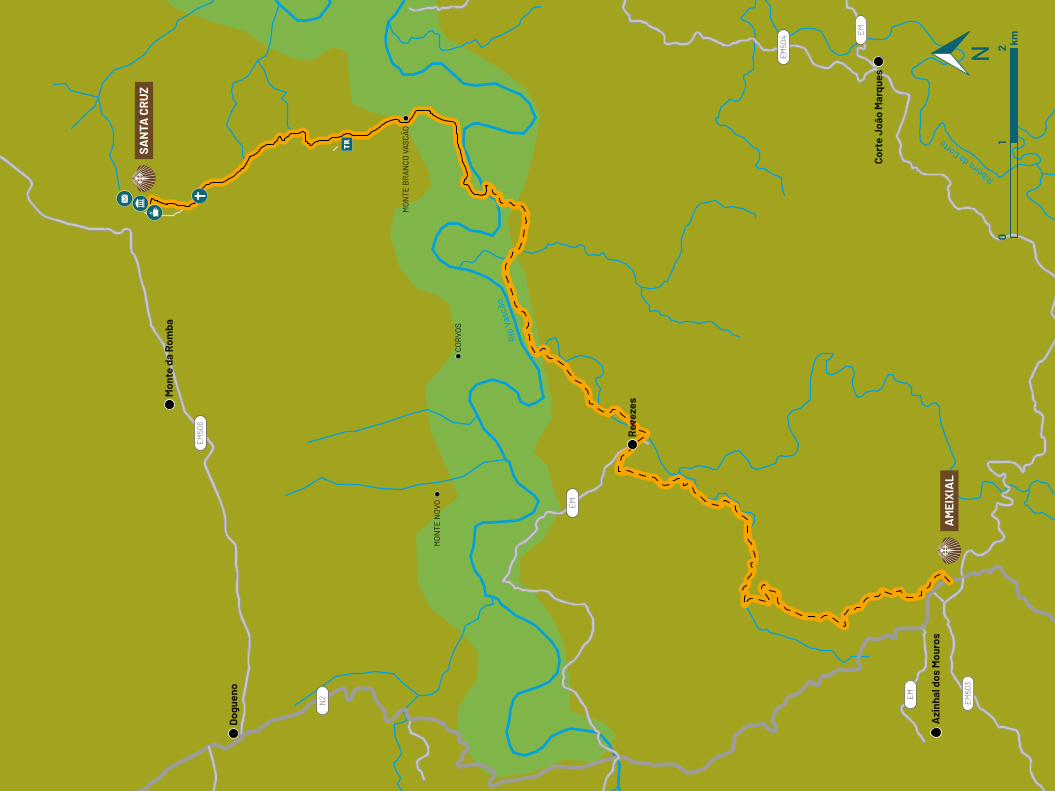
From here, the route stretches along pleasant trails between the successive hills until Ribeira do Vascão. We pass through the village of Revezes and continue along the valley to the old water mill called Cascalheira, for a total of about ten kilometers.
Once we have dipped our feet in the stream or crossed the pedestrian bridge next to the mill, we continue straight through the Vascão valley until we reach the site of Monte Branco, where the friendly resident couple always welcomes the visitors!
Alternatively, you can arrive there in other ways:
- Leaving Ameixial, where the previous stage, coming from Faro, ends, the route extends in easy trails to the valley of Ribeira do Vascão, passing through Revezes village and continuing to Cascalheira mill, for a total of about ten kilometers;
- By the municipal road 1029, which connects Ameixial to Revezes, proceeding on a trail from there, intersecting with the Caminho Algarvio that will follow for three kilometers until the entrance to the Alentejo;
- Coming from the north, by the road that leaves the village of Santa Cruz in the direction of Alcoutim, Martim Longo and Cachoupo, taking the right on a nearby crossroad and following the signs of Cerro das Águias and Monte Branco do Vascão, on a dirt road. Arriving at Monte, the road gives easy access to the trail's beginning at the Ribeira do Vascão.
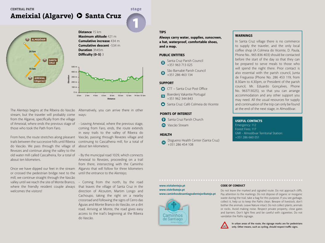
TIPSAlways carry water, supplies, sunscreen, a hat, waterproof, comfortable shoes, and a map.
PUBLIC ENTITIES
Santa Cruz Parish Council +351 963 713 025
São Barnabé Parish Council +351 286 463 134
SUPPORT
CTT − Santa Cruz Post Office
Boerderij Vakantie Portugal +351 962 344 843
Santa Cruz: Café Colmeia do Vicente
POINTS OF INTEREST
Santa Cruz Parish Church
Vascão Stream
HEALTH
Dogueno Health Center (Santa Cruz) +351 286 454 108
WARNINGS
In Santa Cruz village there is no commerce to supply the traveler, and the only local coffee shop (A Colmeia do Vicente, D. Paula, Phone No.. 965 836 403) should be contacted before the start of the day so that they can be prepared to serve meals to those who will spend the night there. Prior contact is also essential with the parish council, Junta de Freguesia (Phone No. 286 453 119, from 8.30am to 4.30pm, or President of the parish council, Mr. Eduardo Gonçalves, Phone No. 963713025), so that you can arrange accommodation and any other support you may need. All the usual resources for supply and continuation of the trip can only be found at the end of the next stage, in Almodôvar.
Distance 15 kmMaximum altitude 421 mCumulative increase 434 m Cumulative descent -534 mDuration 3h45mDifficulty (0-5) 3
USEFUL CONTACTSEmergency: 112Forest Fires: 117GNR - Almodôvar Territorial Station:+351 286 660 051
Ameixial (Algarve) Santa Cruz1stage
www.visitalentejo.ptwww.visitribatejo.ptwww.caminhosdesantiagoalentejoribatejo.pt
CODE OF CONDUCT
Do not leave the marked and signaled route. Do not approach cliffs. Pay attention to the markings. Do not dispose of organic or inorganic waste during the trail, take a bag for this purpose. If you see garbage, collect it, help us to keep the Paths clean. Beware of livestock, don't bother the animals. Leave Nature intact. Do not collect plants, animals or rocks. Avoid making noise. Respect private property, close gates and barriers. Don’t light fires and be careful with cigarettes. Do not vandalize the Paths signage.
In urban areas of the route, the signage marks are for pedestrians only. Other means, such as cycling, should respect traffic signs.
500 m
400 m
Elev
atio
n
Distance
300 m
200 m
100 m
0 m
0 km 2 km 4 km 6 km 8 km 10 km 12 km 14 km 15 km
ALMODÔVAR
SANTACRUZ
AMEIXIAL(Algarve)
20 km
15 km
CENTRAL PATH
Rio
Vasc
ão
Ribeira da Corte
EM
EM
EM
N2
EM50
4
EM50
3
EM50
6
AM
EIX
IAL
SAN
TA C
RU
Z
Mon
te d
a Ro
mba
Dog
ueno
Reve
zes
Azi
nhal
dos
Mou
ros
Cort
e Jo
ão M
arqu
es
MO
NTE
BR
AN
CO
VAS
CÃ
O
MO
NTE
NO
VO
CO
RVO
S
km0
12
When we leave Santa Cruz the landscape changes. In front of us lies now, far out of sight, the soft relief of the undulating plain of Baixo (Low) Alentejo. The views widen and a quiet stage is foreseen, conducive to contemplation.Extensive crops are found in non-fenced properties, as rarely seen in the Alentejo, framed by magnificent secular holm-oaks, cork-oaks and tame pine plantations. Throughout the four seasons the landscape takes on different shades, during spring it explodes in a profusion of colors, of flowering herbs and shrubs, and in the autumn it is no less impressive when, just after the first rains, a vivid green cover appears on the thick red earth.It is also the domain of grazing, where the so-called "Campos de Ourique" begin, which welcomed the ancestral annual transhumance, traveling hundreds of kilometers from Serra da Estrela. We often cross with flocks of curious sheep, whose calves approach without fear, to the traveler's delight.
Almodôvar
This second stage ends in Almodôvar, village, and county, which offers numerous cultural, gastronomic and tourist attractions in general. Due to its strategic location between the Alentejo and the Algarve, until
the middle of the last century, Almodôvar was an important commercial warehouse and a center of artisans, dedicated to an immense variety of arts and crafts, where the cobblers dominated (see the huge sculpture in homage to the cobbler by Aureliano Aguiar, in the Rotunda do Sapateiro roundabout).In the origin (1239), the forest of Almodôvar was the western limit of the possessions that the
Order of Santiago had in Mértola. The village only had regional centrality from 1285, date of the first charter of Almodôvar, donated by King D. Dinis. From 1297, the town was integrated into the Order of Santiago, which established a commendation here until the end of the 18th century. Land of viola campaniça (guitar) and cante alentejano (local singing style), Almodôvar is still a center of traditional footwear manufacture.
Central Way | 35
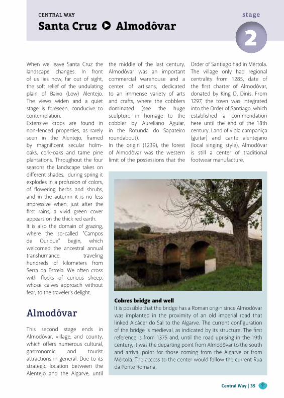
Cobres bridge and wellIt is possible that the bridge has a Roman origin since Almodôvar was implanted in the proximity of an old imperial road that linked Alcácer do Sal to the Algarve. The current configuration of the bridge is medieval, as indicated by its structure. The first reference is from 1375 and, until the road uprising in the 19th century, it was the departing point from Almodôvar to the south and arrival point for those coming from the Algarve or from Mértola. The access to the center would follow the current Rua da Ponte Romana.
Santa Cruz AlmodôvarCENTRAL WAY
2stage
and also...Medieval Market of Almodôvar − AprilFACAL (Arts and Culture Fair) − JulyMushroom and Arbutus Fair − NovemberSouthwest Writing Museum The Southwest Writing Museum reflects the starting point for the understanding of history and shows the ancestral way used to communicate.by the inhabitants of this territory for more than 2500 years. The exhibition presents, in a didactic, functional and aesthetic way, the evolution of spelling and written
knowledge, where it is possible to contemplate stone steles engraved with the oldest writing of the Iberian Peninsula.
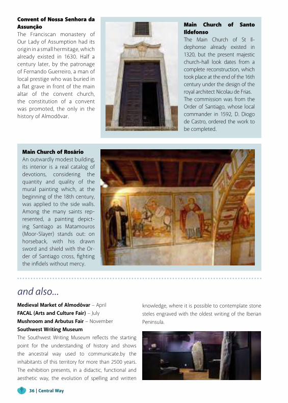
Main Church of Santo IldefonsoThe Main Church of St Il-dephonse already existed in 1320, but the present majestic church-hall look dates from a complete reconstruction, which took place at the end of the 16th century under the design of the royal architect Nicolau de Frias.The commission was from the Order of Santiago, whose local commander in 1592, D. Diogo de Castro, ordered the work to be completed.
Convent of Nossa Senhora da AssunçãoThe Franciscan monastery of Our Lady of Assumption had its origin in a small hermitage, which already existed in 1630. Half a century later, by the patronage of Fernando Guerreiro, a man of local prestige who was buried in a flat grave in front of the main altar of the convent church, the constitution of a convent was promoted, the only in the history of Almodôvar.
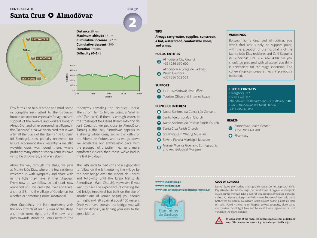
Main Church of RosárioAn outwardly modest building, its interior is a real catalog of devotions, considering the quantity and quality of the mural painting which, at the beginning of the 18th century, was applied to the side walls. Among the many saints rep-resented, a painting depict-ing Santiago as Matamouros (Moor-Slayer) stands out: on horseback, with his drawn sword and shield with the Or-der of Santiago cross, fighting the infidels without mercy.
36 | Central Way
Few farms and hills of stone and mud, some in complete ruin, attest to the dispersed human occupation, especially for agricultural support of the owners and workers living in Almodôvar and other surrounding villages. In the "Dadorde" area we discovered that it was after all the place of the Quinta "Da Ordem" (of Santiago), now partially recovered for leisure accommodation. Recently, a metallic wayside cross was found there, where probably many other historical remains have yet to be discovered, and was rebuilt.
About halfway through the stage, we pass at Monte João Dias, where the few residents welcome us with sympathy and share with us the little they have at their disposal. From now on we follow an old road, now reopened until we cross the river and travel another 3 km to the village of Guedelhas for a coffee or something more substantial.
After Guedelhas, the Path intersects with the only stretch of road (2 km) of the stage and then turns right onto the new rural path towards Monte de Pero Guerreiro (the
toponymy revealing the historical roots). Then, from hill to hill, including a "molha-pés" (foot-wet), if there is enough water, in the crossing of the Oeiras stream (Moinho do José Caetano), we get close to Almodôvar. Turning a final hill, Almodôvar appears as a shining white oasis, set in the valley of the Ribeira de Cobres, and as we go down we accelerate our enthusiastic pace with the prospect of a tastier meal or a more comfortable sleep than those we've had in the last two days.
The Path leads to road 267 and is signposted to follow on the left, entering the village by the new bridge over the Ribeira de Cobres and following until the Igreja Matriz de Almodôvar (Main Church). However, if you want to have the experience of crossing the old bridge (medieval but built on the site of another one of Roman origin), you should turn right and left again at about 100 meters. Once you have crossed the bridge, you will have no difficulty in finding your way to the Igreja Matriz.
Distance 20 kmMaximum altitude 331 mCumulative increase 372 m Cumulative descent -399 mDuration 5h00mDifficulty (0-5) 3
TIPSAlways carry water, supplies, sunscreen, a hat, waterproof, comfortable shoes, and a map.
PUBLIC ENTITIES
Almodôvar City Council +351 286 660 600
Almodôvar e Graça de Padrões Parish Councils +351 286 662 563
SUPPORT
CTT − Almodôvar Post Office
Tourism Office and Internet Space
POINTS OF INTEREST
Nossa Senhora da Conceição Convent
Santo Ildefonso Main Church
Nossa Senhora do Rosário Parish Church
Santa Cruz Parish Church
Southwestern Writing Museum
Severo Portela Municipal Museum
Manuel Vicente Guerreiro Ethnographic and Archeological Museum
WARNINGS
Between Santa Cruz and Almodôvar, you won't find any supply or support point, with the exception of the hospitality of the Monte João Dias residents and Café Sequeira in Guedelhas (Tel. 286 662 430). So you should go prepared with whatever you think is convenient for the stage extension. The coffee shop can prepare meals if previously indicated.
HEALTH
Almodôvar Health Center +351 286 660 200
Pharmacy
USEFUL CONTACTSEmergency: 112Forest Fires: 117Almodôvar Fire Department: +351 286 660 140GNR − Almodôvar Territorial Station:+351 286 660 051
Santa Cruz Almodôvar2stage
www.visitalentejo.ptwww.visitribatejo.ptwww.caminhosdesantiagoalentejoribatejo.pt
500 m
400 m
300 m
200 m
100 m
0 m
0 km 5 km 10 km 15 km 20 km
ALMODÔVAR
CASTRO VERDE
SANTA CRUZ
20 km
30 km
CENTRAL PATH
CODE OF CONDUCT
Do not leave the marked and signaled route. Do not approach cliffs. Pay attention to the markings. Do not dispose of organic or inorganic waste during the trail, take a bag for this purpose. If you see garbage, collect it, help us to keep the Paths clean. Beware of livestock, don't bother the animals. Leave Nature intact. Do not collect plants, animals or rocks. Avoid making noise. Respect private property, close gates and barriers. Don’t light fires and be careful with cigarettes. Do not vandalize the Paths signage.
In urban areas of the route, the signage marks are for pedestrians only. Other means, such as cycling, should respect traffic signs.
Elev
atio
n
Distance
Ribeira de Cobre
s
EM
EM
EM
N2
N2
N26
7
N39
3
EM
EM
EM
EM
EM
EM
SAN
TA C
RU
Z
Mon
te d
a Ro
mba
São
Pedr
o de
Sol
is
Dog
ueno
Reve
zes
ALM
OD
ÔVA
R
Senh
ora
da G
raça
de
Padr
ões
km0
24
Rio
Vasc
ão
Almodôvar Castro VerdeCENTRAL WAY
3stage
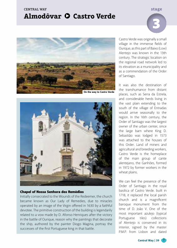
Chapel of Nossa Senhora dos RemédiosInitially consecrated to the Wounds of the Redeemer, the church became known as Our Lady of Remedies, due to miracles operated by an image of the Virgin offered in 1630 by a faithful devotee. The primitive construction of the building is legendarily related to a vow made by D. Afonso Henriques after the victory in the battle of Ourique, reason why the paintings that decorate the ship, authored by the painter Diogo Magina, portray the successes of the first Portuguese king in that battle.
Castro Verde was originally a small village in the immense fields of Ourique, as this part of Baixo (Low) Alentejo was known in the 13th century. The strategic location on the regional road network led to its elevation as a municipality and as a commendation of the Order of Santiago.
It was also the destination of the transhumance from distant places, such as Serra da Estrela, and considerable herds living in the vast plain extending to the south of the village of Entradas would arrive seasonally to the region. In the 16th century, the Order of Santiago was the largest owner of the urban center, since the large barn where King D. Sebastião was lodged in 1573 was attached to the houses of this Order. Land of miners and agricultural and breeding workers, Castro Verde is the homeplace of the main group of cante alentejano, the Ganhões, formed in 1972 by former workers in the wheat plains.
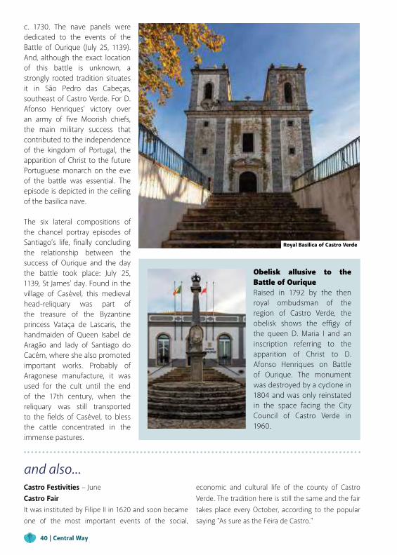
We can feel the presence of the Order of Santiago in the royal basilica of Castro Verde. built in 1718, it replaced the local parish church and is a magnificent baroque monument from the time of D. João V. One of the most important azulejo (typical Portuguese tiles) collections of Alentejo is conserved in its interior, signed by the master P.M.P. from Lisbon and dated
On the way to Castro Verde
Central Way | 39
and also...Castro Festivities − June Castro FairIt was instituted by Filipe II in 1620 and soon became one of the most important events of the social,
economic and cultural life of the county of Castro Verde. The tradition here is still the same and the fair takes place every October, according to the popular saying "As sure as the Feira de Castro."
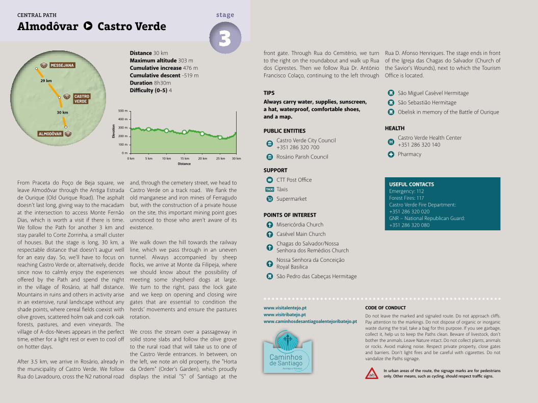
Obelisk allusive to the Battle of OuriqueRaised in 1792 by the then royal ombudsman of the region of Castro Verde, the obelisk shows the effigy of the queen D. Maria I and an inscription referring to the apparition of Christ to D. Afonso Henriques on Battle of Ourique. The monument was destroyed by a cyclone in 1804 and was only reinstated in the space facing the City Council of Castro Verde in 1960.
c. 1730. The nave panels were dedicated to the events of the Battle of Ourique (July 25, 1139). And, although the exact location of this battle is unknown, a strongly rooted tradition situates it in São Pedro das Cabeças, southeast of Castro Verde. For D. Afonso Henriques' victory over an army of five Moorish chiefs, the main military success that contributed to the independence of the kingdom of Portugal, the apparition of Christ to the future Portuguese monarch on the eve of the battle was essential. The episode is depicted in the ceiling of the basilica nave.
The six lateral compositions of the chancel portray episodes of Santiago’s life, finally concluding the relationship between the success of Ourique and the day the battle took place: July 25, 1139, St James' day. Found in the village of Casével, this medieval head-reliquary was part of the treasure of the Byzantine princess Vataça de Lascaris, the handmaiden of Queen Isabel de Aragão and lady of Santiago do Cacém, where she also promoted important works. Probably of Aragonese manufacture, it was used for the cult until the end of the 17th century, when the reliquary was still transported to the fields of Casével, to bless the cattle concentrated in the immense pastures.
Royal Basilica of Castro Verde
40 | Central Way
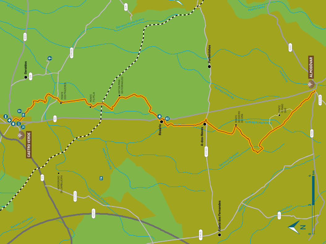
Distance 30 kmMaximum altitude 303 mCumulative increase 476 m Cumulative descent -519 mDuration 8h30mDifficulty (0-5) 4
Almodôvar Castro Verde3stage
www.visitalentejo.ptwww.visitribatejo.ptwww.caminhosdesantiagoalentejoribatejo.pt
From Praceta do Poço de Beja square, we leave Almodôvar through the Antiga Estrada de Ourique (Old Ourique Road). The asphalt doesn't last long, giving way to the macadam at the intersection to access Monte Fernão Dias, which is worth a visit if there is time. We follow the Path for another 3 km and stay parallel to Corte Zorrinha, a small cluster of houses. But the stage is long, 30 km, a respectable distance that doesn't augur well for an easy day. So, we'll have to focus on reaching Castro Verde or, alternatively, decide since now to calmly enjoy the experiences offered by the Path and spend the night in the village of Rosário, at half distance. Mountains in ruins and others in activity arise in an extensive, rural landscape without any shade points, where cereal fields coexist with olive groves, scattered holm oak and cork oak forests, pastures, and even vineyards. The village of A-dos-Neves appears in the perfect time, either for a light rest or even to cool off on hotter days.
After 3.5 km, we arrive in Rosário, already in the municipality of Castro Verde. We follow Rua do Lavadouro, cross the N2 national road
and, through the cemetery street, we head to Castro Verde on a track road. We flank the old manganese and iron mines of Ferragudo but, with the construction of a private house on the site, this important mining point goes unnoticed to those who aren't aware of its existence.
We walk down the hill towards the railway line, which we pass through in an uneven tunnel. Always accompanied by sheep flocks, we arrive at Monte da Filipeja, where we should know about the possibility of meeting some shepherd dogs at large. We turn to the right, pass the lock gate and we keep on opening and closing wire gates that are essential to condition the herds' movements and ensure the pastures rotation.
We cross the stream over a passageway in solid stone slabs and follow the olive grove to the rural road that will take us to one of the Castro Verde entrances. In between, on the left, we note an old property, the "Horta da Ordem" (Order’s Garden), which proudly displays the initial "S" of Santiago at the
TIPSAlways carry water, supplies, sunscreen, a hat, waterproof, comfortable shoes, and a map.
PUBLIC ENTITIES
Castro Verde City Council +351 286 320 700
Rosário Parish Council
SUPPORT
CTT Post Office
Táxis
Supermarket
POINTS OF INTEREST
Misericórdia Church
Casével Main Church
Chagas do Salvador/Nossa Senhora dos Remédios Church
Nossa Senhora da Conceição Royal Basilica
São Pedro das Cabeças Hermitage
São Miguel Casével Hermitage
São Sebastião Hermitage
Obelisk in memory of the Battle of Ourique
HEALTH
Castro Verde Health Center +351 286 320 140
Pharmacy
USEFUL CONTACTSEmergency: 112Forest Fires: 117Castro Verde Fire Department: +351 286 320 020GNR − National Republican Guard: +351 286 320 080
front gate. Through Rua do Cemitério, we turn to the right on the roundabout and walk up Rua dos Ciprestes. Then we follow Rua Dr. António Francisco Colaço, continuing to the left through
Rua D. Afonso Henriques. The stage ends in front of the Igreja das Chagas do Salvador (Church of the Savior’s Wounds), next to which the Tourism Office is located.
500 m
400 m
300 m
200 m
100 m
0 m
0 km 5 km 10 km 15 km 20 km 25 km 30 km
CASTROVERDE
MESSEJANA
ALMODÔVAR
29 km
30 km
CENTRAL PATH
CODE OF CONDUCT
Do not leave the marked and signaled route. Do not approach cliffs. Pay attention to the markings. Do not dispose of organic or inorganic waste during the trail, take a bag for this purpose. If you see garbage, collect it, help us to keep the Paths clean. Beware of livestock, don't bother the animals. Leave Nature intact. Do not collect plants, animals or rocks. Avoid making noise. Respect private property, close gates and barriers. Don’t light fires and be careful with cigarettes. Do not vandalize the Paths signage.
In urban areas of the route, the signage marks are for pedestrians only. Other means, such as cycling, should respect traffic signs.
Elev
atio
n
Distance
Barranco Almoleias
Barranco Zambujeira
Ribeira
Pern
a Seca
Ribeira Mora
Barranco Cachopa
Barranco Ribeirão
Ribeira Oeiras
Rio C
obres
Ribeira Maria Delgada
Barr
anco
Tab
eliã
o
Barranco Monte Branco
Barranco Seixal
EM
N39
3
N26
7
EM
EM
EM50
8
N12
3
N2
IP2
EM1143
A2/IP
1
EM51
5
EM1167
EM12
39
Gera
ldos
AE
RO
DR
OM
O
DA
ZA
MB
UJE
IRA
MO
NTE
D
OS
PRA
ZER
ES
MO
NTE
FI
LIPE
JA AN
TIG
A M
INA
D
O F
ER
RA
GU
DO
Rosá
rio
A-d
os-N
eves
Port
eiri
nhos
MO
NTE
D
O S
OE
IRO
D
E C
IMA
Ald
eia
dos
Fern
ande
s
MO
NTE
FE
RN
ÃO
D
IAS
CAST
RO
VER
DE
ALM
OD
ÔVA
Rkm
02
4
Castro Verde MessejanaCENTRAL WAY
4stage
In one of the poems from his work Ode to Alentejo, Miguel Torga wrote "Alentejo, Alentejo, Vastness of Portugal, Future, Continental! Plowed land that I see, being sea but without salt". This "sea" may well be the immense territory named "Campo Branco", called "de Ourique" in the 16th and 17th centuries when it was the destination for the winter pastures of the big flocks coming from Serra da Estrela, and therefore the phenomenon of transhumance strongly marked the county. This region is the most important cereal-growing area of Portugal, resulting from the extensive cultivation of cereals, and the existence of
many species of birds with unfavorable conservation status depends on it. It is the particular case of the bustard, the heaviest bird of the European continent, whose observation, especially in the months of March and April, moves thousands of people every year to the Environmental Education Center of Vale Gonçalinho, a farm acquired by the NGO Liga para a Protecção da Natureza (League for Nature’s Protection).
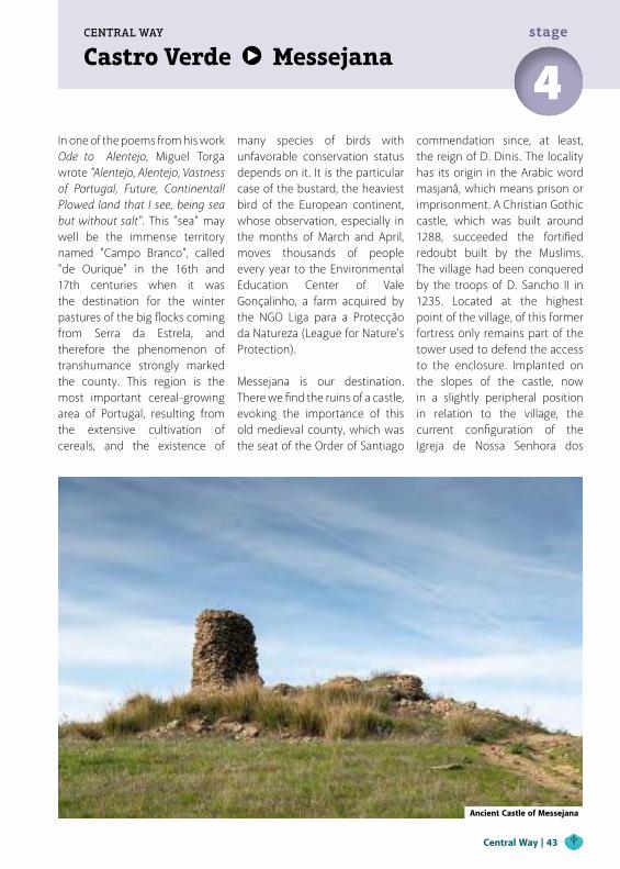
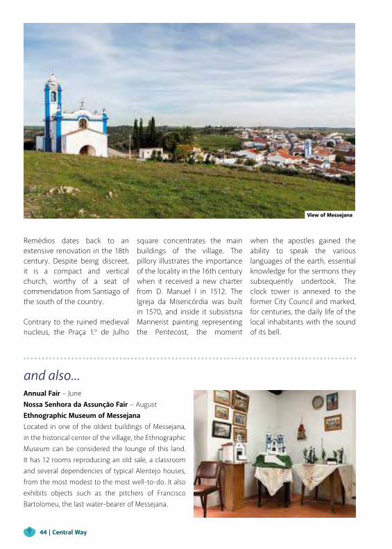
Messejana is our destination. There we find the ruins of a castle, evoking the importance of this old medieval county, which was the seat of the Order of Santiago
commendation since, at least, the reign of D. Dinis. The locality has its origin in the Arabic word masjanâ, which means prison or imprisonment. A Christian Gothic castle, which was built around 1288, succeeded the fortified redoubt built by the Muslims. The village had been conquered by the troops of D. Sancho II in 1235. Located at the highest point of the village, of this former fortress only remains part of the tower used to defend the access to the enclosure. Implanted on the slopes of the castle, now in a slightly peripheral position in relation to the village, the current configuration of the Igreja de Nossa Senhora dos
Ancient Castle of Messejana
Central Way | 43
and also...Annual Fair − JuneNossa Senhora da Assunção Fair − AugustEthnographic Museum of MessejanaLocated in one of the oldest buildings of Messejana, in the historical center of the village, the Ethnographic Museum can be considered the lounge of this land. It has 12 rooms reproducing an old sale, a classroom and several dependencies of typical Alentejo houses, from the most modest to the most well-to-do. It also exhibits objects such as the pitchers of Francisco Bartolomeu, the last water-bearer of Messejana.
Remédios dates back to an extensive renovation in the 18th century. Despite being discreet, it is a compact and vertical church, worthy of a seat of commendation from Santiago of the south of the country.
Contrary to the ruined medieval nucleus, the Praça 1.º de Julho
View of Messejana
square concentrates the main buildings of the village. The pillory illustrates the importance of the locality in the 16th century when it received a new charter from D. Manuel I in 1512. The Igreja da Misericórdia was built in 1570, and inside it subsistsna Mannerist painting representing the Pentecost, the moment
when the apostles gained the ability to speak the various languages of the earth, essential knowledge for the sermons they subsequently undertook. The clock tower is annexed to the former City Council and marked, for centuries, the daily life of the local inhabitants with the sound of its bell.
44 | Central Way
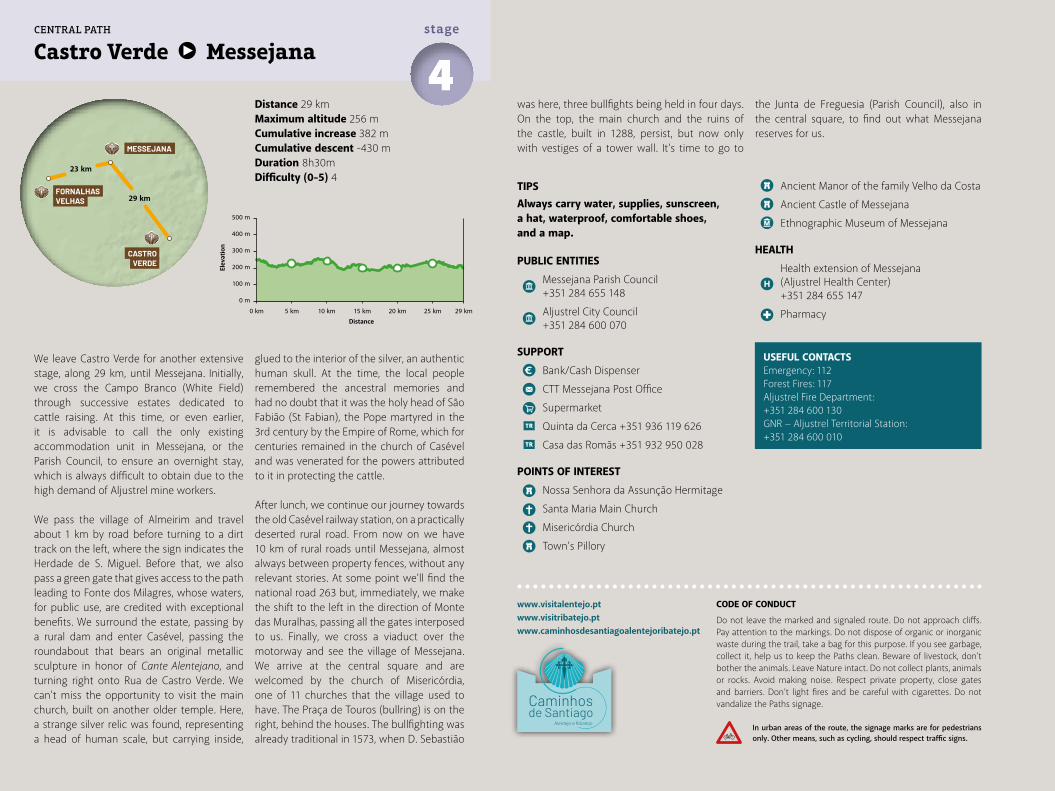
Distance 29 kmMaximum altitude 256 mCumulative increase 382 m Cumulative descent -430 mDuration 8h30mDifficulty (0-5) 4
Castro Verde Messejana4stage
www.visitalentejo.ptwww.visitribatejo.ptwww.caminhosdesantiagoalentejoribatejo.pt
We leave Castro Verde for another extensive stage, along 29 km, until Messejana. Initially, we cross the Campo Branco (White Field) through successive estates dedicated to cattle raising. At this time, or even earlier, it is advisable to call the only existing accommodation unit in Messejana, or the Parish Council, to ensure an overnight stay, which is always difficult to obtain due to the high demand of Aljustrel mine workers.
We pass the village of Almeirim and travel about 1 km by road before turning to a dirt track on the left, where the sign indicates the Herdade de S. Miguel. Before that, we also pass a green gate that gives access to the path leading to Fonte dos Milagres, whose waters, for public use, are credited with exceptional benefits. We surround the estate, passing by a rural dam and enter Casével, passing the roundabout that bears an original metallic sculpture in honor of Cante Alentejano, and turning right onto Rua de Castro Verde. We can't miss the opportunity to visit the main church, built on another older temple. Here, a strange silver relic was found, representing a head of human scale, but carrying inside,
TIPSAlways carry water, supplies, sunscreen, a hat, waterproof, comfortable shoes, and a map.
PUBLIC ENTITIES
Messejana Parish Council +351 284 655 148
Aljustrel City Council +351 284 600 070
SUPPORT
Bank/Cash Dispenser
CTT Messejana Post Office
Supermarket
Quinta da Cerca +351 936 119 626
Casa das Romãs +351 932 950 028
POINTS OF INTEREST
Nossa Senhora da Assunção Hermitage
Santa Maria Main Church
Misericórdia Church
Town’s Pillory
Ancient Manor of the family Velho da Costa
Ancient Castle of Messejana
Ethnographic Museum of Messejana
HEALTH
Health extension of Messejana (Aljustrel Health Center) +351 284 655 147
Pharmacy
glued to the interior of the silver, an authentic human skull. At the time, the local people remembered the ancestral memories and had no doubt that it was the holy head of São Fabião (St Fabian), the Pope martyred in the 3rd century by the Empire of Rome, which for centuries remained in the church of Casével and was venerated for the powers attributed to it in protecting the cattle.
After lunch, we continue our journey towards the old Casével railway station, on a practically deserted rural road. From now on we have 10 km of rural roads until Messejana, almost always between property fences, without any relevant stories. At some point we'll find the national road 263 but, immediately, we make the shift to the left in the direction of Monte das Muralhas, passing all the gates interposed to us. Finally, we cross a viaduct over the motorway and see the village of Messejana. We arrive at the central square and are welcomed by the church of Misericórdia, one of 11 churches that the village used to have. The Praça de Touros (bullring) is on the right, behind the houses. The bullfighting was already traditional in 1573, when D. Sebastião
USEFUL CONTACTSEmergency: 112Forest Fires: 117Aljustrel Fire Department:+351 284 600 130GNR − Aljustrel Territorial Station:+351 284 600 010
was here, three bullfights being held in four days. On the top, the main church and the ruins of the castle, built in 1288, persist, but now only with vestiges of a tower wall. It's time to go to
the Junta de Freguesia (Parish Council), also in the central square, to find out what Messejana reserves for us.
500 m
400 m
300 m
200 m
100 m
0 m
0 km 5 km 10 km 15 km 20 km 25 km 29 km
MESSEJANA
FORNALHASVELHAS
CASTROVERDE
29 km
23 km
CENTRAL PATH
CODE OF CONDUCT
Do not leave the marked and signaled route. Do not approach cliffs. Pay attention to the markings. Do not dispose of organic or inorganic waste during the trail, take a bag for this purpose. If you see garbage, collect it, help us to keep the Paths clean. Beware of livestock, don't bother the animals. Leave Nature intact. Do not collect plants, animals or rocks. Avoid making noise. Respect private property, close gates and barriers. Don’t light fires and be careful with cigarettes. Do not vandalize the Paths signage.
In urban areas of the route, the signage marks are for pedestrians only. Other means, such as cycling, should respect traffic signs.
Elev
atio
n
Distance
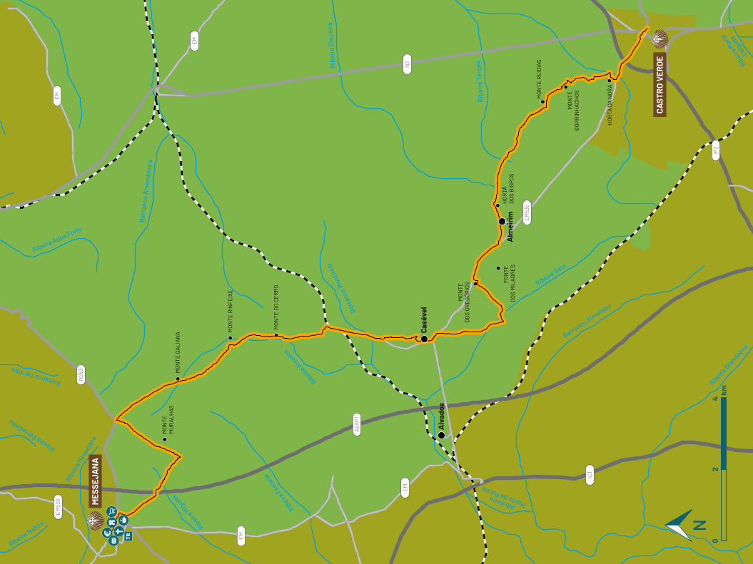
Ribeira Nabos
Ribeira Barradinha
Ribei
ra M
esse
jana
Ribeira M
iguéis
Ribeira A
ivadosRib
eira Ferra
ria
Albufeira Monte da Rocha
Barr
anco
Mon
tinho
Rib
eira
Cin
ceir
a
Rib
eira
Ter
ges Rib
eira M
aria
Delgad
a
Ribeira Gata
Barranco Almoleias
Ribeira Gra
ndaços
Barranco Farrobo
Ribeira Água Forte
Bar
ranc
o A
men
doei
ra
EM
EM
A2/IP
1
EM53
5
EM53
0
EM
IC1
IP2
N26
3
EM
N2
Aiv
ados
Casé
vel
Alm
eiri
m
MO
NTE
M
UR
ALH
ASM
ON
TE G
ALI
AN
A MO
NTE
RIN
FEIX
E
MO
NTE
DO
CE
RR
O
MO
NTE
D
OS
GR
EG
ÓR
IOS
HO
RTA
D
OS
BIS
POS
MO
NTE
RE
IDIA
S
MO
NTE
B
OR
RIN
HA
CH
OS
HO
RTA
DA
NO
RA
FON
TE
DO
S M
ILA
GR
ES
MES
SEJA
NA
CAST
RO
VER
DE
02
4km
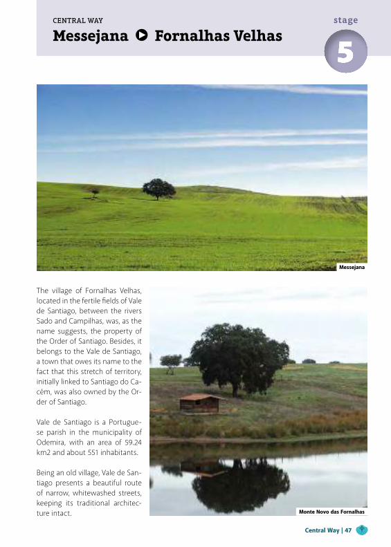
Messejana Fornalhas VelhasCENTRAL WAY
5stage
The village of Fornalhas Velhas, located in the fertile fields of Vale de Santiago, between the rivers Sado and Campilhas, was, as the name suggests, the property of the Order of Santiago. Besides, it belongs to the Vale de Santiago, a town that owes its name to the fact that this stretch of territory, initially linked to Santiago do Ca-cém, was also owned by the Or-der of Santiago.
Vale de Santiago is a Portugue-se parish in the municipality of Odemira, with an area of 59.24 km2 and about 551 inhabitants. Being an old village, Vale de San-tiago presents a beautiful route of narrow, whitewashed streets, keeping its traditional architec-ture intact.
Messejana
Monte Novo das Fornalhas
Central Way | 47
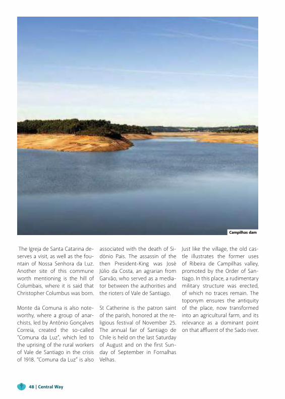
The Igreja de Santa Catarina de-serves a visit, as well as the fou-ntain of Nossa Senhora da Luz. Another site of this commune worth mentioning is the hill of Columbais, where it is said that Christopher Columbus was born.
Monte da Comuna is also note-worthy, where a group of anar-chists, led by António Gonçalves Correia, created the so-called "Comuna da Luz", which led to the uprising of the rural workers of Vale de Santiago in the crisis of 1918. “Comuna da Luz” is also
Campilhas dam
associated with the death of Si-dónio Pais. The assassin of the then President-King was José Júlio da Costa, an agrarian from Garvão, who served as a media-tor between the authorities and the rioters of Vale de Santiago.
St Catherine is the patron saint of the parish, honored at the re-ligious festival of November 25. The annual fair of Santiago de Chile is held on the last Saturday of August and on the first Sun-day of September in Fornalhas Velhas.
Just like the village, the old cas-tle illustrates the former uses of Ribeira de Campilhas valley, promoted by the Order of San-tiago. In this place, a rudimentary military structure was erected, of which no traces remain. The toponym ensures the antiquity of the place, now transformed into an agricultural farm, and its relevance as a dominant point on that affluent of the Sado river.
48 | Central Way
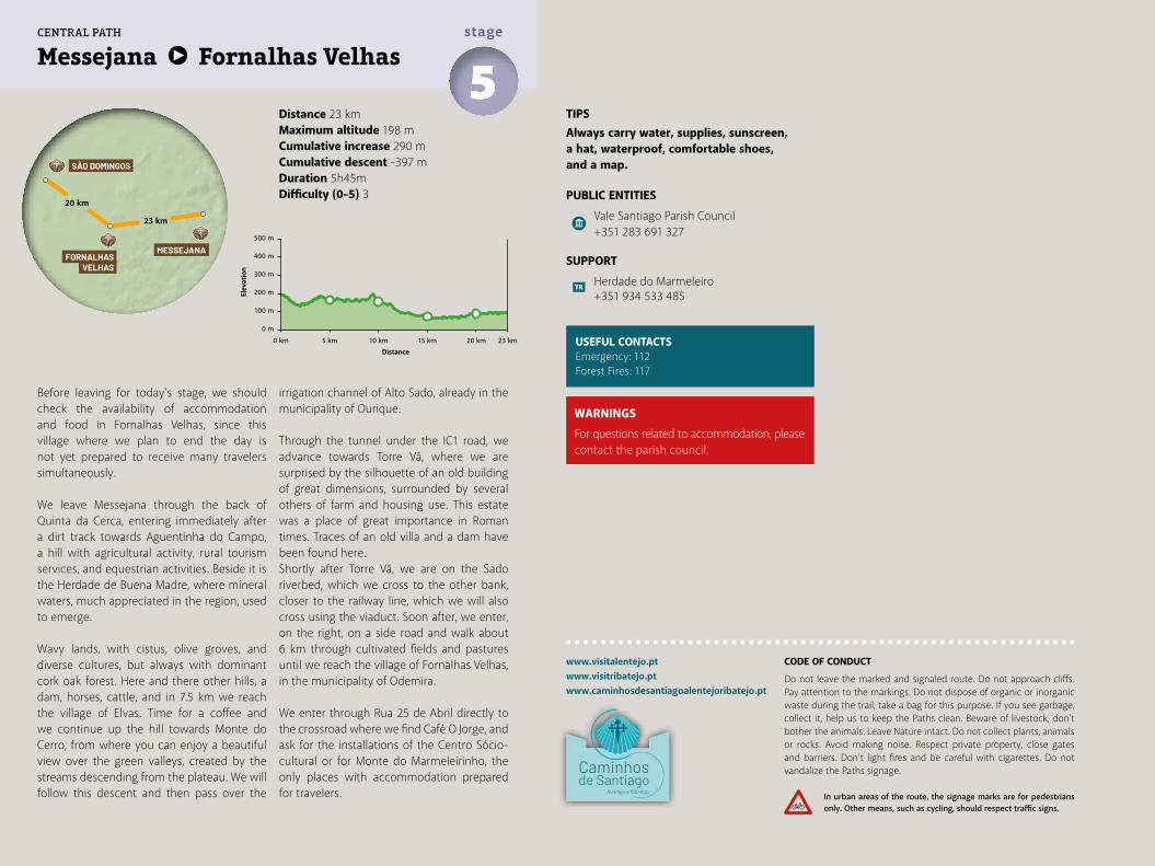
Distance 23 kmMaximum altitude 198 mCumulative increase 290 m Cumulative descent -397 mDuration 5h45mDifficulty (0-5) 3
Messejana Fornalhas Velhas5stage
www.visitalentejo.ptwww.visitribatejo.ptwww.caminhosdesantiagoalentejoribatejo.pt
Before leaving for today's stage, we should check the availability of accommodation and food in Fornalhas Velhas, since this village where we plan to end the day is not yet prepared to receive many travelers simultaneously.
We leave Messejana through the back of Quinta da Cerca, entering immediately after a dirt track towards Aguentinha do Campo, a hill with agricultural activity, rural tourism services, and equestrian activities. Beside it is the Herdade de Buena Madre, where mineral waters, much appreciated in the region, used to emerge.
Wavy lands, with cistus, olive groves, and diverse cultures, but always with dominant cork oak forest. Here and there other hills, a dam, horses, cattle, and in 7.5 km we reach the village of Elvas. Time for a coffee and we continue up the hill towards Monte do Cerro, from where you can enjoy a beautiful view over the green valleys, created by the streams descending from the plateau. We will follow this descent and then pass over the
irrigation channel of Alto Sado, already in the municipality of Ourique. Through the tunnel under the IC1 road, we advance towards Torre Vã, where we are surprised by the silhouette of an old building of great dimensions, surrounded by several others of farm and housing use. This estate was a place of great importance in Roman times. Traces of an old villa and a dam have been found here.Shortly after Torre Vã, we are on the Sado riverbed, which we cross to the other bank, closer to the railway line, which we will also cross using the viaduct. Soon after, we enter, on the right, on a side road and walk about 6 km through cultivated fields and pastures until we reach the village of Fornalhas Velhas, in the municipality of Odemira.
We enter through Rua 25 de Abril directly to the crossroad where we find Café O Jorge, and ask for the installations of the Centro Sócio-cultural or for Monte do Marmeleirinho, the only places with accommodation prepared for travelers.
TIPSAlways carry water, supplies, sunscreen, a hat, waterproof, comfortable shoes, and a map.
PUBLIC ENTITIES
Vale Santiago Parish Council +351 283 691 327
SUPPORT
Herdade do Marmeleiro +351 934 533 485
USEFUL CONTACTSEmergency: 112Forest Fires: 117
500 m
400 m
300 m
200 m
100 m
0 m
0 km 5 km 10 km 15 km 20 km 23 km
MESSEJANA
SÃO DOMINGOS
FORNALHASVELHAS
23 km
20 km
CENTRAL PATH
WARNINGS
For questions related to accommodation, please contact the parish council.
CODE OF CONDUCT
Do not leave the marked and signaled route. Do not approach cliffs. Pay attention to the markings. Do not dispose of organic or inorganic waste during the trail, take a bag for this purpose. If you see garbage, collect it, help us to keep the Paths clean. Beware of livestock, don't bother the animals. Leave Nature intact. Do not collect plants, animals or rocks. Avoid making noise. Respect private property, close gates and barriers. Don’t light fires and be careful with cigarettes. Do not vandalize the Paths signage.
In urban areas of the route, the signage marks are for pedestrians only. Other means, such as cycling, should respect traffic signs.
Elev
atio
n
Distance
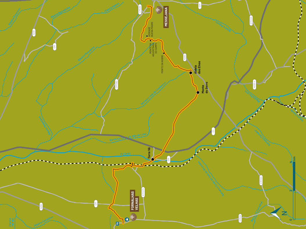
Rib
eira
Mal
hão
Ribei
ra M
esse
jana
Ribei
ra O
utei
rões
Ribeira BarradinhaRibeira Nabos
Ribeira M
essejana
Barranco Vale de Coelheiro
s
Barranco Corgo do Vale de Lobo
Rio Sado
Ribeira Miguéis
Ribeira Ferra
ria
Barranco Ferra
dor
Barranco C
orgo d
o Vale
de A
lcondim
Barr
anco
Car
valh
al
Ribeira Garvão
Ribeira Campilhas
EM
EM
CM10
82
EM
EM
N26
1
IC1
N26
3
EM10
79
EM51
8
EM1109
N26
1-4
EM12
25
EM53
0
N26
2
02
4km
Mon
te
do S
erro
Torr
e Vã
Ald
eia
dos
Elva
s
FOR
NA
LHA
S V
ELH
AS
MES
SEJA
NA
MO
NTE
DA
NO
BR
E
MO
NTE
DA
AG
UE
NTI
NH
AD
O C
AM
PO
HE
RD
AD
E
BU
EN
A M
AD
RE
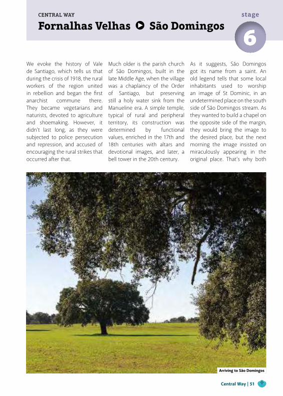
Fornalhas Velhas São DomingosCENTRAL WAY
6stage
We evoke the history of Vale de Santiago, which tells us that during the crisis of 1918, the rural workers of the region united in rebellion and began the first anarchist commune there. They became vegetarians and naturists, devoted to agriculture and shoemaking. However, it didn’t last long, as they were subjected to police persecution and repression, and accused of encouraging the rural strikes that occurred after that.
Arriving to São Domingos
Much older is the parish church of São Domingos, built in the late Middle Age, when the village was a chaplaincy of the Order of Santiago, but preserving still a holy water sink from the Manueline era. A simple temple, typical of rural and peripheral territory, its construction was determined by functional values, enriched in the 17th and 18th centuries with altars and devotional images, and later, a bell tower in the 20th century.
As it suggests, São Domingos got its name from a saint. An old legend tells that some local inhabitants used to worship an image of St Dominic, in an undetermined place on the south side of São Domingos stream. As they wanted to build a chapel on the opposite side of the margin, they would bring the image to the desired place, but the next morning the image insisted on miraculously appearing in the original place. That’s why both
Central Way | 51
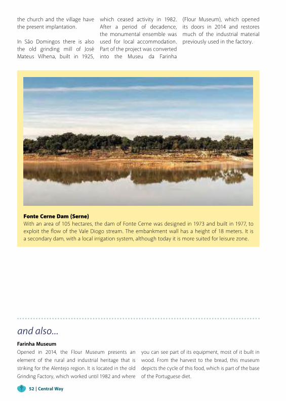
and also...Farinha MuseumOpened in 2014, the Flour Museum presents an element of the rural and industrial heritage that is striking for the Alentejo region. It is located in the old Grinding Factory, which worked until 1982 and where
Fonte Cerne Dam (Serne)With an area of 105 hectares, the dam of Fonte Cerne was designed in 1973 and built in 1977, to exploit the flow of the Vale Diogo stream. The embankment wall has a height of 18 meters. It is a secondary dam, with a local irrigation system, although today it is more suited for leisure zone.
you can see part of its equipment, most of it built in wood. From the harvest to the bread, this museum depicts the cycle of this food, which is part of the base of the Portuguese diet.
the church and the village have the present implantation.
In São Domingos there is also the old grinding mill of José Mateus Vilhena, built in 1925,
which ceased activity in 1982. After a period of decadence, the monumental ensemble was used for local accommodation. Part of the project was converted into the Museu da Farinha
(Flour Museum), which opened its doors in 2014 and restores much of the industrial material previously used in the factory.
52 | Central Way
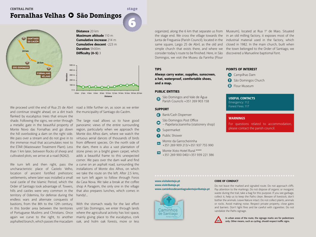
Distance 20 kmMaximum altitude 110 mCumulative increase 214 m Cumulative descent -223 mDuration 5h00mDifficulty (0-5) 3
Fornalhas Velhas São Domingos6stage
www.visitalentejo.ptwww.visitribatejo.ptwww.caminhosdesantiagoalentejoribatejo.pt
We proceed until the end of Rua 25 de Abril and continue straight ahead, on a dirt track flanked by eucalyptus trees that ensure the shade. Following the signs, we enter through a metallic gate in the beautiful property of Monte Novo das Fornalhas and go down the hill overlooking a dam on the right side. We pass over a stream and do not give in to the immense mud that accumulates next to the ETAR (Wastewater Treatment Plant). Less than 1 km later, between flocks of sheep and cultivated plots, we arrive at a road (N262).
We turn left and then right, pass the uncharacteristic place of Castelo Velho, location of ancient fortified prehistoric settlements, where later was installed a small rural castle of the Islamic Period, which the Order of Santiago took advantage of. Towers, hills and castles were very common in the territory of Odemira, for defense during the endless wars and alternate conquests of bastions, from the 8th to the 12th century, in this border area between the territories of Portuguese Muslims and Christians. Once again we curve to the right, to another asphalted branch, which passes the macadam
road a little further on, as soon as we enter the municipality of Santiago do Cacém.
The large road allows us to have good panoramic views of the entire surrounding region, particularly when we approach the Monte dos Alhos dam, where we watch the virtuous aerial dances of thousands of birds from different species. On the north side of the dam, there is also a vast plantation of stone pines on a bright green carpet, which adds a beautiful frame to this unexpected corner. We pass over the dam wall and find a curve on an asphalt road, surrounding the installations of Monte dos Alhos, on which we take the route on the left. After 2.5 kms, we turn left again to follow through Foros da Casa Nova. We take a break at the coffee shop A Paragem, the only one in the village that also prepares lunches, which comes in handy!...
With the stomach ready for the last effort until São Domingos, we enter through lands where the agricultural activity has lost space, mainly giving place to the eucalyptus, cork oak, and holm oak forests, more or less
organized, along the 6 km that separate us from the stage end. We cross the village towards the Junta de Freguesia (Parish Council), located in the same square, Largo 25 de Abril, as the old and simple church that exists there, and where we consider today's route to be finished. Here, in São Domingos, we visit the Museu da Farinha (Flour
Museum), located at Rua 1º de Maio. Situated in an old milling factory, it exposes most of the industrial material used in the factory, which closed in 1982. In the main church, built when the town belonged to the Order of Santiago, we discovered a Manueline baptismal font.
USEFUL CONTACTSEmergency: 112Forest Fires: 117
TIPSAlways carry water, supplies, sunscreen, a hat, waterproof, comfortable shoes, and a map.
PUBLIC ENTITIES
São Domingos and Vale de Água Parish Councils +351 269 903 158
SUPPORT
Bank/Cash Dispenser
São Domingos Post Office − Papelaria Joaninha (stationery shop)
Supermarket
Public Shower
Monte da Garrocheirinha +351 269 909 213/+351 937 755 990
Monte Xisto Hotel Rural **** +351 269 900 040/+351 939 221 386
500 m
400 m
300 m
200 m
100 m
0 m
0 km 2 km 4 km 6 km 8 km 10 km 12 km 14 km 16 km 18 km 20 km
FORNALHASVELHAS
20 km
24 km
SÃO DOMINGOS
SANTIAGO DO CACÉM
CENTRAL PATH
POINTS OF INTEREST
Campilhas Dam
São Domingos Church
Flour Museum
WARNINGS
For questions related to accommodation, please contact the parish council.
CODE OF CONDUCT
Do not leave the marked and signaled route. Do not approach cliffs. Pay attention to the markings. Do not dispose of organic or inorganic waste during the trail, take a bag for this purpose. If you see garbage, collect it, help us to keep the Paths clean. Beware of livestock, don't bother the animals. Leave Nature intact. Do not collect plants, animals or rocks. Avoid making noise. Respect private property, close gates and barriers. Don’t light fires and be careful with cigarettes. Do not vandalize the Paths signage.
In urban areas of the route, the signage marks are for pedestrians only. Other means, such as cycling, should respect traffic signs.
Elev
atio
n
Distance
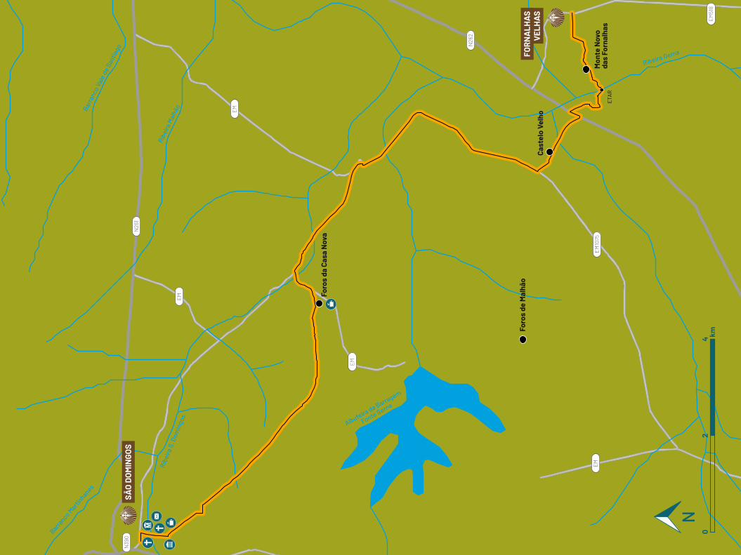
EM
EM
EM
EM
EM10
75
EM51
8
N26
2
N26
1
N39
0
Barranco M
artinhanes
Albufeira da Barragem
Fonte Serne
Ribeira Gema
Ribe
ira S
. Dom
ingo
s
Ribe
ira M
alhã
oBarr
anco
Val
e de
San
tiago
Foro
s de
Mal
hão
Foro
s da
Cas
a N
ova
Cast
elo
Velh
o
Mon
te N
ovo
das
Forn
alha
sE
TAR
SÃO
DO
MIN
GOS
FOR
NA
LHA
SV
ELH
AS
02
4 km
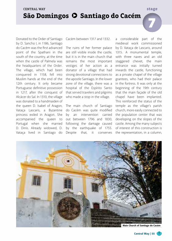
São Domingos Santiago do CacémCENTRAL WAY
7stage
Donated to the Order of Santiago by D. Sancho I, in 1186, Santiago do Cacém was the first advanced point of the Spatharii in the south of the country, at the time when the castle of Palmela was the headquarters of the Order. The village, which had been conquered in 1158, fell into Muslim hands at the end of the 12th century. It only became Portuguese definitive possession in 1217, after the conquest of Alcácer do Sal. In 1310, the village was donated to a handmaiden of the queen D. Isabel of Aragon, Vataça Lascaris, a Byzantine princess exiled in Aragon. She accompanied the queen to Portugal when she married D. Dinis. Already widowed, D. Vataça lived in Santiago do
Cacém between 1317 and 1332.
The ruins of her former palace are still visible inside the castle, but it is in the main church that remains the most important vestiges of her action as a donator of a village that had strong devotional connections to the apostle Santiago. In the lower zone of the village, there was a hospital of the Espírito Santo that served travelers and pilgrims who made a stop in the village.
The main church of Santiago do Cacém was quite modified by an intervention carried out between 1796 and 1830, following the damage caused by the earthquake of 1755. Despite that, it conserves
a considerable part of the medieval work commissioned by D. Vataça de Lascaris, around 1315. A monumental temple, with three naves and an old staggered chevet, the main entrance was initially turned inwards the castle, functioning as a private chapel of the village grantees, who had their palace in the fortress. It was only at the beginning of the 19th century that the main façade of the old chapel have been implanted. This reinforced the status of the temple as the village’s parish church, more easily connected to the population center that was developing on the slopes of the castle. Among the many subjects of interest of this construction is the representation, in a column,
Main Church of Santiago do Cacém
Central Way | 55
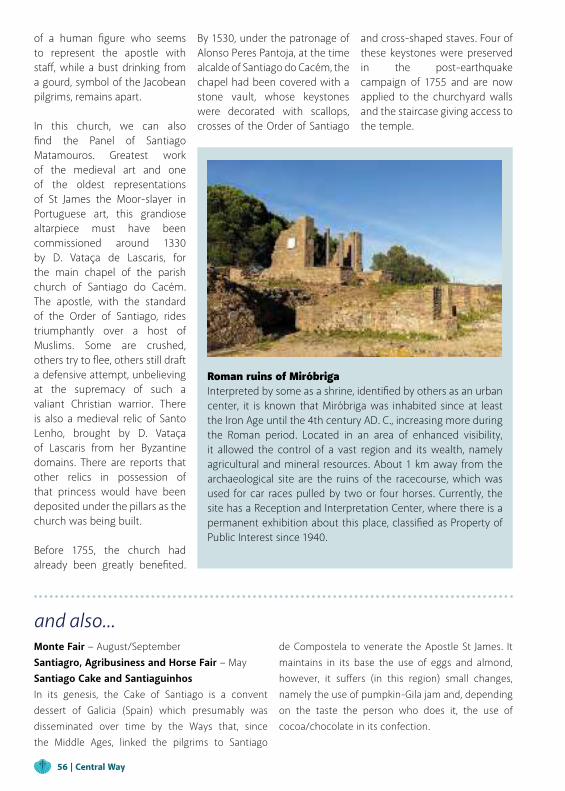
and also...Monte Fair − August/SeptemberSantiagro, Agribusiness and Horse Fair − May Santiago Cake and SantiaguinhosIn its genesis, the Cake of Santiago is a convent dessert of Galicia (Spain) which presumably was disseminated over time by the Ways that, since the Middle Ages, linked the pilgrims to Santiago
de Compostela to venerate the Apostle St James. It maintains in its base the use of eggs and almond, however, it suffers (in this region) small changes, namely the use of pumpkin-Gila jam and, depending on the taste the person who does it, the use of cocoa/chocolate in its confection.
of a human figure who seems to represent the apostle with staff, while a bust drinking from a gourd, symbol of the Jacobean pilgrims, remains apart.
In this church, we can also find the Panel of Santiago Matamouros. Greatest work of the medieval art and one of the oldest representations of St James the Moor-slayer in Portuguese art, this grandiose altarpiece must have been commissioned around 1330 by D. Vataça de Lascaris, for the main chapel of the parish church of Santiago do Cacém. The apostle, with the standard of the Order of Santiago, rides triumphantly over a host of Muslims. Some are crushed, others try to flee, others still draft a defensive attempt, unbelieving at the supremacy of such a valiant Christian warrior. There is also a medieval relic of Santo Lenho, brought by D. Vataça of Lascaris from her Byzantine domains. There are reports that other relics in possession of that princess would have been deposited under the pillars as the church was being built.
Before 1755, the church had already been greatly benefited.
Roman ruins of MiróbrigaInterpreted by some as a shrine, identified by others as an urban center, it is known that Miróbriga was inhabited since at least the Iron Age until the 4th century AD. C., increasing more during the Roman period. Located in an area of enhanced visibility, it allowed the control of a vast region and its wealth, namely agricultural and mineral resources. About 1 km away from the archaeological site are the ruins of the racecourse, which was used for car races pulled by two or four horses. Currently, the site has a Reception and Interpretation Center, where there is a permanent exhibition about this place, classified as Property of Public Interest since 1940.
By 1530, under the patronage of Alonso Peres Pantoja, at the time alcalde of Santiago do Cacém, the chapel had been covered with a stone vault, whose keystones were decorated with scallops, crosses of the Order of Santiago
and cross-shaped staves. Four of these keystones were preserved in the post-earthquake campaign of 1755 and are now applied to the churchyard walls and the staircase giving access to the temple.
56 | Central Way
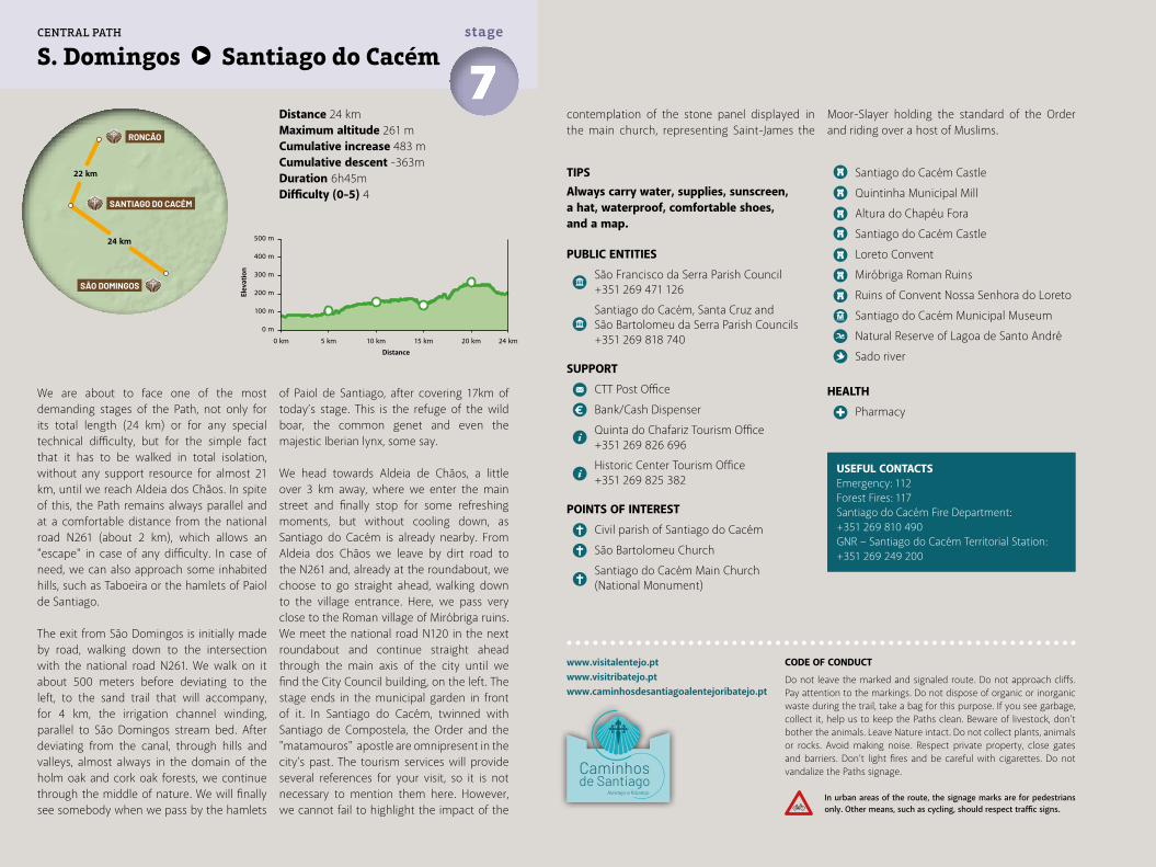
Distance 24 kmMaximum altitude 261 mCumulative increase 483 m Cumulative descent -363mDuration 6h45mDifficulty (0-5) 4
S. Domingos Santiago do Cacém7stage
www.visitalentejo.ptwww.visitribatejo.ptwww.caminhosdesantiagoalentejoribatejo.pt
We are about to face one of the most demanding stages of the Path, not only for its total length (24 km) or for any special technical difficulty, but for the simple fact that it has to be walked in total isolation, without any support resource for almost 21 km, until we reach Aldeia dos Chãos. In spite of this, the Path remains always parallel and at a comfortable distance from the national road N261 (about 2 km), which allows an "escape" in case of any difficulty. In case of need, we can also approach some inhabited hills, such as Taboeira or the hamlets of Paiol de Santiago.
The exit from São Domingos is initially made by road, walking down to the intersection with the national road N261. We walk on it about 500 meters before deviating to the left, to the sand trail that will accompany, for 4 km, the irrigation channel winding, parallel to São Domingos stream bed. After deviating from the canal, through hills and valleys, almost always in the domain of the holm oak and cork oak forests, we continue through the middle of nature. We will finally see somebody when we pass by the hamlets
of Paiol de Santiago, after covering 17km of today’s stage. This is the refuge of the wild boar, the common genet and even the majestic Iberian lynx, some say.
We head towards Aldeia de Chãos, a little over 3 km away, where we enter the main street and finally stop for some refreshing moments, but without cooling down, as Santiago do Cacém is already nearby. From Aldeia dos Chãos we leave by dirt road to the N261 and, already at the roundabout, we choose to go straight ahead, walking down to the village entrance. Here, we pass very close to the Roman village of Miróbriga ruins. We meet the national road N120 in the next roundabout and continue straight ahead through the main axis of the city until we find the City Council building, on the left. The stage ends in the municipal garden in front of it. In Santiago do Cacém, twinned with Santiago de Compostela, the Order and the "matamouros" apostle are omnipresent in the city’s past. The tourism services will provide several references for your visit, so it is not necessary to mention them here. However, we cannot fail to highlight the impact of the
TIPSAlways carry water, supplies, sunscreen, a hat, waterproof, comfortable shoes, and a map.
PUBLIC ENTITIES
São Francisco da Serra Parish Council +351 269 471 126
Santiago do Cacém, Santa Cruz and São Bartolomeu da Serra Parish Councils +351 269 818 740
SUPPORT
CTT Post Office
Bank/Cash Dispenser
Quinta do Chafariz Tourism Office +351 269 826 696
Historic Center Tourism Office +351 269 825 382
POINTS OF INTEREST
Civil parish of Santiago do Cacém
São Bartolomeu Church
Santiago do Cacém Main Church (National Monument)
Santiago do Cacém Castle
Quintinha Municipal Mill
Altura do Chapéu Fora
Santiago do Cacém Castle
Loreto Convent
Miróbriga Roman Ruins
Ruins of Convent Nossa Senhora do Loreto
Santiago do Cacém Municipal Museum
Natural Reserve of Lagoa de Santo André
Sado river
HEALTH
Pharmacy
USEFUL CONTACTSEmergency: 112Forest Fires: 117Santiago do Cacém Fire Department:+351 269 810 490GNR – Santiago do Cacém Territorial Station:+351 269 249 200
contemplation of the stone panel displayed in the main church, representing Saint-James the
Moor-Slayer holding the standard of the Order and riding over a host of Muslims.
500 m
400 m
300 m
200 m
100 m
0 m
0 km 5 km 10 km 15 km 20 km 24 km
24 km
22 km
SÃO DOMINGOS
SANTIAGO DO CACÉM
RONCÃO
CENTRAL PATH
CODE OF CONDUCT
Do not leave the marked and signaled route. Do not approach cliffs. Pay attention to the markings. Do not dispose of organic or inorganic waste during the trail, take a bag for this purpose. If you see garbage, collect it, help us to keep the Paths clean. Beware of livestock, don't bother the animals. Leave Nature intact. Do not collect plants, animals or rocks. Avoid making noise. Respect private property, close gates and barriers. Don’t light fires and be careful with cigarettes. Do not vandalize the Paths signage.
In urban areas of the route, the signage marks are for pedestrians only. Other means, such as cycling, should respect traffic signs.
Elev
atio
n
Distance
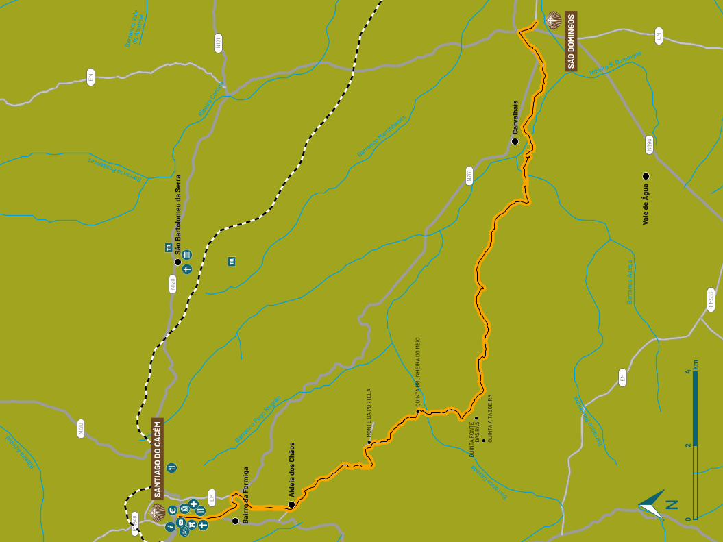
EM
EM
EM
EM
EM55
3
N39
0
N26
1
N12
0
N12
1
N12
0
EM54
8
Barr
anco
Rib
eirin
ha
Bar
ranc
o A
dega
Ribeira S. Domingos
Barranco Marti
nhanes
Barranco Pego N
egrão
Ribei
ra C
orona
Barranco Possancas
Ribeira
Azin
hal
Barr
anco
Val
e do
Abu
tria
l
Barranco Cavada
São
Bar
tolo
meu
da
Serr
a
Carv
alha
is
Vale
de
Águ
a
MO
NTE
DA
PO
RTE
LA
QUIN
TA A
TA
BO
EIR
A
QUIN
TA F
ON
TED
AS R
ÃS
QUIN
TA B
RU
NH
EIR
A D
O M
EIO
Ald
eia
dos
Chão
s
Bai
rro
da F
orm
iga
SAN
TIA
GO D
O C
ACÉ
M
SÃO
DO
MIN
GOS
02
4 km
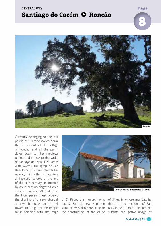
Santiago do Cacém RoncãoCENTRAL WAY
8stage
Currently belonging to the civil parish of S. Francisco da Serra, the settlement of the village of Roncão, and all the parish dates back to the medieval period and is due to the Order of Santiago de Espada (St James with Sword). The Igreja de São Bartolomeu da Serra church lies nearby, built in the 14th century and greatly restored at the end of the 18th century, as attested by an inscription engraved on a column pinnacle. At that time, the local parish priest ordered the drafting of a new chancel, a new altarpiece, and a bell tower. The origin of the temple must coincide with the reign
Church of São Bartolomeu da Serra
of D. Pedro I, a monarch who had St Bartholomew as patron saint. He was also connected to the construction of the castle
of Sines, in whose municipality there is also a church of São Bartolomeu. From the temple subsists the gothic image of
Roncão
Central Way | 59
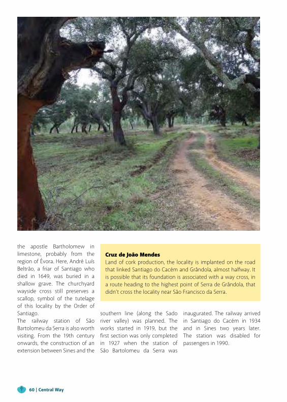
Cruz de João MendesLand of cork production, the locality is implanted on the road that linked Santiago do Cacém and Grândola, almost halfway. It is possible that its foundation is associated with a way cross, in a route heading to the highest point of Serra de Grândola, that didn’t cross the locality near São Francisco da Serra.
the apostle Bartholomew in limestone, probably from the region of Évora. Here, André Luís Beltrão, a friar of Santiago who died in 1649, was buried in a shallow grave. The churchyard wayside cross still preserves a scallop, symbol of the tutelage of this locality by the Order of Santiago.The railway station of São Bartolomeu da Serra is also worth visiting. From the 19th century onwards, the construction of an extension between Sines and the
southern line (along the Sado river valley) was planned. The works started in 1919, but the first section was only completed in 1927 when the station of São Bartolomeu da Serra was
inaugurated. The railway arrived in Santiago do Cacém in 1934 and in Sines two years later. The station was disabled for passengers in 1990.
60 | Central Way
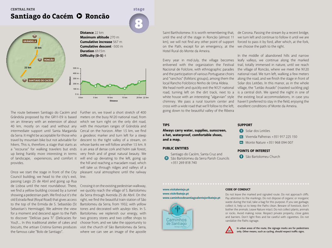
SUPPORT
Solar dos Leitões
Vivenda Palheiras +351 917 225 150
Monte Nature +351 968 094 007
POINTS OF INTEREST
São Bartolomeu Church
Distance 22 kmMaximum altitude 270 mCumulative increase 567 m Cumulative descent -500 mDuration 6h15mDifficulty (0-5) 4
Santiago do Cacém Roncão8stage
www.visitalentejo.ptwww.visitribatejo.ptwww.caminhosdesantiagoalentejoribatejo.pt
The route between Santiago do Cacém and Grândola proposed by the GR11-E9 is based on an itinerary with an extension of about 40 km, mostly on road and without any intermediate support until Santa Margarida da Serra. It might be acceptable for those who travel by mountain bike but not advisable for hikers. This is, therefore, a stage that starts as a "recourse" for walking travelers but ends up being frankly more interesting in terms of landscape, experiences, and comfort it provides.
Once we start the stage in front of the City Council building, we head to the city’s exit, passing Largo 25 de Abril and going up Rua de Lisboa until the next roundabout. There, we find a yellow building crossed by a tunnel showing a pedestrian path. We find out it’s the old Estrada Real (Royal Road) that gives access to the top of the Ermida de S. Sebastião (St Sebastian’s Hermitage). We admire the view for a moment and descend again to the Path to discover "Delícias para Ti" (Delicacies for You)!.... In this traditional atelier of cakes and biscuits, the artisan Cristina Gomes produces the famous cake "Bolo de Santiago".
Further on, we travel a short stretch of 400 meters on the busy N120 national road, from which we turn right on the only dirt road, with the mountain ranges of Grândola and Cercal on the horizon. After 1.5 km, we find a geodesic marker and turn left for a steep descent to the tight valley of a stream, on whose banks we will follow another 1.5 km. It is an area of dense cork and holm oak forest, very fresh and of great natural beauty. We will end up deviating to the left, going up the hill and reaching a macadam road, which will take us through ridges and valleys of a pleasant rural atmosphere until the railway line.
Crossing it on the existing pedestrian walkway, we quickly reach the village of S. Bartolomeu da Serra through Avenida 25 de Abril. On the right, we find the beautiful train station of São Bartolomeu da Serra, from 1932, with yellow tones and decorated with azulejo tiles. In S. Bartolomeu we replenish our energy, with two grocery stores and two coffee shops to choose from, and we take the opportunity to visit the church of São Bartolomeu da Serra, where we can see an image of the apostle
Saint Bartholomew. It is worth remembering that, until the end of the stage in Roncão (almost 11 km), we will not find any other point of support on the Path, except for an emergency, at the Hotel Rural do Monte da Ameira.
Every year in mid-July, the village becomes enlivened with the organization the Festival Nacional de Folclore, with ethnographic parades and the participation of various Portuguese choirs and "ranchos" (folkloric groups), among them the local Rancho Folclórico Ninho de Uma Aldeia.We head north and quickly exit the N121 national road, turning left on the dirt track, next to a white house with an interesting "algarvian" style chimney. We pass a rural tourism center and cross with a wide road that we’ll follow to the left, going down to the beautiful valley of the Ribeira
de Corona. Passing the stream by a recent bridge, we turn left and continue to follow it until we are forced to pass it by ford, after which, at the fork, we choose the path to the right.
In the middle of abandoned hills and narrow leafy valleys, we continue along the marked trail, totally immersed in nature, until we reach the village of Roncão, where we meet the N120 national road. We turn left, walking a few meters along the road, and we finish the stage in front of Solar dos Leitões. In this manor, as in the whole village, the “Leitão Assado” (roasted suckling pig) is a central dish. We spend the night in one of the existing local accommodations, in case you haven't preferred to stay in the field, enjoying the excellent conditions of Monte da Ameira.
TIPSAlways carry water, supplies, sunscreen, a hat, waterproof, comfortable shoes, and a map.
PUBLIC ENTITIES
Santiago do Cacém, Santa Cruz and São Bartolomeu da Serra Parish Councils +351 269 818 740
500 m
400 m
300 m
200 m
100 m
0 m
0 km 5 km 10 km 15 km 20 km 22 km
22 km
23 km
SANTIAGO DO CACÉM
RONCÃO
GRÂNDOLA
CENTRAL PATH
CODE OF CONDUCT
Do not leave the marked and signaled route. Do not approach cliffs. Pay attention to the markings. Do not dispose of organic or inorganic waste during the trail, take a bag for this purpose. If you see garbage, collect it, help us to keep the Paths clean. Beware of livestock, don't bother the animals. Leave Nature intact. Do not collect plants, animals or rocks. Avoid making noise. Respect private property, close gates and barriers. Don’t light fires and be careful with cigarettes. Do not vandalize the Paths signage.
In urban areas of the route, the signage marks are for pedestrians only. Other means, such as cycling, should respect traffic signs.
Elev
atio
n
Distance
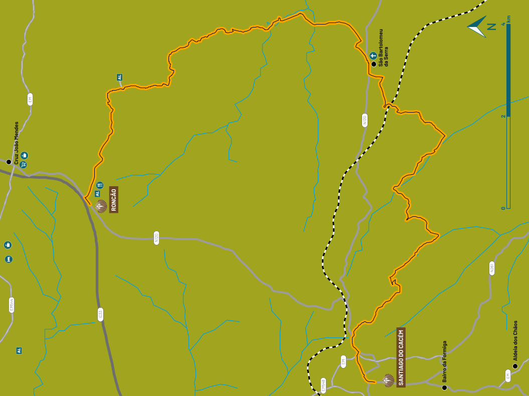
IC33
EM54
4
EM54
8
N12
0
EM
EM
EM
N12
0
N26
1
Bai
rro
da F
orm
iga
Ald
eia
dos
Chão
s
São
Bar
tolo
meu
da
Ser
ra
Cruz
Joã
o M
ende
s
SAN
TIA
GO D
O C
ACÉ
M
RO
NCÃ
O
02
4 km
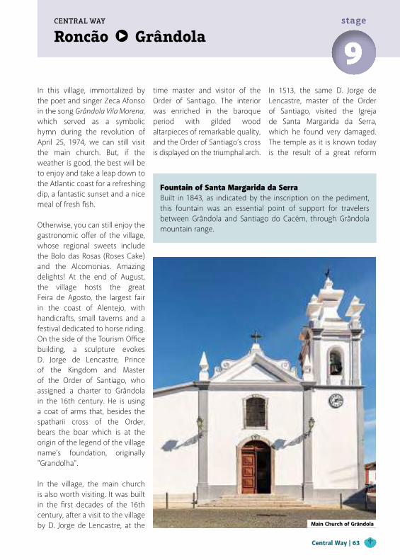
Roncão GrândolaCENTRAL WAY
9stage
In this village, immortalized by the poet and singer Zeca Afonso in the song Grândola Vila Morena, which served as a symbolic hymn during the revolution of April 25, 1974, we can still visit the main church. But, if the weather is good, the best will be to enjoy and take a leap down to the Atlantic coast for a refreshing dip, a fantastic sunset and a nice meal of fresh fish.
Otherwise, you can still enjoy the gastronomic offer of the village, whose regional sweets include the Bolo das Rosas (Roses Cake) and the Alcomonias. Amazing delights! At the end of August, the village hosts the great Feira de Agosto, the largest fair in the coast of Alentejo, with handicrafts, small taverns and a festival dedicated to horse riding.On the side of the Tourism Office building, a sculpture evokes D. Jorge de Lencastre, Prince of the Kingdom and Master of the Order of Santiago, who assigned a charter to Grândola in the 16th century. He is using a coat of arms that, besides the spatharii cross of the Order, bears the boar which is at the origin of the legend of the village name’s foundation, originally "Grandolha".
In the village, the main church is also worth visiting. It was built in the first decades of the 16th century, after a visit to the village by D. Jorge de Lencastre, at the
Fountain of Santa Margarida da Serra Built in 1843, as indicated by the inscription on the pediment, this fountain was an essential point of support for travelers between Grândola and Santiago do Cacém, through Grândola mountain range.
time master and visitor of the Order of Santiago. The interior was enriched in the baroque period with gilded wood altarpieces of remarkable quality, and the Order of Santiago’s cross is displayed on the triumphal arch.
In 1513, the same D. Jorge de Lencastre, master of the Order of Santiago, visited the Igreja de Santa Margarida da Serra, which he found very damaged. The temple as it is known today is the result of a great reform
Main Church of Grândola
Central Way | 63
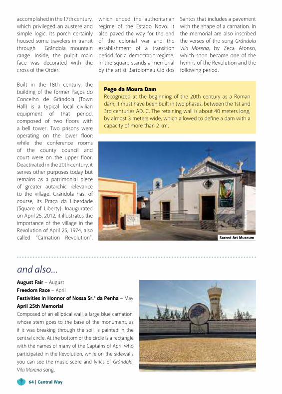
and also...August Fair − AugustFreedom Race − April Festivities in Honnor of Nossa Sr.ª da Penha − May April 25th MemorialComposed of an elliptical wall, a large blue carnation, whose stem goes to the base of the monument, as if it was breaking through the soil, is painted in the central circle. At the bottom of the circle is a rectangle with the names of many of the Captains of April who participated in the Revolution, while on the sidewalls you can see the music score and lyrics of Grândola, Vila Morena song.
Pego da Moura DamRecognized at the beginning of the 20th century as a Roman dam, it must have been built in two phases, between the 1st and 3rd centuries AD. C. The retaining wall is about 40 meters long, by almost 3 meters wide, which allowed to define a dam with a capacity of more than 2 km.
accomplished in the 17th century, which privileged an austere and simple logic. Its porch certainly housed some travelers in transit through Grândola mountain range. Inside, the pulpit main face was decorated with the cross of the Order.
Built in the 18th century, the building of the former Paços do Concelho de Grândola (Town Hall) is a typical local civilian equipment of that period, composed of two floors with a bell tower. Two prisons were operating on the lower floor; while the conference rooms of the county council and court were on the upper floor. Deactivated in the 20th century, it serves other purposes today but remains as a patrimonial piece of greater autarchic relevance to the village. Grândola has, of course, its Praça da Liberdade (Square of Liberty). Inaugurated on April 25, 2012, it illustrates the importance of the village in the Revolution of April 25, 1974, also called “Carnation Revolution”,
which ended the authoritarian regime of the Estado Novo. It also paved the way for the end of the colonial war and the establishment of a transition period for a democratic regime. In the square stands a memorial by the artist Bartolomeu Cid dos
Santos that includes a pavement with the shape of a carnation. In the memorial are also inscribed the verses of the song Grândola Vila Morena, by Zeca Afonso, which soon became one of the hymns of the Revolution and the following period.
Sacred Art Museum
64 | Central Way
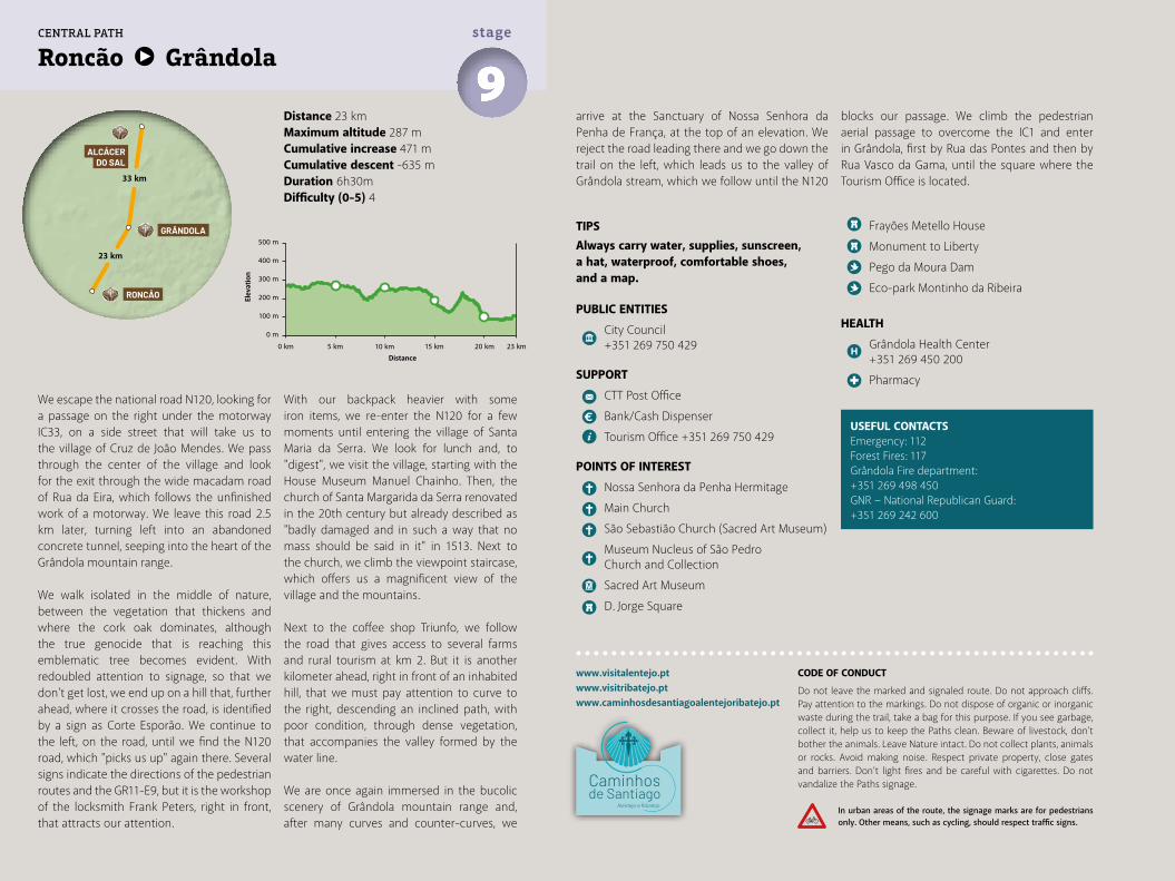
Distance 23 kmMaximum altitude 287 mCumulative increase 471 m Cumulative descent -635 mDuration 6h30mDifficulty (0-5) 4
Roncão Grândola9stage
www.visitalentejo.ptwww.visitribatejo.ptwww.caminhosdesantiagoalentejoribatejo.pt
We escape the national road N120, looking for a passage on the right under the motorway IC33, on a side street that will take us to the village of Cruz de João Mendes. We pass through the center of the village and look for the exit through the wide macadam road of Rua da Eira, which follows the unfinished work of a motorway. We leave this road 2.5 km later, turning left into an abandoned concrete tunnel, seeping into the heart of the Grândola mountain range.
We walk isolated in the middle of nature, between the vegetation that thickens and where the cork oak dominates, although the true genocide that is reaching this emblematic tree becomes evident. With redoubled attention to signage, so that we don't get lost, we end up on a hill that, further ahead, where it crosses the road, is identified by a sign as Corte Esporão. We continue to the left, on the road, until we find the N120 road, which "picks us up" again there. Several signs indicate the directions of the pedestrian routes and the GR11-E9, but it is the workshop of the locksmith Frank Peters, right in front, that attracts our attention.
USEFUL CONTACTSEmergency: 112Forest Fires: 117Grândola Fire department:+351 269 498 450GNR − National Republican Guard: +351 269 242 600
TIPSAlways carry water, supplies, sunscreen, a hat, waterproof, comfortable shoes, and a map.
PUBLIC ENTITIES
City Council +351 269 750 429
SUPPORT
CTT Post Office
Bank/Cash Dispenser
Tourism Office +351 269 750 429
POINTS OF INTEREST
Nossa Senhora da Penha Hermitage
Main Church
São Sebastião Church (Sacred Art Museum)
Museum Nucleus of São Pedro Church and Collection
Sacred Art Museum
D. Jorge Square
Frayões Metello House
Monument to Liberty
Pego da Moura Dam
Eco-park Montinho da Ribeira
HEALTH
Grândola Health Center +351 269 450 200
Pharmacy
With our backpack heavier with some iron items, we re-enter the N120 for a few moments until entering the village of Santa Maria da Serra. We look for lunch and, to "digest", we visit the village, starting with the House Museum Manuel Chainho. Then, the church of Santa Margarida da Serra renovated in the 20th century but already described as "badly damaged and in such a way that no mass should be said in it" in 1513. Next to the church, we climb the viewpoint staircase, which offers us a magnificent view of the village and the mountains.
Next to the coffee shop Triunfo, we follow the road that gives access to several farms and rural tourism at km 2. But it is another kilometer ahead, right in front of an inhabited hill, that we must pay attention to curve to the right, descending an inclined path, with poor condition, through dense vegetation, that accompanies the valley formed by the water line.
We are once again immersed in the bucolic scenery of Grândola mountain range and, after many curves and counter-curves, we
arrive at the Sanctuary of Nossa Senhora da Penha de França, at the top of an elevation. We reject the road leading there and we go down the trail on the left, which leads us to the valley of Grândola stream, which we follow until the N120
blocks our passage. We climb the pedestrian aerial passage to overcome the IC1 and enter in Grândola, first by Rua das Pontes and then by Rua Vasco da Gama, until the square where the Tourism Office is located.
500 m
400 m
300 m
200 m
100 m
0 m
0 km 5 km 10 km 15 km 20 km 23 km
23 km
33 km
RONCÃO
GRÂNDOLA
ALCÁCERDO SAL
CENTRAL PATH
CODE OF CONDUCT
Do not leave the marked and signaled route. Do not approach cliffs. Pay attention to the markings. Do not dispose of organic or inorganic waste during the trail, take a bag for this purpose. If you see garbage, collect it, help us to keep the Paths clean. Beware of livestock, don't bother the animals. Leave Nature intact. Do not collect plants, animals or rocks. Avoid making noise. Respect private property, close gates and barriers. Don’t light fires and be careful with cigarettes. Do not vandalize the Paths signage.
In urban areas of the route, the signage marks are for pedestrians only. Other means, such as cycling, should respect traffic signs.
Elev
atio
n
Distance
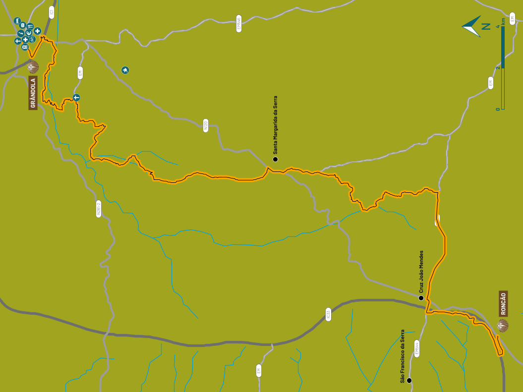
EM
EM
EM
EM
EM
N12
0
IC33
EM54
4
EM54
6
N26
1-2
IC1
São
Fran
cisc
o da
Ser
ra
Cruz
Joã
o M
ende
s
Sant
a M
arga
rida
da
Serr
a
RO
NCÃ
O
GRÂ
ND
OLA
02
4 km
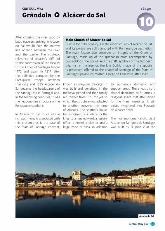
Grândola Alcácer do SalCENTRAL WAY
10stage
After crossing the river Sado by boat, travelers arriving in Alcácer do Sal would face the narrow line of land between the river and the castle. The strategic relevance of Alcácer’s cliff led to the submission of the locality to the Order of Santiago before 1172 and again in 1217, after the definitive conquest by the Portuguese troops. Between that date and 1235, Alcácer do Sal became the headquarters of the santiaguists in Portugal and, in the following centuries, it was the headquarters structure of the Portuguese spatharii.
In Alcácer do Sal, much of the rich patrimony is associated with this presence as is the case of the friars of Santiago convent,
known as meysom d'alcaçar. It was built and benefited in the medieval period and then totally refurbished from 1573, the year in which the structure was adapted to another convent, this time of Aracoeli. The spatharii house had a dormitory, a palace for the knights, a nursing ward, a registry office, a hostel, a cloister and a large zone of silos, in addition
to numerous domestic and support areas. There was also a chapel dedicated to St James, a religious space that also served for the friars' meetings. It still exists, integrated into Pousada de Alcácer hotel.
The most monumental church of Alcácer do Sal, Igreja de Santiago, was built by D. João V at the
Alcácer do Sal
Main Church of Alcácer do SalBuilt in the 13th century, it is the oldest church of Alcácer do Sal, and its portals are still connoted with Romanesque aesthetics. The main façade also preserves an insignia of the Order of Santiago, made up of the spatharian cross accompanied by two scallops, the gourd, and the staff, symbols of the Jacobean pilgrims. In the interior, the late Gothic image of the apostle is preserved, offered to the chapel of Santiago of the friars of Santiago’s palace, by master D. Jorge de Lencastre, after 1512.
Central Way | 67
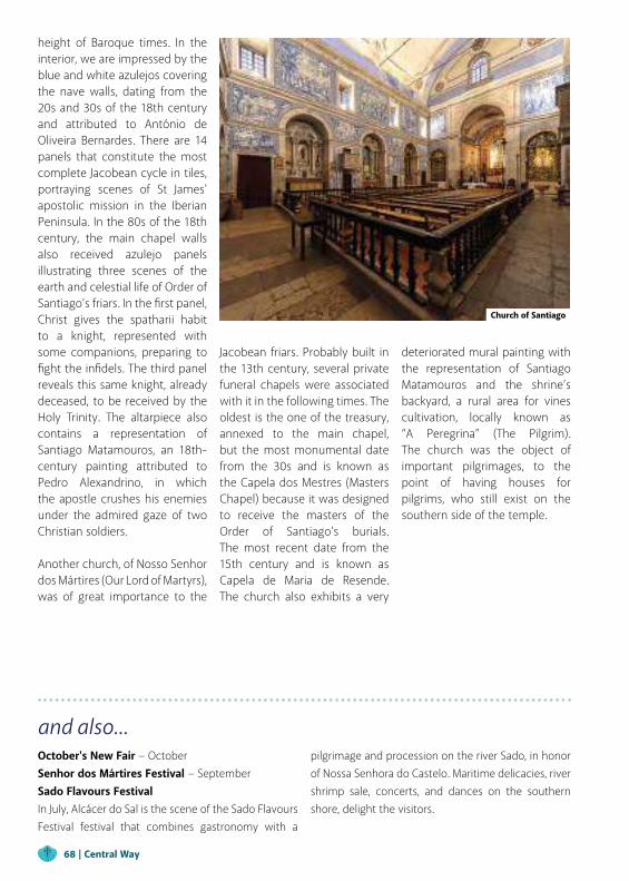
and also...October's New Fair − October Senhor dos Mártires Festival − SeptemberSado Flavours FestivalIn July, Alcácer do Sal is the scene of the Sado Flavours Festival festival that combines gastronomy with a
pilgrimage and procession on the river Sado, in honor of Nossa Senhora do Castelo. Maritime delicacies, river shrimp sale, concerts, and dances on the southern shore, delight the visitors.
height of Baroque times. In the interior, we are impressed by the blue and white azulejos covering the nave walls, dating from the 20s and 30s of the 18th century and attributed to António de Oliveira Bernardes. There are 14 panels that constitute the most complete Jacobean cycle in tiles, portraying scenes of St James' apostolic mission in the Iberian Peninsula. In the 80s of the 18th century, the main chapel walls also received azulejo panels illustrating three scenes of the earth and celestial life of Order of Santiago’s friars. In the first panel, Christ gives the spatharii habit to a knight, represented with some companions, preparing to fight the infidels. The third panel reveals this same knight, already deceased, to be received by the Holy Trinity. The altarpiece also contains a representation of Santiago Matamouros, an 18th-century painting attributed to Pedro Alexandrino, in which the apostle crushes his enemies under the admired gaze of two Christian soldiers.
Another church, of Nosso Senhor dos Mártires (Our Lord of Martyrs), was of great importance to the
Jacobean friars. Probably built in the 13th century, several private funeral chapels were associated with it in the following times. The oldest is the one of the treasury, annexed to the main chapel, but the most monumental date from the 30s and is known as the Capela dos Mestres (Masters Chapel) because it was designed to receive the masters of the Order of Santiago’s burials. The most recent date from the 15th century and is known as Capela de Maria de Resende. The church also exhibits a very
deteriorated mural painting with the representation of Santiago Matamouros and the shrine’s backyard, a rural area for vines cultivation, locally known as “A Peregrina” (The Pilgrim). The church was the object of important pilgrimages, to the point of having houses for pilgrims, who still exist on the southern side of the temple.
Church of Santiago
68 | Central Way
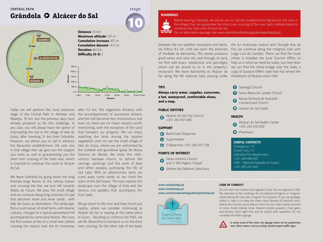
Distance 33 kmMaximum altitude 107 mCumulative increase 307 m Cumulative descent -412 mDuration 8h15mDifficulty (0-5) 3
Grândola Alcácer do Sal 10stage
www.visitalentejo.ptwww.visitribatejo.ptwww.caminhosdesantiagoalentejoribatejo.pt
Today we will perform the most extensive stage of the Central Path in Alentejo and Ribatejo, 33 km, but the previous days have already prepared us for this challenge. In any case, you will always have the option of interrupting the trip in the village of Vale de Guiso, after traveling 21 km from Grândola. However, we advise you to call in advance the Baracinha establishment, the only one in that village that can give you the support you need, as well as guaranteeing you the short river crossing of the Sado river, which is essential to continue the route to Alcácer do Sal.
We leave Grândola by going down the long Avenida Jorge Nunes to the railway station and, crossing the line, we turn left towards Aldeia do Futuro. We pass the small village and we continue along long stretches of road that becomes more and more sandy , with Vale do Guiso as destination. The landscape, first a rural mosaic of small farms with diverse cultures, changes to a typical pastureland hill accompanied by some pine forests. We cross the first stream at the on a small weir, before crossing the viaduct over the A2 motorway
after 5.5 km. The vegetation thickens with the accompaniment of successive streams and the trail becomes less monotonous, but even so, there are no major reasons worth mentioning, with the exception of the sand that hampers our progress. We can enjoy watching the birds among the riparian vegetation until we see the small village of Vale do Guiso, where we are welcomed by the isolated and grandiose Igreja de Nossa Senhora do Monte. We enter this 16th-century baroque church, to admire the carvings, paintings and the work of blue and white azulejos, portraying the life of Our Lady. With an adventurous spirit, we scare away some storks as we climb the stairs of the bell tower. The eyes explore the landscape over the village of Arêz and the famous rice paddies that accompany the river Sado.
We go down to the river and have lunch just nearby, where we consider continuing to Alcácer do Sal or staying at this same place in Guiso... Deciding to continue the Path, we ask Mr. Baracinha to transport us on the short river crossing. On the other side of the bank,
between the rice paddies, mountains and dams, we follow 8.5 km until we reach the premises of Herdade da Barrosinha. This estate produces good wines and olive oils, and through its land, we find wild boars, woodcocks and partridges, which can be served to us in the property's restaurant. We leave Barrosinha to Alcácer do Sal along the N5 national road, passing under
the A2 motorway viaduct and, through Rua da Foz, we continue along the marginal road until Largo Luís de Camões. There, we find the kiosk where is installed the local Tourism Office, to help us in what we need for today. Just next door we can find the metal bridge over the Sado, a copy of Gustave Eiffel's style that has served the inhabitants of Alcácer since 1945.
USEFUL CONTACTSEmergency: 112Forest Fires: 117Grândola Fire department: +351 269 498 450GNR − National Republican Guard: +351 269 242 600
TIPSAlways carry water, supplies, sunscreen, a hat, waterproof, comfortable shoes, and a map.
PUBLIC ENTITIES
Alcácer do Sal City Council +351 265 601 040
SUPPORT
Bank/Cash Dispenser
Supermarket
O Baracinha +351 265 637 158
POINTS OF INTEREST
Santo António Church and 11 Mil Virgens Chapel
Senhor dos Mártires Sanctuary
Santiago Church
Santa Maria do Castelo Church
Nossa Senhora de Aracoelli Convent and Church
Alcácer do Sal Castle
HEALTH
Alcácer do Sal Health Center +351 265 610 500
Pharmacy
500 m
400 m
300 m
200 m
100 m
0 m
0 km 5 km 10 km 15 km 20 km 25 km 30 km 33 km
33 km
23 km
GRÂNDOLA
ALCÁCER DO SAL
CASEBRES
CENTRAL PATH
WARNINGSBefore leaving Grândola, we advise you to call the establishment Baracinha, the only in the village that can guarantee the short river crossing of the river Sado, indispensable to continue the Path until Alcácer do Sal.For an alternative passage see www.caminhosdesantiagoalentejoribatejo.pt
CODE OF CONDUCT
Do not leave the marked and signaled route. Do not approach cliffs. Pay attention to the markings. Do not dispose of organic or inorganic waste during the trail, take a bag for this purpose. If you see garbage, collect it, help us to keep the Paths clean. Beware of livestock, don't bother the animals. Leave Nature intact. Do not collect plants, animals or rocks. Avoid making noise. Respect private property, close gates and barriers. Don’t light fires and be careful with cigarettes. Do not vandalize the Paths signage.
In urban areas of the route, the signage marks are for pedestrians only. Other means, such as cycling, should respect traffic signs.
Elev
atio
n
Distance
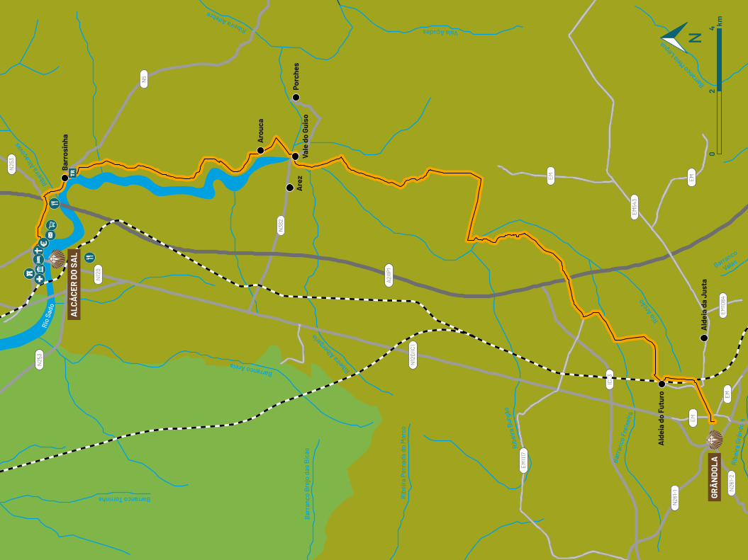
Barranco Torrinha
Rio
Sado
Ribeira
Alc
açova
s
Ribeira Alfebre
Bar
ranc
o B
rejo
das
Bic
as
Barranco Areia
Ribeira Alberg
aria
Rib
eira
Per
nada
do
Mar
co
Ribe
ira
Burg
ão
Vala Açudes
Barr
anco
Fre
ixei
ra
Barranco
Valas
Barranco M
eia LéguaRio
Arc
ão
Rib
eira
Grâ
ndol
a
EM10
84
EM54
3
IC33
EM
EM
EM1117
N12
0/IC
1
N26
1-1 N26
1-2
N38
2
N25
3
N25
3
N12
0
N5
EM
EM
A2/IP
1
Bar
rosi
nha
Are
z
Aro
uca
Vale
do
Guis
oPo
rche
s
Ald
eia
do F
utur
o
Ald
eia
da J
usta
GRÂ
ND
OLA
ALC
ÁCE
R D
O S
AL
02
4 km
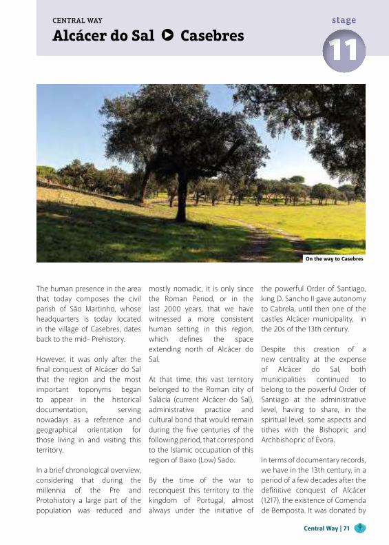
Alcácer do Sal CasebresCENTRAL WAY
11stage
The human presence in the area that today composes the civil parish of São Martinho, whose headquarters is today located in the village of Casebres, dates back to the mid- Prehistory.
However, it was only after the final conquest of Alcácer do Sal that the region and the most important toponyms began to appear in the historical documentation, serving nowadays as a reference and geographical orientation for those living in and visiting this territory.
In a brief chronological overview, considering that during the millennia of the Pre and Protohistory a large part of the population was reduced and
mostly nomadic, it is only since the Roman Period, or in the last 2000 years, that we have witnessed a more consistent human setting in this region, which defines the space extending north of Alcácer do Sal. At that time, this vast territory belonged to the Roman city of Salácia (current Alcácer do Sal), administrative practice and cultural bond that would remain during the five centuries of the following period, that correspond to the Islamic occupation of this region of Baixo (Low) Sado.
By the time of the war to reconquest this territory to the kingdom of Portugal, almost always under the initiative of
the powerful Order of Santiago, king D. Sancho II gave autonomy to Cabrela, until then one of the castles Alcácer municipality, in the 20s of the 13th century.
Despite this creation of a new centrality at the expense of Alcácer do Sal, both municipalities continued to belong to the powerful Order of Santiago at the administrative level, having to share, in the spiritual level, some aspects and tithes with the Bishopric and Archbishopric of Évora.
In terms of documentary records, we have in the 13th century, in a period of a few decades after the definitive conquest of Alcácer (1217), the existence of Comenda de Bemposta. It was donated by
On the way to Casebres
Central Way | 71
and also...Religious festivities in honnor of São Martinho − MaySão João Festivities − JuneJoy Festival − August
Christmas "midnight"On this “Midnight” of Christmas, young people leave their home and occupy the abandoned hills, taking with them turkey, drinks, and seasonings to make a recipe. The tradition, unique in the country, is repeated in Casebres every year.
the Order of Santiago to Maria Martins Navarra and yielded 100 pounds.
Shortly afterward, appears the reference to St Martin, patron saint and toponym of the commune and the river that crosses its territory.
For centuries, the main church was located on the site called "Freguesia" (Parish) and is today, by virtue of the administrative arrangements of the 19th century, in the nearby town of Montemor-o-Novo. The earliest parish books date from 1651.
As a final note, some elements of historical nature regarding the church, hermitage, and hospice of Nossa Senhora da Serrinha, which is nowadays the most important religious monument of the commune. It is the only known hermitage that the Order of the Calced Carmelites had in the municipality of Alcácer do Sal, as well as in the territory of the Order of Santiago. There are some documental evidences that suggest the existence of this hermitage in 1594. Although, we only have certainties for 1729, at which time this hermitage is
referred for the first time, based on known documents.
The current church, hospice and attached houses, whose works began in 1739, were born of the pious initiative of Francisco de Matos, from Alcácer, and his family. All this religious space was ceded to a religious community of the Order of the Calced Carmelites and Third Parties. The Main Church of São Martinho was deactivated at a date, still undetermined, in the mid-19th or 20th century.
On December 8, 1966, the headquarters of São Martinho’s parish moved to the village of Casebres. In Casebres, as in the rest of the Alentejo, the occupations are essentially agricultural, such as cork harvesting, tomato and pine nuts collection, eucalyptus planting and cutting, tree extraction, among other agricultural and forestry works.
Some of the older people, especially men, perform work related to livestock, shepherding,
milking and shearing. A small percentage of the population works in factories or in services existing in the adjacent municipalities.
This area’s gastronomy benefits from the richness of the Alentejo cuisine condiments. The Ensopado de Borrego (Lamb stew), the Açorda de Alho (Garlic bread soup), and the Migas (Breadcrumbs) with entrecote are particularly appreciated. The artisanal confectionery, such as the pinhoadas, the pine and honey cakes, the pine cups, and the honey cakes, is based on the ingredients offered by the region.
Although there are no organized touristic structures, this civil parish gathers tourists in its outdoor events, balls and popular festivals. Also of tourist interest, we suggest the reservoirs of Bemposta and Azenha Pintada, perfect for fishing and picnics lovers. The village of Casebres, within its quietness and typical Alentejo characteristics, is an ideal location for those who seek this region’s calm and serenity.
72 | Central Way
Distance 23 kmMaximum altitude 86 kmCumulative increase 342 km Cumulative descent -304 kmDuration 5h45mDifficulty (0-5) 3
Alcácer do Sal Casebres 11stage
www.visitalentejo.ptwww.visitribatejo.ptwww.caminhosdesantiagoalentejoribatejo.pt
The exit of Alcácer do Sal towards north seems a difficult task for those who travel by foot or bicycle. "Surrounded" by a motorway (A2) and a highway (IC1), on which the north exit's road (N5) converges, and enclosed by extensive private properties that fill the spaces between these roads, there are no safe mobility solutions for the more sustainable forms of travel, which are walking and cycling.
Even so, the defined itinerary minimizes those impacts. It begins with the crossing of Avenida dos Aviadores (N5) to the east, continuing through Avenida dos Clérigos until Bairro do Venâncio. At the end of the avenue, we detour to the left, to a dirt track, until the next intersection.
We open and close the access gate to the land in front, where the progression will be hampered by the amount of loose sand. We follow the fence on the right until we find the viaduct passing over the A2.We get into the cork and holm oak forest, to reach the entrance gate of Herdade de Vale de Reis, with a large photoelectric power station on our right side.
After passing the wicket door, we walk straight ahead until we find on the left the descent to the facilities of the estate, a future rural hotel just over 1 km away. From here we climb the church hill, bypassing it on the left. We continue through the dense and beautiful cork oak forest for 5.5 km, to the wicket door that allows us to leave the estate and access the municipal road that will lead us to Casebres.
From now on, we face the remaining 7.5 km with tranquility and without much effort, along a road practically flat and without traffic, with biodiversity as a company.
We advance between the Jardim Municipal (Municipal Garden) tables and benches and continue through the Largo José Afonso. We notice the calm and serenity of this village typical of Alentejo. The inhabitants subsist on the cattle, cork harvesting, tomato and pine cone harvesting, eucalyptus plantation and cutting, among other agricultural works. In November, Saint Martin’s Day is celebrated with dances, roasted chestnuts and “água-pé” (piquette). We also visit
the parish church of São Martinho, Priory of the Order of Santiago, which established an
agricultural estate here. They are waiting for us in the Parish Council...
USEFUL CONTACTSEmergency: 112Forest Fires: 117
TIPSAlways carry water, supplies, sunscreen, a hat, waterproof, comfortable shoes, and a map.
PUBLIC ENTITIES
Parish Council +351 265 649 124
SUPPORT
Bank/Cash Dispenser
Café Batista
Café/Restaurante Sabores d’Campo
WARNINGS
For questions related to accommodation, please contact the parish council.
500 m
400 m
300 m
200 m
100 m
0 m
0 km 5 km 10 km 15 km 20 km 23 km
23 km
22 km
CASEBRES
VENDAS NOVAS
ALCÁCERDO SAL
CENTRAL PATH
CODE OF CONDUCT
Do not leave the marked and signaled route. Do not approach cliffs. Pay attention to the markings. Do not dispose of organic or inorganic waste during the trail, take a bag for this purpose. If you see garbage, collect it, help us to keep the Paths clean. Beware of livestock, don't bother the animals. Leave Nature intact. Do not collect plants, animals or rocks. Avoid making noise. Respect private property, close gates and barriers. Don’t light fires and be careful with cigarettes. Do not vandalize the Paths signage.
In urban areas of the route, the signage marks are for pedestrians only. Other means, such as cycling, should respect traffic signs.
Elev
atio
n
Distance
Barranco Vale das Balsas
Ribeira Vale do Enxofra
l
Ribe
ira d
e
S. M
artin
ho
Ribe
ira A
ssei
ceira
Barranco C
ordeira
Ribeira Ulm
eira
Ribeira Alberginho
Barranco Torrinha
Lim
ite in
tern
o es
tuár
io R
io S
ado
Ribe
ira V
ale
de R
eis
Ribe
ira A
lcaç
ovas
Rio Sado
EM
EM
EM
EM
EM
N5
N5-
1
EM
N25
3
N12
0
N25
3
A2/IP
1
N12
0/IC
1
Bar
rosi
nha
ALC
ÁCE
R D
O S
AL
CASE
BR
ES
02
4 km
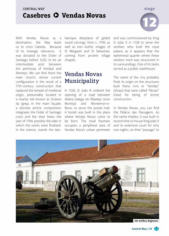
Casebres Vendas NovasCENTRAL WAY
12stage
With Vendas Novas as a destination, the Way leads us to cross Cabrela. Because of its strategic relevance, it was donated to the Order of Santiago before 1220, to be an intermediate post between the peninsula of Setúbal and Alentejo. We can find there the main church, whose current configuration is the result of a 17th-century construction that replaced the temple of medieval origin, presumably located in a nearby site known as Outeiro da Igreja. In the main façade, a discrete artistic composition integrates the Order of Santiago cross and the door bears the year of 1704, possibly the date in which the works were finalized. In the interior, stands the late-
baroque altarpiece of gilded wood carvings, from c. 1790, as well as two Gothic images of St Margaret and St Sebastian, coming from ancient village chapels.
Vendas NovasMunicipality
In 1526, D. João III ordered the opening of a road between Aldeia Galega do Ribatejo (now Montijo) and Montemor-o-Novo, to serve the postal mail. A hostel was built in the place where Vendas Novas came to be born. The royal fountain occupies a peripheral area of Vendas Nova's urban perimeter
and was commissioned by King D. João V in 1728 to serve the workers who built the royal palace, as it appears that the ephemeral quarter where these workers lived was structured in its surroundings. One of its tanks served as a public washhouse.
The name of the city probably finds its origin on the structures built there, inns or "Vendas" (shops) that were called “Novas” (new) for being of recent construction.
In Vendas Novas, you can find the Palácio das Passagens. As the name implies, it was built in record time to house King João V and its extensive court for only two nights, on their “passage” to
5th Artillery Regiment
Central Way | 75
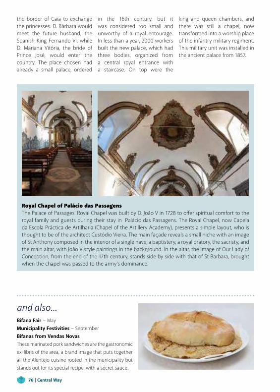
and also...Bifana Fair − May Municipality Festivities − September Bifanas from Vendas NovasThese marinated pork sandwiches are the gastronomic ex-libris of the area, a brand image that puts together all the Alentejo cuisine rooted in the municipality but stands out for its special recipe, with a secret sauce.
the border of Caia to exchange the princesses. D. Bárbara would meet the future husband, the Spanish King Fernando VI, while D. Mariana Vitória, the bride of Prince José, would enter the country. The place chosen had already a small palace, ordered
in the 16th century, but it was considered too small and unworthy of a royal entourage. In less than a year, 2000 workers built the new palace, which had three bodies, organized from a central royal entrance with a staircase. On top were the
king and queen chambers, and there was still a chapel, now transformed into a worship place of the infantry military regiment. This military unit was installed in the ancient palace from 1857.
Royal Chapel of Palácio das Passagens The Palace of Passages’ Royal Chapel was built by D. João V in 1728 to offer spiritual comfort to the royal family and guests during their stay in Palácio das Passagens. The Royal Chapel, now Capela da Escola Práctica de Artilharia (Chapel of the Artillery Academy), presents a simple layout, who is thought to be of the architect Custódio Vieira. The main façade reveals a small niche with an image of St Anthony composed in the interior of a single nave, a baptistery, a royal oratory, the sacristy, and the main altar, with João V style paintings in the background. In the altar, the image of Our Lady of Conception, from the end of the 17th century, stands side by side with that of St Barbara, brought when the chapel was passed to the army’s dominance.
76 | Central Way

Distance 22 kmMaximum altitude 150 kmCumulative increase 409 km Cumulative descent -295 kmDuration 5h30mDifficulty (0-5) 3
Casebres Vendas Novas 12stage
www.visitalentejo.ptwww.visitribatejo.ptwww.caminhosdesantiagoalentejoribatejo.pt
From Largo da Igreja we cross Casebres until Rua da Maforinha, which takes us to the village periphery. Along 3.5 km we walk through a dense eucalyptus plantation, cyclically devastated for paper pulp production, so we can both walk under good shade or a blazing sun.
We then enter into extensive pine forest where in some times of the year we can see groups of people collecting pine cones to remove the pine nuts, and other resins, with multiple industrial and consumer applications. We access the road to pass the bridge over the Marateca stream and we don’t come back to the forest. The missing 3 km are completed through an almost deserted road until we enter Herdade da Palhavã, which we’ll cross to reach Vendas Novas town. However, considering the fatigue and time of the day, we decide to continue straight ahead another 1 km until Cabrela for a break and a “bifana” (pork sandwich)! We complement it with a Filhós de Cabrela, a traditional sweet from the village, nowadays appreciated in all coastal Alentejo.
Before returning to the Path, we learn a bit more about Cabrela's past, as we discover on the mother church’s main façade a small image of the spatharios cross, also evident in the locality’s blazon. We return to the entrance of the Herdade da Palhavã and follow a 3 km stretch of trodden sand, crossing cork and holm oak forests, some creeks and herds pastures. We leave Herdade da Palhavã through another gate on the opposite side, and after 5.5 km we cross the viaduct over the A6 motorway and sight Vendas Novas already nearby.
We walk another 3 km in macadam until we reach Estrada da Afeiteira, which leads us to the urban nucleus of Vendas Novas through Avenida 25 de Abril. We pass a replica of a windmill that should house the Tourism Office but, once it is closed, we continue to the City Council, in Avenida da República, via Rua António Coelho de Oliveira, where we finished today's stage.
Vendas Novas is a young and "practical" city, with no great traces of beauty or patrimonial wealth. In the 18th century, it was still a mere
hamlet originated by a "Venda" (Sale), i.e., a small area of commerce for muleteers and travelers, which was only significantly boosted by effect of the Palácio das Passagens construction (where were based the Artillery's Militar Regiment No. 5 and the Museum of Artillery Academy No. 5).
Its gastronomy is also "practical" as, perhaps due to the high proportion of the military population and industrial workers, it is focused on the famous Bifanas de Vendas Novas (sandwiches of pork meat) and various soups.
To accompany, the wines produced in the region, which are gaining space and recognition, so it is worth to visit a winery and be inebriated with their particular aromas. In Vendas Novas we also take the opportunity to visit the Queijaria das Romãs, with a long history of artisan production of fresh cheese, cottage cheese and, for connoisseurs, the "almece", a traditional Alentejo product, resulting from the whey curd of sheep cheese.
TIPSAlways carry water, supplies, sunscreen, a hat, waterproof, comfortable shoes, and a map.
PUBLIC ENTITIES
Vendas Novas City Council +351 265 807 700
SUPPORT
CTT Post Office
Bank/Cash Dispenser
Vendas Novas Tourism Office
Supermarket
HEALTH
Vendas Novas Health Center +351 265 809 000
Pharmacy
USEFUL CONTACTSEmergency: 112Forest Fires: 117Fire department: +351 265 807 170GNR − Vendas Novas Territorial Station:+351 265 809 780
500 m
400 m
300 m
200 m
100 m
0 m
0 km 5 km 10 km 15 km 20 km 22 km
22 km
33 km
CASEBRES
VENDAS NOVAS
BRANCA
CENTRAL PATH
CODE OF CONDUCT
Do not leave the marked and signaled route. Do not approach cliffs. Pay attention to the markings. Do not dispose of organic or inorganic waste during the trail, take a bag for this purpose. If you see garbage, collect it, help us to keep the Paths clean. Beware of livestock, don't bother the animals. Leave Nature intact. Do not collect plants, animals or rocks. Avoid making noise. Respect private property, close gates and barriers. Don’t light fires and be careful with cigarettes. Do not vandalize the Paths signage.
In urban areas of the route, the signage marks are for pedestrians only. Other means, such as cycling, should respect traffic signs.
Elev
atio
n
Distance
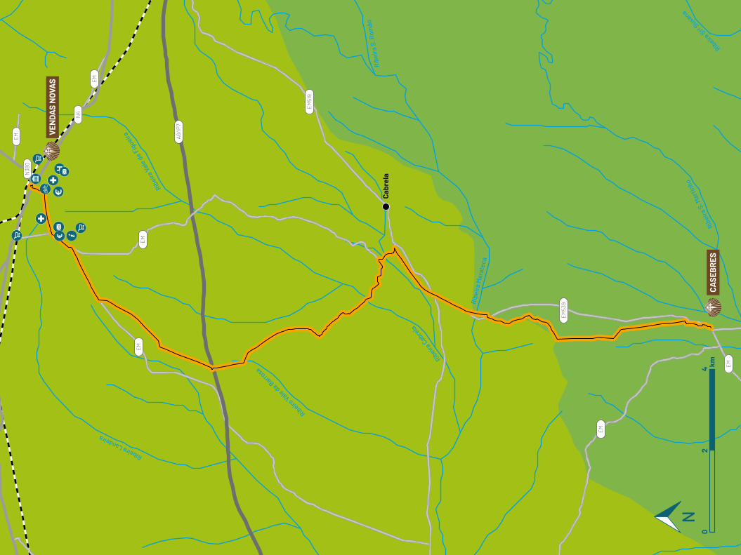
Ribeira Landeira
Ribei
ra V
ale
de F
igue
ira
Ribeiro Vale da Barro
sa
Ribeira
Cabre
la
Ribe
ira
Mar
atec
a
Ribe
ira S
. Mar
tinho
Ribeira Stª
Susana
Rib
eira
S. R
omão
A6/IP
7
EM
EM
N4
EM
EM
EM
EM
EM53
9
EM51
9
N38
0
VEN
DAS
NOV
AS
CASE
BR
ES
Cabr
ela
02
4 km
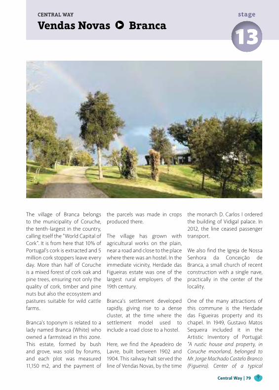
Vendas Novas BrancaCENTRAL WAY
13stage
The village of Branca belongs to the municipality of Coruche, the tenth-largest in the country, calling itself the "World Capital of Cork". It is from here that 10% of Portugal’s cork is extracted and 5 million cork stoppers leave every day. More than half of Coruche is a mixed forest of cork oak and pine trees, ensuring not only the quality of cork, timber and pine nuts but also the ecosystem and pastures suitable for wild cattle farms.
Branca’s toponym is related to a lady named Branca (White) who owned a farmstead in this zone. This estate, formed by bush and grove, was sold by forums, and each plot was measured 11,150 m2, and the payment of
the parcels was made in crops produced there.
The village has grown with agricultural works on the plain, near a road and close to the place where there was an hostel. In the immediate vicinity, Herdade das Figueiras estate was one of the largest rural employers of the 19th century.
Branca's settlement developed rapidly, giving rise to a dense cluster, at the time where the settlement model used to include a road close to a hostel.
Here, we find the Apeadeiro de Lavre, built between 1902 and 1904. This railway halt served the line of Vendas Novas, by the time
the monarch D. Carlos I ordered the building of Vidigal palace. In 2012, the line ceased passenger transport.
We also find the Igreja de Nossa Senhora da Conceição de Branca, a small church of recent construction with a single nave, practically in the center of the locality.
One of the many attractions of this commune is the Herdade das Figueiras property and its chapel. In 1949, Gustavo Matos Sequeira included it in the Artistic Inventory of Portugal: "A rustic house and property, in Coruche moorland, belonged to Mr. Jorge Machado Castelo Branco (Figueira). Center of a typical
Central Way | 79
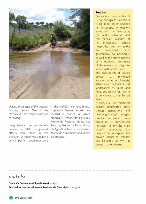
and also...Branca's Culture and Sports Week − April Festival in Honnor of Nossa Senhora da Conceição − August
cluster, in the style of the regional housing centers. Next to the Herdade is a hermitage dedicated to St Mary."
Long before the commune’s creation in 1984, the greatest efforts were made in this direction, as there was already a very important population core
TourismBranca is a place to feel. It is not enough to talk about it, tell its history or describe its landscape. A mystery surrounds the landscape, the land’s cultivation and the secular wisdom of its inhabitants, whose hospitality and sympathy are recognized. From gastronomy to handicraft, as well as the strong rooting of its traditions, are many of the reasons to delight us with a walk on this land.The civil parish of Branca enjoys a privileged location in terms of tourist attractions, due to its natural landscapes, its fauna and flora, and to the fact that it is very close to the Sorraia River.It enjoys a rich traditional culture, transmitted orally through generations and diverging through the ages. Branca’s civil parish is very proud of its architectural heritage, namely the main church, venerating Our Lady of the Conception, the private Chapel of Herdade das Figueiras, as well as several manor houses.
in the mid-20th century. Several important farming estates are located in Branca, of which stand out: Herdade das Figueiras, Monte da Pestana, Monte dos Pelados, Monte da Torre, Monte da Água Boa, Monte das Mestras, Monte da Abrunheira, and Monte do Trozoito.
80 | Central Way
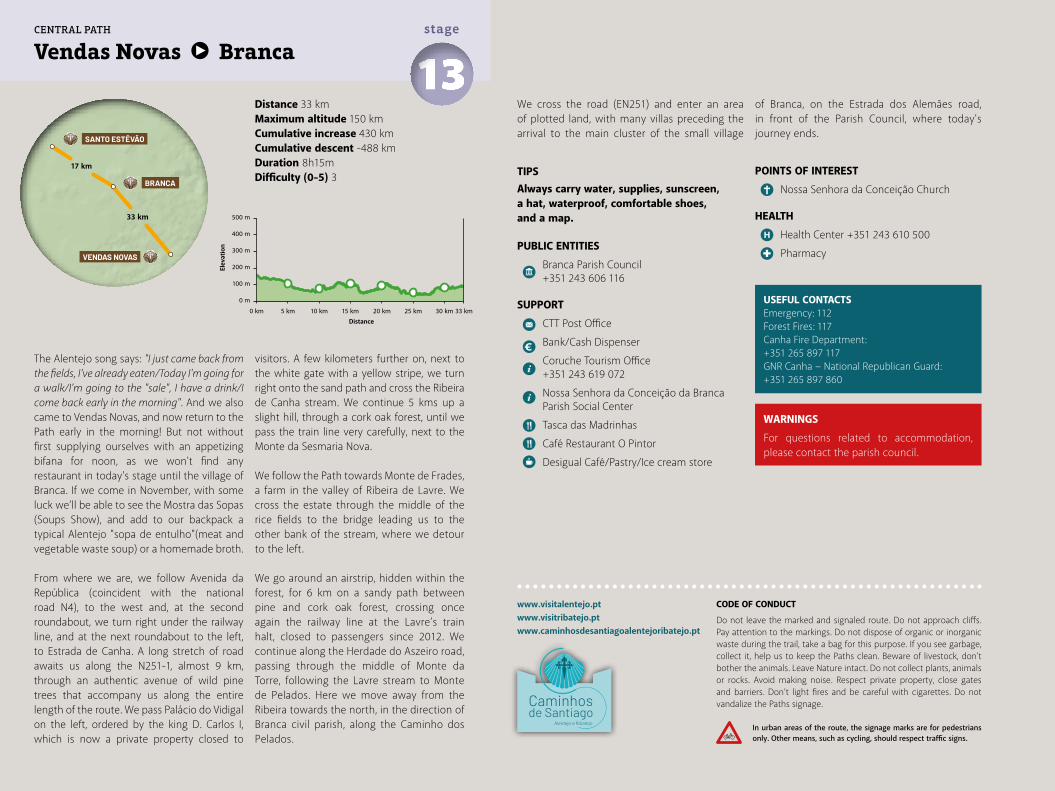
Distance 33 kmMaximum altitude 150 kmCumulative increase 430 km Cumulative descent -488 kmDuration 8h15mDifficulty (0-5) 3
Vendas Novas Branca 13stage
www.visitalentejo.ptwww.visitribatejo.ptwww.caminhosdesantiagoalentejoribatejo.pt
The Alentejo song says: "I just came back from the fields, I've already eaten/Today I'm going for a walk/I'm going to the "sale", I have a drink/I come back early in the morning". And we also came to Vendas Novas, and now return to the Path early in the morning! But not without first supplying ourselves with an appetizing bifana for noon, as we won't find any restaurant in today's stage until the village of Branca. If we come in November, with some luck we’ll be able to see the Mostra das Sopas (Soups Show), and add to our backpack a typical Alentejo "sopa de entulho"(meat and vegetable waste soup) or a homemade broth.
From where we are, we follow Avenida da República (coincident with the national road N4), to the west and, at the second roundabout, we turn right under the railway line, and at the next roundabout to the left, to Estrada de Canha. A long stretch of road awaits us along the N251-1, almost 9 km, through an authentic avenue of wild pine trees that accompany us along the entire length of the route. We pass Palácio do Vidigal on the left, ordered by the king D. Carlos I, which is now a private property closed to
visitors. A few kilometers further on, next to the white gate with a yellow stripe, we turn right onto the sand path and cross the Ribeira de Canha stream. We continue 5 kms up a slight hill, through a cork oak forest, until we pass the train line very carefully, next to the Monte da Sesmaria Nova.
We follow the Path towards Monte de Frades, a farm in the valley of Ribeira de Lavre. We cross the estate through the middle of the rice fields to the bridge leading us to the other bank of the stream, where we detour to the left.
We go around an airstrip, hidden within the forest, for 6 km on a sandy path between pine and cork oak forest, crossing once again the railway line at the Lavre’s train halt, closed to passengers since 2012. We continue along the Herdade do Aszeiro road, passing through the middle of Monte da Torre, following the Lavre stream to Monte de Pelados. Here we move away from the Ribeira towards the north, in the direction of Branca civil parish, along the Caminho dos Pelados.
We cross the road (EN251) and enter an area of plotted land, with many villas preceding the arrival to the main cluster of the small village
of Branca, on the Estrada dos Alemães road, in front of the Parish Council, where today's journey ends.
POINTS OF INTEREST
Nossa Senhora da Conceição Church
HEALTH
Health Center +351 243 610 500
Pharmacy
USEFUL CONTACTSEmergency: 112Forest Fires: 117Canha Fire Department: +351 265 897 117GNR Canha − National Republican Guard: +351 265 897 860
TIPSAlways carry water, supplies, sunscreen, a hat, waterproof, comfortable shoes, and a map.
PUBLIC ENTITIES
Branca Parish Council +351 243 606 116
SUPPORT
CTT Post Office
Bank/Cash Dispenser
Coruche Tourism Office +351 243 619 072
Nossa Senhora da Conceição da Branca Parish Social Center
Tasca das Madrinhas
Café Restaurant O Pintor
Desigual Café/Pastry/Ice cream store
500 m
400 m
300 m
200 m
100 m
0 m
0 km 5 km 10 km 15 km 20 km 25 km 30 km 33 km
33 km
17 km
VENDAS NOVAS
BRANCA
SANTO ESTÊVÃO
CENTRAL PATH
WARNINGS
For questions related to accommodation, please contact the parish council.
CODE OF CONDUCT
Do not leave the marked and signaled route. Do not approach cliffs. Pay attention to the markings. Do not dispose of organic or inorganic waste during the trail, take a bag for this purpose. If you see garbage, collect it, help us to keep the Paths clean. Beware of livestock, don't bother the animals. Leave Nature intact. Do not collect plants, animals or rocks. Avoid making noise. Respect private property, close gates and barriers. Don’t light fires and be careful with cigarettes. Do not vandalize the Paths signage.
In urban areas of the route, the signage marks are for pedestrians only. Other means, such as cycling, should respect traffic signs.
Elev
atio
n
Distance
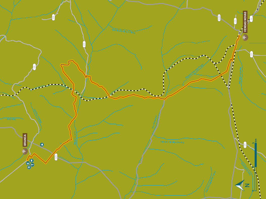
Vala Real
Ribe
ira T
rejo
ito
Rib
eira
Lav
re
Ribeiro Vale da Caneira
Ribeira Vale de Cebolas
Rio
Alm
anso
r
Ribe
ira L
agoa
do
Calv
o
Vala A
sseic
eiraR
ibei
ra L
ande
ira
Ribeira Vale das Pegas
EM
EM
N38
0
N25
1
EM N
4
EM
EM
EM
BR
AN
CA
VEN
DAS
NOV
AS
02
4 km
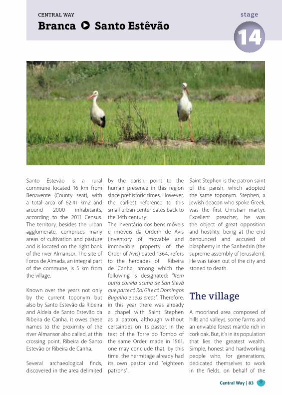
Branca Santo EstêvãoCENTRAL WAY
14stage
Santo Estevão is a rural commune located 16 km from Benavente (County seat), with a total area of 62.41 km2 and around 2000 inhabitants, according to the 2011 Census. The territory, besides the urban agglomerate, comprises many areas of cultivation and pasture and is located on the right bank of the river Almansor. The site of Foros de Almada, an integral part of the commune, is 5 km from the village. Known over the years not only by the current toponym but also by Santo Estevão da Ribeira and Aldeia de Santo Estevão da Ribeira de Canha, it owes these names to the proximity of the river Almansor also called, at this crossing point, Ribeira de Santo Estevão or Ribeira de Canha.
Several archaeological finds, discovered in the area delimited
by the parish, point to the human presence in this region since prehistoric times. However, the earliest reference to this small urban center dates back to the 14th century:The Inventário dos bens móveis e imóveis da Ordem de Avis (Inventory of movable and immovable property of the Order of Avis) dated 1364, refers to the herdades of Ribeira de Canha, among which the following is designated: "Item outra coirela acima de San Stevã que parte cõ Roi Gil e cõ Domingos Bugalho e seus ereos". Therefore, in this year there was already a chapel with Saint Stephen as a patron, although without certainties on its pastor. In the text of the Torre do Tombo of the same Order, made in 1561, one may conclude that, by this time, the hermitage already had its own pastor and "eighteen patrons".
Saint Stephen is the patron saint of the parish, which adopted the same toponym. Stephen, a Jewish deacon who spoke Greek, was the first Christian martyr. Excellent preacher, he was the object of great opposition and hostility, being at the end denounced and accused of blasphemy in the Sanhedrin (the supreme assembly of Jerusalem). He was taken out of the city and stoned to death.
The village
A moorland area composed of hills and valleys, some farms and an enviable forest mantle rich in cork oak. But, it’s in its population that lies the greatest wealth. Simple, honest and hardworking people who, for generations, dedicated themselves to work in the fields, on behalf of the
Central Way | 83
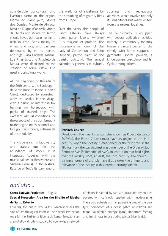
and also...Santo Estêvão Festivities − August Special Protection Area for the Birdlife of Ribeira de Santo EstevãoCovering the entire river valley, which includes the Site of Ornithological Interest, the Special Protection Area for the Birdlife of Ribeira de Santo Estevão is an area of alluvial soils, occupied by rice fields, a network
of channels skirted by tábua, surrounded by an area covered with cork oak, together with meadow pine. There also subsists a small palustrine area of the paul type, composed of a dense patch of willows and tábua. Vulnerable biotope (paul), important feeding area for Limosa limosa during winter (rice fields).
considerable agricultural and livestock farms in the region. Monte do Zambujeiro, Monte dos Condes, Monte de Almada, Mata do Duque (Cadaval), Monte da Quinta and Monte do Termo should have a particular highlight. Rich in crop fields mainly of wheat and rice, and pastures dominated by cattle, horses, and pigs. Casa Cadaval, Manuel Luís Anastácio, and Anacleto de Moura were dedicated to the creation of brave cattle, also used in agricultural works. At the beginning of the 60s of the 20th century, the Equipagem de Santo Huberto (Saint Hubert’s Crew), dedicated to equestrian activities, settled in the village with a particular interest in fox hunting on horseback, with packs of trained dogs. The excellent natural conditions for the exercise of this sport brought to the region many national and foreign practitioners, enthusiasts of this modality. The village is rich in biodiversity and stands out for the abundance of storks. It is integrated (together with the municipalities of Benavente and Samora Correia) in the Natural Reserve of Tejo’s Estuary, one of
the wetlands of excellence for the stationing of migratory birds from Europe.
Over the years, the people of Santo Estevão have always been party lovers, whether it is religious or profane. The processions in honor of Our Lady of Conception and Saint Stephen, patron saint of the parish, outstand. The annual calendar is generous in cultural,
sporting and recreational activities, which involve not only its inhabitants but many visitors from the nearest localities. The municipality is equipped with several collective facilities, namely: a community meeting house, a daycare center for the elderly with home support, a gymnastic sports pavilion, a kindergarten, pre-school and 1st Cycle, among others.
Parisch Church Overlooking the river Almansor (also known as Ribeira de Santo Estêvão), the Parish Church must have its origins in the 14th century, when the locality is mentioned for the first time. In the 18th century, the parish priest was a member of the Order of São Bento de Avis (St Benedict of Avis), an institution that held rights over the locality since, at least, the 16th century. The church is a simple temple of a single nave that evokes the antiquity and relevance of the locality in this interior territory stretch.
84 | Central Way
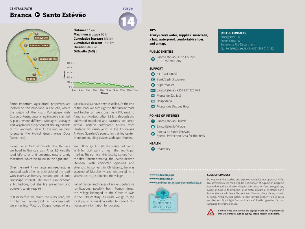
Distance 17 kmMaximum altitude 96 kmCumulative increase 156 km Cumulative descent -233 kmDuration 4h00mDifficulty (0-5) 2
Branca Santo Estêvão 14stage
www.visitalentejo.ptwww.visitribatejo.ptwww.caminhosdesantiagoalentejoribatejo.pt
Some important agricultural properties are located on this moorland in Coruche, where the origin of the most Portuguese dish, Cozido à Portuguesa, is legitimately claimed. A place where different cabbages, sausages and vegetables are produced, the ingredients of this wonderful stew. At the end we can’t forgetting the typical desert Arroz Doce (sweet rice).
From the asphalt of Estrada dos Alemães, we head to Branca’s exit. After 3.5 km, the road bifurcates and becomes now a sandy macadam, which we follow in the right lane.
Over the next 7 km, large enclosed estates succeed each other on both sides of the road, with extensive forestry explorations of little landscape interest. The route can become a bit tedious, but the fire prevention and traveler's safety require it.
500 m before we reach the N119 road, we turn left and proceed, still by macadam, until we enter into Mata do Duque forest, where
luxurious villas have been installed. At the end of the road, we turn right to the tarmac road, and further on we cross the N119, next to Almansor riverbed. After 1.3 km, through the cultivated moorland and pastures, we come across Lusitano crossbreed horses, from Herdade do Zambujeiro. In the Coudelaria António Guerriero's equestrian training center, there are coupling classes with sport horses.
We follow 2,7 km till the center of Santo Estêvão civil parish, near the municipal market. The name of this locality comes from the first Christian martyr, the Jewish deacon Stephen. With convicted opinions and attempts to convert to Christianity, he was accused of blasphemy and sentenced to a violent death, just outside the village.
Full of history and traces of ancient defensive fortifications, possibly from Roman times, this village belonged to the Order of Avis in the 16th century. As usual, we go to the local parish council in order to collect the necessary information for our stay.
USEFUL CONTACTSEmergency: 112Forest Fires: 117Benavente Fire Department(Santo Estêvão section): +351 263 516 122
TIPSAlways carry water, supplies, sunscreen, a hat, waterproof, comfortable shoes, and a map.
PUBLIC ENTITIES
Santo Estêvão Parish Council +351 263 949 216
SUPPORT
CTT Post Office
Bank/Cash Dispenser
Supermarket
Santo Estêvão +351 917 323 679
Monte de São José
Hospedaria
Monte dos Duques Hotel
POINTS OF INTEREST
Santo Estêvão Church
Santo Estêvão Village
Ribeira de Santo Estêvão Special Protection Area for the Birds
HEALTH
Pharmacy
500 m
400 m
300 m
200 m
100 m
0 m
0 km 2 km 4 km 6 km 8 km 10 km 12 km 14 km 16 km 17 km
17 km
16 km
10 km
BRANCA
SANTO ESTÊVÃO
BENAVENTE
SAMORA CORREIA
CENTRAL PATH
CODE OF CONDUCT
Do not leave the marked and signaled route. Do not approach cliffs. Pay attention to the markings. Do not dispose of organic or inorganic waste during the trail, take a bag for this purpose. If you see garbage, collect it, help us to keep the Paths clean. Beware of livestock, don't bother the animals. Leave Nature intact. Do not collect plants, animals or rocks. Avoid making noise. Respect private property, close gates and barriers. Don’t light fires and be careful with cigarettes. Do not vandalize the Paths signage.
In urban areas of the route, the signage marks are for pedestrians only. Other means, such as cycling, should respect traffic signs.
Elev
atio
n
Distance
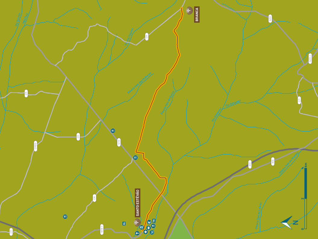
Rio Almansor
Rio A
lman
sor
Ribe
ira V
ale
da Q
uint
aRibeira Vale das M
ulheres
Ribe
ira T
rejo
ito
Vala
Rea
l
Rio
Sorr
aia
Rib
eira
Val
e de
Leb
res
Ribeira
Vale de Aivados
EM
EM
EM
EM
EM
EM
N119
N25
1N10
A13
EM51
5
N118-
1
N25
1-1
SAN
TO E
STÊV
ÃO
BR
AN
CA
02
4 km
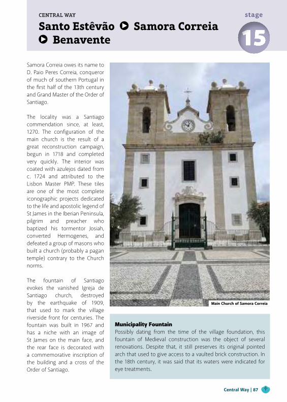
Santo Estêvão Samora Correia Benavente
CENTRAL WAY
15stage
Samora Correia owes its name to D. Paio Peres Correia, conqueror of much of southern Portugal in the first half of the 13th century and Grand Master of the Order of Santiago.
The locality was a Santiago commendation since, at least, 1270. The configuration of the main church is the result of a great reconstruction campaign, begun in 1718 and completed very quickly. The interior was coated with azulejos dated from c. 1724 and attributed to the Lisbon Master PMP. These tiles are one of the most complete iconographic projects dedicated to the life and apostolic legend of St James in the Iberian Peninsula, pilgrim and preacher who baptized his tormentor Josiah, converted Hermogenes, and defeated a group of masons who built a church (probably a pagan temple) contrary to the Church norms.
The fountain of Santiago evokes the vanished Igreja de Santiago church, destroyed by the earthquake of 1909, that used to mark the village riverside front for centuries. The fountain was built in 1967 and has a niche with an image of St James on the main face, and the rear face is decorated with a commemorative inscription of the building and a cross of the Order of Santiago.
Municipality FountainPossibly dating from the time of the village foundation, this fountain of Medieval construction was the object of several renovations. Despite that, it still preserves its original pointed arch that used to give access to a vaulted brick construction. In the 18th century, it was said that its waters were indicated for eye treatments.
Main Church of Samora Correia
Central Way | 87
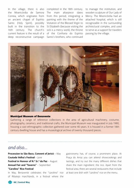
and also...Procession to São Baco, Convent of Jericó − MayCoutada Velha's Festival − JuneFestival in Honnor of N.ª Sr.ª da Paz − AugustAnnual Fair and "Taverns" − September"Carolino" Rice FestivalIn May, Benavente celebrates the “carolino” rice of Ribatejo marchlands, in a festival where the
Municipal Museum of BenaventeGathering a range of reference collections in the area of agricultural machinery, costume, photography, ceramics, and traditional crafts, the Municipal Museum was inaugurated in July 1980, housing a vast ethnographic collection gathered over some 40 years. It is housed in a former 18th century dwelling house and has a museological archive of twenty thousand pieces.
gastronomy has, of course, a prominent place. At Praça do Arroz you can attend showcookings and tastings, and try out the many different dishes that share the main ingredient: the rice. Apart from the festival area, there are several restaurants that include at least one dish with “carolino” rice on the menu.
In the village, there is also the Misericórdia de Samora Correia, which originates from an ancient chapel of Espírito Santo (Holy Spirit), possibly built in the transition to the 16th century. The church's current feature is the result of a deep reconstructive campaign
completed in the 18th century. The main altarpiece dates from this period, integrating a painting with the theme of the Visitation of the Blessed Virgin to St Elizabeth (because visiting the sick is a mercy work), the throne of the Confraria do Espírito Santo’s brothers, who continued
to manage the institution, and wooden sculpture of Our Lady of Mercy. The Misericórdia had an attached hospital, which is still recognizable in the surrounding architectural complex, and used to serve as a support for travelers passing by the village.
88 | Central Way
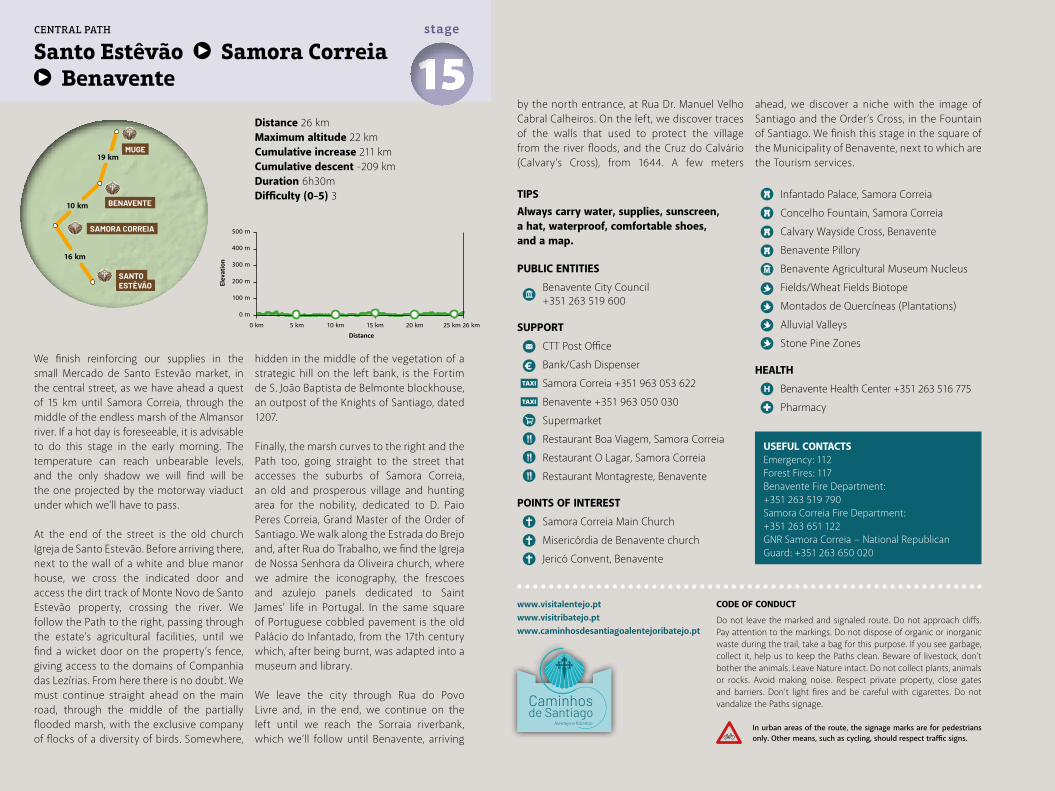
Distance 26 kmMaximum altitude 22 kmCumulative increase 211 km Cumulative descent -209 kmDuration 6h30mDifficulty (0-5) 3
www.visitalentejo.ptwww.visitribatejo.ptwww.caminhosdesantiagoalentejoribatejo.pt
We finish reinforcing our supplies in the small Mercado de Santo Estevão market, in the central street, as we have ahead a quest of 15 km until Samora Correia, through the middle of the endless marsh of the Almansor river. If a hot day is foreseeable, it is advisable to do this stage in the early morning. The temperature can reach unbearable levels, and the only shadow we will find will be the one projected by the motorway viaduct under which we'll have to pass.
At the end of the street is the old church Igreja de Santo Estevão. Before arriving there, next to the wall of a white and blue manor house, we cross the indicated door and access the dirt track of Monte Novo de Santo Estevão property, crossing the river. We follow the Path to the right, passing through the estate’s agricultural facilities, until we find a wicket door on the property’s fence, giving access to the domains of Companhia das Lezírias. From here there is no doubt. We must continue straight ahead on the main road, through the middle of the partially flooded marsh, with the exclusive company of flocks of a diversity of birds. Somewhere,
USEFUL CONTACTSEmergency: 112Forest Fires: 117Benavente Fire Department:+351 263 519 790Samora Correia Fire Department:+351 263 651 122GNR Samora Correia − National Republican Guard: +351 263 650 020
TIPSAlways carry water, supplies, sunscreen, a hat, waterproof, comfortable shoes, and a map.
PUBLIC ENTITIES
Benavente City Council +351 263 519 600
SUPPORT
CTT Post Office
Bank/Cash Dispenser
Samora Correia +351 963 053 622
Benavente +351 963 050 030
Supermarket
Restaurant Boa Viagem, Samora Correia
Restaurant O Lagar, Samora Correia
Restaurant Montagreste, Benavente
POINTS OF INTEREST
Samora Correia Main Church
Misericórdia de Benavente church
Jericó Convent, Benavente
Infantado Palace, Samora Correia
Concelho Fountain, Samora Correia
Calvary Wayside Cross, Benavente
Benavente Pillory
Benavente Agricultural Museum Nucleus
Fields/Wheat Fields Biotope
Montados de Quercíneas (Plantations)
Alluvial Valleys
Stone Pine Zones
HEALTH
Benavente Health Center +351 263 516 775
Pharmacy
hidden in the middle of the vegetation of a strategic hill on the left bank, is the Fortim de S. João Baptista de Belmonte blockhouse, an outpost of the Knights of Santiago, dated 1207.
Finally, the marsh curves to the right and the Path too, going straight to the street that accesses the suburbs of Samora Correia, an old and prosperous village and hunting area for the nobility, dedicated to D. Paio Peres Correia, Grand Master of the Order of Santiago. We walk along the Estrada do Brejo and, after Rua do Trabalho, we find the Igreja de Nossa Senhora da Oliveira church, where we admire the iconography, the frescoes and azulejo panels dedicated to Saint James’ life in Portugal. In the same square of Portuguese cobbled pavement is the old Palácio do Infantado, from the 17th century which, after being burnt, was adapted into a museum and library.
We leave the city through Rua do Povo Livre and, in the end, we continue on the left until we reach the Sorraia riverbank, which we’ll follow until Benavente, arriving
by the north entrance, at Rua Dr. Manuel Velho Cabral Calheiros. On the left, we discover traces of the walls that used to protect the village from the river floods, and the Cruz do Calvário (Calvary’s Cross), from 1644. A few meters
ahead, we discover a niche with the image of Santiago and the Order’s Cross, in the Fountain of Santiago. We finish this stage in the square of the Municipality of Benavente, next to which are the Tourism services.
500 m
400 m
Elev
atio
n
Distance
300 m
200 m
100 m
0 m
0 km 5 km 10 km 15 km 20 km 25 km 26 km
15stage
Santo Estêvão Samora Correia Benavente
CENTRAL PATH
16 km
10 km
19 km
SANTO ESTÊVÃO
BENAVENTE
MUGE
SAMORA CORREIA
CODE OF CONDUCT
Do not leave the marked and signaled route. Do not approach cliffs. Pay attention to the markings. Do not dispose of organic or inorganic waste during the trail, take a bag for this purpose. If you see garbage, collect it, help us to keep the Paths clean. Beware of livestock, don't bother the animals. Leave Nature intact. Do not collect plants, animals or rocks. Avoid making noise. Respect private property, close gates and barriers. Don’t light fires and be careful with cigarettes. Do not vandalize the Paths signage.
In urban areas of the route, the signage marks are for pedestrians only. Other means, such as cycling, should respect traffic signs.
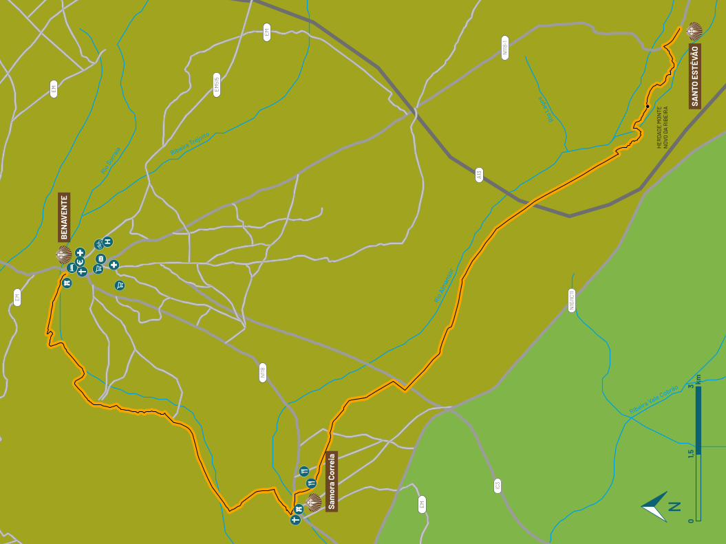
Rio
Alm
anso
r
Ribeira Vale Cobrão
Rio
Lago
s
Ribeira Trejoito
Rio S
orrai
a
EM
EM
A13
IC3
EM51
5
N118-
1
N10
/IC11
EM
EM
N118
BEN
AVEN
TE
SAN
TO E
STÊV
ÃO
HE
RD
AD
E M
ON
TEN
OVO
DA
RIB
EIR
A
Sam
ora
Corr
eia
01,5
3 km
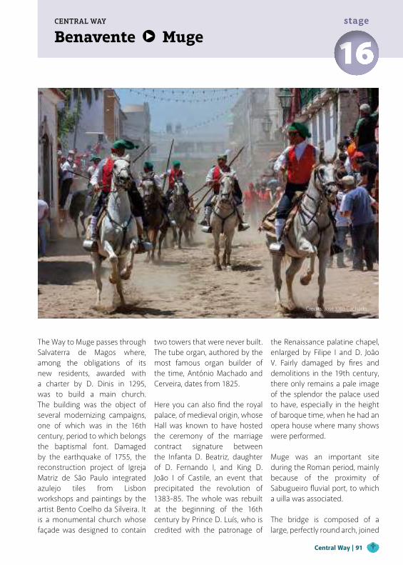
Benavente MugeCENTRAL WAY
16stage
The Way to Muge passes through Salvaterra de Magos where, among the obligations of its new residents, awarded with a charter by D. Dinis in 1295, was to build a main church. The building was the object of several modernizing campaigns, one of which was in the 16th century, period to which belongs the baptismal font. Damaged by the earthquake of 1755, the reconstruction project of Igreja Matriz de São Paulo integrated azulejo tiles from Lisbon workshops and paintings by the artist Bento Coelho da Silveira. It is a monumental church whose façade was designed to contain
two towers that were never built. The tube organ, authored by the most famous organ builder of the time, António Machado and Cerveira, dates from 1825.
Here you can also find the royal palace, of medieval origin, whose Hall was known to have hosted the ceremony of the marriage contract signature between the Infanta D. Beatriz, daughter of D. Fernando I, and King D. João I of Castile, an event that precipitated the revolution of 1383-85. The whole was rebuilt at the beginning of the 16th century by Prince D. Luís, who is credited with the patronage of
the Renaissance palatine chapel, enlarged by Filipe I and D. João V. Fairly damaged by fires and demolitions in the 19th century, there only remains a pale image of the splendor the palace used to have, especially in the height of baroque time, when he had an opera house where many shows were performed.
Muge was an important site during the Roman period, mainly because of the proximity of Sabugueiro fluvial port, to which a uilla was associated.
The bridge is composed of a large, perfectly round arch, joined
Central Way | 91
Credits: José Júlio Cachado
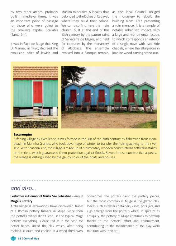
and also...Festivities in Honnor of Mártir São Sebastião − AugustMuge's PotteryArchaeological excavations have discovered traces of a Roman pottery furnace in Muge. Since then, the potter's wheel didn’t stop. In the typical Muge pottery, everything is executed as in the past: the potter hands knead the clay which, after being molded, is dried and cooked in a wood-fired oven.
Sometimes the potters paint the pottery pieces, but the most common in Muge is the glazed clay. Pieces such as water containers, vases, pots, jars, and jugs emerge from the potter's wheel. In spite of its antiquity, the pottery of Muge continues to develop thanks to the potters’ effort and commitment, contributing to the maintenance of the clay work tradition with their art.
by two other arches, probably built in medieval times. It was an important point of passage for those who were going to the province capital, Scallabis (Santarém).
It was in Paço de Muge that King D. Manuel, in 1496, decreed the expulsion edict of Jewish and
Escaroupim A fishing village by excellence, it was formed in the 30s of the 20th century by fishermen from Vieira beach in Marinha Grande, who took advantage of winter to transfer the fishing activity to the river Tejo. With seasonal use, the village is made up of rudimentary wooden constructions settled in stakes on the river, which guaranteed them protection against floods. Beyond these constructive aspects, the village is distinguished by the gaudy color of the boats and houses.
Muslim minorities. A locality that belonged to the Dukes of Cadaval, where they build their palace. We can also find here the main church, built at the end of the 13th century by the patron saint of Salvaterra de Magos, and held for centuries by the monastery of Alcobaça. The ensemble evolved into a Baroque temple,
as the local Council obliged the monastery to rebuild the building from 1712 presenting a ruin menace. It is a temple of notable urbanistic impact, with a large and monumental façade, to which corresponds an interior of a single nave with two side chapels, where the altarpieces in Joanine wood carving stand out.
92 | Central Way
Distance 19 kmMaximum altitude 19 kmCumulative increase 182 km Cumulative descent -185 kmDuration 4h30mDifficulty (0-5) 2
Benavente Muge 16stage
www.visitalentejo.ptwww.visitribatejo.ptwww.caminhosdesantiagoalentejoribatejo.pt
We return to Praça do Município to begin today's stage and head towards the river on Rua Dr. Ruy Azevedo, along the pleasant garden Jardim da Fateixa, on the Sorraia riverbanks. We cross the river over the white pedestrian bridge, on the right, and continue along the trail in the strip that separates the cultivated lands. We pass under the viaduct of the N118 national road and continue the path through the fields.
Still avoiding the busy and narrow N118 road, we get into the side fields, which may be submerged, thus forcing us to go up back to the road. In any case, 1 km ahead we’ll have to do it, in a dangerous intersection, following on the left through the secondary road to Salvaterra de Magos. If we would choose the right we would find Aldeia do Peixe, about 5 km beside the Sorraia river, a place with many records of the "avieiros" fishermen culture.
At the end of the Estrada do Convento, we enter the village through Rua do Tejo where, right at the entrance, we find the Falcoaria Real (Royal Falconry). If you have time, watch a demonstration of this art, in the sessions
that take place regularly. Continuing along Rua do Tejo, we observe a small "marina" and, on the right, we also find the Capela Real (Royal Chapel), from the 17th century, with renovation works during the Rococo period.
We pass the bridge over the Vala Real (Royal Valley), which was used to the transport of goods and for the royal family's boat when they visited this locality. Soon we arrive at the junction that indicates the picturesque village of Escaroupim to the left. Here, we take a break to visit the museum, the stilts port and the old "avieira" houses, preserved in their original state for the tourists.
We leave Escaroupim still on Rua do Tejo, which bifurcates a little further on. We follow the road on the left that takes us to the campsite and continues on a pleasant and fresh path for 4 km through the Escaroupim Forest until a level crossing. Shortly after, we arrive at a crossroad where, turning left, we could go to Ponte Rainha D. Amélia bridge over the Tejo and, from there, intersect with the Path to Santiago coming from Lisbon, by the Tejo river northern bank.
Since this is not our option, we move on to the entrance of Muge, looking for the Parish Council street, where we rush to ask for directions about the available accommodation, which is not abundant around here. As we explore the village, we can find the Roman bridge of Muge in the
north, with 400 m of extension, which served part of the Roman road that used to connect the Alentejo to Santarém. Before the day ends, we rest at Casa Cadaval, an estate with 400 years of history.
Duke's Palace - Cadaval House
Muge Shell-middens
Rainha D. Amélia Railway Bridge
Muge Pottery
USEFUL CONTACTSEmergency: 112Forest Fires: 117
TIPSAlways carry water, supplies, sunscreen, a hat, waterproof, comfortable shoes, and a map.
PUBLIC ENTITIES
Muge Parish Council +351 243 581 130
SUPPORT
CTT Post Office
Bank/Cash Dispenser
Escaroupim Camping +351 263 595 484
POINTS OF INTEREST
Nossa Senhora da Conceição Church
Nossa Senhora da Glória Chapel
Muge Roman Bridge
500 m
400 m
300 m
200 m
100 m
0 m
0 km 2 km 4 km 6 km 8 km 10 km 12 km 14 km 16 km 18 km 19 km
19 km
20 km
BENAVENTE
SANTARÉM
MUGE
CENTRAL PATH
WARNINGS
For questions related to accommodation, please contact the parish council.
CODE OF CONDUCT
Do not leave the marked and signaled route. Do not approach cliffs. Pay attention to the markings. Do not dispose of organic or inorganic waste during the trail, take a bag for this purpose. If you see garbage, collect it, help us to keep the Paths clean. Beware of livestock, don't bother the animals. Leave Nature intact. Do not collect plants, animals or rocks. Avoid making noise. Respect private property, close gates and barriers. Don’t light fires and be careful with cigarettes. Do not vandalize the Paths signage.
In urban areas of the route, the signage marks are for pedestrians only. Other means, such as cycling, should respect traffic signs.
Elev
atio
n
Distance
Rio M
aior
Rio Te
jo
Rio
Sorr
aia
Ribeira
Magos
EM
EM
EM
EM
EM
EM
EM
EM
EM
EM
EM
N3-
2
N3-
3
N114-
3
N118-
1EM51
5
A13
N118
N36
7
BEN
AVEN
TE
MU
GE
SALV
ATER
RA
DE
MA
GOS
ALD
EIA
DA
PA
LHO
TA
RE
GU
EN
GO
ESC
AR
OU
PIM
VAL
AD
A
POR
TO D
E M
UG
E
01,5
3 km
Muge SantarémCENTRAL WAY
17stage
In the commune of Almeirim, before arriving at Ribeira de Santarém, the Igreja de Santa Marta, in Benfica do Ribatejo, inspires a visit. It was built in the 18th century as a chapel of Quinta de Santa Marta, an extensive agricultural estate that dominated the region since the late Middle Ages. The ensemble was fully restored in the late 20th century, as attested by the commemorative inscription placed on the main façade.
Gate of SantiagoIt was the main door of Santarém castle, for that reason called "Porta da Alcáçova", whose first mention dates from 1249. The present designation derives from the invocation of the church where the sidewalk connecting the plateau’s spur of the plateau to the river used to pass. Until the 16th century, it also served as access to the village, through a way considered unrecoverable in 1797. In it, one can see a “Fernandinos de Portugal” coat of arms that documents the town walls reinforcement. There is also no memory remain of the Hospital de Jesus Cristo, which was located in this pathway and allowed the support of pilgrims and travelers who came to the city. It is currently crossed by the numerous pilgrims of the Way to Santiago.
Cathedral of Santarém
Church of Graça | Santarém
Tomb of Pedro Álvares Cabral
Central Way | 95
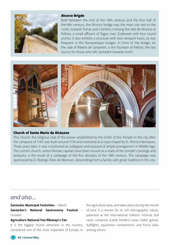
Church of Santa Maria da AlcáçovaThis church, the religious seat of the power established by the Order of the Temple in the city after the conquest of 1147, was built around 1154 and instituted as a royal chapel by D. Afonso Henriques. Three years later, it was constituted as collegiate and enjoyed of ample protagonism in Middle Age. The current church, where Roman capitals have been reused as a mark of the temple’s prestige and antiquity, is the result of a campaign of the first decades of the 18th century. The campaign was sponsored by D. Rodrigo Teles de Meneses, descending from a family with great tradition in the city.
and also...Santarém Municipal Festivities − March Santarém's National Gastronomy Festival − OctoberAgriculture National Fair/Ribatejo's Fair It is the biggest tourist attraction in the country, considered one of the most important of Europe, in
the agriculture area, and takes place during the month of June. It is known for its rich ethnographic values, patented at the International Folkloric Festival, bull races, campinos (cattle herders) races, halter games, bullfights, equestrian competitions, and horse raids, among others.
Alcorce BrigdeBuilt between the end of the 19th century and the first half of the14th century, the Alcorce bridge was the main city exit to the north, towards Tomar and Coimbra, crossing the Vala de Alcorce or Palhais, a small affluent of Tagus river. Endowed with four round arches, it also exhibits a structure with two rampant hauls, as was frequent in the Romanesque bridges. In front of the bridge, on the side of Ribeira de Santarém, is the fountain of Palhais, the last source for those who left Santarém towards north.
96 | Central Way
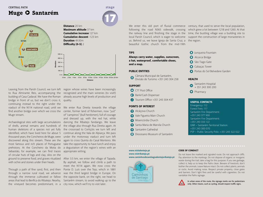
Distance 20 kmMaximum altitude 37 kmCumulative increase 127 km Cumulative descent -123 kmDuration 4h30mDifficulty (0-5) 2
Muge Santarém 17stage
www.visitalentejo.ptwww.visitribatejo.ptwww.caminhosdesantiagoalentejoribatejo.pt
Leaving from the Parish Council, we turn left to Rua Almirante Reis, accompanying the building of Casa Cadaval. We have the Roman bridge in front of us, but we don’t cross it, continuing instead to the right under the viaduct of the N114 national road, until we find another bridge over which we cross the Muge stream.
Archaeological sites with large accumulations of shells, animal remains and hundreds of human skeletons of a species not yet fully identified, which have lived here for about 5 thousand years, the Concheiros de Muge, were discovered along this stream. These are the most famous and rich places of Portuguese prehistory. At the Concheiro da Moita do Sebastião, for example, we can find traces of circular huts of logs and clay, silos on the ground to preserve food, and graves ritualized with ochre and stones under their heads.
Through a path of fine sand, first, and then through a narrow rural road, we advance through the immense cultivated or fallow areas that lead to Benfica do Ribatejo. Nearby, the vineyard becomes predominant, in a
region whose wines have been increasingly recognized and the main wineries (to visit!) already assume high levels of production and quality.
We enter Rua Direita towards the village center, former land of fishermen, now "just" of "campinos" (bull herdsmen), full of courage and dressed up, with the red hat, while dancing the Ribatejo fandango. We leave the village also through Rua Direita again. At the crossroad to Cortiçóis we turn left and continue along the Vala de Alpiarça. We pass under the motorway viaduct and turn left again to cross Quinta do Casal Monteiro. We take the opportunity to have lunch and enjoy a degustation of the region's wines with an appropriate setting.
After 3.5 km, we enter the village of Tapada. By asphalt, we follow and climb a path to meet the N114 again. We now cross the Ponte D. Luís over the Tejo, which in 1881 was the third largest bridge in Europe. On the opposite bank, on the right, we head to Santarém stream, to avoid walking up to the city now, which we'll try to visit later.
We enter this old port of fluvial commerce following the road N365 sidewalk, crossing the railway line and finishing the stage in the local Parish Council, which is eager to welcome us. Behind us, we leave Igreja de Santa Cruz, a beautiful Gothic church from the mid-19th
century, that used to serve the local population, which grew a lot between 1218 and 1260. At that time, the bustling village was a building site to support the construction of large monasteries in the region.
500 m
400 m
300 m
200 m
100 m
0 m
0 km 2 km 4 km 6 km 8 km 10 km 12 km 14 km 16 km 18 km 20 km
20 km
32 km
SANTARÉM
GOLEGÃ
MUGE
CENTRAL PATH
CODE OF CONDUCT
Do not leave the marked and signaled route. Do not approach cliffs. Pay attention to the markings. Do not dispose of organic or inorganic waste during the trail, take a bag for this purpose. If you see garbage, collect it, help us to keep the Paths clean. Beware of livestock, don't bother the animals. Leave Nature intact. Do not collect plants, animals or rocks. Avoid making noise. Respect private property, close gates and barriers. Don’t light fires and be careful with cigarettes. Do not vandalize the Paths signage.
In urban areas of the route, the signage marks are for pedestrians only. Other means, such as cycling, should respect traffic signs.
Elev
atio
n
Distance
TIPSAlways carry water, supplies, sunscreen, a hat, waterproof, comfortable shoes, and a map.
PUBLIC ENTITIES
Câmara Municipal de Santarém, Divisão de Turismo +351 243 304 258
SUPPORT
CTT Post Office
Bank/Cash Dispenser
Tourism Office +351 243 304 437
POINTS OF INTEREST
Alcáçova Church
Vale Figueira Main Church
Misericórdia Church
Santa Maria de Marvila Church
Santarém Cathedral
Diocesano Museum of Santarém
Junqueira Fountain
Alcorce Bridge
São Tiago Gate
Cabaças Tower
Portas do Sol Belvedere Garden
HEALTH
Santarém Hospital + 351 243 300 200
Pharmacy
USEFUL CONTACTSEmergency: 112Forest Fires: 117Santarém Fire Department:+351 243 377 900Santarém Fire Department:+351 243 333 122GNR − Santarém Territorial Station:+351 243 300 070PSP − Public Security Polic: +351 243 322 022
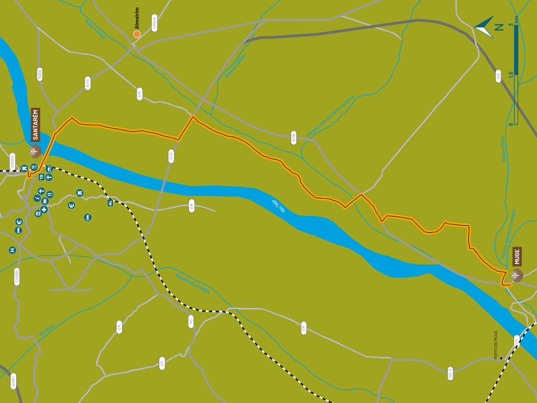
Rio Maior
Rio Tejo
Ribeira Fontainhas
Ribeira Ulm
e
Ribeira
Falhão
Ribe
ira
Vale
de
Coel
heiro
Rib
eira
Mug
eRibeira Vale da Fonte da Moca
A1/IP
1
EM
EM
EM
EM
EM
A13
EM
N3
N36
8
IC10
N114
N118
N3-
3
EM57
8
EN36
5EM36
5
MU
GE
SAN
TAR
ÉM
Alm
eiri
m
POR
TO D
E M
UG
E
01,5
3 km
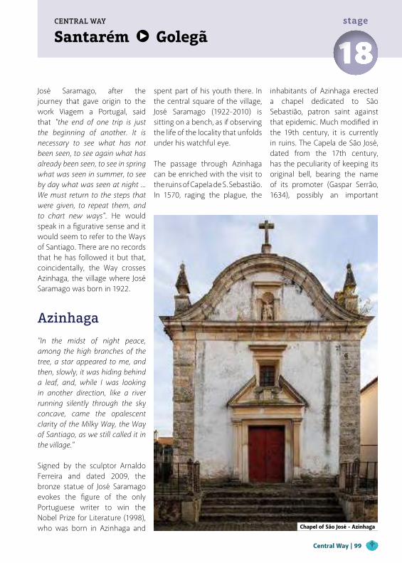
José Saramago, after the journey that gave origin to the work Viagem a Portugal, said that "the end of one trip is just the beginning of another. It is necessary to see what has not been seen, to see again what has already been seen, to see in spring what was seen in summer, to see by day what was seen at night ... We must return to the steps that were given, to repeat them, and to chart new ways". He would speak in a figurative sense and it would seem to refer to the Ways of Santiago. There are no records that he has followed it but that, coincidentally, the Way crosses Azinhaga, the village where José Saramago was born in 1922.
Azinhaga
"In the midst of night peace, among the high branches of the tree, a star appeared to me, and then, slowly, it was hiding behind a leaf, and, while I was looking in another direction, like a river running silently through the sky concave, came the opalescent clarity of the Milky Way, the Way of Santiago, as we still called it in the village." Signed by the sculptor Arnaldo Ferreira and dated 2009, the bronze statue of José Saramago evokes the figure of the only Portuguese writer to win the Nobel Prize for Literature (1998), who was born in Azinhaga and
spent part of his youth there. In the central square of the village, José Saramago (1922-2010) is sitting on a bench, as if observing the life of the locality that unfolds under his watchful eye.
The passage through Azinhaga can be enriched with the visit to the ruins of Capela de S. Sebastião. In 1570, raging the plague, the
inhabitants of Azinhaga erected a chapel dedicated to São Sebastião, patron saint against that epidemic. Much modified in the 19th century, it is currently in ruins. The Capela de São José, dated from the 17th century, has the peculiarity of keeping its original bell, bearing the name of its promoter (Gaspar Serrão, 1634), possibly an important
Central Way | 99
Santarém GolegãCENTRAL WAY
18stage
Chapel of São José - Azinhaga
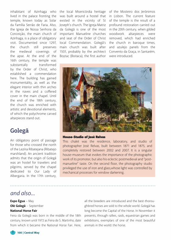
inhabitant of Azinhaga who lived in the palace fronting the temple, known today as Solar da Família Serrão de Faria. Also, the Igreja de Nossa Senhora da Conceição, the main church of Azinhaga, is a place of obligatory visit. Documented since 1297, the church still preserves the medieval coverings of the apse. At the end of the 16th century, the temple was substantially transformed by the Order of Christ, who established a commendation here. The building has gained monumentality, as well as the elegant interior with thin arches in the naves and a coffered cover in the main chapel. Until the end of the 18th century, the church was enriched with artistic and devotional elements, of which the polychrome carved altarpieces stand out.
Golegã
An obligatory point of passage for those who crossed the north of the Lezíria Ribatejana (Ribatejo marshland). An ancient tradition admits that the origin of Golegã was an hostel for travelers and pilgrims, served by the chapel dedicated to Our Lady of Albergaria. In the 17th century,
House-Studio of José RelvasThis chalet was the residence, laboratory, and studio of photographer José Relvas, built between 1871 and 1875, and completely restored between 2002 and 2007. It is a singular house-museum that evokes the importance of the photographic work of its promoter, but also his eclectic postmedieval and “post-manueline” taste. On the second floor, the photography studio privileged the use of iron and glass,whose light was controlled by mechanical processes for window darkening.
and also...Expo Égua − MayOlé Golegã − SeptemberNational Horse FairFeira da Golegã was born in the middle of the 18th century, known until 1972 as Feira de S. Martinho, date from which it became the National Horse Fair. Here,
all the breeders are introduced and the best-thorou-ghbred horses are sold to the whole world. Golegã has long become the Capital of the Horse. In November it presents, through rallies, raids, equestrian games and exhibitions, exemplars of one of the most beautiful animals in the world: the horse.
the local Misericórdia heritage was built around a hostel that existed in the vicinity of St Joseph’s church. The Igreja Matriz da Golegã is one of the most important Manueline churches and seat of the Order of Christ local Commendation. Golegã's main church was built after 1501, probably by the architect Boytac (Boitaca), the first author
of the Mosteiro dos Jerónimos in Lisbon. The current feature of the temple is the result of a profound restoration carried out in the 20th century, when gilded woodwork altarpieces were removed, which had enriched the church in baroque times, and azulejo panels from the Convento da Graça, in Santarém, were introduced.
100 | Central Way
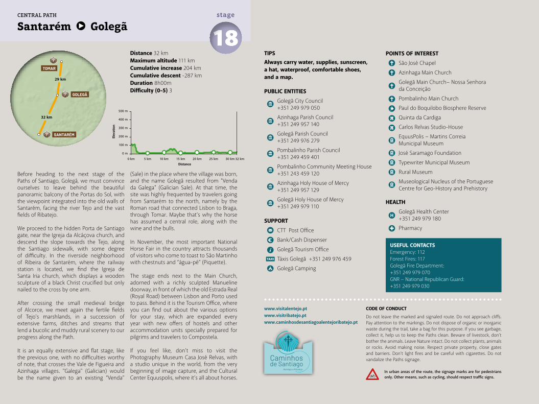
Before heading to the next stage of the Paths of Santiago, Golegã, we must convince ourselves to leave behind the beautiful panoramic balcony of the Portas do Sol, with the viewpoint integrated into the old walls of Santarém, facing the river Tejo and the vast fields of Ribatejo.
We proceed to the hidden Porta de Santiago gate, near the Igreja da Alcáçova church, and descend the slope towards the Tejo, along the Santiago sidewalk, with some degree of difficulty. In the riverside neighborhood of Ribeira de Santarém, where the railway station is located, we find the Igreja de Santa Iria church, which displays a wooden sculpture of a black Christ crucified but only nailed to the cross by one arm.
After crossing the small medieval bridge of Alcorce, we meet again the fertile fields of Tejo's marshlands, in a succession of extensive farms, ditches and streams that lend a bucolic and muddy rural scenery to our progress along the Path.
It is an equally extensive and flat stage, like the previous one, with no difficulties worthy of note, that crosses the Vale de Figueira and Azinhaga villages. "Galega" (Galician) would be the name given to an existing “Venda”
(Sale) in the place where the village was born, and the name Golegã resulted from "Venda da Galega" (Galician Sale). At that time, the site was highly frequented by travelers going from Santarém to the north, namely by the Roman road that connected Lisbon to Braga, through Tomar. Maybe that's why the horse has assumed a central role, along with the wine and the bulls.
In November, the most important National Horse Fair in the country attracts thousands of visitors who come to toast to São Martinho with chestnuts and “água-pé” (Piquette).
The stage ends next to the Main Church, adorned with a richly sculpted Manueline doorway, in front of which the old Estrada Real (Royal Road) between Lisbon and Porto used to pass. Behind it is the Tourism Office, where you can find out about the various options for your stay, which are expanded every year with new offers of hostels and other accommodation units specially prepared for pilgrims and travelers to Compostela.
If you feel like, don’t miss to visit the Photography Museum Casa José Relvas, with a studio unique in the world, from the very beginning of image capture, and the Cultural Center Equuspolis, where it’s all about horses.
Distance 32 kmMaximum altitude 111 kmCumulative increase 204 km Cumulative descent -287 kmDuration 8h00mDifficulty (0-5) 3
TIPSAlways carry water, supplies, sunscreen, a hat, waterproof, comfortable shoes, and a map.
PUBLIC ENTITIES
Golegã City Council +351 249 979 050
Azinhaga Parish Council +351 249 957 140
Golegã Parish Council +351 249 976 279
Pombalinho Parish Council +351 249 459 401
Pombalinho Community Meeting House +351 243 459 120
Azinhaga Holy House of Mercy +351 249 957 129
Golegã Holy House of Mercy +351 249 979 110
SUPPORT
CTT Post Office
Bank/Cash Dispenser
Golegã Tourism Office
Táxis Golegã +351 249 976 459
Golegã Camping
USEFUL CONTACTSEmergency: 112Forest Fires: 117Golegã Fire Department: +351 249 979 070GNR − National Republican Guard: +351 249 979 030
POINTS OF INTEREST
São José Chapel
Azinhaga Main Church
Golegã Main Church− Nossa Senhora da Conceição
Pombalinho Main Church
Paul do Boquilobo Biosphere Reserve
Quinta da Cardiga
Carlos Relvas Studio-House
EquusPolis − Martins Correia Municipal Museum
José Saramago Foundation
Typewriter Municipal Museum
Rural Museum
Museological Nucleus of the Portuguese Centre for Geo-History and Prehistory
HEALTH
Golegã Health Center +351 249 979 180
Pharmacy
Santarém Golegã 18stage
www.visitalentejo.ptwww.visitribatejo.ptwww.caminhosdesantiagoalentejoribatejo.pt
500 m
400 m
300 m
200 m
100 m
0 m
0 km 5 km 10 km 15 km 20 km 25 km 30 km 32 km
32 km
29 km
SANTARÉM
GOLEGÃ
TOMAR
CENTRAL PATH
CODE OF CONDUCT
Do not leave the marked and signaled route. Do not approach cliffs. Pay attention to the markings. Do not dispose of organic or inorganic waste during the trail, take a bag for this purpose. If you see garbage, collect it, help us to keep the Paths clean. Beware of livestock, don't bother the animals. Leave Nature intact. Do not collect plants, animals or rocks. Avoid making noise. Respect private property, close gates and barriers. Don’t light fires and be careful with cigarettes. Do not vandalize the Paths signage.
In urban areas of the route, the signage marks are for pedestrians only. Other means, such as cycling, should respect traffic signs.
Elev
atio
n
Distance
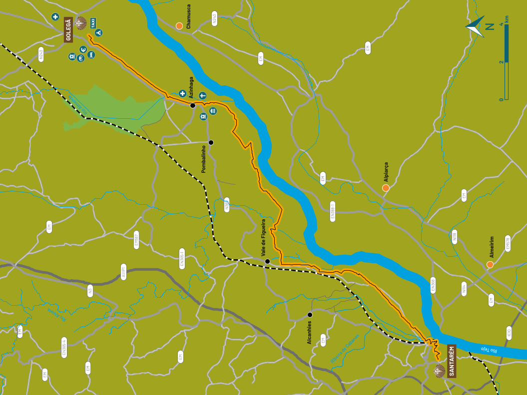
02
4 km
EM
EM
EM
EM
EM
EM
EM
EM
EM
EM
EM
A1/IP
1
EN36
5-1
EM56
7
EN36
5-4
N3
EN36
8-1
EN36
8
EM57
8N118
N114
IC10
N24
3
N24
3
N36
5
Rio Tejo
Rio Alviela
Rio Almonda
Ribeira de Cabanas
Azi
nhag
a
Pom
balin
ho
Alc
anhi
es
Vale
de
Figu
eira
Cham
usca
Alp
iarç
a
Alm
eiri
m
GOLE
GÃ
SAN
TAR
ÉM
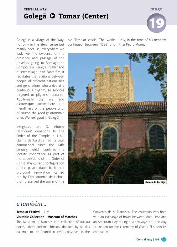
Golegã Tomar (Center)CENTRAL WAY
19stage
Golegã is a village of the Way, not only in the literal sense but mainly because, everywhere we look, we find evidence of the presence and passage of the travelers going to Santiago de Compostela. Being a smaller and quieter village than Santarém, it facilitates the relations between people of different nationalities and generations who arrive at a continuous rhythm, so services targeted to pilgrims appeared. Additionally, the rural and picturesque atmosphere, the friendliness of the people and, of course, the good gastronomic offer. We feel good in Golegã!
Integrated on D. Afonso Henriques’ donations to the Order of the Temple in 1169, Quinta da Cardiga had its own commander since the 14th century, which confirms the locality importance as part of the possessions of the Order of Christ. The current configuration of the palace dates back to a profound renovation carried out by Friar António de Lisboa, that preserved the tower of the
e também...Templar Festival − JulyVisitable Collection - Museum of MatchesThe Museum of Matches is a collection of 60,000 boxes, labels, and matchboxes, donated by Aquiles da Mota to the Council in 1980, conserved in the
Convento de S. Francisco. The collection was born with an exchange of boxes between Mota Lima and an American lady during a sea voyage, on their way to London for the ceremony of Queen Elizabeth II’s coronation.
old Templar castle. The works continued between 1592 and
1617, in the time of his nephew, Friar Pedro Moniz.
Quinta da Cardiga
Central Way | 103
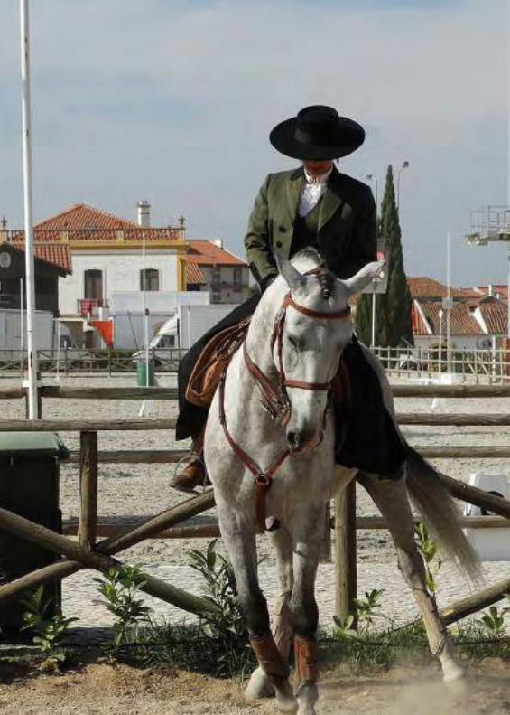
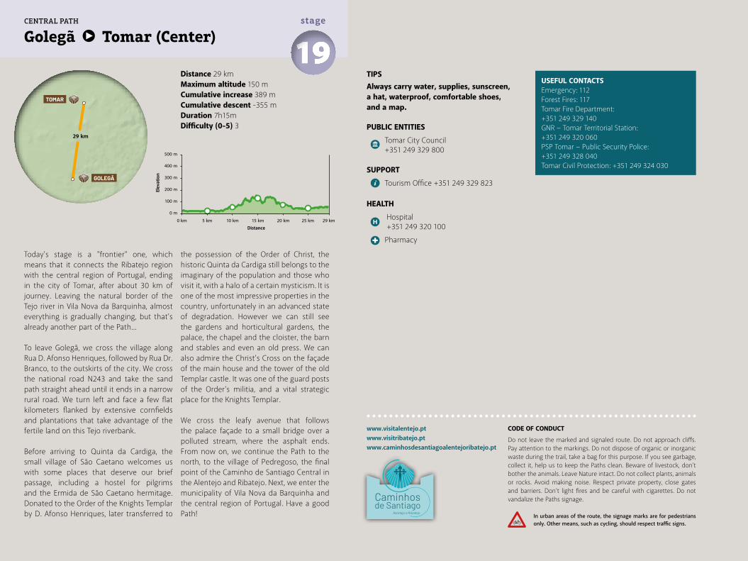
Distance 29 kmMaximum altitude 150 mCumulative increase 389 m Cumulative descent -355 mDuration 7h15mDifficulty (0-5) 3
Golegã Tomar (Center) 19stage
www.visitalentejo.ptwww.visitribatejo.ptwww.caminhosdesantiagoalentejoribatejo.pt
Today's stage is a "frontier" one, which means that it connects the Ribatejo region with the central region of Portugal, ending in the city of Tomar, after about 30 km of journey. Leaving the natural border of the Tejo river in Vila Nova da Barquinha, almost everything is gradually changing, but that’s already another part of the Path...
To leave Golegã, we cross the village along Rua D. Afonso Henriques, followed by Rua Dr. Branco, to the outskirts of the city. We cross the national road N243 and take the sand path straight ahead until it ends in a narrow rural road. We turn left and face a few flat kilometers flanked by extensive cornfields and plantations that take advantage of the fertile land on this Tejo riverbank.
Before arriving to Quinta da Cardiga, the small village of São Caetano welcomes us with some places that deserve our brief passage, including a hostel for pilgrims and the Ermida de São Caetano hermitage. Donated to the Order of the Knights Templar by D. Afonso Henriques, later transferred to
the possession of the Order of Christ, the historic Quinta da Cardiga still belongs to the imaginary of the population and those who visit it, with a halo of a certain mysticism. It is one of the most impressive properties in the country, unfortunately in an advanced state of degradation. However we can still see the gardens and horticultural gardens, the palace, the chapel and the cloister, the barn and stables and even an old press. We can also admire the Christ’s Cross on the façade of the main house and the tower of the old Templar castle. It was one of the guard posts of the Order's militia, and a vital strategic place for the Knights Templar.
We cross the leafy avenue that follows the palace façade to a small bridge over a polluted stream, where the asphalt ends. From now on, we continue the Path to the north, to the village of Pedregoso, the final point of the Caminho de Santiago Central in the Alentejo and Ribatejo. Next, we enter the municipality of Vila Nova da Barquinha and the central region of Portugal. Have a good Path!
500 m
400 m
300 m
200 m
100 m
0 m
0 km 5 km 10 km 15 km 20 km 25 km 29 km
TIPSAlways carry water, supplies, sunscreen, a hat, waterproof, comfortable shoes, and a map.
PUBLIC ENTITIES
Tomar City Council +351 249 329 800
SUPPORT
Tourism Office +351 249 329 823
HEALTH
Hospital +351 249 320 100
Pharmacy
USEFUL CONTACTSEmergency: 112Forest Fires: 117Tomar Fire Department:+351 249 329 140GNR − Tomar Territorial Station: +351 249 320 060PSP Tomar − Public Security Police:+351 249 328 040Tomar Civil Protection: +351 249 324 030
29 km
GOLEGÃ
TOMAR
CENTRAL PATH
CODE OF CONDUCT
Do not leave the marked and signaled route. Do not approach cliffs. Pay attention to the markings. Do not dispose of organic or inorganic waste during the trail, take a bag for this purpose. If you see garbage, collect it, help us to keep the Paths clean. Beware of livestock, don't bother the animals. Leave Nature intact. Do not collect plants, animals or rocks. Avoid making noise. Respect private property, close gates and barriers. Don’t light fires and be careful with cigarettes. Do not vandalize the Paths signage.
In urban areas of the route, the signage marks are for pedestrians only. Other means, such as cycling, should respect traffic signs.
Elev
atio
n
Distance

Ribeira da Atalaia
Ribe
ira d
e Sa
nta
Cata
rina
Rio Tejo
EM
EM
EM
EM
EM
N110
N36
5
EM57
1
N36
5
N24
3
São
Caet
ano
Quin
ta d
a Ca
rdig
a
Pedr
egos
o
Entr
onca
men
toV
ila N
ova
da B
arqu
inha
GOLE
GÃ0
12 km
WAYS GUIDE
Alentejo e Ribatejo
Caminhos de Santiago Alentejo e Ribatejo
Central − via TagusWay
EasternWay

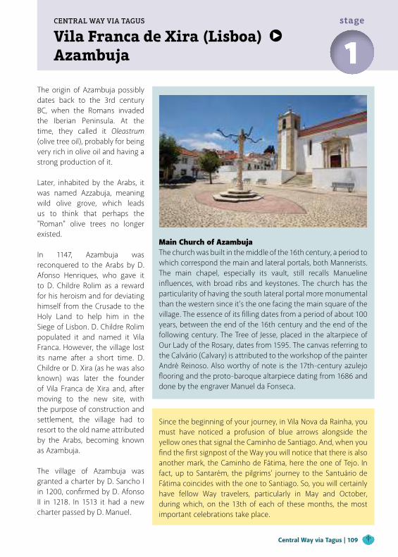
Vila Franca de Xira (Lisboa) Azambuja
CENTRAL WAY VIA TAGUS
1stage
The origin of Azambuja possibly dates back to the 3rd century BC, when the Romans invaded the Iberian Peninsula. At the time, they called it Oleastrum (olive tree oil), probably for being very rich in olive oil and having a strong production of it.
Later, inhabited by the Arabs, it was named Azzabuja, meaning wild olive grove, which leads us to think that perhaps the "Roman" olive trees no longer existed.
In 1147, Azambuja was reconquered to the Arabs by D. Afonso Henriques, who gave it to D. Childre Rolim as a reward for his heroism and for deviating himself from the Crusade to the Holy Land to help him in the Siege of Lisbon. D. Childre Rolim populated it and named it Vila Franca. However, the village lost its name after a short time. D. Childre or D. Xira (as he was also known) was later the founder of Vila Franca de Xira and, after moving to the new site, with the purpose of construction and settlement, the village had to resort to the old name attributed by the Arabs, becoming known as Azambuja. The village of Azambuja was granted a charter by D. Sancho I in 1200, confirmed by D. Afonso II in 1218. In 1513 it had a new charter passed by D. Manuel.
Main Church of Azambuja The church was built in the middle of the 16th century, a period to which correspond the main and lateral portals, both Mannerists. The main chapel, especially its vault, still recalls Manueline influences, with broad ribs and keystones. The church has the particularity of having the south lateral portal more monumental than the western since it’s the one facing the main square of the village. The essence of its filling dates from a period of about 100 years, between the end of the 16th century and the end of the following century. The Tree of Jesse, placed in the altarpiece of Our Lady of the Rosary, dates from 1595. The canvas referring to the Calvário (Calvary) is attributed to the workshop of the painter André Reinoso. Also worthy of note is the 17th-century azulejo flooring and the proto-baroque altarpiece dating from 1686 and done by the engraver Manuel da Fonseca.
Since the beginning of your journey, in Vila Nova da Rainha, you must have noticed a profusion of blue arrows alongside the yellow ones that signal the Caminho de Santiago. And, when you find the first signpost of the Way you will notice that there is also another mark, the Caminho de Fátima, here the one of Tejo. In fact, up to Santarém, the pilgrims' journey to the Santuário de Fátima coincides with the one to Santiago. So, you will certainly have fellow Way travelers, particularly in May and October, during which, on the 13th of each of these months, the most important celebrations take place.
Central Way via Tagus | 109
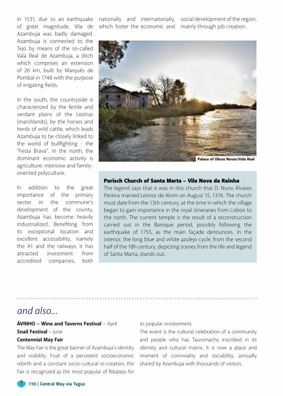
and also...ÁVINHO − Wine and Taverns Festival − AprilSnail Festival − JuneCentennial May Fair The May Fair is the great banner of Azambuja’s identity and visibility. Fruit of a persistent socioeconomic rebirth and a constant socio-cultural re-creation, the Fair is recognized as the most popular of Ribatejo for
its popular involvement.The event is the cultural celebration of a community and people who has Tauromachy inscribed in its identity and cultural matrix. It is now a place and moment of conviviality and sociability, annually shared by Azambuja with thousands of visitors.
Parisch Church of Santa Marta – Vila Nova da Rainha The legend says that it was in this church that D. Nuno Álvares Pereira married Leonor de Alvim on August 15, 1376. The church must date from the 13th century, at the time in which the village began to gain importance in the royal itineraries from Lisbon to the north. The current temple is the result of a reconstruction carried out in the Baroque period, possibly following the earthquake of 1755, as the main façade denounces. In the interior, the long blue and white azulejo cycle, from the second half of the 18h century, depicting scenes from the life and legend of Santa Marta, stands out.
In 1531, due to an earthquake of great magnitude, Vila de Azambuja was badly damaged. Azambuja is connected to the Tejo by means of the so-called Vala Real de Azambuja, a ditch which comprises an extension of 26 km, built by Marquês de Pombal in 1748 with the purpose of irrigating fields. In the south, the countryside is characterized by the fertile and verdant plains of the Lezírias (marshlands), by the horses and herds of wild cattle, which leads Azambuja to be closely linked to the world of bullfighting - the "Festa Brava". In the north, the dominant economic activity is agriculture: intensive and family-oriented polyculture.
In addition to the great importance of the primary sector in the commune’s development of the county, Azambuja has become heavily industrialized. Benefiting from its exceptional location and excellent accessibility, namely the A1 and the railways, it has attracted investment from accredited companies, both
nationally and internationally, which foster the economic and
social development of the region, mainly through job creation.
Palace of Obras Novas/Vala Real
110 | Central Way via Tagus
Vila Franca de Xira (Lisboa) Azambuja 1
stage
"The Tejo unites different feelings, as if it wanted to be the elder of a large family that everyone admires and respects." (Francisco Hipólito Raposo, "Ribatejo")
The Tejo is also the link that unites the regions of Lisbon and Ribatejo, guiding us along the Lezírias do Tejo (Tagus marshlands) to the small town of Vila Nova da Rainha, which is "da Rainha" (of the Queen) because it was in Santa Marta Main Church that king D. Nuno Álvares Pereira, the Countable, who was largely responsible for the independence of the Portuguese Kingdom, got married in the 14th century.
We pass the only bridge over two rivers (Ota and Alenquer) in Portugal and enter the village at lunchtime, where the perfect symbiosis between the marshland and the Tejo river takes the form of a typical "Caldeirada à Fragateiro" (fish dish), accompanied by good bread and wine. But we mainly remember a surprising and unique Chèvre cheese, produced nearby in the village of Maçussa!
We leave the village crossing the busy road N3 towards the railway halt and, following the
Avenida Gago Coutinho, we see on the left the wide terrain where the national aviation cradle was once located, inaugurated in 1915. In this Aviation School of Vila Nova da Rainha, Sacadura Cabral was a pilot instructor and later, in 1922 together with Gago Coutinho, he would make the first air crossing of the South Atlantic to Brazil!
After the railway station, with the city of Azambuja on the horizon, we follow the railway line, an occasion to enjoy the Tejo alluvial valleys, and the abundant bird life with the Stork and the famous Royal Heron well represented.
The trail that takes us to Azambuja ends by passing under the railway viaduct and we return to the N3 road, arriving right at the southern entrance of Azambuja, a city with centuries of history. Turn left at the intersection and follow Avenida de Valverde.
It was here that the Comendadeira do Mosteiro (Monastery Commander) de Santos da Ordem de Santiago da Espada, built the Igreja da Confraria de Nossa Senhora do Paraíso church, in 1555.
This stage finishes in the Praça do Município, an ample square topped by the church of the patron
saint Nossa Senhora da Assunção, where the most diverse local festivities take place.
www.visitalentejo.ptwww.visitribatejo.ptwww.caminhosdesantiagoalentejoribatejo.pt
TIPSAlways carry water, supplies, sunscreen, a hat, waterproof, comfortable shoes, and a map.
PUBLIC ENTITIES
Azambuja City Council +351 263 400 400
Azambuja Parish Council +351 263 402 647
Vila Nova da Rainha Parish Council +351 263 853 360
Santa Casa da Misericórdia de Azambuja +351 263 418 602
SUPPORT
CTT Post Office
Bank/Cash Dispenser
Tourism Office +351 263 400 476
Táxis
POINTS OF INTEREST
São Sebastião Chapel
Senhor Jesus da Misericórdia Church
Santa Maria das Virtudes Church and Convent
USEFUL CONTACTSEmergency: 112Forest Fires: 117Azambuja Fire Department:+351 263 401 144GNR − Azambuja Territorial Station: +351 263 418 841Vila Nova da Rainha Civil Protection:+351 263 403 720
Nossa Senhora da Assunção de Azambuja Main Church
Sebastião Mateus Arenque Municipal Museum
Azambuja Library
Industrial Chimney in the Urban Garden
Aviation Panels, Vila Nova da Rainha
Azambuja Pillory
Azambuja Landmark
Lezíria Ribatejana (Marshland)
Tagus River
Vala Real
HEALTH
Azambuja Health Center +351 263 407 600
Pharmacy
Distance 26 kmMaximum altitude 22 kmCumulative increase 211 km Cumulative descent -209 kmDuration 6h30mDifficulty (0-5) 3
500 m
400 m
Elev
atio
n
Distance
300 m
200 m
100 m
0 m
0 km 5 km 10 km 15 km 20 km 25 km 26 km
22 km
33 km
VILA FRANCADE XIRA (Lisboa)
AZAMBUJA
SANTARÉM
CENTRAL PATH VIA TAGUS
CODE OF CONDUCT
Do not leave the marked and signaled route. Do not approach cliffs. Pay attention to the markings. Do not dispose of organic or inorganic waste during the trail, take a bag for this purpose. If you see garbage, collect it, help us to keep the Paths clean. Beware of livestock, don't bother the animals. Leave Nature intact. Do not collect plants, animals or rocks. Avoid making noise. Respect private property, close gates and barriers. Don’t light fires and be careful with cigarettes. Do not vandalize the Paths signage.
In urban areas of the route, the signage marks are for pedestrians only. Other means, such as cycling, should respect traffic signs.
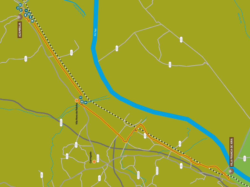
Rio
Tej
o
Vala da Aza
mbuja
Rio
Sorr
aia
EM
EM
EM
EM
EM
EM
EM
EM
EM
N1
EM
EM
EM
N10
A1/IP
1
EM12
16 EM12
39
N115-
4
VIL
A F
RA
NCA
DE
XIR
A
AZA
MB
UJA
Vila
Nov
a da
Rai
nha
Carr
egad
o

Azambuja SantarémCENTRAL WAY VIA TAGUS
2stage
In Santarém, a city of great importance to the Order of Santiago, you must visit the Marvila Church, built by the Templars in 1147, with rents offered by the Bishop of Lisbon. Enriched in the 17th century by D. Manuel, its walls are a testimonial of azulejo panels decorative art. Take time to admire the symbolic-cultural richness, the armillary sphere, the Christ cross, the fleurs-de-lys, and the heraldic weapons.
On the way to the top of the hill, we enter the citadel protected by the Muralha (Wall), through Porta de Santiago (Santiago Gate), used by thousands of pilgrims. Here you can observe the “Fernandinos of Portugal” coat of arms, which documents the reinforcement of the village walls. Already at the top, visit the
"Avieira" CultureIn the middle of the 19th century, fishermen from the north fled the harsh conditions of the sea and moved to the Tejo and Sado areas, settling on their riverbanks, which provided them with fish all year round. The particular way of life of these populations, the palafitte houses and docks, and the typical boats, the bateiras, are testimonies that you can still find and visit in this part of the Way, first in Avieira Porto da Palha village, and more to the north, 1 km after the entrance of Reguengo, in the village of Palhota.
Igreja de Santa Maria da Alcáçova church which, after the conquest of Santarém to the Moors by D. Afonso Henriques, was founded by the Templar Knights, masters of Santarém’s ecclesiastic, in 1154.
Finally, stop to visit the museum of Torre do Relógio (Clock Tower) and discover the 8 calabashes, or gourds, associated with the
king’s legend. By necessity, the village asked the king a Clock Tower. During its construction, the king, who already suspected that public monies were being mismanaged, was very displeased during his visit. Thus it is said that the king had eight calabashes placed, symbolizing the hollow head of the work’s architects, to the shame of the village.
Church of Santa Maria de Marvila | Santarém
Central Way via Tagus | 113
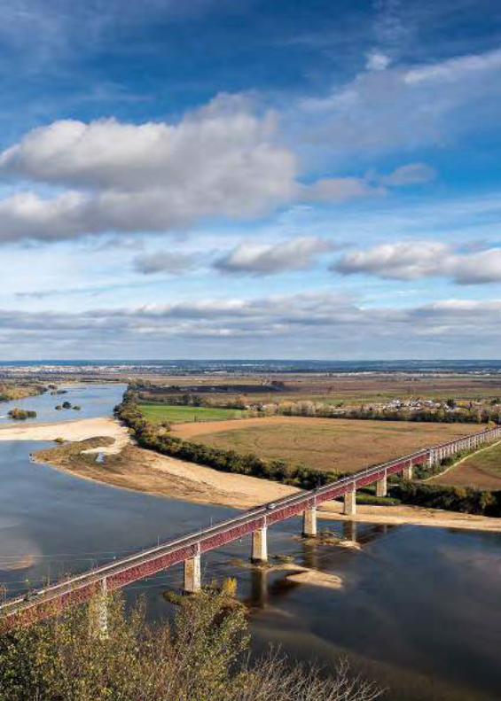
Azambuja Santarém2stage
To leave Azambuja, we overcome again the unavoidable barrier of the railway line. We get immediately into the immensity of the marshland, following the road for 1.5 km until we reach Vala Real, where we deviate to the left and follow the main canal, and then a secondary canal, on your right.
If you come with time, in the place before the road exit follow instead the detour to the right through the cultivated fields, and discover this section of Vala Real until its mouth (about 3.5 km), a canal with a total length of 26 km built at the behest of Marquês de Pombal, in the 18th century. Near the mouth, be sure to appreciate the natural charm of the surrounding flora and fauna and find the Palácio da Rainha. Although it is in an advanced state of degradation, it was a landmark at the end of the 18th century, functioning as a warehouse and hostel to support the group of steam boats that circulated in the Tejo.
We come back to the previous point and, at the end of the secondary canal, we reach again the almost deserted road, through
which we follow, among cultivated fields to lose sight, until Aldeia do Reguengo.
As a curiosity, we suggest here a detour of 1 km towards the river Tejo, to the site of Palhota, where there are important records of the so-called "Avieira Culture", candidate for National Heritage (see box).
From Reguengo to Valada, we walk 2 km without history, but we advise you to stop and recover your energy in this small but typical Ribatejo village.
Head to Rua da Cova da Onça, along the dyke on the Tejo riverbanks until Porto de Muge, an old resort in Roman times. From here you have the option to take the additional 2.5 km road to Muge and pass over the century-old Rainha D. Amélia bridge over the Tejo.
Before proceeding to Santarém, make sure you have all the supplies and water needed, because you won’t find other support points until the end of this stage. Entering through Rua do Sabugueiro, you now have about 10 km of dirt track ahead, before reaching the tarmac
road that passes under a viaduct and flanks the airfield, then passing through the village of Onias, already in the city vicinity. On your left you will now have to face the final ascent of the Calçada da Junqueira sidewalk which, on hot days, turns out to be a real ordeal! Maybe that's why, almost 200 years ago, someone wanted to ease the pilgrims suffering and ordered the construction
of a fountain in the middle of the arduous climb. The water is unsuitable for drinking, but the tanks refresh our sore feet and soul...We finally enter Santarém and head for Largo Cândido dos Reis square. In front of the mall you will find an interpretative panel that marks the place where the Paths of Santiago and Fátima split.
www.visitalentejo.ptwww.visitribatejo.ptwww.caminhosdesantiagoalentejoribatejo.pt
TIPSAlways carry water, supplies, sunscreen, a hat, waterproof, comfortable shoes, and a map.
PUBLIC ENTITIES
Câmara Municipal de Santarém, Divisão de Turismo +351 243 304 258
SUPPORT
CTT Post Office
Bank/Cash Dispenser
Tourism Office +351 243 304 437
POINTS OF INTEREST
Alcáçova Church
Vale Figueira Main Church
Misericórdia Church
Santa Maria de Marvila Church
Santarém Cathedral
Diocesano Museum of Santarém
Junqueira Fountain
Alcorce Bridge
São Tiago Gate
Cabaças Tower
Portas do Sol Belvedere Garden
HEALTH
Santarém Hospital + 351 243 300 200
Pharmacy
USEFUL CONTACTSEmergency: 112Forest Fires: 117Santarém Fire Department:+351 243 377 900Santarém Fire Department:+351 243 333 122GNR − Santarém Territorial Station:+351 243 300 070PSP − Public Security Polic: +351 243 322 022
500 m
400 m
300 m
200 m
100 m
0 m
0 km 5 km 10 km 15 km 20 km 25 km 30 km33 km
Distance 33 kmMaximum altitude 110 mCumulative increase 262 m Cumulative descent -162 mDuration 8h00mDifficulty (0-5) 3
33 km
AZAMBUJA
SANTARÉM
CENTRAL PATH VIA TAGUS
CODE OF CONDUCT
Do not leave the marked and signaled route. Do not approach cliffs. Pay attention to the markings. Do not dispose of organic or inorganic waste during the trail, take a bag for this purpose. If you see garbage, collect it, help us to keep the Paths clean. Beware of livestock, don't bother the animals. Leave Nature intact. Do not collect plants, animals or rocks. Avoid making noise. Respect private property, close gates and barriers. Don’t light fires and be careful with cigarettes. Do not vandalize the Paths signage.
In urban areas of the route, the signage marks are for pedestrians only. Other means, such as cycling, should respect traffic signs.
Elev
atio
n
Distance
Vala R
eal
Rib
eira
de
Mug
e
Rio Tejo
Vala
da
Azam
buja
EM
EM
EM
EM
EM
EM
EM
EM
EM
EM
EM
EM
EM
EM
EM
EM
EM
EM
N3
EM
IC10
N36
6
N3-
2N3-
3
A1/IP
1
N118-
2
N118
N36
7
EN36
5
N114-
2
SAN
TAR
ÉM
MU
GE
AZA
MB
UJA
Cart
axo
Port
o de
Mug
e
Vala
da
Regu
engo
Esca
roup
im
Ald
eia
da P
alho
ta
02
4 km
WAYS GUIDE
Alentejo e Ribatejo
Caminhos de Santiago Alentejo e Ribatejo
CentralWay
EasternWay

Alcoutim (Algarve) MesquitaEASTERN WAY
1stage
Coming from Alcoutim, we "navigate" the Guadiana river always along the Portuguese margin, following the signs of route GR15, until we reach the stream Ribeira do Vascão, already with the accumulated fatigue of some kilometers through the Algarve mountains. The passage of Vascão Stream is made in the marked area, assuming that the water level is shallow, as it almost always is, except in the periods of heavy rains.
River of VascãoThe Ribeira do Vascão is an affluent of the Guadiana river and is one of the few watercourses still practically wild in the south of the country. It ranges about 70 Kms in schistous terrain, from Cerro do Zebro, at more than 500 m of altitude, to Guadiana's mouth, at 10 m altitude. It is possible that the name comes from the Arabic word basqa, which means "stony zone".
Eastern Way | 119
Hermitage of Nossa Senhora das NevesIn the locality of Mesquita, municipality of Mértola, this hermitage of Our Lady of the Snow rises on top of a hill whose construction dates back to the time before the reconquest. From the 8th and 9th centuries onward, the first signs of sacralization are evident. A marble column on the site shows the date of its construction. Despite its sacralization, there are archaeological remains in Mértola's archaeological field that point out that this place would also have been a Paleo-Christian mosque at the time. The first information dates back to 1515, by a visitor from the Order of Santiago. This church, which had some importance in terms of its assets, was not known until today. It is known from its description that there were three altars, one dedicated to S. Bento (St Benedict), another dedicated to S. Bartolomeu (St Bartholomew) and the main altar dedicated to Nossa Senhora das Flores (Our Lady of the Flowers), the patron saint of the hermitage. Later, this church would be consecrated to Nossa Senhora das Neves (Our Lady of the Snow), and even today we can see its image in the center of the main altar, dated from the 19th century.
Mesquita
Mesquita is located at a strategic point, a natural access road to the Guadiana river. There used to be one of the main natural barriers to larger boats, which at that time moored at the local port and made their trade.
Different people and different products were found here, making the river a great highway of commercial traffic at that time.
120 | Eastern Way
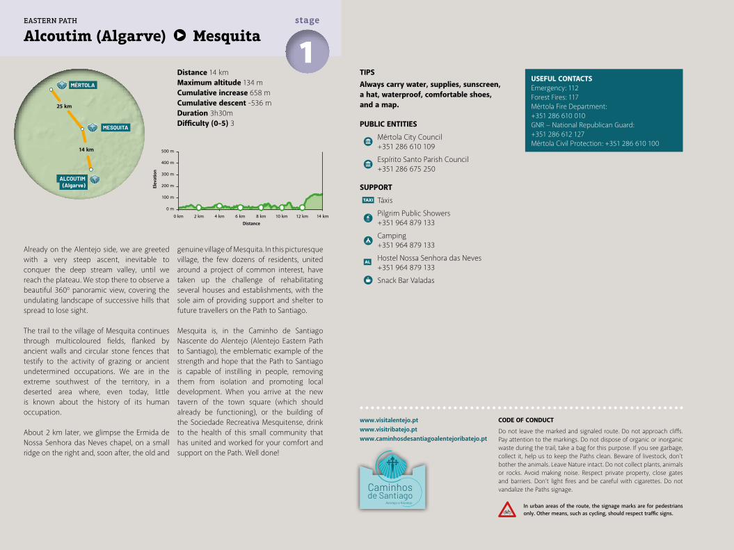
TIPSAlways carry water, supplies, sunscreen, a hat, waterproof, comfortable shoes, and a map.
PUBLIC ENTITIES
Mértola City Council +351 286 610 109
Espírito Santo Parish Council +351 286 675 250
SUPPORT
Táxis
Pilgrim Public Showers +351 964 879 133
Camping +351 964 879 133
Hostel Nossa Senhora das Neves +351 964 879 133
Snack Bar Valadas
Distance 14 kmMaximum altitude 134 mCumulative increase 658 m Cumulative descent -536 mDuration 3h30mDifficulty (0-5) 3
USEFUL CONTACTSEmergency: 112Forest Fires: 117Mértola Fire Department: +351 286 610 010GNR − National Republican Guard: +351 286 612 127Mértola Civil Protection: +351 286 610 100
Alcoutim (Algarve) Mesquita1stage
Already on the Alentejo side, we are greeted with a very steep ascent, inevitable to conquer the deep stream valley, until we reach the plateau. We stop there to observe a beautiful 360º panoramic view, covering the undulating landscape of successive hills that spread to lose sight.
The trail to the village of Mesquita continues through multicoloured fields, flanked by ancient walls and circular stone fences that testify to the activity of grazing or ancient undetermined occupations. We are in the extreme southwest of the territory, in a deserted area where, even today, little is known about the history of its human occupation.
About 2 km later, we glimpse the Ermida de Nossa Senhora das Neves chapel, on a small ridge on the right and, soon after, the old and
genuine village of Mesquita. In this picturesque village, the few dozens of residents, united around a project of common interest, have taken up the challenge of rehabilitating several houses and establishments, with the sole aim of providing support and shelter to future travellers on the Path to Santiago.
Mesquita is, in the Caminho de Santiago Nascente do Alentejo (Alentejo Eastern Path to Santiago), the emblematic example of the strength and hope that the Path to Santiago is capable of instilling in people, removing them from isolation and promoting local development. When you arrive at the new tavern of the town square (which should already be functioning), or the building of the Sociedade Recreativa Mesquitense, drink to the health of this small community that has united and worked for your comfort and support on the Path. Well done!
www.visitalentejo.ptwww.visitribatejo.ptwww.caminhosdesantiagoalentejoribatejo.pt
MESQUITA
MÉRTOLA
ALCOUTIM(Algarve)
25 km
14 km 500 m
400 m
300 m
200 m
100 m
0 m
0 km 2 km 4 km 6 km 8 km 10 km 12 km 14 km
EASTERN PATH
CODE OF CONDUCT
Do not leave the marked and signaled route. Do not approach cliffs. Pay attention to the markings. Do not dispose of organic or inorganic waste during the trail, take a bag for this purpose. If you see garbage, collect it, help us to keep the Paths clean. Beware of livestock, don't bother the animals. Leave Nature intact. Do not collect plants, animals or rocks. Avoid making noise. Respect private property, close gates and barriers. Don’t light fires and be careful with cigarettes. Do not vandalize the Paths signage.
In urban areas of the route, the signage marks are for pedestrians only. Other means, such as cycling, should respect traffic signs.
Elev
atio
n
Distance
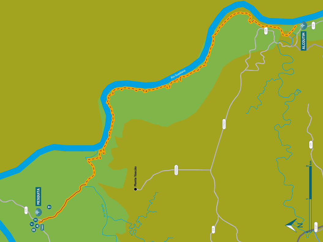
EM
EM
EM
EM
EM
EM10
54
EM50
7
IC27
Rio Guadiana
Rio
Vasc
ão
Mon
te V
ascã
o
MES
QUIT
A
ALC
OU
TIM
01
2 km
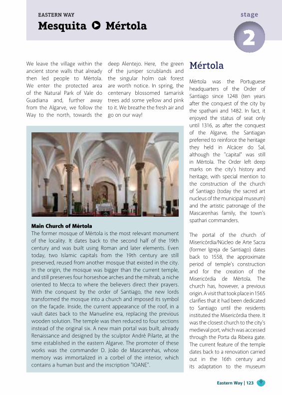
Mesquita MértolaEASTERN WAY
2stage
We leave the village within the ancient stone walls that already then led people to Mértola. We enter the protected area of the Natural Park of Vale do Guadiana and, further away from the Algarve, we follow the Way to the north, towards the
deep Alentejo. Here, the green of the juniper scrublands and the singular holm oak forest are worth notice. In spring, the centenary blossomed tamarisk trees add some yellow and pink to it. We breathe the fresh air and go on our way!
Mértola
Mértola was the Portuguese headquarters of the Order of Santiago since 1248 (ten years after the conquest of the city by the spatharii and 1482. In fact, it enjoyed the status of seat only until 1316, as after the conquest of the Algarve, the Santiagan preferred to reinforce the heritage they held in Alcácer do Sal, although the "capital" was still in Mértola. The Order left deep marks on the city’s history and heritage, with special mention to the construction of the church of Santiago (today the sacred art nucleus of the municipal museum) and the artistic patronage of the Mascarenhas family, the town's spathari commanders.
The portal of the church of Misericórdia/Núcleo de Arte Sacra (former Igreja de Santiago) dates back to 1558, the approximate period of temple’s construction and for the creation of the Misericórdia de Mértola. The church has, however, a previous origin. A visit that took place in 1565 clarifies that it had been dedicated to Santiago until the residents instituted the Misericórdia there. It was the closest church to the city's medieval port, which was accessed through the Porta da Ribeira gate. The current feature of the temple dates back to a renovation carried out in the 16th century and its adaptation to the museum
Main Church of MértolaThe former mosque of Mértola is the most relevant monument of the locality. It dates back to the second half of the 19th century and was built using Roman and later elements. Even today, two Islamic capitals from the 19th century are still preserved, reused from another mosque that existed in the city. In the origin, the mosque was bigger than the current temple, and still preserves four horseshoe arches and the mihrab, a niche oriented to Mecca to where the believers direct their prayers. With the conquest by the order of Santiago, the new lords transformed the mosque into a church and imposed its symbol on the façade. Inside, the current appearance of the roof, in a vault dates back to the Manueline era, replacing the previous wooden solution. The temple was then reduced to four sections instead of the original six. A new main portal was built, already Renaissance and designed by the sculptor André Pilarte, at the time established in the eastern Algarve. The promoter of these works was the commander D. João de Mascarenhas, whose memory was immortalized in a corbel of the interior, which contains a human bust and the inscription "IOANE".
Eastern Way | 123
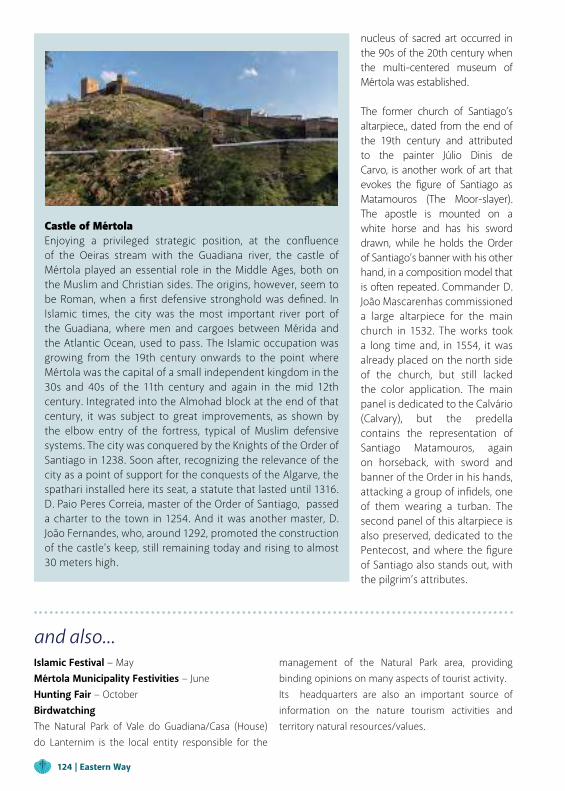
Castle of MértolaEnjoying a privileged strategic position, at the confluence of the Oeiras stream with the Guadiana river, the castle of Mértola played an essential role in the Middle Ages, both on the Muslim and Christian sides. The origins, however, seem to be Roman, when a first defensive stronghold was defined. In Islamic times, the city was the most important river port of the Guadiana, where men and cargoes between Mérida and the Atlantic Ocean, used to pass. The Islamic occupation was growing from the 19th century onwards to the point where Mértola was the capital of a small independent kingdom in the 30s and 40s of the 11th century and again in the mid 12th century. Integrated into the Almohad block at the end of that century, it was subject to great improvements, as shown by the elbow entry of the fortress, typical of Muslim defensive systems. The city was conquered by the Knights of the Order of Santiago in 1238. Soon after, recognizing the relevance of the city as a point of support for the conquests of the Algarve, the spathari installed here its seat, a statute that lasted until 1316. D. Paio Peres Correia, master of the Order of Santiago, passed a charter to the town in 1254. And it was another master, D. João Fernandes, who, around 1292, promoted the construction of the castle's keep, still remaining today and rising to almost 30 meters high.
nucleus of sacred art occurred in the 90s of the 20th century when the multi-centered museum of Mértola was established.
The former church of Santiago’s altarpiece,, dated from the end of the 19th century and attributed to the painter Júlio Dinis de Carvo, is another work of art that evokes the figure of Santiago as Matamouros (The Moor-slayer). The apostle is mounted on a white horse and has his sword drawn, while he holds the Order of Santiago’s banner with his other hand, in a composition model that is often repeated. Commander D. João Mascarenhas commissioned a large altarpiece for the main church in 1532. The works took a long time and, in 1554, it was already placed on the north side of the church, but still lacked the color application. The main panel is dedicated to the Calvário (Calvary), but the predella contains the representation of Santiago Matamouros, again on horseback, with sword and banner of the Order in his hands, attacking a group of infidels, one of them wearing a turban. The second panel of this altarpiece is also preserved, dedicated to the Pentecost, and where the figure of Santiago also stands out, with the pilgrim’s attributes.
and also...Islamic Festival − MayMértola Municipality Festivities − JuneHunting Fair − OctoberBirdwatchingThe Natural Park of Vale do Guadiana/Casa (House) do Lanternim is the local entity responsible for the
management of the Natural Park area, providing binding opinions on many aspects of tourist activity.Its headquarters are also an important source of information on the nature tourism activities and territory natural resources/values.
124 | Eastern Way

After Mesquita, we follow the tarmac road for 4 km, towards the Colgadeiros site. We continue to the right through the fields, where we are accompanied by countless partridges in dizzy runs.
After almost 5 km, with the village of Roncanito on the right, we put our energy back into a cozy coffee shop in Boavista, which we leave on beaten earth, in the direction of Roncão de Cima. The path continues for 2.5 km to the center of Lombardos, a village with some support facilities.
From Lombardos we travel 1,5 km by dirt track to a wide viewpoint over the majestic Guadiana river. We walk down a steep stream to the banks of "Rio dos Patos" (Duck River) and, if we go carefully, apart from those we see a whole universe of birds that make the delights of birdwatching lovers. We are at the mouth of a stream whose flows rise and fall daily, according to the Guadiana tides. On the left, we find a bridge and a dam that allow us to cross it and access Herdade da Bombeira. We follow the path along 18 ha
of vineyards, always bordering the Guadiana. Already outside the Herdade, we continue to follow the river, in a path also marked with the pedestrian trail "PR1" signs, then climbing between hills to reach Poço dos Dois Irmãos well, just before the junction with the tarmac road (IC27). We continue along the IC27 with some caution, because the traffic here is already significant, and the berms are narrow. After 1.7 km, we are at the gates of this town-museum of Mértola.
We cross the bridge, where the currents of the Ribeira de Oeiras stream bubble up. We go up the slope on the right, along the south wall, bypassing the protected citadel inside the fortification.
Almost in the centre of the village, we head down an alley, on the left, to the Tourism Office. Here, it is imperative to seek all available information, as you will not want to follow the Path without having the opportunity to know in depth all that this ancient Order of Santiago seat has to reveal and can't be described here. In Mértola you will feel well and be well served.
Distance 25 kmMaximum altitude 182 mCumulative increase 636 m Cumulative descent -724 mDuration 6h15mDifficulty (0-5) 3
TIPSAlways carry water, supplies, sunscreen, a hat, waterproof, comfortable shoes, and a map.
PUBLIC ENTITIES
Mértola City Council +351 286 610 109
Mértola Parish Council +351 286 612 420
Espírito Santo Parish Council +351 286 675 250
SUPPORT
CTT Post Office
Bank/Cash Dispenser
Mértola Tourism Info Point +351 286 610 109
Táxis
POINTS OF INTEREST
São Miguel do Pinheiro Parish Council
Espírito Santo Parish Council
Heritage circuit and Mértola Museum
Mértola Historic and Cultural Heritage: Order of Santiago
Salvador Hermitage, Mosteiro Museological Nucleus
Mesquita Mértola2stage
ICNF - Natural Park of Vale do Guadiana/ Casa do Lanternim – Seat of PNVG
Vale do Guadiana Natural Park
Pulo do lobo
Guadiana River
HEALTH
Mértola Health Center +351 286 610 900
Pharmacy
www.visitalentejo.ptwww.visitribatejo.ptwww.caminhosdesantiagoalentejoribatejo.pt
USEFUL CONTACTSEmergency: 112Forest Fires: 117Mértola Fire Department: +351 286 610 010GNR − National Republican Guard: +351 286 612 127Mértola Civil Protection: +351 286 610 100
MESQUITA
MÉRTOLA
AMENDOEIRADA SERRA
25 km
29 km
500 m
400 m
300 m
200 m
100 m
0 m
0 km 5 km 10 km 15 km 20 km 25 km
EASTERN PATH
CODE OF CONDUCT
Do not leave the marked and signaled route. Do not approach cliffs. Pay attention to the markings. Do not dispose of organic or inorganic waste during the trail, take a bag for this purpose. If you see garbage, collect it, help us to keep the Paths clean. Beware of livestock, don't bother the animals. Leave Nature intact. Do not collect plants, animals or rocks. Avoid making noise. Respect private property, close gates and barriers. Don’t light fires and be careful with cigarettes. Do not vandalize the Paths signage.
In urban areas of the route, the signage marks are for pedestrians only. Other means, such as cycling, should respect traffic signs.
Elev
atio
n
Distance
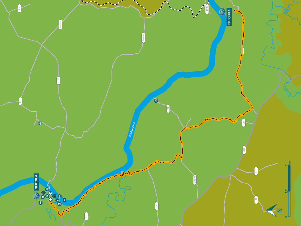
01,5
3 km
EM
EM
EM
N26
5N26
5-1
EM
EM
EM
EM
EM
EM
EM51
4
EM1153
EM1178
N12
2
Rio
Guad
iana
Rio V
ascã
o
Rio
Oeira
s
MÉR
TOLA
MES
QUIT
A
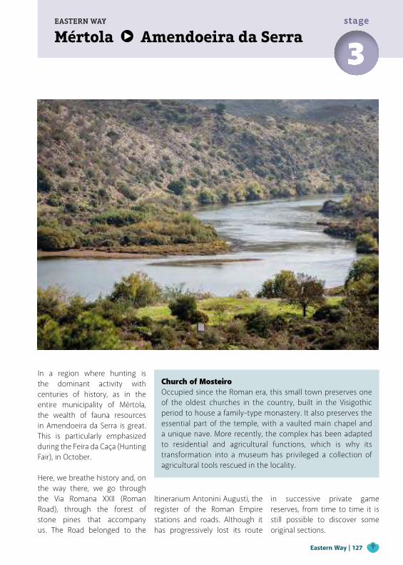
Mértola Amendoeira da SerraEASTERN WAY
3stage
In a region where hunting is the dominant activity with centuries of history, as in the entire municipality of Mértola, the wealth of fauna resources in Amendoeira da Serra is great. This is particularly emphasized during the Feira da Caça (Hunting Fair), in October. Here, we breathe history and, on the way there, we go through the Via Romana XXII (Roman Road), through the forest of stone pines that accompany us. The Road belonged to the
Church of MosteiroOccupied since the Roman era, this small town preserves one of the oldest churches in the country, built in the Visigothic period to house a family-type monastery. It also preserves the essential part of the temple, with a vaulted main chapel and a unique nave. More recently, the complex has been adapted to residential and agricultural functions, which is why its transformation into a museum has privileged a collection of agricultural tools rescued in the locality.
Itinerarium Antonini Augusti, the register of the Roman Empire stations and roads. Although it has progressively lost its route
in successive private game reserves, from time to time it is still possible to discover some original sections.
Eastern Way | 127
and also...Ethnobotanist Festival Pulo do Lobo − MayHermitage of Salvador, current museum nucleus of MosteiroThe small town of Mosteiro is located on the way to Pulo do Lobo, near Amendoeira da Serra. At one of its edges, slightly far away, there is a building that, due to its architectural characteristics, can be identified as a small cult building. In ancient times this place was a villa or mansion, and later, with the adoption of Christianity as the official religion, it was adapted into a family-type monastery. The hermitage of S. Salvador is probably a 17th-century construction and
was already unoccupied in the 19th century.The importance of this building’s conservation led to the development of a recovery and enhancement project that culminated, in 2012, with its integration into the Museum of Mértola. The adaptation into the museum nucleus includes a set of contents and exhibition solutions that allow the visitor to fully understand the site. On the other hand, through the exhibition of agricultural tools offered by local inhabitants, it is also possible to connect the people, creating identity ties and promoting the collective memory preservation.
The Iberian lynx is the most threatened carnivorous mammal in Europe and the most threatened feline in the world, due to the small number of animals and populations existing in nature and its limited area of distribution. The reintroduction of the Iberian lynx into Portugal began in 2015, and between 2015 and 2017, 27 animals were released in Vale do Guadiana as part of the LIFE Iberlince project, whose goal is to recover the historical distribution of the species. The harmonious coexistence of human activities and the viability of this wild cat in the Natural Park of Vale do Guadiana has not been easy, with frequent reports of road kills and other causes. Knowing and respecting the Iberian lynx and its habitat is, therefore, an essential aspect for environmental citizenship and an important contribution to its conservation and recovery of the species.
The Municipality of Mértola is one of the main territories of Portugal’s hunting activity, and the one, among all through which the Way passes, where hunting takes prominence at all levels.Whenever you observe a signboard with the sign reproduced here (regardless of the text written on it), you will be in a hunting zone. In the period between the beginning of October and the end of December (or until the end of February, in some cases), you will often hear shots along the Way.This has led to the need to adapt the route in order to ensure the safety of travelers at any time of the year, requiring a greater length of road travel than it would be desirable. That’s why we highlight the need not to make detours or other incursions into hunting grounds during the period mentioned above.
Landscape Interpretation Center of Amendoeira da SerraEstablished in environmen-tally sensitive territory, the Interpretation Center for Amendoeira da Serra Lands-cape has information on the flora and fauna of the region, as well as on the human use of the Guadiana river and human occupation in the vast area, now almost desert, between Mértola and Beja.
128 | Eastern Way
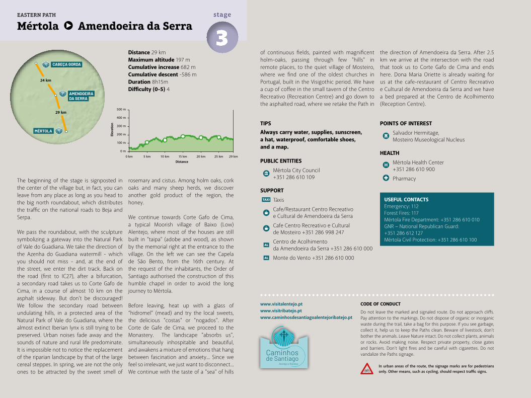
TIPSAlways carry water, supplies, sunscreen, a hat, waterproof, comfortable shoes, and a map.
PUBLIC ENTITIES
Mértola City Council +351 286 610 109
SUPPORT
Táxis
Cafe/Restaurant Centro Recreativo e Cultural de Amendoeira da Serra
Cafe Centro Recreativo e Cultural de Mosteiro +351 286 998 247
Centro de Acolhimento da Amendoeira da Serra +351 286 610 000
Monte do Vento +351 286 610 000
Distance 29 kmMaximum altitude 197 mCumulative increase 682 m Cumulative descent -586 mDuration 8h15mDifficulty (0-5) 4
Mértola Amendoeira da Serra3stage
The beginning of the stage is signposted in the center of the village but, in fact, you can leave from any place as long as you head to the big north roundabout, which distributes the traffic on the national roads to Beja and Serpa.
We pass the roundabout, with the sculpture symbolizing a gateway into the Natural Park of Vale do Guadiana. We take the direction of the Azenha do Guadiana watermill - which you should not miss - and, at the end of the street, we enter the dirt track. Back on the road (first to IC27), after a bifurcation, a secondary road takes us to Corte Gafo de Cima, in a course of almost 10 km on the asphalt sideway. But don't be discouraged! We follow the secondary road between undulating hills, in a protected area of the Natural Park of Vale do Guadiana, where the almost extinct Iberian lynx is still trying to be preserved. Urban noises fade away and the sounds of nature and rural life predominate. It is impossible not to notice the replacement of the riparian landscape by that of the large cereal steppes. In spring, we are not the only ones to be attracted by the sweet smell of
rosemary and cistus. Among holm oaks, cork oaks and many sheep herds, we discover another gold product of the region, the honey.
We continue towards Corte Gafo de Cima, a typical Moorish village of Baixo (Low) Alentejo, where most of the houses are still built in "taipa" (adobe and wood), as shown by the memorial right at the entrance to the village. On the left we can see the Capela de São Bento, from the 16th century. At the request of the inhabitants, the Order of Santiago authorised the construction of this humble chapel in order to avoid the long journey to Mértola.
Before leaving, heat up with a glass of “hidromel” (mead) and try the local sweets, the delicious "costas" or "nogados". After Corte de Gafe de Cima, we proceed to the Monastery. The landscape "absorbs us", simultaneously inhospitable and beautiful, and awakens a mixture of emotions that hang between fascination and anxiety... Since we feel so irrelevant, we just want to disconnect...We continue with the taste of a "sea" of hills
USEFUL CONTACTSEmergency: 112Forest Fires: 117Mértola Fire Department: +351 286 610 010GNR − National Republican Guard: +351 286 612 127Mértola Civil Protection: +351 286 610 100
www.visitalentejo.ptwww.visitribatejo.ptwww.caminhosdesantiagoalentejoribatejo.pt
POINTS OF INTEREST
Salvador Hermitage, Mosteiro Museological Nucleus
HEALTH
Mértola Health Center +351 286 610 900
Pharmacy
of continuous fields, painted with magnificent holm-oaks, passing through few "hills" in remote places, to the quiet village of Mosteiro, where we find one of the oldest churches in Portugal, built in the Visigothic period. We have a cup of coffee in the small tavern of the Centro Recreativo (Recreation Centre) and go down to the asphalted road, where we retake the Path in
the direction of Amendoeira da Serra. After 2.5 km we arrive at the intersection with the road that took us to Corte Gafo de Cima and ends here. Dona Maria Oriette is already waiting for us at the cafe-restaurant of Centro Recreativo e Cultural de Amendoeira da Serra and we have a bed prepared at the Centro de Acolhimento (Reception Centre).
500 m
400 m
300 m
200 m
100 m
0 m
0 km 5 km 10 km 15 km 20 km 25 km 29 km
MÉRTOLA
AMENDOEIRADA SERRA
29 km
24 km
CABEÇA GORDA
EASTERN PATH
CODE OF CONDUCT
Do not leave the marked and signaled route. Do not approach cliffs. Pay attention to the markings. Do not dispose of organic or inorganic waste during the trail, take a bag for this purpose. If you see garbage, collect it, help us to keep the Paths clean. Beware of livestock, don't bother the animals. Leave Nature intact. Do not collect plants, animals or rocks. Avoid making noise. Respect private property, close gates and barriers. Don’t light fires and be careful with cigarettes. Do not vandalize the Paths signage.
In urban areas of the route, the signage marks are for pedestrians only. Other means, such as cycling, should respect traffic signs.
Elev
atio
n
Distance
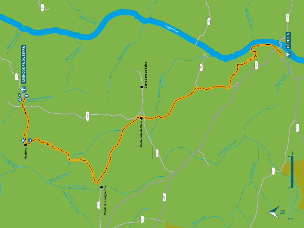
Rio Cobres
Barra
nco B
icho V
eado
Barranco Venda
Bar
ranc
o Fr
eixi
al
Barra
nco A
tala
ia
Barranco Ata
laia
Barranco Furada
Rio Guadiana
Ribe
ira
Alv
acar
Ribeira
Oeira
s
Barr
anco
Gra
nde
Ribeira Chada
Barranco Corte
Velha
Barranco Corcho
Barranco Amendoeira
Ribeira
Cac
hoposEM
EM
EM
EM
EM
EM
EM
EM
EM51
0
N12
3
N12
2
R26
5
R26
7
AM
END
OEI
RA
DA
SER
RA M
ÉRTO
LA
Mos
teir
o
Vend
a do
s Sa
lgue
iros
Cort
e Ga
fo d
e Ci
ma
Cort
e Ga
fo d
e B
aixo
02
4 km
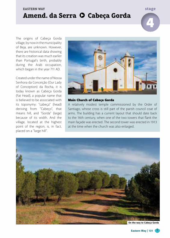
Amend. da Serra Cabeça GordaEASTERN WAY
4stage
The origins of Cabeça Gorda village, by now in the municipality of Beja, are unknown. However, there are historical data showing that its creation was much earlier than Portugal’s birth, probably during the Arab occupation, which began in the year 711 AD. Created under the name of Nossa Senhora da Conceição (Our Lady of Conception) da Rocha, it is today known as Cabeça Gorda (Fat Head), a popular name that is believed to be associated with its toponymy: "cabeça" (head) deriving from "Cabeço", that means hill, and "Gorda" (large) because of its width. And the village, located at the highest point of the region, is, in fact, placed on a "large hill".
Main Church of Cabeça Gorda A relatively modest temple commissioned by the Order of Santiago, whose cross is still part of the parish council coat of arms. The building has a current layout that should date back to the 16th century, when one of the two towers that flank the main façade was erected. The second tower was erected in 1913 at the time when the church was also enlarged.
On the way to Cabeça Gorda
Eastern Way | 131
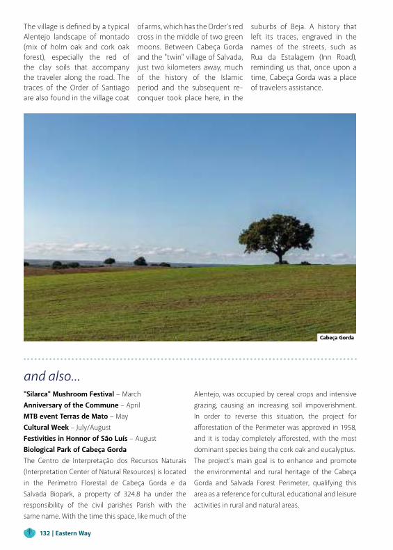
The village is defined by a typical Alentejo landscape of montado (mix of holm oak and cork oak forest), especially the red of the clay soils that accompany the traveler along the road. The traces of the Order of Santiago are also found in the village coat
of arms, which has the Order’s red cross in the middle of two green moons. Between Cabeça Gorda and the "twin" village of Salvada, just two kilometers away, much of the history of the Islamic period and the subsequent re-conquer took place here, in the
suburbs of Beja. A history that left its traces, engraved in the names of the streets, such as Rua da Estalagem (Inn Road), reminding us that, once upon a time, Cabeça Gorda was a place of travelers assistance.
and also..."Silarca" Mushroom Festival − MarchAnniversary of the Commune – AprilMTB event Terras de Mato – MayCultural Week – July/August Festivities in Honnor of São Luís – August Biological Park of Cabeça GordaThe Centro de Interpretação dos Recursos Naturais (Interpretation Center of Natural Resources) is located in the Perímetro Florestal de Cabeça Gorda e da Salvada Biopark, a property of 324.8 ha under the responsibility of the civil parishes Parish with the same name. With the time this space, like much of the
Alentejo, was occupied by cereal crops and intensive grazing, causing an increasing soil impoverishment. In order to reverse this situation, the project for afforestation of the Perimeter was approved in 1958, and it is today completely afforested, with the most dominant species being the cork oak and eucalyptus.The project’s main goal is to enhance and promote the environmental and rural heritage of the Cabeça Gorda and Salvada Forest Perimeter, qualifying this area as a reference for cultural, educational and leisure activities in rural and natural areas.
Cabeça Gorda
132 | Eastern Way
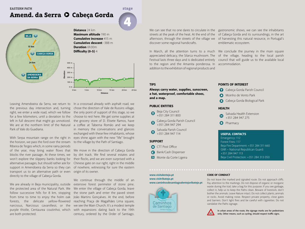
TIPSAlways carry water, supplies, sunscreen, a hat, waterproof, comfortable shoes, and a map.
PUBLIC ENTITIES
Beja City Council +351 284 311 800
Cabeça Gorda Parish Council +351 284 947 294
Salvada Parish Council +351 284 947 114
SUPPORT
CTT Post Office
Bank/Cash Dispenser
Monte da Corte Ligeira
Distance 24 kmMaximum altitude 190 mCumulative increase 415 m Cumulative descent -388 mDuration 6h30mDifficulty (0-5) 4
USEFUL CONTACTSEmergency: 112Forest Fires: 117Beja Fire Department: +351 284 311 660GNR − National Republican Guard: +351 284 947 113Beja Civil Protection: +351 284 313 050
Amend. da Serra Cabeça Gorda4stage
Leaving Amendoeira da Serra, we return to the previous day intersection and, turning right, we enter a wide road, which we follow for a few kilometers, until a deviation to the left in full descent that might go unnoticed. We are at the northern limit of the Natural Park of Vale do Guadiana.
With Serpa mountain range on the right in the horizon, we pass the ford over the stream Ribeira de Terges which, in some rainy periods of the year, may bring water flows that blocks the river passage. At these times, we won't explore the slippery banks looking for alternative passages, but should rather ask for support in Amendoeira da Serra so they can transport us to an alternative path or even directly to the village of Cabeça Gorda.
We are already in Beja municipality, outside the protected area of the Natural Park. We follow successive hills for 8 km, stopping from time to time to enjoy the holm oak forests, the delicate yellow-flowered narcissus, Narcissus cavanillesii, or the purple thistle, Centaurea coutinhoi, which are both protected.
In a crossroad already with asphalt road, we chose the direction of Vale de Russins village, the only point of support of this stage, so we choose to rest here. We get some supplies at the grocery store of D. Elisete Ramos, have a coffee at Taberna Romão and we keep in memory the conversations and glances exchanged with these few inhabitants, whose eyes shine again with the new "life" brought to the village by the Path of Santiago.
We move in the direction of Cabeça Gorda by dirt track. We find several estates and their flocks, and we are even surprised with a Chinese gate on our right, right in the middle of nowhere, witnessing for sure the eastern origin of its owner.
We continue through the middle of an extensive forest perimeter of stone pine. We enter the village of Cabeça Gorda, leave the stone path and enter the paved street João Martins Gonçalves. At the end, before reaching Praça de Magalhães Lima square, we see the Main Church. It’s a modest temple with expansions dating back to the 19th century, ordered by the Order of Santiago.
POINTS OF INTEREST
Cabeça Gorda Parish Council
Moinho de Vento Park
Cabeça Gorda Biological Park
HEALTH
Salvada Health Extension +351 284 947 275
Pharmacy
We can see that no one dares to circulate in the streets at the peak of the heat. At the end of the afternoon, through the streets of the village we discover some regional handicrafts.
In March, all the attention turns to a much appreciated delicacy, the Silarca mushroom. The Festival lasts three days and is dedicated entirely to the region and the Amanita ponderosa. In addition to the exhibition of regional products and
gastronomic shows, we can see the inhabitants of Cabeça Gorda and its surroundings, in the art of harvesting this natural resource, in Portugal's emblematic ecosystem.
We conclude the journey in the main square of the village, heading to the local parish council that will guide us to the available local accommodation.
www.visitalentejo.ptwww.visitribatejo.ptwww.caminhosdesantiagoalentejoribatejo.pt
500 m
400 m
300 m
200 m
100 m
0 m
0 km 5 km 10 km 15 km 20 km 24 km
BEJA
CABEÇA GORDA
AMENDOEIRADA SERRA
15 km
24 km
EASTERN PATH
CODE OF CONDUCT
Do not leave the marked and signaled route. Do not approach cliffs. Pay attention to the markings. Do not dispose of organic or inorganic waste during the trail, take a bag for this purpose. If you see garbage, collect it, help us to keep the Paths clean. Beware of livestock, don't bother the animals. Leave Nature intact. Do not collect plants, animals or rocks. Avoid making noise. Respect private property, close gates and barriers. Don’t light fires and be careful with cigarettes. Do not vandalize the Paths signage.
In urban areas of the route, the signage marks are for pedestrians only. Other means, such as cycling, should respect traffic signs.
Elev
atio
n
Distance
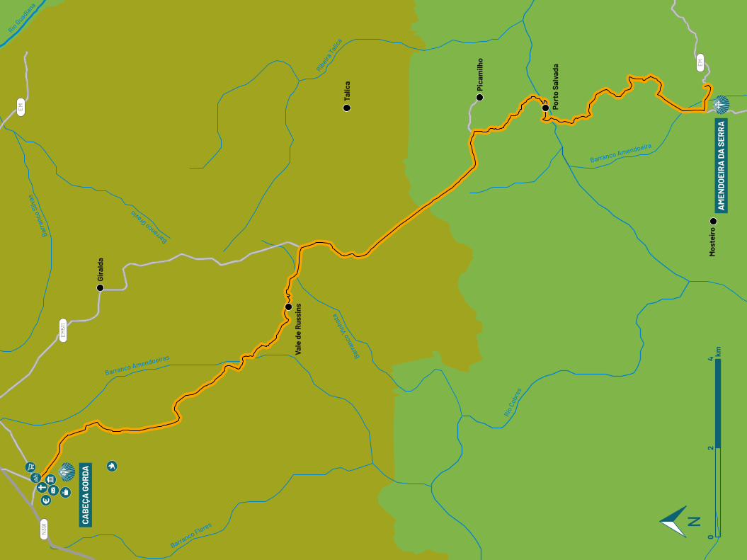
Barr
anco
Silv
as
Barranco Gravio
Rio G
uadiana
Barranco Flores
Barr
anco
Vin
hota
Rio
Cobr
es
Barranco Amendoeiras
Barranco Amendoeira
Ribeira
Talic
a
EM
EM
EM51
1
N39
1
Mos
teir
o
Port
o Sa
lvad
a
Pica
milh
o
Talic
a
Vale
de
Rus
sins
Gira
lda
AM
END
OEI
RA
DA
SER
RA
CAB
EÇA
GO
RDA
02
4 km
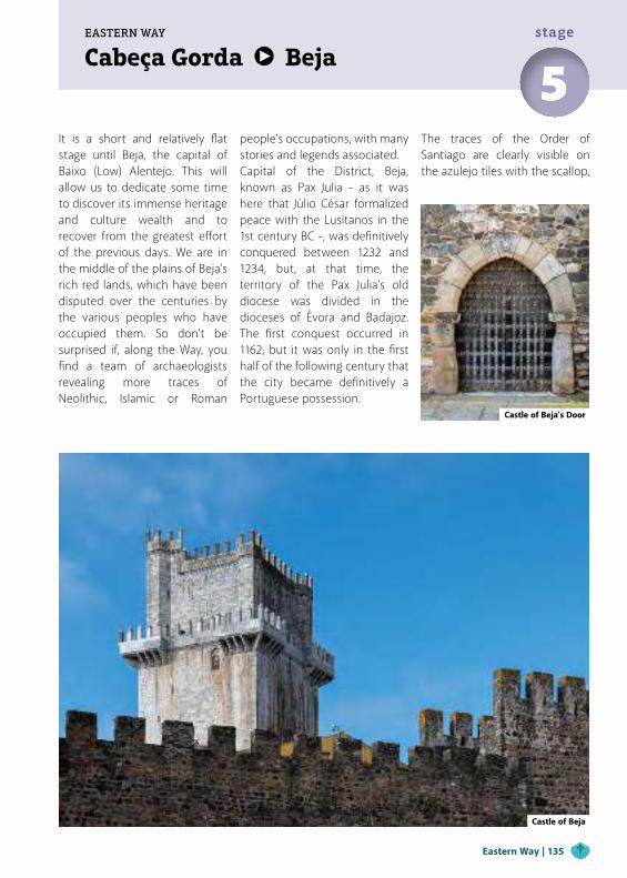
Cabeça Gorda BejaEASTERN WAY
5stage
It is a short and relatively flat stage until Beja, the capital of Baixo (Low) Alentejo. This will allow us to dedicate some time to discover its immense heritage and culture wealth and to recover from the greatest effort of the previous days. We are in the middle of the plains of Beja’s rich red lands, which have been disputed over the centuries by the various peoples who have occupied them. So don't be surprised if, along the Way, you find a team of archaeologists revealing more traces of Neolithic, Islamic or Roman
Castle of Beja's Door
Castle of Beja
people's occupations, with many stories and legends associated.Capital of the District, Beja, known as Pax Julia - as it was here that Júlio César formalized peace with the Lusitanos in the 1st century BC -, was definitively conquered between 1232 and 1234, but, at that time, the territory of the Pax Julia’s old diocese was divided in the dioceses of Évora and Badajoz. The first conquest occurred in 1162, but it was only in the first half of the following century that the city became definitively a Portuguese possession.
The traces of the Order of Santiago are clearly visible on the azulejo tiles with the scallop,
Eastern Way | 135
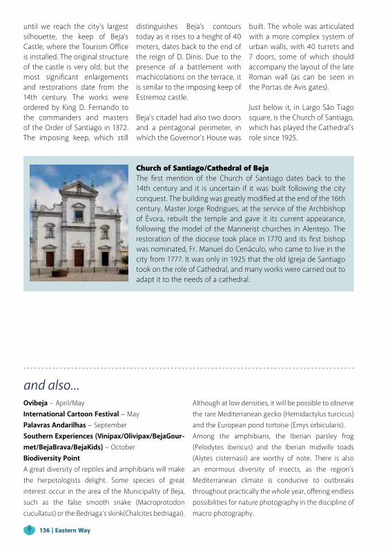
Church of Santiago/Cathedral of BejaThe first mention of the Church of Santiago dates back to the 14th century and it is uncertain if it was built following the city conquest. The building was greatly modified at the end of the 16th century. Master Jorge Rodrigues, at the service of the Archbishop of Évora, rebuilt the temple and gave it its current appearance, following the model of the Mannerist churches in Alentejo. The restoration of the diocese took place in 1770 and its first bishop was nominated, Fr. Manuel do Cenáculo, who came to live in the city from 1777. It was only in 1925 that the old Igreja de Santiago took on the role of Cathedral, and many works were carried out to adapt it to the needs of a cathedral.
and also...Ovibeja − April/MayInternational Cartoon Festival − May Palavras Andarilhas − SeptemberSouthern Experiences (Vinipax/Olivipax/BejaGour-met/BejaBrava/BejaKids) − OctoberBiodiversity PointA great diversity of reptiles and amphibians will make the herpetologists delight. Some species of great interest occur in the area of the Municipality of Beja, such as the false smooth snake (Macroprotodon cucullatus) or the Bedriaga’s skink(Chalcites bedriagai).
Although at low densities, it will be possible to observe the rare Mediterranean gecko (Hemidactylus turcicus) and the European pond tortoise (Emys orbicularis).Among the amphibians, the Iberian parsley frog (Pelodytes ibericus) and the Iberian midwife toads (Alytes cisternasii) are worthy of note. There is also an enormous diversity of insects, as the region's Mediterranean climate is conducive to outbreaks throughout practically the whole year, offering endless possibilities for nature photography in the discipline of macro photography.
until we reach the city's largest silhouette, the keep of Beja’s Castle, where the Tourism Office is installed. The original structure of the castle is very old, but the most significant enlargements and restorations date from the 14th century. The works were ordered by King D. Fernando to the commanders and masters of the Order of Santiago in 1372. The imposing keep, which still
distinguishes Beja’s contours today as it rises to a height of 40 meters, dates back to the end of the reign of D. Dinis. Due to the presence of a battlement with machicolations on the terrace, it is similar to the imposing keep of Estremoz castle.
Beja’s citadel had also two doors and a pentagonal perimeter, in which the Governor's House was
built. The whole was articulated with a more complex system of urban walls, with 40 turrets and 7 doors, some of which should accompany the layout of the late Roman wall (as can be seen in the Portas de Avis gates). Just below it, in Largo São Tiago square, is the Church of Santiago, which has played the Cathedral’s role since 1925.
136 | Eastern Way
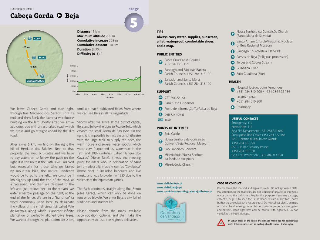
TIPSAlways carry water, supplies, sunscreen, a hat, waterproof, comfortable shoes, and a map.
PUBLIC ENTITIES
Santa Cruz Parish Council +351 963 713 025
Santiago and São João Batista Parish Councils +351 284 313 100
Salvador and Santa Maria Parish Councils +351 284 313 100
SUPPORT
CTT Post Office
Bank/Cash Dispenser
Posto de Informação Turística de Beja
Beja Camping
Táxis
POINTS OF INTEREST
Beja Castle
Nossa Senhora da Conceição Convent/Beja Regional Museum
São Francisco Convent
Misericórdia/Nossa Senhora da Piedade Hospitals
Misericórdia Church
Distance 15 kmMaximum altitude 289 mCumulative increase 208 m Cumulative descent -109 mDuration 3h30mDifficulty (0-5) 2
USEFUL CONTACTSEmergency: 112Forest Fires: 117Beja Fire Department: +351 284 311 660Portuguese Red Cross: +351 284 322 484GNR − National Republican Guard: +351 284 310 770PSP − Public Security Police: +351 284 313 150 Beja Civil Protection: +351 284 313 050
Cabeça Gorda Beja5stage
We leave Cabeça Gorda and turn right, through Rua Machado dos Santos, until its end, and then flank the Laverda warehouse building on the left. Shortly after, we arrive at a crossroad with an asphalted road, which we cross and go straight ahead by the dirt road.
After some 5 km, we find on the right the hill of Herdade dos Falcões. Next to that property, the road bifurcates and we have to pay attention to follow the path on the right. It is certain that the Path is well marked but, especially for those who go faster, by mountain bike, the natural tendency would be to go to the left... We continue 1 km slightly up until the end of the road, at a crossroad, and then we descend to the left and, just below, next to the stream, we enter a narrow passage on the right, at the end of the fence. We are in a "barranco" (a word commonly used here to designate the valleys of the small streams), called Vale de Mértola, along which is another infinite plantation of perfectly aligned olive trees. We wander through the plantation, for 2 km,
until we reach cultivated fields from where we can see Beja in all its magnitude.
Shortly after, we arrive at the district capital, Beja, and follow the signs to Rua de Beja, which crosses the small Bairro de São João. On the right, it is impossible to miss the amphitheatre with the large tank, to supply the rides, the wash house and several water spouts, which were very frequented by watermen in the 19th and 20th centuries. Called "Tanque dos Cavalos" (Horse Tank), it was the meeting point for riders who, in celebration of Saint John, made a pilgrimage known as "Cavalgada" (horse ride). It included banquets and live music, and was forbidden in 1835 due to the violence of the equestrian games.
The Path continues straight along Rua Bento Jesus Caraça, which can only be done on foot or by bicycle. We enter Beja, a city full of traditions and student life.
Please choose from the many available accomodation options, and then take the opportunity to taste the region's delicacies.
Nossa Senhora da Conceição Church (Santa Maria da Salvada)
Santo Amaro Church/Visigothic Nucleus of Beja Regional Museum
Santiago Church/Beja Cathedral
Passos de Beja (Religious procession)
Terges and Cobres Stream
Guadiana River
Sítio Guadiana (Site)
HEALTH
Hospital José Joaquim Fernandes +351 284 310 200 / +351 284 322 134
Health Center +351 284 310 200
Pharmacy
www.visitalentejo.ptwww.visitribatejo.ptwww.caminhosdesantiagoalentejoribatejo.pt
500 m
400 m
300 m
200 m
100 m
0 m
0 km 2 km 4 km 6 km 8 km 10 km 12 km 14 km 15 km
CUBA
BEJA
CABEÇA GORDA
20 km
15 km
EASTERN PATH
CODE OF CONDUCT
Do not leave the marked and signaled route. Do not approach cliffs. Pay attention to the markings. Do not dispose of organic or inorganic waste during the trail, take a bag for this purpose. If you see garbage, collect it, help us to keep the Paths clean. Beware of livestock, don't bother the animals. Leave Nature intact. Do not collect plants, animals or rocks. Avoid making noise. Respect private property, close gates and barriers. Don’t light fires and be careful with cigarettes. Do not vandalize the Paths signage.
In urban areas of the route, the signage marks are for pedestrians only. Other means, such as cycling, should respect traffic signs.
Elev
atio
n
Distance
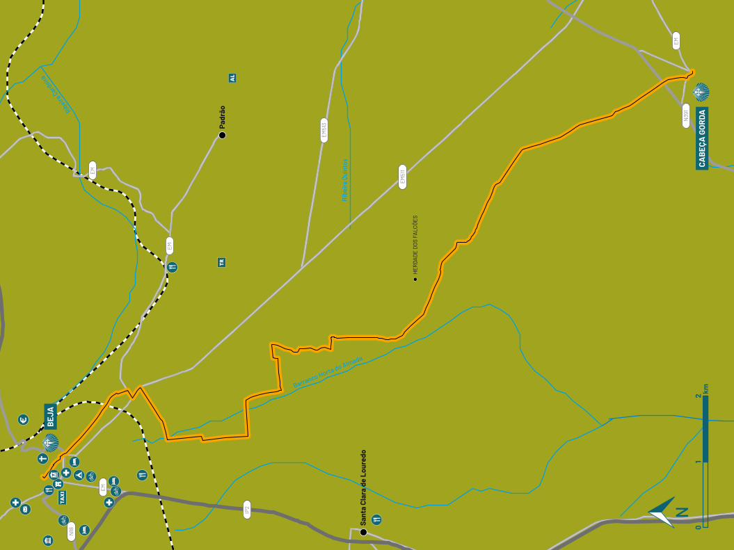
Ribeira
Card
eira
Rib
eira
Qui
ntos
Barranco Horta do Almada
EM
EM
EM
IP2
EM
EM51
1
N39
1
EM51
3
N18
Padr
ão
Sant
a Cl
ara
de L
oure
do
HE
RD
AD
E D
OS
FALC
ÕE
S
CAB
EÇA
GO
RDA
BEJ
A
01
2 km
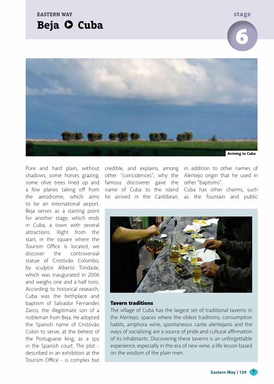
Beja CubaEASTERN WAY
6stage
Pure and hard plain, without shadows, some horses grazing, some olive trees lined up and a few planes taking off from the aerodrome, which aims to be an international airport. Beja serves as a starting point for another stage, which ends in Cuba, a town with several attractions. Right from the start, in the square where the Tourism Office is located, we discover the controversial statue of Cristóvão Colombo, by sculptor Alberto Trindade, which was inaugurated in 2006 and weighs one and a half tons. According to historical research, Cuba was the birthplace and baptism of Salvador Fernandes Zarco, the illegitimate son of a nobleman from Beja. He adopted the Spanish name of Cristóvão Colon to serve, at the behest of the Portuguese king, as a spy in the Spanish court. The plot - described in an exhibition at the Tourism Office - is complex but
Tavern traditionsThe village of Cuba has the largest set of traditional taverns in the Alentejo, spaces where the oldest traditions, consumption habits, amphora wine, spontaneous cante alentejano and the ways of socializing are a source of pride and cultural affirmation of its inhabitants. Discovering these taverns is an unforgettable experience, especially in the era of new wine, a life lesson based on the wisdom of the plain men.
Arriving to Cuba
credible, and explains, among other "coincidences", why the famous discoverer gave the name of Cuba to the island he arrived in the Caribbean,
in addition to other names of Alentejo origin that he used in other "baptisms".Cuba has other charms, such as the fountain and public
Eastern Way | 139
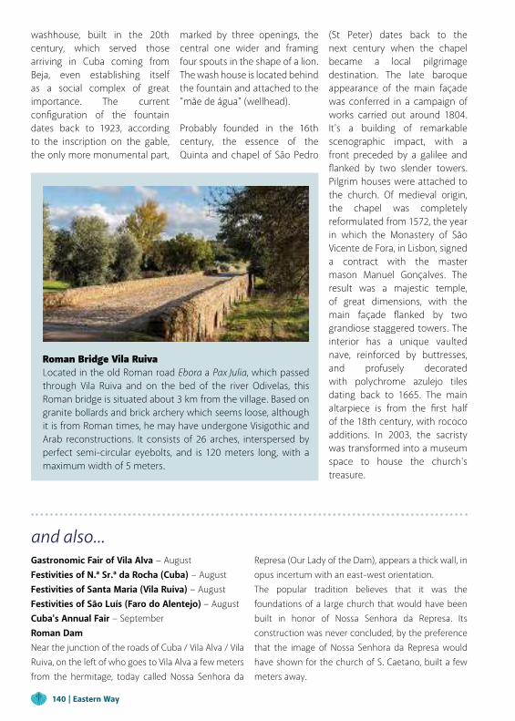
Roman Bridge Vila RuivaLocated in the old Roman road Ebora a Pax Julia, which passed through Vila Ruiva and on the bed of the river Odivelas, this Roman bridge is situated about 3 km from the village. Based on granite bollards and brick archery which seems loose, although it is from Roman times, he may have undergone Visigothic and Arab reconstructions. It consists of 26 arches, interspersed by perfect semi-circular eyebolts, and is 120 meters long, with a maximum width of 5 meters.
and also...Gastronomic Fair of Vila Alva − August Festivities of N.ª Sr.ª da Rocha (Cuba) − AugustFestivities of Santa Maria (Vila Ruiva) − August Festivities of São Luís (Faro do Alentejo) − August Cuba's Annual Fair − SeptemberRoman DamNear the junction of the roads of Cuba / Vila Alva / Vila Ruiva, on the left of who goes to Vila Alva a few meters from the hermitage, today called Nossa Senhora da
Represa (Our Lady of the Dam), appears a thick wall, in opus incertum with an east-west orientation.The popular tradition believes that it was the foundations of a large church that would have been built in honor of Nossa Senhora da Represa. Its construction was never concluded, by the preference that the image of Nossa Senhora da Represa would have shown for the church of S. Caetano, built a few meters away.
washhouse, built in the 20th century, which served those arriving in Cuba coming from Beja, even establishing itself as a social complex of great importance. The current configuration of the fountain dates back to 1923, according to the inscription on the gable, the only more monumental part,
marked by three openings, the central one wider and framing four spouts in the shape of a lion. The wash house is located behind the fountain and attached to the "mãe de água" (wellhead).
Probably founded in the 16th century, the essence of the Quinta and chapel of São Pedro
(St Peter) dates back to the next century when the chapel became a local pilgrimage destination. The late baroque appearance of the main façade was conferred in a campaign of works carried out around 1804. It's a building of remarkable scenographic impact, with a front preceded by a galilee and flanked by two slender towers. Pilgrim houses were attached to the church. Of medieval origin, the chapel was completely reformulated from 1572, the year in which the Monastery of São Vicente de Fora, in Lisbon, signed a contract with the master mason Manuel Gonçalves. The result was a majestic temple, of great dimensions, with the main façade flanked by two grandiose staggered towers. The interior has a unique vaulted nave, reinforced by buttresses, and profusely decorated with polychrome azulejo tiles dating back to 1665. The main altarpiece is from the first half of the 18th century, with rococo additions. In 2003, the sacristy was transformed into a museum space to house the church's treasure.
140 | Eastern Way
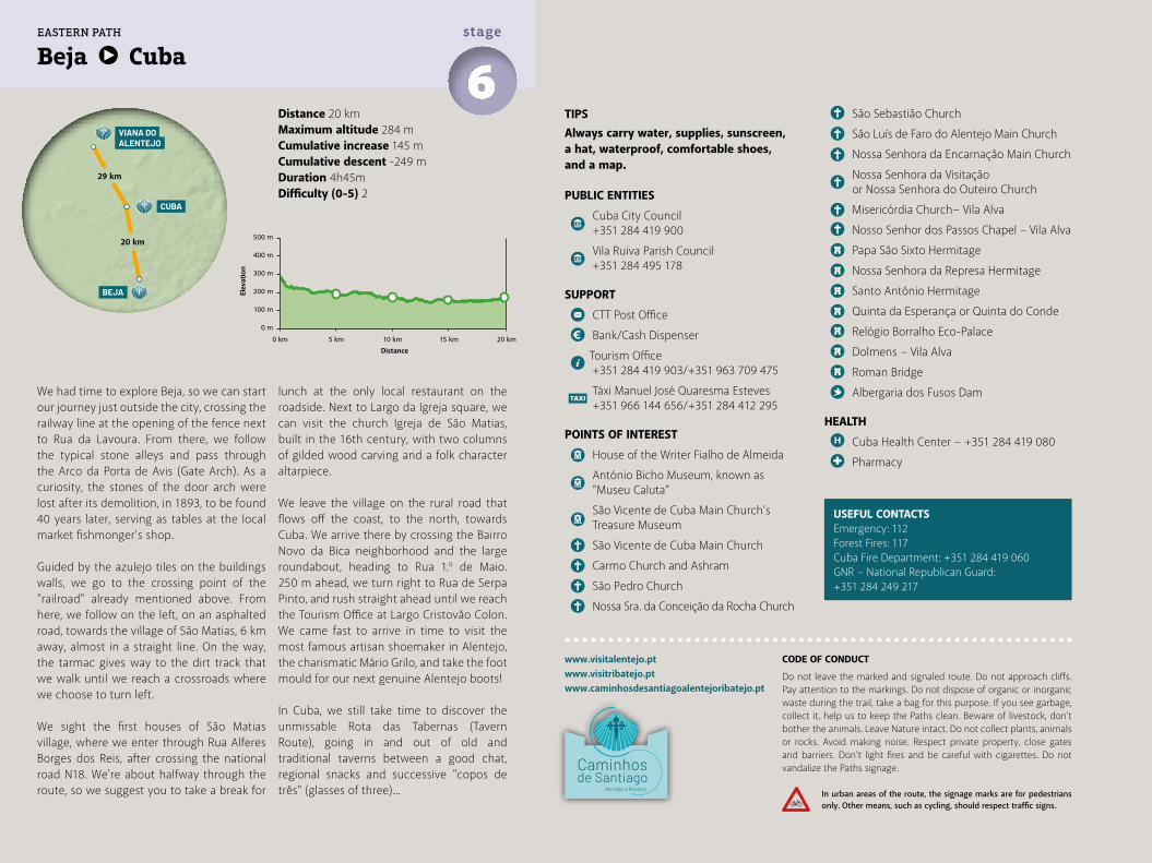
Distance 20 kmMaximum altitude 284 mCumulative increase 145 m Cumulative descent -249 mDuration 4h45mDifficulty (0-5) 2
Beja Cuba6stage
We had time to explore Beja, so we can start our journey just outside the city, crossing the railway line at the opening of the fence next to Rua da Lavoura. From there, we follow the typical stone alleys and pass through the Arco da Porta de Avis (Gate Arch). As a curiosity, the stones of the door arch were lost after its demolition, in 1893, to be found 40 years later, serving as tables at the local market fishmonger's shop.
Guided by the azulejo tiles on the buildings walls, we go to the crossing point of the "railroad" already mentioned above. From here, we follow on the left, on an asphalted road, towards the village of São Matias, 6 km away, almost in a straight line. On the way, the tarmac gives way to the dirt track that we walk until we reach a crossroads where we choose to turn left.
We sight the first houses of São Matias village, where we enter through Rua Alferes Borges dos Reis, after crossing the national road N18. We're about halfway through the route, so we suggest you to take a break for
lunch at the only local restaurant on the roadside. Next to Largo da Igreja square, we can visit the church Igreja de São Matias, built in the 16th century, with two columns of gilded wood carving and a folk character altarpiece.
We leave the village on the rural road that flows off the coast, to the north, towards Cuba. We arrive there by crossing the Bairro Novo da Bica neighborhood and the large roundabout, heading to Rua 1.º de Maio. 250 m ahead, we turn right to Rua de Serpa Pinto, and rush straight ahead until we reach the Tourism Office at Largo Cristovão Colon. We came fast to arrive in time to visit the most famous artisan shoemaker in Alentejo, the charismatic Mário Grilo, and take the foot mould for our next genuine Alentejo boots!
In Cuba, we still take time to discover the unmissable Rota das Tabernas (Tavern Route), going in and out of old and traditional taverns between a good chat, regional snacks and successive "copos de três" (glasses of three)...
TIPSAlways carry water, supplies, sunscreen, a hat, waterproof, comfortable shoes, and a map.
PUBLIC ENTITIES
Cuba City Council +351 284 419 900
Vila Ruiva Parish Council +351 284 495 178
SUPPORT
CTT Post Office
Bank/Cash Dispenser
Tourism Office +351 284 419 903/+351 963 709 475
Táxi Manuel José Quaresma Esteves +351 966 144 656/+351 284 412 295
POINTS OF INTEREST
House of the Writer Fialho de Almeida
António Bicho Museum, known as “Museu Caluta”
São Vicente de Cuba Main Church’s Treasure Museum
São Vicente de Cuba Main Church
Carmo Church and Ashram
São Pedro Church
Nossa Sra. da Conceição da Rocha Church
São Sebastião Church
São Luís de Faro do Alentejo Main Church
Nossa Senhora da Encarnação Main Church
Nossa Senhora da Visitação or Nossa Senhora do Outeiro Church
Misericórdia Church− Vila Alva
Nosso Senhor dos Passos Chapel – Vila Alva
Papa São Sixto Hermitage
Nossa Senhora da Represa Hermitage
Santo António Hermitage
Quinta da Esperança or Quinta do Conde
Relógio Borralho Eco-Palace
Dolmens − Vila Alva
Roman Bridge
Albergaria dos Fusos Dam
HEALTH
Cuba Health Center − +351 284 419 080
Pharmacy
www.visitalentejo.ptwww.visitribatejo.ptwww.caminhosdesantiagoalentejoribatejo.pt
USEFUL CONTACTSEmergency: 112Forest Fires: 117Cuba Fire Department: +351 284 419 060GNR − National Republican Guard: +351 284 249 217
CUBA
VIANA DO ALENTEJO
BEJA
20 km
29 km
EASTERN PATH
500 m
400 m
300 m
200 m
100 m
0 m
0 km 5 km 10 km 15 km 20 km
CODE OF CONDUCT
Do not leave the marked and signaled route. Do not approach cliffs. Pay attention to the markings. Do not dispose of organic or inorganic waste during the trail, take a bag for this purpose. If you see garbage, collect it, help us to keep the Paths clean. Beware of livestock, don't bother the animals. Leave Nature intact. Do not collect plants, animals or rocks. Avoid making noise. Respect private property, close gates and barriers. Don’t light fires and be careful with cigarettes. Do not vandalize the Paths signage.
In urban areas of the route, the signage marks are for pedestrians only. Other means, such as cycling, should respect traffic signs.
Elev
atio
n
Distance
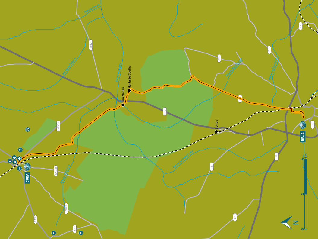
EM
EM
EM
EM
EM
EM
EM
EM10
08
EM12
23
EM52
1
N25
8-1
IP2
IP8
N18
N38
7
Ribe
ira B
arre
iros
Barranco C
abaco
Rib
eira
Ode
arca
Ribeira
Mata
Frades
Barr
anco
Car
valh
al
Barranco Santa Luzia
Ribeira Freixo
CUBA
BEJ
A
Coit
os
Hor
ta d
o Co
elho
São
Mat
ias
02
4 km
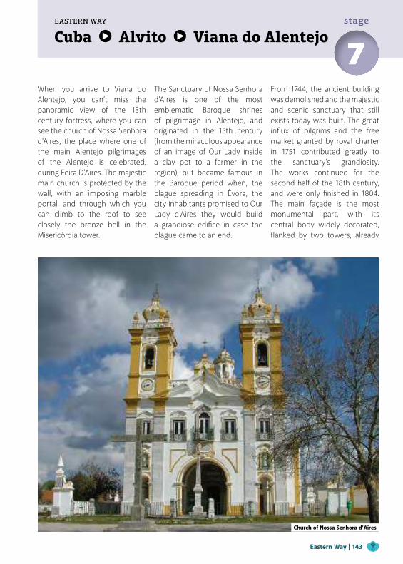
Cuba Alvito Viana do AlentejoEASTERN WAY
7stage
When you arrive to Viana do Alentejo, you can’t miss the panoramic view of the 13th century fortress, where you can see the church of Nossa Senhora d'Aires, the place where one of the main Alentejo pilgrimages of the Alentejo is celebrated, during Feira D'Aires. The majestic main church is protected by the wall, with an imposing marble portal, and through which you can climb to the roof to see closely the bronze bell in the Misericórdia tower.
The Sanctuary of Nossa Senhora d'Aires is one of the most emblematic Baroque shrines of pilgrimage in Alentejo, and originated in the 15th century (from the miraculous appearance of an image of Our Lady inside a clay pot to a farmer in the region), but became famous in the Baroque period when, the plague spreading in Évora, the city inhabitants promised to Our Lady d'Aires they would build a grandiose edifice in case the plague came to an end.
From 1744, the ancient building was demolished and the majestic and scenic sanctuary that still exists today was built. The great influx of pilgrims and the free market granted by royal charter in 1751 contributed greatly to the sanctuary’s grandiosity. The works continued for the second half of the 18th century, and were only finished in 1804. The main façade is the most monumental part, with its central body widely decorated, flanked by two towers, already
Church of Nossa Senhora d’Aires
Eastern Way | 143
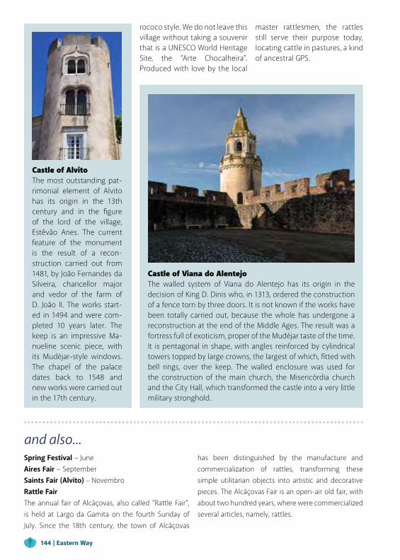
and also...Spring Festival − June Aires Fair − SeptemberSaints Fair (Alvito) – NovembroRattle FairThe annual fair of Alcáçovas, also called "Rattle Fair", is held at Largo da Gamita on the fourth Sunday of July. Since the 18th century, the town of Alcáçovas
has been distinguished by the manufacture and commercialization of rattles, transforming these simple utilitarian objects into artistic and decorative pieces. The Alcáçovas Fair is an open-air old fair, with about two hundred years, where were commercialized several articles, namely, rattles.
rococo style. We do not leave this village without taking a souvenir that is a UNESCO World Heritage Site, the “Arte Chocalheira”. Produced with love by the local
Castle of Viana do AlentejoThe walled system of Viana do Alentejo has its origin in the decision of King D. Dinis who, in 1313, ordered the construction of a fence torn by three doors. It is not known if the works have been totally carried out, because the whole has undergone a reconstruction at the end of the Middle Ages. The result was a fortress full of exoticism, proper of the Mudéjar taste of the time. It is pentagonal in shape, with angles reinforced by cylindrical towers topped by large crowns, the largest of which, fitted with bell rings, over the keep. The walled enclosure was used for the construction of the main church, the Misericórdia church and the City Hall, which transformed the castle into a very little military stronghold.
master rattlesmen, the rattles still serve their purpose today, locating cattle in pastures, a kind of ancestral GPS.
144 | Eastern Way
Castle of AlvitoThe most outstanding pat-rimonial element of Alvito has its origin in the 13th century and in the figure of the lord of the village, Estêvão Anes. The current feature of the monument is the result of a recon-struction carried out from 1481, by João Fernandes da Silveira, chancellor major and vedor of the farm of D. João II. The works start-ed in 1494 and were com-pleted 10 years later. The keep is an impressive Ma-nueline scenic piece, with its Mudéjar-style windows. The chapel of the palace dates back to 1548 and new works were carried out in the 17th century.
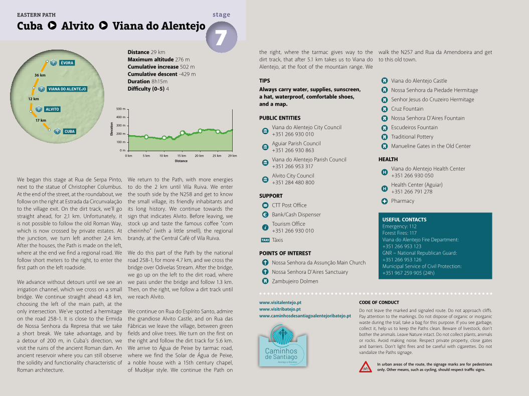
Distance 29 kmMaximum altitude 276 mCumulative increase 502 m Cumulative descent -429 mDuration 8h15mDifficulty (0-5) 4
Cuba Alvito Viana do Alentejo7stage
www.visitalentejo.ptwww.visitribatejo.ptwww.caminhosdesantiagoalentejoribatejo.pt
500 m
400 m
300 m
200 m
100 m
0 m
0 km 5 km 10 km 15 km 20 km 25 km 29 km
EASTERN PATH
We began this stage at Rua de Serpa Pinto, next to the statue of Christopher Columbus. At the end of the street, at the roundabout, we follow on the right at Estrada da Circunvalação to the village exit. On the dirt track, we'll go straight ahead, for 2,1 km. Unfortunately, it is not possible to follow the old Roman Way, which is now crossed by private estates. At the junction, we turn left another 2,4 km. After the houses, the Path is made on the left, where at the end we find a regional road. We follow short meters to the right, to enter the first path on the left roadside.
We advance without detours until we see an irrigation channel, which we cross on a small bridge. We continue straight ahead 4.8 km, choosing the left of the main path, at the only intersection. We've spotted a hermitage on the road 258-1. It is close to the Ermida de Nossa Senhora da Represa that we take a short break. We take advantage, and by a detour of 200 m, in Cuba's direction, we visit the ruins of the ancient Roman dam. An ancient reservoir where you can still observe the solidity and functionality characteristic of Roman architecture.
We return to the Path, with more energies to do the 2 km until Vila Ruiva. We enter the south side by the N258 and get to know the small village, its friendly inhabitants and its long history. We continue towards the sign that indicates Alvito. Before leaving, we stock up and taste the famous coffee "com cheirinho" (with a little smell), the regional brandy, at the Central Café of Vila Ruiva.
We do this part of the Path by the national road 258-1, for more 4.7 km, and we cross the bridge over Odivelas Stream. After the bridge, we go up on the left to the dirt road, where we pass under the bridge and follow 1.3 km. Then, on the right, we follow a dirt track until we reach Alvito.
We continue on Rua do Espírito Santo, admire the grandiose Alvito Castle, and on Rua das Fábricas we leave the village, between green fields and olive trees. We turn on the first on the right and follow the dirt track for 5.6 km. We arrive to Água de Peixe by tarmac road, where we find the Solar de Água de Peixe, a noble house with a 15th century chapel, of Mudéjar style. We continue the Path on
the right, where the tarmac gives way to the dirt track, that after 5.1 km takes us to Viana do Alentejo, at the foot of the mountain range. We
TIPSAlways carry water, supplies, sunscreen, a hat, waterproof, comfortable shoes, and a map.
PUBLIC ENTITIES
Viana do Alentejo City Council +351 266 930 010
Aguiar Parish Council +351 266 930 863
Viana do Alentejo Parish Council +351 266 953 317
Alvito City Council +351 284 480 800
SUPPORT
CTT Post Office
Bank/Cash Dispenser
Tourism Office +351 266 930 010
Táxis
POINTS OF INTEREST
Nossa Senhora da Assunção Main Church
Nossa Senhora D’Aires Sanctuary
Zambujeiro Dolmen
Viana do Alentejo Castle
Nossa Senhora da Piedade Hermitage
Senhor Jesus do Cruzeiro Hermitage
Cruz Fountain
Nossa Senhora D’Aires Fountain
Escudeiros Fountain
Traditional Pottery
Manueline Gates in the Old Center
HEALTH
Viana do Alentejo Health Center +351 266 930 050
Health Center (Aguiar) +351 266 791 278
Pharmacy
USEFUL CONTACTSEmergency: 112Forest Fires: 117Viana do Alentejo Fire Department: +351 266 953 123GNR − National Republican Guard: +351 266 953 126Municipal Service of Civil Protection: +351 967 259 905 (24h)
walk the N257 and Rua da Amendoeira and get to this old town.
CODE OF CONDUCT
Do not leave the marked and signaled route. Do not approach cliffs. Pay attention to the markings. Do not dispose of organic or inorganic waste during the trail, take a bag for this purpose. If you see garbage, collect it, help us to keep the Paths clean. Beware of livestock, don't bother the animals. Leave Nature intact. Do not collect plants, animals or rocks. Avoid making noise. Respect private property, close gates and barriers. Don’t light fires and be careful with cigarettes. Do not vandalize the Paths signage.
In urban areas of the route, the signage marks are for pedestrians only. Other means, such as cycling, should respect traffic signs.
Elev
atio
n
Distance
CUBA
ÉVORA
VIANA DO ALENTEJO
ALVITO
36 km
12 km
17 km
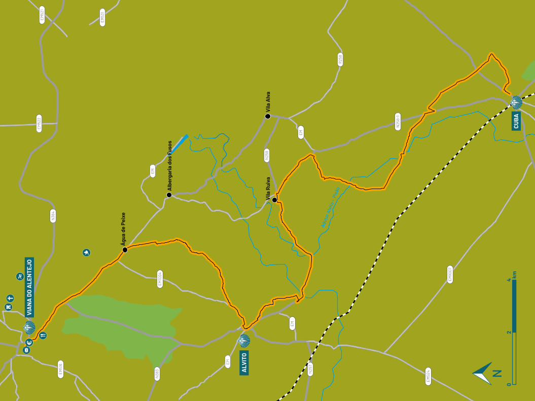
EM
EM
EM
EM
N25
7
N25
8
R25
8
EM10
04
EM51
6
N25
8-1
EM10
07
EM52
4
EM53
1
EM52
2EM52
1
N38
3
N38
4
Águ
a de
Pei
xe
Alb
erga
ria
dos
Fuso
s
Vila
Rui
vaV
ila A
lva
VIA
NA
DO
ALE
NTE
JO
ALV
ITO
CUBA
Adut
or A
lvito
- P
isão
02
4 km
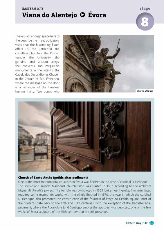
Viana do Alentejo ÉvoraEASTERN WAY
8stage
Church of Santo Antão (gothic altar pediment)One of the most monumental churches in Évora was finished in the time of cardinal D. Henrique.The scenic and austere Mannerist church-salon was started in 1557, according to the architect Miguel de Arruda's project. The temple was completed in 1563, but an earthquake, five years later, required some restoration works, with the whole finished in 1570, the year in which the cardinal D. Henrique also promoted the construction of the fountain of Praça do Giraldo square. Most of the contents date back to the 17th and 18th centuries, with the exception of the alabaster altar pediment, where the Apostolate (and Santiago among the apostles) was depicted, one of the few works of Evora sculpture of the 15th century that are still preserved.
There is not enough space here to the describe the many obligatory visits that the fascinating Évora offers us: the Cathedral, the countless churches, the Roman temple, the University, the genuine and ancient alleys, the convents and megalithic monuments in the vicinity, the Capela dos Ossos (Bones Chapel) in the Church of São. Francisco, where the message on the door is a reminder of the timeless human frailty: "We bones who Church of Graça
Eastern Way | 147
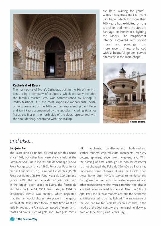
and also...São João FairThe Saint John's Fair has existed under this name since 1569, but other fairs were already held at the Rossio de São Brás in Évora: Feira de Santiago (1275), Feira Franqueada (since 1286), Feira dos Pucarinhos ou das Candeias (1525), Feira dos Estudantes (1569), Feira dos Ramos (1839), Feira Nova de São Cipriano (since 1900). The first Feira de São João was held in the largest open space in Évora, the Rossio de São Brás, on June 24, 1569. Years later, in 1574, D. Sebastião's license was created, which regulated that the fair would always take place in the space where it still takes place today. At that time, as still a little bit today, the Fair was composed of merchants' tents and crafts, such as gold and silver goldsmiths,
silk merchants, candle-makers, boilermakers, leather tanners, colored cloth merchants, crockery potters, spinners, shoemakers, weavers, etc. With the passing of time, although the popular character has not changed, the Feira de São João de Évora has undergone some changes. During the Estado Novo (New State), after 1940, it served to reinforce the Portuguese culture, with the costume parades and other manifestations that would transmit the idea of a united, even imperial, homeland. After the 25th of April 1974, the fair was modernized, and the economic activities started to be highlighted. The importance of the São João Fair for Évora has been such that, in the middle of the 20th century, the municipal holiday was fixed on June 29th (Saint Peter's Day).
are here, waiting for yours"... Without forgetting the Church of São Tiago, which for more than 700 years has exhibited on the top of its pediment the apostle Santiago on horseback, fighting the Moors. The magnificent interior is covered with azulejo murals and paintings from more recent times, enhanced with a beautiful golden carved altarpiece in the main chapel.
Cathedral of ÉvoraThe main portal of Évora’s Cathedral, built in the 30s of the 14th century by a company of sculptors, which probably included the famous master Pero, was commissioned by Bishop D. Pedro Martínez. It is the most important monumental portal of Portuguese art of the 14th century, representing Saint Peter and Saint Paul accompanied by the apostles, including St. James Major, the first on the north side of the door, represented with the shoulder bag, decorated with the scallop.
Giraldo Square
148 | Eastern Way
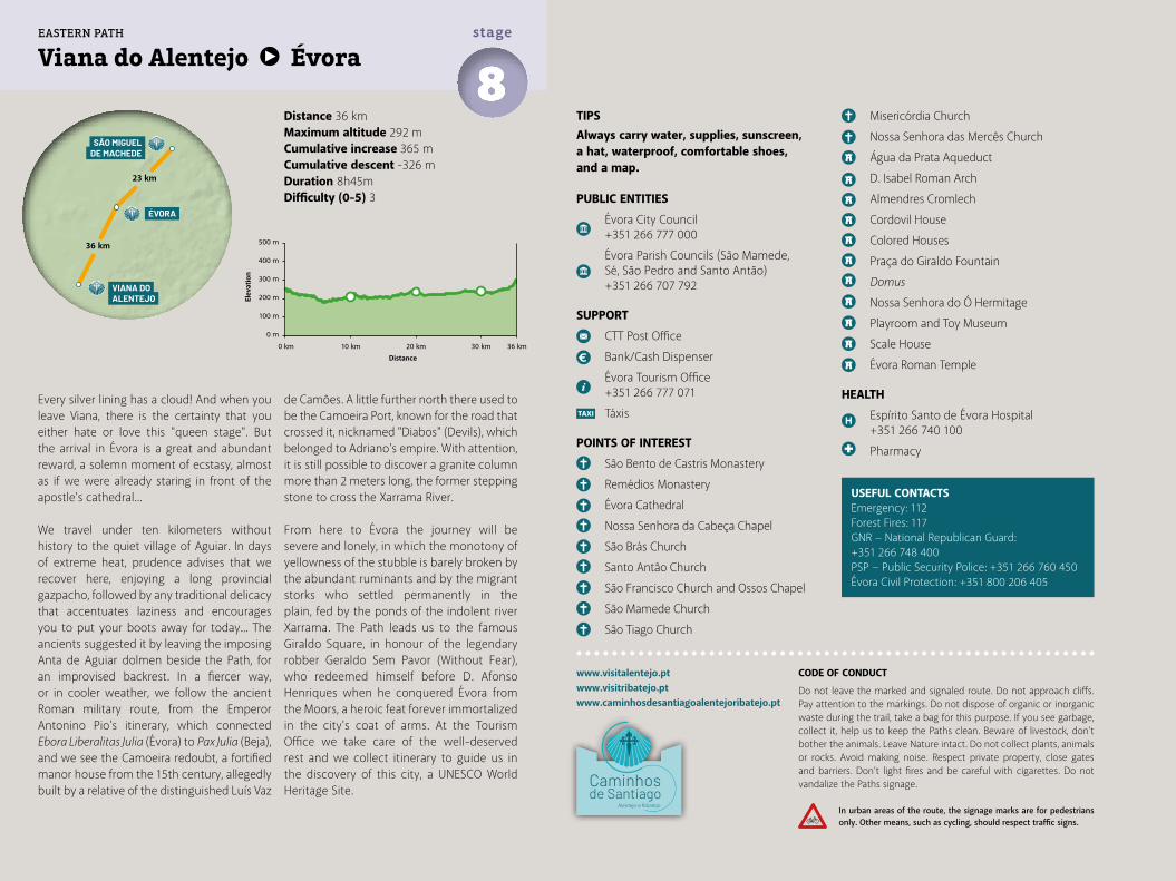
Distance 36 kmMaximum altitude 292 mCumulative increase 365 m Cumulative descent -326 mDuration 8h45mDifficulty (0-5) 3
Viana do Alentejo Évora8stage
www.visitalentejo.ptwww.visitribatejo.ptwww.caminhosdesantiagoalentejoribatejo.pt
500 m
400 m
300 m
200 m
100 m
0 m
0 km 10 km 20 km 30 km 36 km
EASTERN PATH
Every silver lining has a cloud! And when you leave Viana, there is the certainty that you either hate or love this "queen stage". But the arrival in Évora is a great and abundant reward, a solemn moment of ecstasy, almost as if we were already staring in front of the apostle's cathedral...
We travel under ten kilometers without history to the quiet village of Aguiar. In days of extreme heat, prudence advises that we recover here, enjoying a long provincial gazpacho, followed by any traditional delicacy that accentuates laziness and encourages you to put your boots away for today... The ancients suggested it by leaving the imposing Anta de Aguiar dolmen beside the Path, for an improvised backrest. In a fiercer way, or in cooler weather, we follow the ancient Roman military route, from the Emperor Antonino Pio's itinerary, which connected Ebora Liberalitas Julia (Évora) to Pax Julia (Beja), and we see the Camoeira redoubt, a fortified manor house from the 15th century, allegedly built by a relative of the distinguished Luís Vaz
de Camões. A little further north there used to be the Camoeira Port, known for the road that crossed it, nicknamed "Diabos" (Devils), which belonged to Adriano's empire. With attention, it is still possible to discover a granite column more than 2 meters long, the former stepping stone to cross the Xarrama River.
From here to Évora the journey will be severe and lonely, in which the monotony of yellowness of the stubble is barely broken by the abundant ruminants and by the migrant storks who settled permanently in the plain, fed by the ponds of the indolent river Xarrama. The Path leads us to the famous Giraldo Square, in honour of the legendary robber Geraldo Sem Pavor (Without Fear), who redeemed himself before D. Afonso Henriques when he conquered Évora from the Moors, a heroic feat forever immortalized in the city's coat of arms. At the Tourism Office we take care of the well-deserved rest and we collect itinerary to guide us in the discovery of this city, a UNESCO World Heritage Site.
TIPSAlways carry water, supplies, sunscreen, a hat, waterproof, comfortable shoes, and a map.
PUBLIC ENTITIES
Évora City Council +351 266 777 000
Évora Parish Councils (São Mamede, Sé, São Pedro and Santo Antão) +351 266 707 792
SUPPORT
CTT Post Office
Bank/Cash Dispenser
Évora Tourism Office +351 266 777 071
Táxis
POINTS OF INTEREST
São Bento de Castris Monastery
Remédios Monastery
Évora Cathedral
Nossa Senhora da Cabeça Chapel
São Brás Church
Santo Antão Church
São Francisco Church and Ossos Chapel
São Mamede Church
São Tiago Church
Misericórdia Church
Nossa Senhora das Mercês Church
Água da Prata Aqueduct
D. Isabel Roman Arch
Almendres Cromlech
Cordovil House
Colored Houses
Praça do Giraldo Fountain
Domus
Nossa Senhora do Ó Hermitage
Playroom and Toy Museum
Scale House
Évora Roman Temple
HEALTH
Espírito Santo de Évora Hospital +351 266 740 100
Pharmacy
USEFUL CONTACTSEmergency: 112Forest Fires: 117GNR − National Republican Guard: +351 266 748 400PSP − Public Security Police: +351 266 760 450Évora Civil Protection: +351 800 206 405
ÉVORA
VIANA DOALENTEJO
36 km
SÃO MIGUELDE MACHEDE
23 km
CODE OF CONDUCT
Do not leave the marked and signaled route. Do not approach cliffs. Pay attention to the markings. Do not dispose of organic or inorganic waste during the trail, take a bag for this purpose. If you see garbage, collect it, help us to keep the Paths clean. Beware of livestock, don't bother the animals. Leave Nature intact. Do not collect plants, animals or rocks. Avoid making noise. Respect private property, close gates and barriers. Don’t light fires and be careful with cigarettes. Do not vandalize the Paths signage.
In urban areas of the route, the signage marks are for pedestrians only. Other means, such as cycling, should respect traffic signs.
Elev
atio
n
Distance
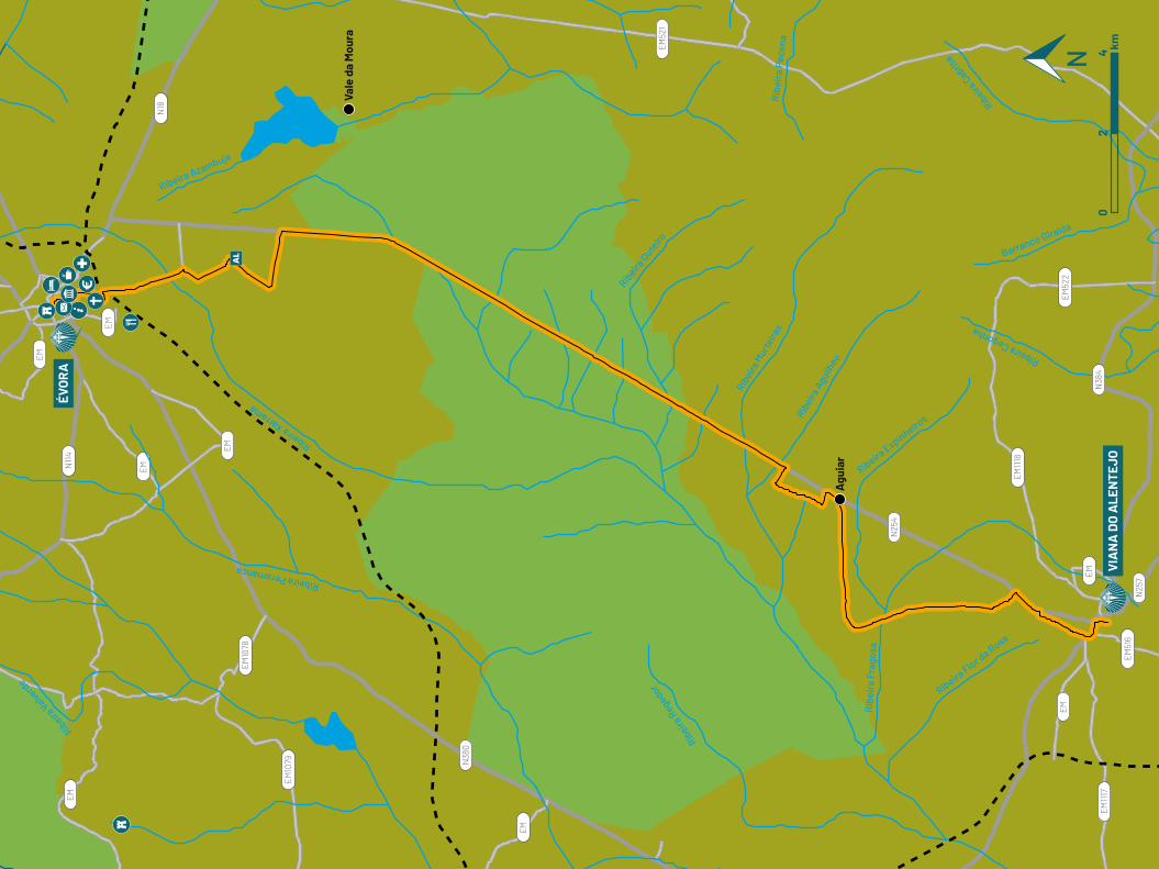
EM
EM
EM
EM
EM
EM
EM
N38
0
N25
4
N114
N18
EM52
1
EM52
2
EM51
6
EM1117
EM1118
EM10
78
EM10
79
N25
7
Ribeira Cegonha
Barranco Giralda
Ribeira
Cabrit
a
Ribeira Espinheiro
sRibei
ra A
guilh
eo
Ribei
ra M
urte
iras
Rib
eira
Pec
ena
Ribeira
Oute
iro
Ribeira Azambuja
Ribeira Xarrama
Ribeira Valverd
e
Ribeira Peramanca
Ribeira Flor d
a Rosa
Rib
eira
Fra
gosa
Ribeira
Regedor
Vale
da
Mou
ra
Agu
iar
ÉVO
RA
VIA
NA
DO
ALE
NTE
JO0
24 km
EM
N38
4
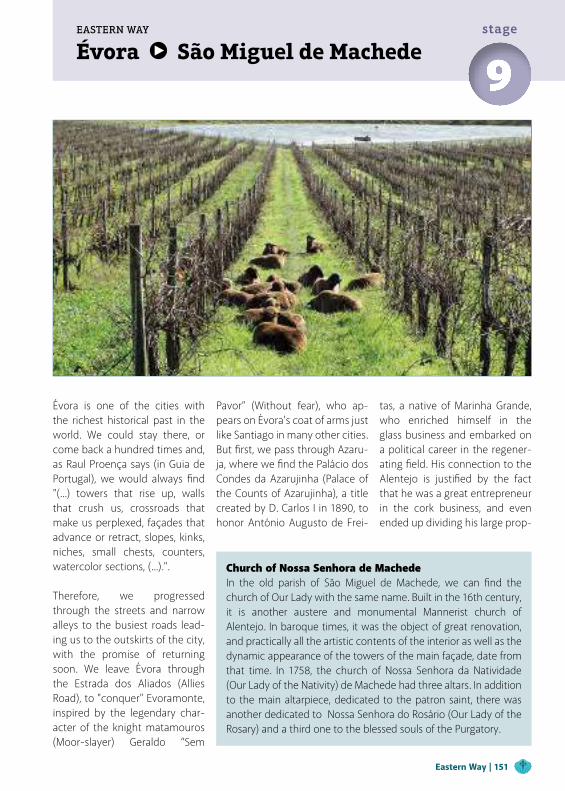
Évora São Miguel de MachedeEASTERN WAY
9stage
Évora is one of the cities with the richest historical past in the world. We could stay there, or come back a hundred times and, as Raul Proença says (in Guia de Portugal), we would always find "(...) towers that rise up, walls that crush us, crossroads that make us perplexed, façades that advance or retract, slopes, kinks, niches, small chests, counters, watercolor sections, (...).".
Therefore, we progressed through the streets and narrow alleys to the busiest roads lead-ing us to the outskirts of the city, with the promise of returning soon. We leave Évora through the Estrada dos Aliados (Allies Road), to "conquer" Evoramonte, inspired by the legendary char-acter of the knight matamouros (Moor-slayer) Geraldo “Sem
Pavor” (Without fear), who ap-pears on Évora's coat of arms just like Santiago in many other cities. But first, we pass through Azaru-ja, where we find the Palácio dos Condes da Azarujinha (Palace of the Counts of Azarujinha), a title created by D. Carlos I in 1890, to honor António Augusto de Frei-
tas, a native of Marinha Grande, who enriched himself in the glass business and embarked on a political career in the regener-ating field. His connection to the Alentejo is justified by the fact that he was a great entrepreneur in the cork business, and even ended up dividing his large prop-
Church of Nossa Senhora de MachedeIn the old parish of São Miguel de Machede, we can find the church of Our Lady with the same name. Built in the 16th century, it is another austere and monumental Mannerist church of Alentejo. In baroque times, it was the object of great renovation, and practically all the artistic contents of the interior as well as the dynamic appearance of the towers of the main façade, date from that time. In 1758, the church of Nossa Senhora da Natividade (Our Lady of the Nativity) de Machede had three altars. In addition to the main altarpiece, dedicated to the patron saint, there was another dedicated to Nossa Senhora do Rosário (Our Lady of the Rosary) and a third one to the blessed souls of the Purgatory.
Eastern Way | 151
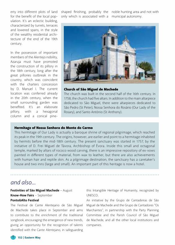
Church of São Miguel de Machede The church was built in the second half of the 16th century. In 1758, the church had five altars. In addition to the main altarpiece dedicated to São Miguel, there were altarpieces dedicated to São Pedro (St Peter), Nossa Senhora do Rosário (Our Lady of the Rosary), and Santo António (St Anthony).
and also...Festivities of São Miguel Machede − AugustKnow-How Fairs − September Ponto&Alto FestivalThe Festival de Cante Alentejano de São Miguel de Machede takes place in September and aims to contribute to the enrichment of the traditional songbook, encouraging the emergence of new trends, giving an opportunity for the recognition of talents identified with the Cante Alentejano, in safeguarding
this Intangible Heritage of Humanity, recognized by UNESCO.An initiative by the Grupo de Cantadeiras de São Miguel de Machede and the Grupo de Cantadores "Os Marchantes", in partnership with the Party Planning Committee and the Parish Council of São Miguel de Machede, and all the other local institutions and companies.
erty into different plots of land for the benefit of the local pop-ulation. It's an eclectic building, characterized by turrets, terraces and lowered spans, in the style of the wealthy residential archi-tecture of the end of the 19th century.
In the possession of important members of the Alentejo nobility, Azaruja must have promoted the construction of its pillory in the 18th century, long after the great pillories outbreak in the country, which was coincident with the charters concession by D. Manuel I. The current location was conferred already in the 20th century, when the small surrounding garden was benefited. It's an elaborate pillory, with a hexagonal column and a conical pine-
shaped finishing, probably the only which is associated with a
noble hunting area and not with municipal autonomy.
Hermitage of Nossa Senhora do Monte do CarmoThis hermitage of Our Lady is actually a baroque shrine of regional pilgrimage, which reached its peak in the 19th century. The origins, however, are earlier and point to a hermitage inhabited by hermits before the mid-18th century. The present sanctuary was started in 1757, by the initiative of D. Frei Miguel de Távora, Archbishop of Évora. Inside this small and octagonal temple, marked by altars of rococo wood carving, there is an impressive repository of ex-vows painted in different types of material, from wax to leather, but there are also achievements with human hair and reptile skin. As a pilgrimage destination, the sanctuary has a caretaker's house and two inns (large and small). An important part of this heritage is now a hotel.
152 | Eastern Way
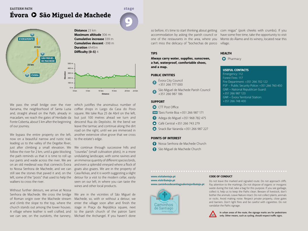
HEALTH
Pharmacy
Distance 23 kmMaximum altitude 306 mCumulative increase 339 m Cumulative descent -398 mDuration 6h45mDifficulty (0-5) 4
Évora São Miguel de Machede9stage
We pass the small bridge over the river Xarrama, the neighborhood of Santa Luzia and, straight ahead on the Path, already in macadam, we reach the gates of Herdade da Fonte Coberta, about 5 km after the beginning of our journey.
We bypass the entire property on the left, now on a beautiful narrow and rustic trail, leading us to the valley of the Degebe River, just after climbing a small elevation. We follow the river for 2 km, until a gate blocking the path reminds us that it is time to roll up our pants and wade across the river. We are on an old medieval way that connects Évora to Nossa Senhora de Machede, and we can still see the stones that paved it and, on the left, some of the "posts" that used to help the walkers to cross the river.
Without further detours, we arrive at Nossa Senhora de Machede. We cross the bridge of Roman origin over the Machede stream and climb the slope to the top, where the church stands out among the lower houses. A village where leather is well crafted, and we can see, on the outskirts, the tannery,
which justifies the anomalous number of coffee shops in Largo da Casa do Povo square. We take Rua 25 de Abril on the left, but just 100 metres ahead we turn and descend Rua do Depósito. At the bend we leave the tarmac and continue along the dirt road on the right, until we are immersed in another extensive olive grove that we cross to the estate’s edge.
We continue through successive hills and "courelas" (small cultivation plots), in a more undulating landscape, with some ravines and an immense quantity of different species birds, and even a splendid vineyard where a flock of goats also grazes. We are in the property of Casa Relvas, and it is worth suggesting a slight detour for a visit to the modern cellar, easily seen on our left, in where you can taste the wines and other local products.
We are in the vicinities of São Miguel de Machede, so, with or without a detour, we enter the village soon after and finish the stage in Praça da República square, next to the parish church of the patron Saint Michael the Archangel. If you haven't done
TIPSAlways carry water, supplies, sunscreen, a hat, waterproof, comfortable shoes, and a map.
PUBLIC ENTITIES
Évora City Council +351 266 777 000
São Miguel de Machede Parish Council +351 266 987 186
SUPPORT
CTT Post Office
Táxis Fonte Boa +351 266 987 171
Adega do Miguel +351 968 782 475
Café Central +351 266 743 279
Snack Bar Varanda +351 266 987 227
POINTS OF INTEREST
Nossa Senhora de Machede Church
São Miguel de Machede Church
www.visitalentejo.ptwww.visitribatejo.ptwww.caminhosdesantiagoalentejoribatejo.pt
USEFUL CONTACTSEmergency: 112Forest Fires: 117Fire Department: +351 266 702 122PSP − Public Security Police: +351 266 760 450GNR − National Republican Guard: +351 266 987 123GNR − Évora Territorial Station: +351 266 748 400
so before, it's time to start thinking about getting accommodation by asking the parish council or one of the restaurants in the area, where you can't miss the delicacy of "bochechas de porco
com migas" (pork cheeks with crumbs). If you have some free time, take the opportunity to visit Monte do Álamo and its winery, located near this village.
500 m
400 m
300 m
200 m
100 m
0 m
0 km 5 km 10 km 15 km 20 km 23 km
ÉVORA
EVORAMONTE
SÃO MIGUELDE MACHEDE
23 km
23 km
EASTERN PATH
CODE OF CONDUCT
Do not leave the marked and signaled route. Do not approach cliffs. Pay attention to the markings. Do not dispose of organic or inorganic waste during the trail, take a bag for this purpose. If you see garbage, collect it, help us to keep the Paths clean. Beware of livestock, don't bother the animals. Leave Nature intact. Do not collect plants, animals or rocks. Avoid making noise. Respect private property, close gates and barriers. Don’t light fires and be careful with cigarettes. Do not vandalize the Paths signage.
In urban areas of the route, the signage marks are for pedestrians only. Other means, such as cycling, should respect traffic signs.
Elev
atio
n
Distance
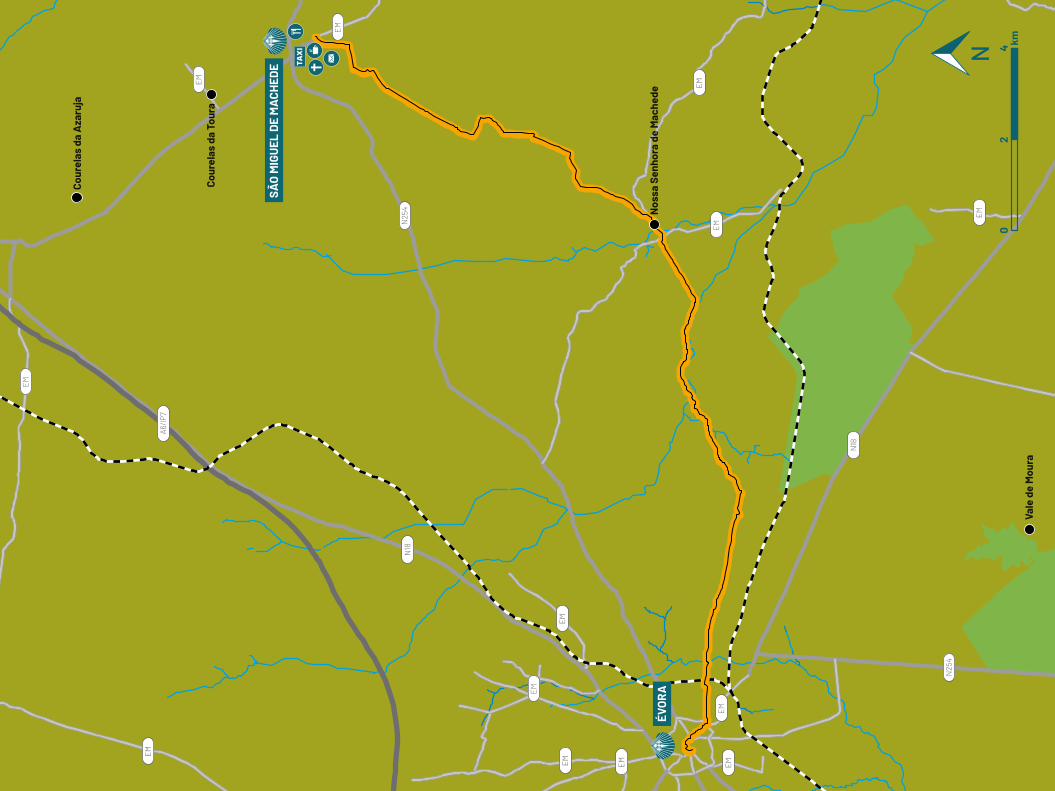
EM
EM
EM
EM
EM
EM
EM
EM
EMEM
EM
EM
EM
N25
4
N25
4
N18
N18
A6/IP
7
Cour
elas
da
Aza
ruja
Cour
elas
da
Tour
a
Nos
sa S
enho
ra d
e M
ache
de
Vale
de
Mou
ra
ÉVO
RA
SÃO
MIG
UEL
DE
MA
CHED
E
02
4 km
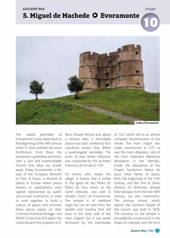
S. Miguel de Machede EvoramonteEASTERN WAY
10stage
The walled perimeter of Evoramonte Castle dates back to the beginning of the 14th century when D. Dinis ordered the town fortification. From there, the panorama is grandiose and stern, with a vast and imperturbable horizon that takes our breath away. Today, Evoramonte is the seat of the European Network of Sites of Peace, a network of places in Europe where peace treaties or capitulations were signed, represented by public and private institutions, in order to work together to build a culture of peace and promote these places based on their Common Historical Heritage - the PEACE. In the time of D. João I, the castle became the property of D.
Nuno Álvares Pereira and, about a century later, a formidable palace was built, marked by four cylindrical towers that define a quadrangular perimeter. The work, of clear Italian influence, was conducted by the architect Francisco de Arruda in 1531.
It's history who makes the village. A history that is visible in the Igreja de São Pedro (St Peter) de Fora which, as the name indicates, was (still is) outside ("fora") of Evoramonte. The temple is of medieval origin (as can be seen from the double arch window that still tears in the back wall of the main chapel), but it was partly destroyed by the earthquake
of 1531, which led to an almost complete reconstruction of the whole. The main chapel was under construction in 1577, as was the main altarpiece, one of the most important Mannerist altarpieces in the Alentejo. Inside, the altarpieces of the chapel Santíssimo Nome de Jesus (Holy Name of Jesus), from the beginning of the 17th century, and the one of Santo António (St Anthony), already fully baroque, from the mid-18th century, are also noteworthy. The primary school, which adjoins the southern façade of the church, was built in 1878. The entrance to the temple is preceded by a small porch in the shape of a temple, and the front
Castle of Evoramonte
Eastern Way | 155
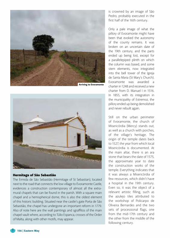
is crowned by an image of São Pedro, probably executed in the first half of the 16th century.
Only a pale image of what the pillory of Evoramonte might have been that evoked the autonomy of the county remains. It was broken on an uncertain date of the 19th century, and the parts ended up being lost, except for a parallelepiped plinth on which the column was based, and some stem elements, now integrated into the bell tower of the Igreja de Santa Maria (St Mary’s Church). Evoramonte was awarded a charter in 1248 and received a new charter from D. Manuel I in 1516. In 1855, with its integration in the municipality of Estremoz, the pillory ended up being demolished and never rebuilt again.
Still on the urban perimeter of Evoramonte, the church of Misericórdia (Mercy) stands out, as well as a church with porches, of the village's heritage. The origin of the temple dates back to 1527, the year from which local Misericórdia is documented. At the main altar, there is an ara stone that bears the date of 1575, the approximate year to date the construction works of the temple. Everything indicates that it was always a Misericórdia of few resources, which didn't have a hospital in the 19th century. Even so, it was the object of a relevant artistic filling, such as the azulejo tiles attributed to the workshop of Policarpo de Oliveira Bernardes and the two sets of processional flags, one from the mid-17th century and the other from the middle of the following century.
Hermitage of São SebastiãoThe Ermida de São Sebastião (Hermitage of St Sebastian), located next to the road that connects the low village to Evoramonte Castle, evidences a construction contemporary of almost all the extra-mural chapels that can be found in the parish. With a square main chapel and a hemispherical dome, this is also the oldest element of this historic building. Situated near the castle's gate Porta de São Sebastião, the chapel has undergone an important reform in 1779. Also of note here are the wall paintings and sgraffitos of the main chapel vault where, according to Túlio Espanca, crosses of the Order of Malta, along with other motifs, may appear.
Arriving to Evoramonte
156 | Eastern Way
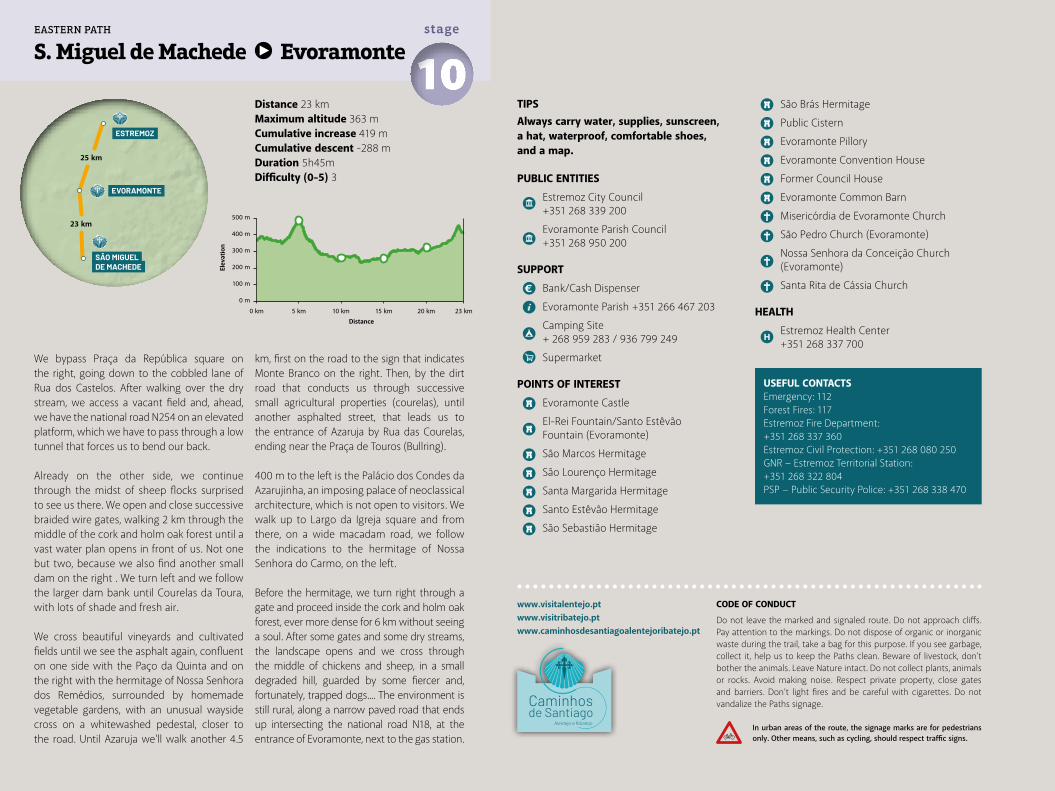
Distance 23 kmMaximum altitude 363 mCumulative increase 419 m Cumulative descent -288 mDuration 5h45mDifficulty (0-5) 3
S. Miguel de Machede Evoramonte 10stage
We bypass Praça da República square on the right, going down to the cobbled lane of Rua dos Castelos. After walking over the dry stream, we access a vacant field and, ahead, we have the national road N254 on an elevated platform, which we have to pass through a low tunnel that forces us to bend our back.
Already on the other side, we continue through the midst of sheep flocks surprised to see us there. We open and close successive braided wire gates, walking 2 km through the middle of the cork and holm oak forest until a vast water plan opens in front of us. Not one but two, because we also find another small dam on the right . We turn left and we follow the larger dam bank until Courelas da Toura, with lots of shade and fresh air.
We cross beautiful vineyards and cultivated fields until we see the asphalt again, confluent on one side with the Paço da Quinta and on the right with the hermitage of Nossa Senhora dos Remédios, surrounded by homemade vegetable gardens, with an unusual wayside cross on a whitewashed pedestal, closer to the road. Until Azaruja we'll walk another 4.5
km, first on the road to the sign that indicates Monte Branco on the right. Then, by the dirt road that conducts us through successive small agricultural properties (courelas), until another asphalted street, that leads us to the entrance of Azaruja by Rua das Courelas, ending near the Praça de Touros (Bullring).
400 m to the left is the Palácio dos Condes da Azarujinha, an imposing palace of neoclassical architecture, which is not open to visitors. We walk up to Largo da Igreja square and from there, on a wide macadam road, we follow the indications to the hermitage of Nossa Senhora do Carmo, on the left.
Before the hermitage, we turn right through a gate and proceed inside the cork and holm oak forest, ever more dense for 6 km without seeing a soul. After some gates and some dry streams, the landscape opens and we cross through the middle of chickens and sheep, in a small degraded hill, guarded by some fiercer and, fortunately, trapped dogs.... The environment is still rural, along a narrow paved road that ends up intersecting the national road N18, at the entrance of Evoramonte, next to the gas station.
TIPSAlways carry water, supplies, sunscreen, a hat, waterproof, comfortable shoes, and a map.
PUBLIC ENTITIES
Estremoz City Council +351 268 339 200
Evoramonte Parish Council +351 268 950 200
SUPPORT
Bank/Cash Dispenser
Evoramonte Parish +351 266 467 203
Camping Site + 268 959 283 / 936 799 249
Supermarket
POINTS OF INTEREST
Evoramonte Castle
El-Rei Fountain/Santo Estêvão Fountain (Evoramonte)
São Marcos Hermitage
São Lourenço Hermitage
Santa Margarida Hermitage
Santo Estêvão Hermitage
São Sebastião Hermitage
São Brás Hermitage
Public Cistern
Evoramonte Pillory
Evoramonte Convention House
Former Council House
Evoramonte Common Barn
Misericórdia de Evoramonte Church
São Pedro Church (Evoramonte)
Nossa Senhora da Conceição Church (Evoramonte)
Santa Rita de Cássia Church
HEALTH
Estremoz Health Center +351 268 337 700
www.visitalentejo.ptwww.visitribatejo.ptwww.caminhosdesantiagoalentejoribatejo.pt
USEFUL CONTACTSEmergency: 112Forest Fires: 117Estremoz Fire Department:+351 268 337 360Estremoz Civil Protection: +351 268 080 250GNR − Estremoz Territorial Station: +351 268 322 804PSP − Public Security Police: +351 268 338 470
500 m
400 m
300 m
200 m
100 m
0 m
0 km 5 km 10 km 15 km 20 km 23 km
ESTREMOZ
SÃO MIGUELDE MACHEDE
23 km
25 km
EVORAMONTE
EASTERN PATH
CODE OF CONDUCT
Do not leave the marked and signaled route. Do not approach cliffs. Pay attention to the markings. Do not dispose of organic or inorganic waste during the trail, take a bag for this purpose. If you see garbage, collect it, help us to keep the Paths clean. Beware of livestock, don't bother the animals. Leave Nature intact. Do not collect plants, animals or rocks. Avoid making noise. Respect private property, close gates and barriers. Don’t light fires and be careful with cigarettes. Do not vandalize the Paths signage.
In urban areas of the route, the signage marks are for pedestrians only. Other means, such as cycling, should respect traffic signs.
Elev
atio
n
Distance
Ribeira Fargela
Ribe
ira P
inhe
iro
Ribeira Piscina
Ribeira M
achede
Ribeira Charca
Ribeiro Pardiela
EM
EM
EM
EM
EM
EM
N25
4
N18
A6/IP
7
N25
4-1
N37
2-1
Aza
ruja
Cour
elas
da
Aza
ruja
Cour
elas
da
Tour
a
Foro
s do
Que
imad
o
EVO
RA
MO
NTE
SÃO
MIG
UEL
DE
MA
CHED
E0
24 km
Evoramonte EstremozEASTERN WAY
11stage
Until Estremoz we will have another journey of long intimacy with the cork oak and holm oak forest, winding through the dark green of the plantations and the buildings of the scarce estates. It is essential to prepare ourselves, both in terms of physical supply and mental robustness, because it is not foreseeable that we will find any kind of support on the Way. In the city, the religious presence is quite profuse, with the presence of the Church and its religious orders, with convents, churches, chapels, and hermitages spread throughout the commune. An example of this is the Igreja de Santiago de Estremoz church, founded in the reign of D. Afonso III. Its edification, on the north-western edge of the perimeter wall, and in a land that would be
Palace of the CourtAttached to the castle and the royal palace, this building dates back to the time of D. Dinis and is contemporary with the construction of the castle's keep, since Master Anton's signature is exhibited in both monuments. The palace is preceded by a galilé of five spans, which was initially covered by a wooden ceiling, however replaced by the current vault of crossed ogives, in the reign of D. Manuel I. In the center, a pointed portal surmounted by a sculptural frame with the insignia of D. Afonso IV (the monarch who supposedly finished the set) allows access to the audience hall, a space of trapezoidal plant covered by a Manueline octagonal vault.
called "the Loureiro", meant the constitution of an element on the definition of Estremoz urbanism and unification of a neighborhood called "Santiago". Despite the great transformations the temple underwent, especially in the 17th century, it is still possible to see the Order of Avis cross on the main façade.
In the municipal museum, we quickly put aside the external attractions so that, in the words of José Saramago, "(...) we can marvel, at will, at the clay dolls that have taken their name from Estremoz. To marvel, he says, and there's no better term. (...) The traveler doesn't know where to look (...)". And he finishes
Castle of Estremoz
Eastern Way | 159
and also...Traditional Fair of Estremoz − MayRainha Santa Isabel Festival − JulyTraditional Fair of Santiago − JulyFestivities of Exaltação de Santa Cruz − SeptemberFestivities of N. Sr.ª dos Mártires − SeptemberEstremoz DollsThe production of clay figures, commonly known as "Estremoz Dolls", is an art with more than three
centuries and is part of the cultural identity of this commune. More than one hundred different figures are inventoried and new themes are invented every day, always related to the daily life of the Alentejo people, in their rural and urban living. The skillful hands that work with clay give life to the emblematic figures that, with their bright colors and unique shapes, enchant those who pass through here.
inventing "To Estremoz you will go, its dolls you will see, your soul you will save" (in Viagem a Portugal). The city also reveals the statue of Rainha Santa Isabel (Holy Queen Elizabeth), by the sculptor Martins Correia, which evokes the importance of D. Isabel of Aragon for Estremoz. The Queen, D. Dinis' wife, elected Estremoz as her place of residence for long periods and died here on July 4, 1336. She was herself a pilgrim to Santiago de Compostela in 1325, shortly after the death of D. Dinis, and there are still signs that point to a second pilgrimage in 1335. The list of miracles attributed to her was approved by Leon X in 1516, and the queen was canonized in 1625.
Integrated into the Pousada de Estremoz hotel, the Rainha Santa Isabel Chapel also evokes the importance of the Queen's memory in Estremoz history. The oratory was built in 1659 by Queen D. Luísa de Gusmão, but the whole is, however, worth the magnificent works carried out on the initiative of D. João V, between the 20s and 30s of the 18th century, which gave the
temple its appearance of total art. Oil paintings attributed to André Gonçalves and azulejo panels by Teotónio dos Santos illustrate the miracles of St Elizabeth of Aragon. The importance of the Holy Queen for Estremoz population
was also witnessed by the 1808 inscription accompanying the chapel's marble choir, in which the inhabitants of Estremoz thank her divine intervention for the protection granted during the French invasions.
Professor Joaquim Vermelho Municipal MuseumThe building construction dates back to the 13th/14th century and it underwent renovations in the following centuries. You can visit there the permanent exhibition, which is divided into two floors and located at the top of the popular art collections (horn, cork, and wood) by artisans such as Mestre Rolo, José Vinagre, or Joaquim Velhinho. The reconstitution of an Alentejo House from the end of the 19th century is also presented, and on the ground floor, the Estremoz figurative and local pottery collections from the last two decades of the 19th and early 20th centuries.
160 | Eastern Way
Distance 25 kmMaximum altitude 493 mCumulative increase 662 m Cumulative descent -608 mDuration 7h00mDifficulty (0-5) 4
USEFUL CONTACTSEmergency: 112Forest Fires: 117Estremoz Fire Department: +351 268 337 360Estremoz Civil Protection: +351 268 080 250GNR − Estremoz National Republican Guard:+351 268 322 804PSP − Public Security Police: +351 268 338 470
Evoramonte Estremoz 11stage
Back to the central square, we cross the road and enter Rua das Correias, following the signs that indicate Ermida de S. Brás immediately to the left. We go up until we find the gate of Monte da Alagoinha, and then access, on the left, a dirt track to Herdade da Junceira, along 6 km.
In the middle of the cork oak forest, we see the marks of the periodic harvests of the valuable cork, transformed into stoppers, "cocharros" (sort of spoon to drink water from the fountain, typical from Alentejo) and many other items.
From the nearby Herdade da Defesa we continue along the trail between the cork oak forest and across the plateau, now also with aligned olive groves and vineyards. The estates Herdade da Junceira and Herdade da Defesa are reference areas for hunters, but now the land is fenced to protect cattle and crops, and we are forced to deviate and enter the road (N381), near a viaduct over the Tera stream, fortunately with little traffic. Along the way, the landscape looks like a mosaic, where the yellow of the stubble alternates
with the reddish vineyards in the autumn period. After almost 3 km, in front of a farm with an atypical circular house, we detour to the left, to the dirt track. Further on we see the motorway and pass through the lower tunnel, always following the macadamia road until a junction.
On the right we see Estremoz in the horizon! Another passage through the motorway, now on a viaduct and, straight ahead, we reach the bustling intersection of the N4 national road. We walk 150 m on the left side of the road and, very carefully, cross the N4 to the other side, next to the white house with blue stripes on the corner. We can see the continuation of our way up to the walls of Estremoz.
After a slight ascent, we reached the bastion wall and penetrated this fortification through the Porta de Évora gate. On the right, we continue the stone path, next to the wall, and enter the Castle through Rua do Arco de Santarém. Inside the wall of the citadel we go to the Municipal Museum for information.
TIPSAlways carry water, supplies, sunscreen, a hat, waterproof, comfortable shoes, and a map.
PUBLIC ENTITIES
Estremoz City Council +351 268 339 200
Estremoz Parish Councils (Santa Maria and Santo André) +351 268 323 577
SUPPORT
Bank/Cash Dispenser
CTT Post Office
Tourism Office/Casa de Estremoz +351 268 339 227
Santo André de Estremoz Parish Social Center +351 268 324 842
Supermarket
POINTS OF INTEREST
Prof. Joaquim Vermelho Municipal Museum
Marqueses de Praia e Monforte Palace
Estremoz Castle
“Bonecos de Estremoz” Clay Pottery Figurines
Living Science Center
Gadanha Lake
Former Council House/Alcaide-Mor House
Santiago Neighborhood
Rainha Santa Isabel Chapel
Santiago Church
Santa Maria Church
São Francisco Church
Montado Alentejano (Typical Alentejo Cork and Holm Oak forest)
Serra d’Ossa (Moutain Range)
Vineyards
HEALTH
Estremoz Health Center +351 268 337 700
Pharmacy
www.visitalentejo.ptwww.visitribatejo.ptwww.caminhosdesantiagoalentejoribatejo.pt
500 m
400 m
300 m
200 m
100 m
0 m
0 km 5 km 10 km 15 km 20 km 25 km
ESTREMOZ
SOUSEL
25 km
21 km
EVORAMONTE
EASTERN PATH
CODE OF CONDUCT
Do not leave the marked and signaled route. Do not approach cliffs. Pay attention to the markings. Do not dispose of organic or inorganic waste during the trail, take a bag for this purpose. If you see garbage, collect it, help us to keep the Paths clean. Beware of livestock, don't bother the animals. Leave Nature intact. Do not collect plants, animals or rocks. Avoid making noise. Respect private property, close gates and barriers. Don’t light fires and be careful with cigarettes. Do not vandalize the Paths signage.
In urban areas of the route, the signage marks are for pedestrians only. Other means, such as cycling, should respect traffic signs.
Elev
atio
n
Distance
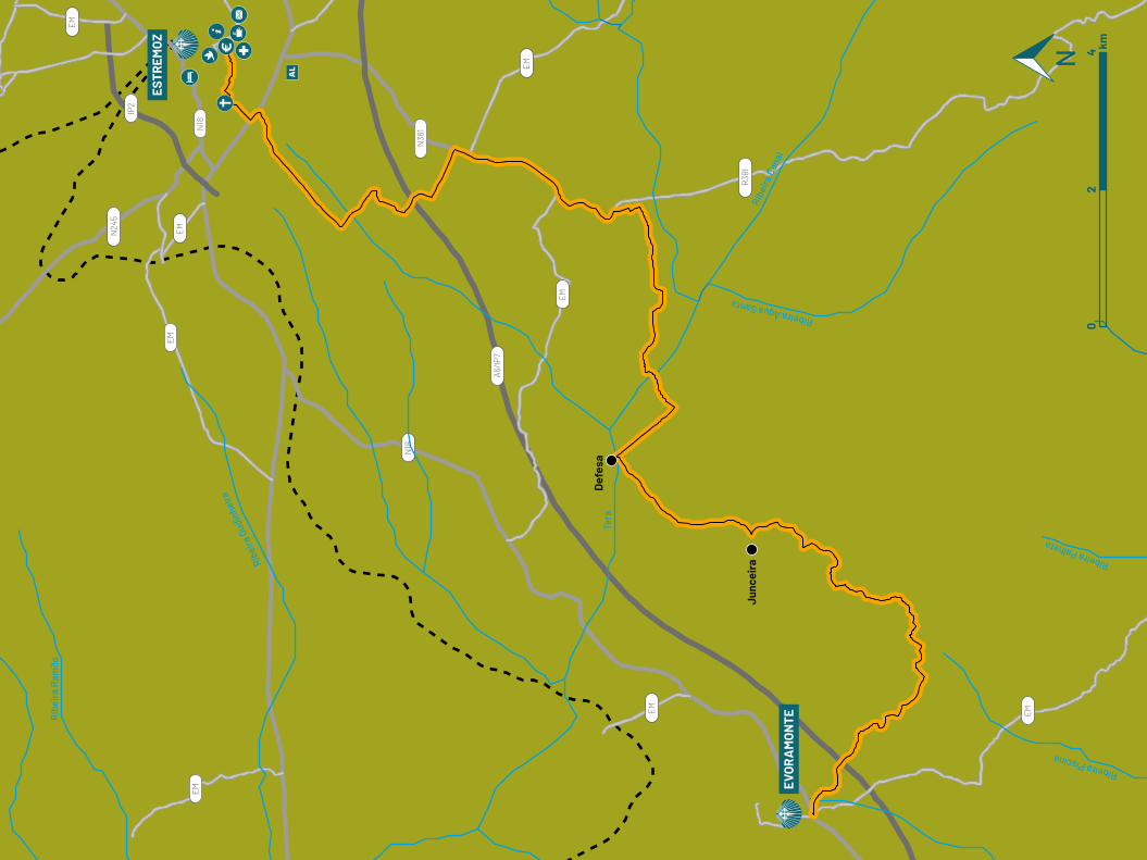
EM
EM
EM
EM
EM
EM
EM
N18
N18
IP2
EM
A6/IP
7
N38
1
N24
5
R38
1
Ribe
ira G
udin
heira
Rib
eira
Ram
ilo
Tera
Ribe
ira C
anal
Ribeira Água Santa
Ribeira Piscina
Ribeira Palheta
Def
esa
Junc
eira
EVO
RA
MO
NTE
ESTR
EMO
Z
02
4 km
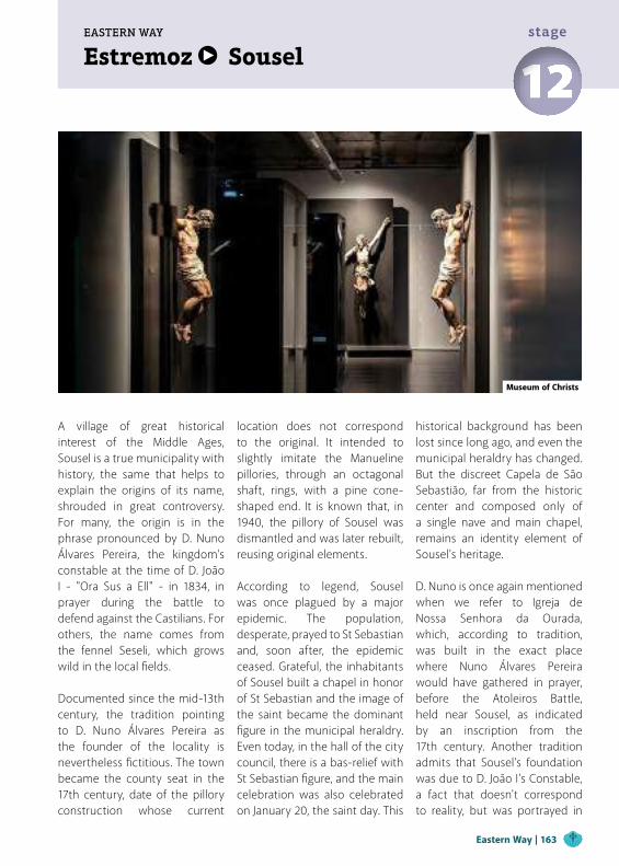
Estremoz SouselEASTERN WAY
12stage
A village of great historical interest of the Middle Ages, Sousel is a true municipality with history, the same that helps to explain the origins of its name, shrouded in great controversy. For many, the origin is in the phrase pronounced by D. Nuno Álvares Pereira, the kingdom’s constable at the time of D. João I - "Ora Sus a Ell" - in 1834, in prayer during the battle to defend against the Castilians. For others, the name comes from the fennel Seseli, which grows wild in the local fields. Documented since the mid-13th century, the tradition pointing to D. Nuno Álvares Pereira as the founder of the locality is nevertheless fictitious. The town became the county seat in the 17th century, date of the pillory construction whose current
location does not correspond to the original. It intended to slightly imitate the Manueline pillories, through an octagonal shaft, rings, with a pine cone-shaped end. It is known that, in 1940, the pillory of Sousel was dismantled and was later rebuilt, reusing original elements.
According to legend, Sousel was once plagued by a major epidemic. The population, desperate, prayed to St Sebastian and, soon after, the epidemic ceased. Grateful, the inhabitants of Sousel built a chapel in honor of St Sebastian and the image of the saint became the dominant figure in the municipal heraldry. Even today, in the hall of the city council, there is a bas-relief with St Sebastian figure, and the main celebration was also celebrated on January 20, the saint day. This
historical background has been lost since long ago, and even the municipal heraldry has changed. But the discreet Capela de São Sebastião, far from the historic center and composed only of a single nave and main chapel, remains an identity element of Sousel's heritage.
D. Nuno is once again mentioned when we refer to Igreja de Nossa Senhora da Ourada, which, according to tradition, was built in the exact place where Nuno Álvares Pereira would have gathered in prayer, before the Atoleiros Battle, held near Sousel, as indicated by an inscription from the 17th century. Another tradition admits that Sousel’s foundation was due to D. João I's Constable, a fact that doesn't correspond to reality, but was portrayed in
Museum of Christs
Eastern Way | 163
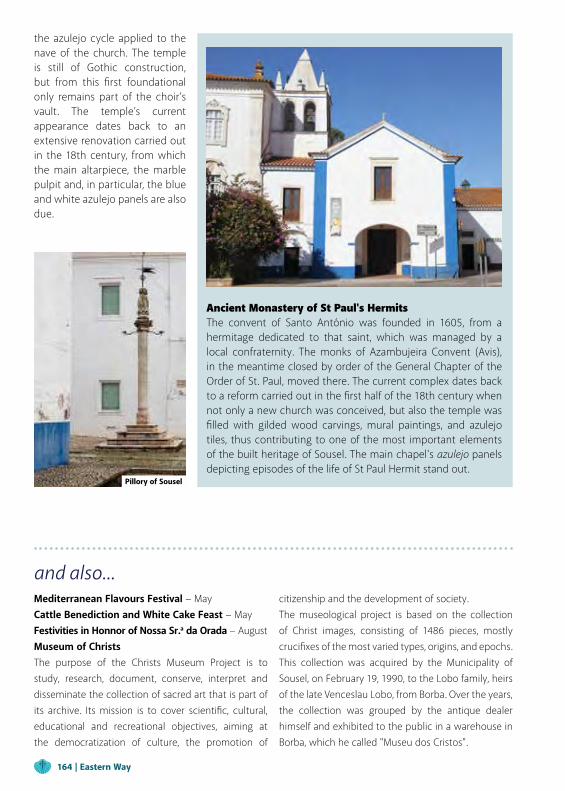
Ancient Monastery of St Paul's HermitsThe convent of Santo António was founded in 1605, from a hermitage dedicated to that saint, which was managed by a local confraternity. The monks of Azambujeira Convent (Avis), in the meantime closed by order of the General Chapter of the Order of St. Paul, moved there. The current complex dates back to a reform carried out in the first half of the 18th century when not only a new church was conceived, but also the temple was filled with gilded wood carvings, mural paintings, and azulejo tiles, thus contributing to one of the most important elements of the built heritage of Sousel. The main chapel's azulejo panels depicting episodes of the life of St Paul Hermit stand out.
and also...Mediterranean Flavours Festival − MayCattle Benediction and White Cake Feast − MayFestivities in Honnor of Nossa Sr.a da Orada − AugustMuseum of ChristsThe purpose of the Christs Museum Project is to study, research, document, conserve, interpret and disseminate the collection of sacred art that is part of its archive. Its mission is to cover scientific, cultural, educational and recreational objectives, aiming at the democratization of culture, the promotion of
citizenship and the development of society.The museological project is based on the collection of Christ images, consisting of 1486 pieces, mostly crucifixes of the most varied types, origins, and epochs. This collection was acquired by the Municipality of Sousel, on February 19, 1990, to the Lobo family, heirs of the late Venceslau Lobo, from Borba. Over the years, the collection was grouped by the antique dealer himself and exhibited to the public in a warehouse in Borba, which he called "Museu dos Cristos".
the azulejo cycle applied to the nave of the church. The temple is still of Gothic construction, but from this first foundational only remains part of the choir’s vault. The temple’s current appearance dates back to an extensive renovation carried out in the 18th century, from which the main altarpiece, the marble pulpit and, in particular, the blue and white azulejo panels are also due.
Pillory of Sousel
164 | Eastern Way
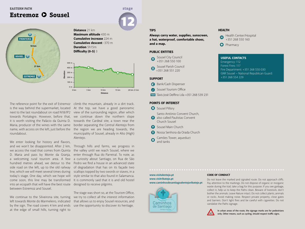
Distance 21 kmMaximum altitude 430 mCumulative increase 224 m Cumulative descent -370 mDuration 5h15mDifficulty (0-5) 3
Estremoz Sousel 12stage
TIPSAlways carry water, supplies, sunscreen, a hat, waterproof, comfortable shoes, and a map.
PUBLIC ENTITIES
Sousel City Council +351 268 550 100
Sousel Parish Council +351 268 551 220
SUPPORT
Bank/Cash Dispenser
Sousel Tourism Office
Táxis José Delfino Lda +351 268 539 231
POINTS OF INTEREST
Sousel Pillory
Santo António Convent Church, also called Paulistas Convent Church Sousel
Sousel Main Church
Nossa Senhora da Orada Church
Camões Tower, aqueduct and tanks
HEALTH
Health Center/Hospital +351 268 550 160
Pharmacy
USEFUL CONTACTSEmergency: 112Forest Fires: 117Fire Department: +351 268 550 030GNR Sousel − National Republican Guard:+351 268 554 229
The reference point for the exit of Estremoz is the way behind the supermarket, located next to the last roundabout on road N18/IP2 towards Portalegre. However, before that, it is worth visiting the Palácio da Quinta D. Maria, producer of the wines with the same name, with access on the left, just before the roundabout.
We enter looking for history and flavors, and we won't be disappointed. After 2 km, we access the road that comes from Quinta D. Maria and pass by Monte da Granja, a welcoming rural tourism area. A few hundred metres ahead, we detour to the side road on the left, up to the old railway line, which we will meet several times during today's stage. One day, which we hope will come soon, this line may be transformed into an ecopath that will have the best route between Estremoz and Sousel.
We continue to the Silveirona site, turning left towards Monte do Marmeleiro, indicated by the sign. The road covers 4 km and ends at the edge of small hills, turning right to
climb the mountain, already in a dirt track. At the top, we have a good panoramic view of the surrounding region, after which we continue down the northern slope towards the Cardeal site, a town near the border separating the Central Alentejo from the region we are heading towards, the municipality of Sousel, already in Alto (High) Alentejo.
Through hills and farms, we progress in the valley until we reach Sousel, where we enter through Rua do Parreiral. To note, as a curiosity about Santiago, on Rua de São Pedro we find a house in an advanced state of degradation that has on its façade two scallops topped by two swords or staves, in a style similar to that also found in Salamanca. It is commonly said that it is and old hostel designed to receive pilgrims.
The stage was short so, at the Tourism Office, we try to collect all the interest information that allows us to enjoy Sousel resources, and use the opportunity to discover its heritage.
www.visitalentejo.ptwww.visitribatejo.ptwww.caminhosdesantiagoalentejoribatejo.pt
500 m
400 m
300 m
200 m
100 m
0 m
0 km 5 km 10 km 15 km 20 km 21 km
ESTREMOZ
SOUSEL
FRONTEIRA
21 km
18 km
EASTERN PATH
CODE OF CONDUCT
Do not leave the marked and signaled route. Do not approach cliffs. Pay attention to the markings. Do not dispose of organic or inorganic waste during the trail, take a bag for this purpose. If you see garbage, collect it, help us to keep the Paths clean. Beware of livestock, don't bother the animals. Leave Nature intact. Do not collect plants, animals or rocks. Avoid making noise. Respect private property, close gates and barriers. Don’t light fires and be careful with cigarettes. Do not vandalize the Paths signage.
In urban areas of the route, the signage marks are for pedestrians only. Other means, such as cycling, should respect traffic signs.
Elev
atio
n
Distance
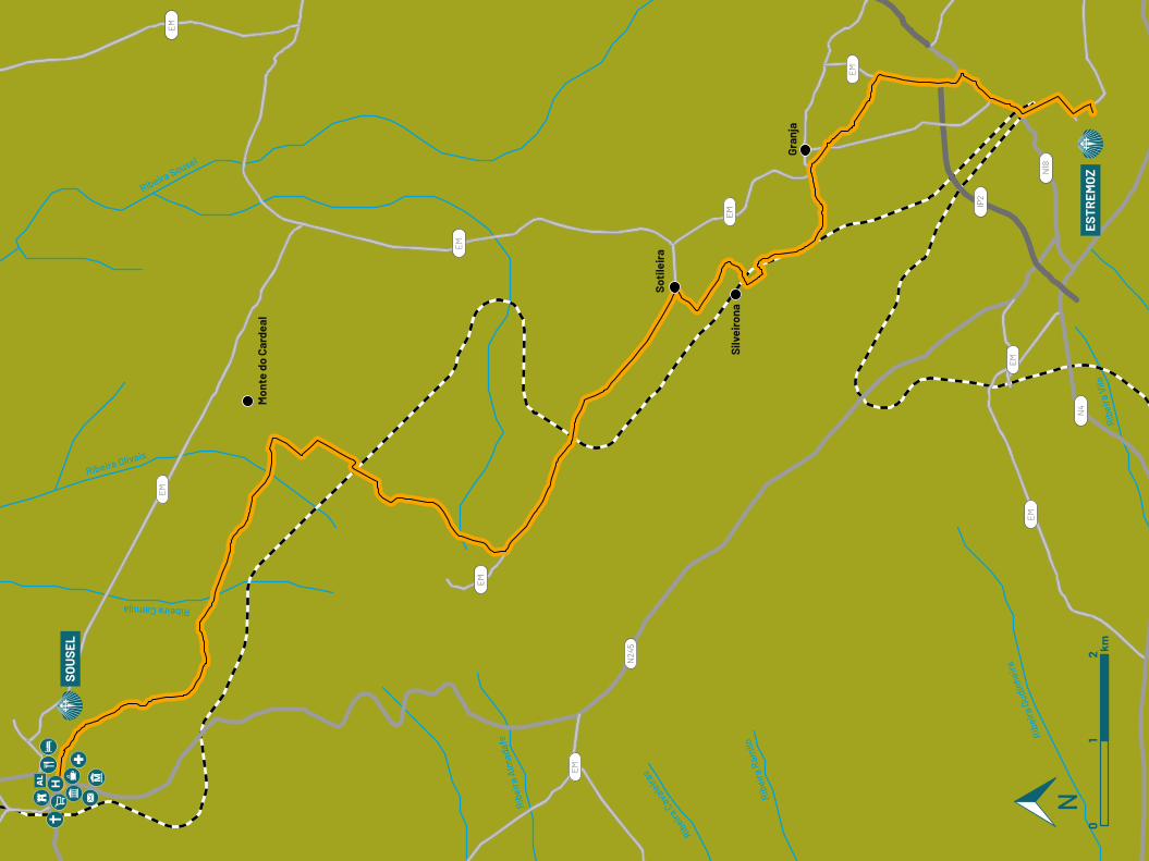
Ribeira Sousel
Ribeira Olivais
Ribeira Camuja
Ribe
ira A
lmad
afe
Ribeira
Cav
aleira
s
Ribe
ira R
amilo
Ribe
ira G
udin
heira
EM
EM
EM
EM
EM
EM
EM
EM
EM
N18
N4
IP2
N24
5
Soti
leir
a
Silv
eiro
na
Gran
ja
Mon
te d
o Ca
rdea
l
SOU
SEL
ESTR
EMO
Z
Ribe
ira V
ila0
12 km
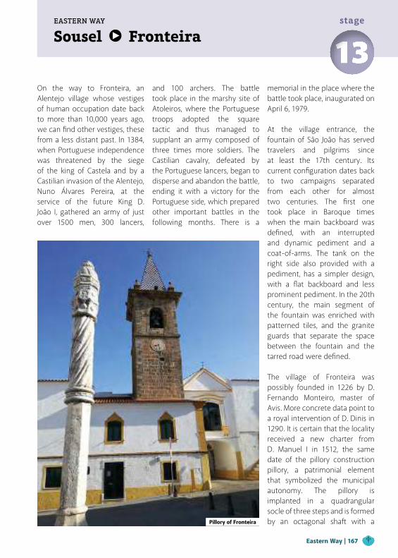
Sousel FronteiraEASTERN WAY
13stage
On the way to Fronteira, an Alentejo village whose vestiges of human occupation date back to more than 10,000 years ago, we can find other vestiges, these from a less distant past. In 1384, when Portuguese independence was threatened by the siege of the king of Castela and by a Castilian invasion of the Alentejo, Nuno Álvares Pereira, at the service of the future King D. João I, gathered an army of just over 1500 men, 300 lancers,
and 100 archers. The battle took place in the marshy site of Atoleiros, where the Portuguese troops adopted the square tactic and thus managed to supplant an army composed of three times more soldiers. The Castilian cavalry, defeated by the Portuguese lancers, began to disperse and abandon the battle, ending it with a victory for the Portuguese side, which prepared other important battles in the following months. There is a
memorial in the place where the battle took place, inaugurated on April 6, 1979.
At the village entrance, the fountain of São João has served travelers and pilgrims since at least the 17th century. Its current configuration dates back to two campaigns separated from each other for almost two centuries. The first one took place in Baroque times when the main backboard was defined, with an interrupted and dynamic pediment and a coat-of-arms. The tank on the right side also provided with a pediment, has a simpler design, with a flat backboard and less prominent pediment. In the 20th century, the main segment of the fountain was enriched with patterned tiles, and the granite guards that separate the space between the fountain and the tarred road were defined.
The village of Fronteira was possibly founded in 1226 by D. Fernando Monteiro, master of Avis. More concrete data point to a royal intervention of D. Dinis in 1290. It is certain that the locality received a new charter from D. Manuel I in 1512, the same date of the pillory construction pillory, a patrimonial element that symbolized the municipal autonomy. The pillory is implanted in a quadrangular socle of three steps and is formed by an octagonal shaft with a Pillory of Fronteira
Eastern Way | 167
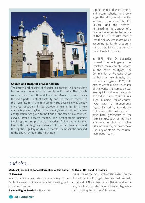
capital decorated with spheres, and a semi-spherical pine cone edge. The pillory was dismantled in 1865, by order of the City Council, and the elements remained in the custody of a private. It was only in the decade of the 30s of the 20th century that the pillory was reassembled, according to its description in the Livro do Tombo dos Bens do Concelho de Fronteira.
In 1571, King D. Sebastião ordered the enlargement of Fronteira main church, located in the castle courtyard. The Commander of Fronteira chose to build a new temple, and the works began in 1576, with master António Góis in charge of the works. The campaign was very quick and was practically finished in 1594, resulting in a large building, “salon-church” type, with a monumental façade flanked by two double bell towers. The artistic pieces date back generically to the 18th century, such as the main altarpiece, in black and white Estremoz marble, or the image of Our Lady of Atalaia, the church's main patron saint.
and also...Medieval Fair and Historical Recreation of the Battle of AtoleirosIn April, Fronteira celebrates the anniversary of the Battle of Atoleiros with a medieval fair, traveling back to the 19th century.Balloon Flights Festival − November
24 Hours Off-Road - FronteiraThis is one of the most emblematic events on the off-road circuit in Portugal. It has been held annually at the end of November, since 1998. An endurance race, which took on the national off-road big venue status, closing the season of this sport.
Church and Hospital of MisericórdiaThe church and hospital of Misericórdia constitute a particularly harmonious monumental ensemble in Fronteira. The church was completed in 1583 and, from that Mannerist period, dates the main portal, in strict austerity, and the padded corners of the main façade. In the 18th century, the ensemble was greatly enriched, especially in its devotional elements. So a new main altarpiece of gilded wood carvings was built, and a new configuration was given to the finish of the façade in a counter-curved profile already rococo. The scenographic painting involving the triumphal arch, in shades of blue and white that frames the painting from Calvary in the center, was done, and the registrars' gallery was built in marble. The hospital is annexed to the church through the north side.
168 | Eastern Way
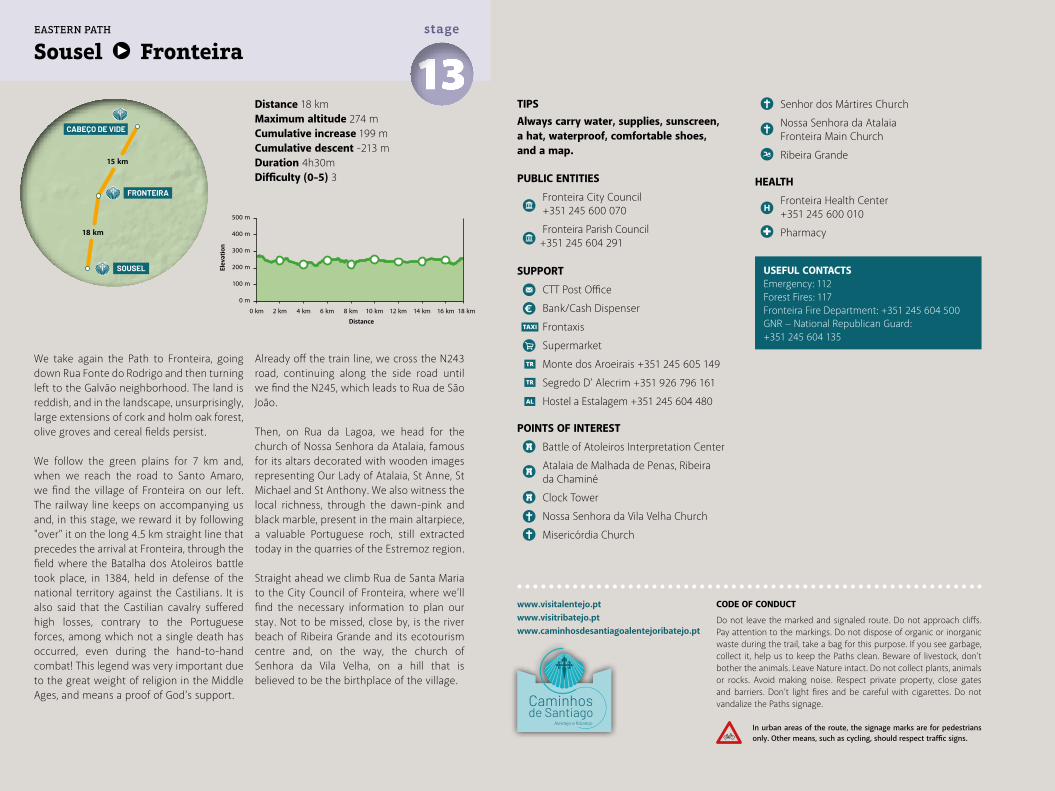
Distance 18 kmMaximum altitude 274 mCumulative increase 199 m Cumulative descent -213 mDuration 4h30mDifficulty (0-5) 3
Sousel Fronteira 13stage
www.visitalentejo.ptwww.visitribatejo.ptwww.caminhosdesantiagoalentejoribatejo.pt
We take again the Path to Fronteira, going down Rua Fonte do Rodrigo and then turning left to the Galvão neighborhood. The land is reddish, and in the landscape, unsurprisingly, large extensions of cork and holm oak forest, olive groves and cereal fields persist.
We follow the green plains for 7 km and, when we reach the road to Santo Amaro, we find the village of Fronteira on our left. The railway line keeps on accompanying us and, in this stage, we reward it by following "over" it on the long 4.5 km straight line that precedes the arrival at Fronteira, through the field where the Batalha dos Atoleiros battle took place, in 1384, held in defense of the national territory against the Castilians. It is also said that the Castilian cavalry suffered high losses, contrary to the Portuguese forces, among which not a single death has occurred, even during the hand-to-hand combat! This legend was very important due to the great weight of religion in the Middle Ages, and means a proof of God's support.
Already off the train line, we cross the N243 road, continuing along the side road until we find the N245, which leads to Rua de São João.
Then, on Rua da Lagoa, we head for the church of Nossa Senhora da Atalaia, famous for its altars decorated with wooden images representing Our Lady of Atalaia, St Anne, St Michael and St Anthony. We also witness the local richness, through the dawn-pink and black marble, present in the main altarpiece, a valuable Portuguese roch, still extracted today in the quarries of the Estremoz region.
Straight ahead we climb Rua de Santa Maria to the City Council of Fronteira, where we’ll find the necessary information to plan our stay. Not to be missed, close by, is the river beach of Ribeira Grande and its ecotourism centre and, on the way, the church of Senhora da Vila Velha, on a hill that is believed to be the birthplace of the village.
TIPSAlways carry water, supplies, sunscreen, a hat, waterproof, comfortable shoes, and a map.
PUBLIC ENTITIES
Fronteira City Council +351 245 600 070
Fronteira Parish Council +351 245 604 291
SUPPORT
CTT Post Office
Bank/Cash Dispenser
Frontaxis
Supermarket
Monte dos Aroeirais +351 245 605 149
Segredo D’ Alecrim +351 926 796 161
Hostel a Estalagem +351 245 604 480
POINTS OF INTEREST
Battle of Atoleiros Interpretation Center
Atalaia de Malhada de Penas, Ribeira da Chaminé
Clock Tower
Nossa Senhora da Vila Velha Church
Misericórdia Church
USEFUL CONTACTSEmergency: 112Forest Fires: 117Fronteira Fire Department: +351 245 604 500GNR − National Republican Guard: +351 245 604 135
Senhor dos Mártires Church
Nossa Senhora da Atalaia Fronteira Main Church
Ribeira Grande
HEALTH
Fronteira Health Center +351 245 600 010
Pharmacy500 m
400 m
300 m
200 m
100 m
0 m
0 km 2 km 4 km 6 km 8 km 10 km 12 km 14 km 16 km 18 km
SOUSEL
FRONTEIRA
CABEÇO DE VIDE
18 km
15 km
EASTERN PATH
CODE OF CONDUCT
Do not leave the marked and signaled route. Do not approach cliffs. Pay attention to the markings. Do not dispose of organic or inorganic waste during the trail, take a bag for this purpose. If you see garbage, collect it, help us to keep the Paths clean. Beware of livestock, don't bother the animals. Leave Nature intact. Do not collect plants, animals or rocks. Avoid making noise. Respect private property, close gates and barriers. Don’t light fires and be careful with cigarettes. Do not vandalize the Paths signage.
In urban areas of the route, the signage marks are for pedestrians only. Other means, such as cycling, should respect traffic signs.
Elev
atio
n
Distance
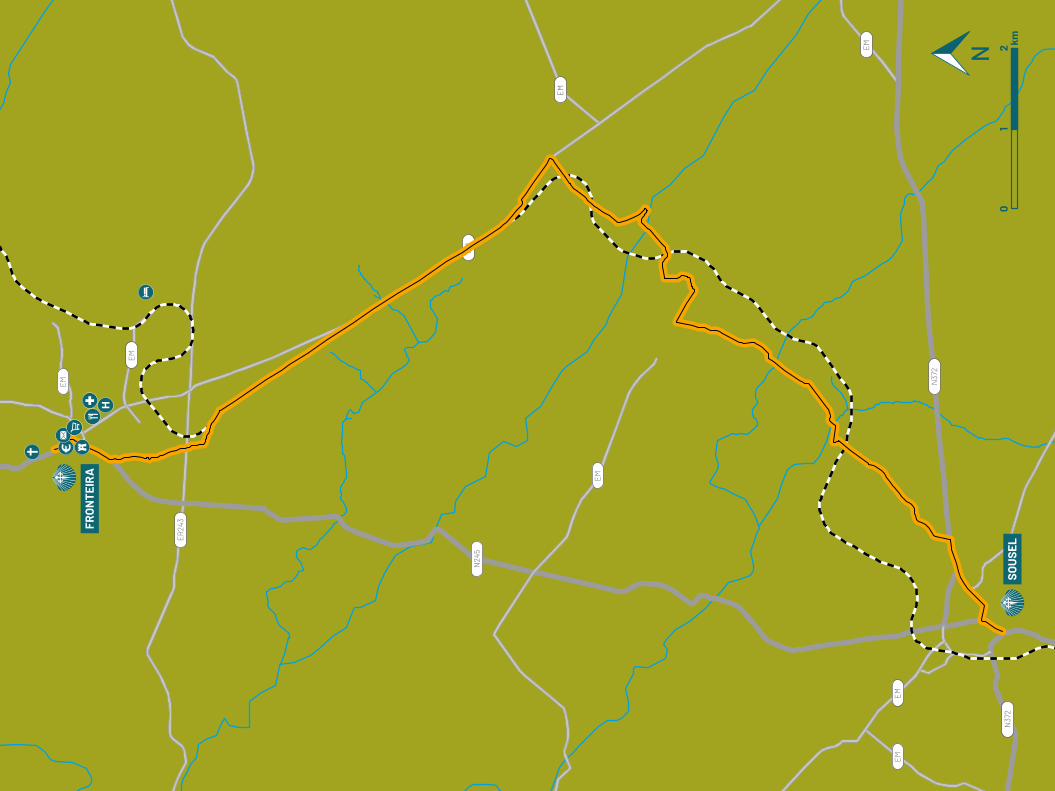
EM
EM
EM
EM
EM
EM
EM
EM
ER24
3
N24
5
N37
2
N37
2SO
USE
L
FRO
NTE
IRA
01
2 km
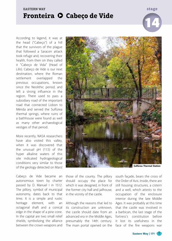
Fronteira Cabeço de VideEASTERN WAY
14stage
According to legend, it was at the head ("Cabeço") of a hill that the survivors of the plague that followed a Saracen attack took refuge and, recovering their health, from then on they called it "Cabeço de Vida" (Head of Life). Cabeço de Vide is our next destination, where the Roman settlement overlapped the previous occupations, known since the Neolithic period, and left a strong influence in the region. There used to pass a subsidiary road of the important road that connected Lisbon to Mérida and served the Sulfúrea thermal springs, where ruins of a bathhouse were found as well as many other archaeological vestiges of that period.
More recently, NASA researchers have also visited this valley, when it was discovered that the unusual pH (11.5) of the hyper alkaline waters of this site indicated hydrogeological conditions very similar to those of the geology detected on Mars!
Cabeço de Vide became an autonomous town by charter passed by D. Manuel I in 1512. The pillory, symbol of municipal autonomy, dates back to that time. It is a simple and rustic heritage element, with an octagonal shaft and a conical edge in the shape of a pine cone. In the capital are two small relief shields, symbolizing the alliance between the crown weapons and
those of the county. The pillory should occupy the place for which it was designed, in front of the former city hall and jailhouse, in the vicinity of the castle.
Although the reasons that led to its construction are unknown, the castle should date from an advanced era in the Middle Ages, presumably the 14th century. The main portal opened on the
south façade, bears the cross of the Order of Avis. Inside, there are still housing structures, a cistern and a well, which attests to the occupation of the enclosure interior during the late Middle Ages. It was probably at this time that the castle was involved in a barbican, the last stage of the fortress's constitution before it lost its usefulness in the face of the fire weapons war
Sulfúrea Thermal Station
Eastern Way | 171
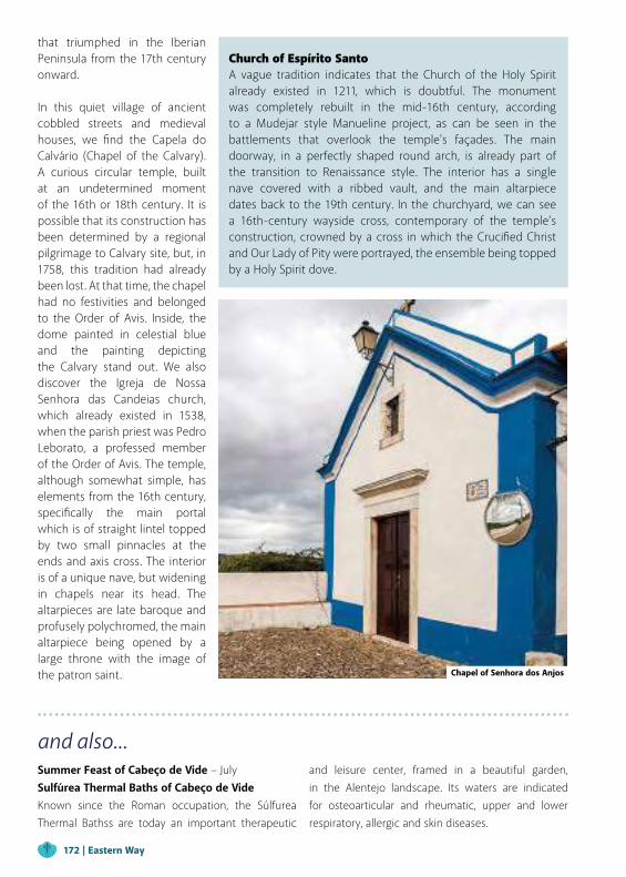
and also...Summer Feast of Cabeço de Vide − July Sulfúrea Thermal Baths of Cabeço de VideKnown since the Roman occupation, the Súlfurea Thermal Bathss are today an important therapeutic
and leisure center, framed in a beautiful garden, in the Alentejo landscape. Its waters are indicated for osteoarticular and rheumatic, upper and lower respiratory, allergic and skin diseases.
Church of Espírito SantoA vague tradition indicates that the Church of the Holy Spirit already existed in 1211, which is doubtful. The monument was completely rebuilt in the mid-16th century, according to a Mudejar style Manueline project, as can be seen in the battlements that overlook the temple's façades. The main doorway, in a perfectly shaped round arch, is already part of the transition to Renaissance style. The interior has a single nave covered with a ribbed vault, and the main altarpiece dates back to the 19th century. In the churchyard, we can see a 16th-century wayside cross, contemporary of the temple’s construction, crowned by a cross in which the Crucified Christ and Our Lady of Pity were portrayed, the ensemble being topped by a Holy Spirit dove.
that triumphed in the Iberian Peninsula from the 17th century onward.
In this quiet village of ancient cobbled streets and medieval houses, we find the Capela do Calvário (Chapel of the Calvary). A curious circular temple, built at an undetermined moment of the 16th or 18th century. It is possible that its construction has been determined by a regional pilgrimage to Calvary site, but, in 1758, this tradition had already been lost. At that time, the chapel had no festivities and belonged to the Order of Avis. Inside, the dome painted in celestial blue and the painting depicting the Calvary stand out. We also discover the Igreja de Nossa Senhora das Candeias church, which already existed in 1538, when the parish priest was Pedro Leborato, a professed member of the Order of Avis. The temple, although somewhat simple, has elements from the 16th century, specifically the main portal which is of straight lintel topped by two small pinnacles at the ends and axis cross. The interior is of a unique nave, but widening in chapels near its head. The altarpieces are late baroque and profusely polychromed, the main altarpiece being opened by a large throne with the image of the patron saint. Chapel of Senhora dos Anjos
172 | Eastern Way
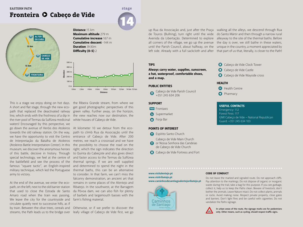
Distance 15 kmMaximum altitude 279 mCumulative increase 167 m Cumulative descent -144 mDuration 3h30mDifficulty (0-5) 2
Fronteira Cabeço de Vide 14stage
www.visitalentejo.ptwww.visitribatejo.ptwww.caminhosdesantiagoalentejoribatejo.pt
This is a stage we enjoy doing on hot days. A short and flat stage, through the new eco-path that replaced the deactivated railway line, which ends with the freshness of a dip in the river pool of Termas da Sulfúrea medicinal waters! Encouraged by this perspective, we go down the avenue of Heróis dos Atoleiros towards the old railway station. On the way, we have the opportunity to visit the Centro de Interpretação da Batalha de Atoleiros (Atoleiros Battle Interpretation Center). In this museum, we discover the anonymous heroes of this battle, decisive in history. Through special technology, we feel at the centre of the battlefield and see the process of the famous "square tactic", an English-inspired military technique, which led the Portuguese army to victory.
At the end of the avenue, we enter the eco-path, on the left, next to the old barrier station that used to close the Estrada de Santo Amaro road when the train was passing. We leave the city for the countryside and circulate quietly next to successive hills, as if by train. Between the olive trees, cereals and streams, the Path leads us to the bridge over
the Ribeira Grande stream, from where we get good photographic perspectives of this green valley. Further away, on the horizon, the view reaches now our destination, the white houses of Cabeço de Vide.
At kilometer 10 we detour from the eco-path to climb Rua da Associação until the entrance of Cabeço de Vide. After 200 metres, we reach a crossroad and we have the possibility to choose the road on the right, which the sign indicates the direction to Quinta do Cabeçote and also gives direct and faster access to the Termas da Sulfúrea thermal springs. If we are well supplied and determined to spend the night in the thermal baths, this can be an alternative to consider. In that farm, we can't miss the falconry demonstration, an ancient art that remains in some places of the Alentejo and Ribatejo. In the southwest, at the Barragem da Póvoa dam, we can also fish for plenty of barbels and largemouth basses with the farm’s fishing material.
Otherwise, or if we prefer to discover the leafy village of Cabeço de Vide first, we go
up Rua da Associação and, just after the Praça de Touros (Bullring), turn right until the wide Avenida da Libertação. Determined to explore all corners of the village, we go up the avenue until the Parish Council, about halfway, on the left side. Already with a full sackcloth and after
TIPSAlways carry water, supplies, sunscreen, a hat, waterproof, comfortable shoes, and a map.
PUBLIC ENTITIES
Cabeço de Vide Parish Council +351 245 634 206
SUPPORT
Frontaxis
Supermarket
Forja Bar
POINTS OF INTEREST
Espírito Santo Church
Cabeço de Vide Main Church or Nossa Senhora das Candeias de Cabeço de Vide Church
Cabeço de Vide Fortress and Fort
Cabeço de Vide Clock Tower
Cabeço de Vide Castle
Cabeço de Vide Wayside cross
HEALTH
Health Centre
Pharmacy
walking all the alleys, we descend through Rua do Santo Mártir and then through a narrow rural alleyway to the site of the thermal baths. Before the day is over, we still bathe in these waters, unique in the country, a moment appreciated by that part of us that, literally, is closer to the Path!
USEFUL CONTACTSEmergency: 112Forest Fires: 117GNR Cabeço de Vide − National Republican Guard: +351 245 634 103
500 m
400 m
300 m
200 m
100 m
0 m
0 km 2 km 4 km 6 km 8 km 12 km 14 km10 km 15 km
FRONTEIRA
ALTER DO CHÃO
CABEÇO DE VIDE
15 km
15 km
EASTERN PATH
CODE OF CONDUCT
Do not leave the marked and signaled route. Do not approach cliffs. Pay attention to the markings. Do not dispose of organic or inorganic waste during the trail, take a bag for this purpose. If you see garbage, collect it, help us to keep the Paths clean. Beware of livestock, don't bother the animals. Leave Nature intact. Do not collect plants, animals or rocks. Avoid making noise. Respect private property, close gates and barriers. Don’t light fires and be careful with cigarettes. Do not vandalize the Paths signage.
In urban areas of the route, the signage marks are for pedestrians only. Other means, such as cycling, should respect traffic signs.
Elev
atio
n
Distance
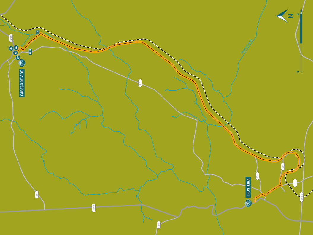
Ribeira
Gra
nde
EM
EM
EM
EM
EM
EM
N24
5
N36
9
ER24
3
CAB
EÇO
DE
VID
E
FRO
NTE
IRA
01
2 km
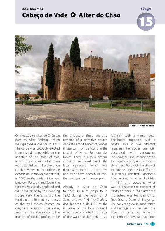
Cabeço de Vide Alter do ChãoEASTERN WAY
15stage
On the way to Alter do Chão we pass by Alter Pedroso, which was granted a charter in 1216. The castle was probably erected from that date, possibly on the initiative of the Order of Avis, in whose possessions the town was established. The evolution of the works in the following decades is unknown, except that, in 1662, in the midst of the war between Portugal and Spain, the fortress was totally depleted and was devastated by the invading troops. Very little remains of the fortification, limited to traces of the wall, which formed an originally elliptical perimeter, and the main access door to the interior, of Gothic profile. Inside
the enclosure, there are also remains of a primitive church dedicated to St Benedict, whose image can now be found in the church of Nossa Senhora das Neves. There is also a cistern, certainly medieval, and the local cemetery, which was deactivated in the 19th century, and must have been built over the medieval parish necropolis.
Already in Alter do Chão, founded as a municipality in 1232 during the reign of D. Sancho II, we find the Chafariz dos Bonecos, build 1799 by the initiative of the local Council, which also promoted the arrival of the water to the tank. It is a
fountain with a monumental backboard, tripartite, with a central axis in two different registers, the upper one well decorated with cartouches including allusive inscriptions to the construction, and a rococo style medallion, with the effigy of the prince regent D. João (future D. João VI). The first Franciscan friars arrived to Alter do Chão in 1614 and occupied what was to become the convent of Santo António in 1617, after the monastery was founded by D. Teodósio II, Duke of Bragança. The convent grew in importance and heritage and has been the object of grandiose works in the 19th century. At that time,
Castle of Alter do Chão
Eastern Way | 175
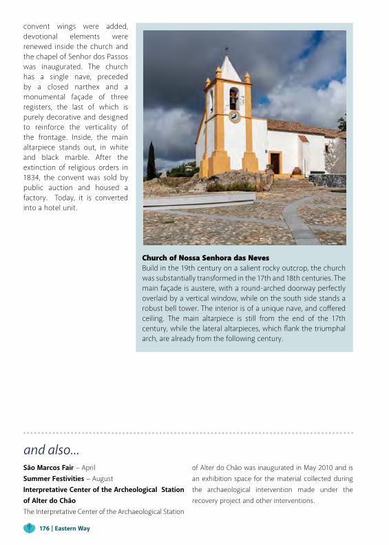
convent wings were added, devotional elements were renewed inside the church and the chapel of Senhor dos Passos was inaugurated. The church has a single nave, preceded by a closed narthex and a monumental façade of three registers, the last of which is purely decorative and designed to reinforce the verticality of the frontage. Inside, the main altarpiece stands out, in white and black marble. After the extinction of religious orders in 1834, the convent was sold by public auction and housed a factory. Today, it is converted into a hotel unit.
and also...São Marcos Fair − AprilSummer Festivities − August Interpretative Center of the Archeological Station of Alter do ChãoThe Interpretative Center of the Archaeological Station
of Alter do Chão was inaugurated in May 2010 and is an exhibition space for the material collected during the archaeological intervention made under the recovery project and other interventions.
Church of Nossa Senhora das Neves Build in the 19th century on a salient rocky outcrop, the church was substantially transformed in the 17th and 18th centuries. The main façade is austere, with a round-arched doorway perfectly overlaid by a vertical window, while on the south side stands a robust bell tower. The interior is of a unique nave, and coffered ceiling. The main altarpiece is still from the end of the 17th century, while the lateral altarpieces, which flank the triumphal arch, are already from the following century.
176 | Eastern Way

Distance 15 kmMaximum altitude 389 mCumulative increase 242 m Cumulative descent -246 mDuration 3h45mDifficulty (0-5) 3
Cabeço de Vide Alter do Chão 15stage
www.visitalentejo.ptwww.visitribatejo.ptwww.caminhosdesantiagoalentejoribatejo.pt
Today's stage is only apparently "shorter" and easier, but will be about 13 km by rougher terrains. Neither will we have any supply point, with the exception of water and toilet available in Alter Pedroso. However, it is a course with other natural nuances. We eat and sleep in Termas da Súlfurea hotsprings, at the exit of which we cross the road and turn to the left, in an asphalted street, deviating again to the left, on a dirt track.
We cross a gate that gives us access to the domains of Monte das Ferrarias estate and, straight ahead, we arrive to its facilities. We cross through the middle without reacting to some dogs and, shortly after, we leave the estate and enter the municipality of Alter do Chão. After a kilometre of stone pine forest, we turn right into a cereal field, in which the Path is barely defined. At the end, a wicket door allows us to access the next terrain and, leaning against the fence, we turn left until we cross an insignificant stream. We are walking through a scattered cork and holm oak forest, when dozens of cattle slowly move in front of us. We know they are meek... except when the females feel their young at risk! Walking
slowly, in silence and without sudden gestures is the correct posture. And, if a more curious calf comes to us, we must stop until the audacity passes. The Path now crosses a plain where we are forced to wait for the herd to let us continue, and then we go up the hill to the farm’s private road, which we cross. After passing the gate through a side wicket door, we leave the property directly to the centre of this quiet village, through Rua do Forno. We pass the church, but can't leave the village through Estrada da Fonte road without first going up to the old castle and chapel ruins.
We discover the geodesic landmark and climb, according to the sign indicating "miradouro" (viewpoint). With Alter Pedroso on our back, we start the descent through the asphalt of Estrada da Fonte but, as soon as the indicator sign is presented, we turn right to the "anta" (dolmen) of Alter Pedroso. Further on, we find the prehistoric dolmen, the hill ruins and a left-hand gate on the fence, which gives access to the road that passes on the northside of Monte dos Tapadões. Just over one kilometer more to the village, where we enter by the road next to the cemetery.
TIPSAlways carry water, supplies, sunscreen, a hat, waterproof, comfortable shoes, and a map.
PUBLIC ENTITIES
Alter do Chão City Council +351 245 619 160
Alter do Chão Parish Council +351 245 612 385
SUPPORT
Bank/Cash Dispenser
CTT Post Office
Tourism Office +351 245 610 004
Táxi
POINTS OF INTEREST
Santo António Convent Church
Senhor Jesus do Outeiro Church
São Francisco Church
Misericórdia Chapel and Hospital
Santana Chapel
Quinta do Pião Roman Village
Barreto Caldeira Square
Late Necropolis
Álamo House and Gardens
Coudelaria de Alter: Casas Altas (Stud-farm)
Seda Castle Walls’ Ruins
Heritage Club
Vila Formosa Roman Bridge
Alter Pedroso Castle Traces
Medusa House (Alter do Chão Archeological Station)
Alter do Chão Castle
HEALTH
Alter do Chão Health Center +351 245 619 160
Pharmacy
USEFUL CONTACTSEmergency: 112Forest Fires: 117Alter do Chão Fire Department: +351 245 612 314GNR − National Republican Guard: +351 245 612 162
500 m
400 m
300 m
200 m
100 m
0 m
0 km 2 km 4 km 6 km 8 km 10 km 12 km 14 km15 km
ALTER DO CHÃO
CABEÇO DE VIDE
15 km
13 km
CRATO
EASTERN PATH
CODE OF CONDUCT
Do not leave the marked and signaled route. Do not approach cliffs. Pay attention to the markings. Do not dispose of organic or inorganic waste during the trail, take a bag for this purpose. If you see garbage, collect it, help us to keep the Paths clean. Beware of livestock, don't bother the animals. Leave Nature intact. Do not collect plants, animals or rocks. Avoid making noise. Respect private property, close gates and barriers. Don’t light fires and be careful with cigarettes. Do not vandalize the Paths signage.
In urban areas of the route, the signage marks are for pedestrians only. Other means, such as cycling, should respect traffic signs.
Elev
atio
n
Distance

Ribe
ira A
lter
Ribe
ira
Sarr
azol
a
Ribeira Chaminé
Ribe
ira P
ina
EM
EM
EM
EM
EM
EM
EM
N24
5-1
EM24
5
N24
5
N36
9
Alt
er P
edro
so
Mon
te d
as F
erra
rias
ALT
ER D
O C
HÃ
O
CAB
EÇO
DE
VID
E
01
2 km
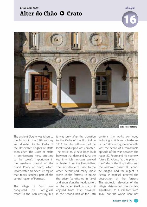
Alter do Chão CratoEASTERN WAY
16stage
The ancient Ucrate was taken to the Moors in the 12th century and donated to the Order of the Hospitaller Knights of Malta soon after. The Cross of Malta is omnipresent here, attesting to the town’s importance in the medieval period of the Grand Priory of Crato, which incorporated an extensive region that today reaches part of the central region of Portugal.
The village of Crato was conquered by Portuguese troops in the 12th century, but
it was only after the donation to the Order of the Hospital, in 1232, that the settlement of the locality and region was uprooted. The castle must have been built between that date and 1270, the year in which the town received a charter from the Hospitallers. The importance of Crato to the order determined many more works in the fortress, to house the priory (constituted in 1340) and, soon after, the headquarters of the order itself, a status it enjoyed from 1350 onwards. In the second half of the 14th
century, the works continued including a ditch and a barbican. In the 15th century, Crato's castle was the scene of a remarkable episode of the war between the regent D. Pedro and his nephew, future D. Afonso V: the prior of the Order of the Hospital housed the widowed queen D. Leonor de Aragão, and the regent D. Pedro, in reprisal, ordered the destruction of the fortress. The strategic relevance of the village determined the castle's adjustment to a star fort, from 1642, but the works were not
Grão Prior balcony
Eastern Way | 179
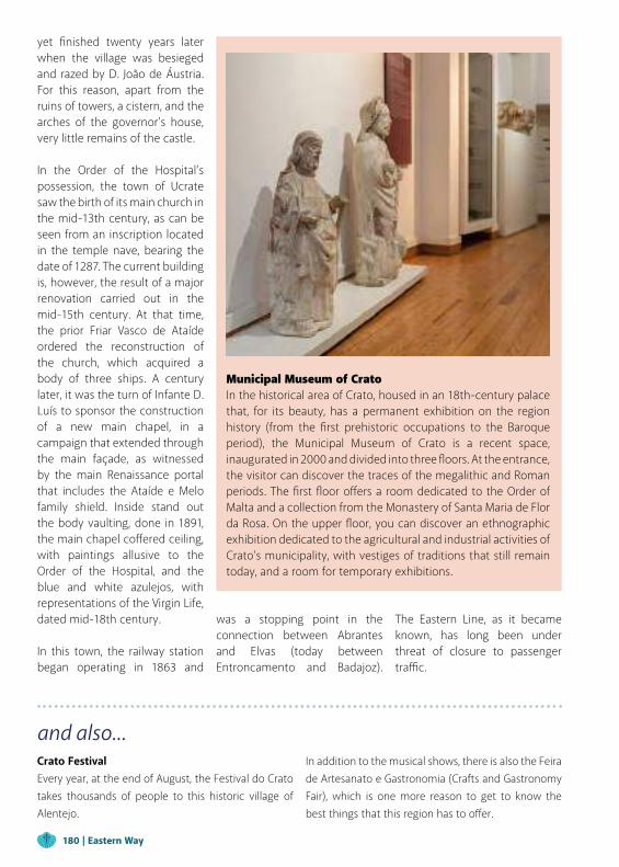
yet finished twenty years later when the village was besieged and razed by D. João de Áustria. For this reason, apart from the ruins of towers, a cistern, and the arches of the governor's house, very little remains of the castle.
In the Order of the Hospital’s possession, the town of Ucrate saw the birth of its main church in the mid-13th century, as can be seen from an inscription located in the temple nave, bearing the date of 1287. The current building is, however, the result of a major renovation carried out in the mid-15th century. At that time, the prior Friar Vasco de Ataíde ordered the reconstruction of the church, which acquired a body of three ships. A century later, it was the turn of Infante D. Luís to sponsor the construction of a new main chapel, in a campaign that extended through the main façade, as witnessed by the main Renaissance portal that includes the Ataíde e Melo family shield. Inside stand out the body vaulting, done in 1891, the main chapel coffered ceiling, with paintings allusive to the Order of the Hospital, and the blue and white azulejos, with representations of the Virgin Life, dated mid-18th century.
In this town, the railway station began operating in 1863 and
and also...Crato FestivalEvery year, at the end of August, the Festival do Crato takes thousands of people to this historic village of Alentejo.
In addition to the musical shows, there is also the Feira de Artesanato e Gastronomia (Crafts and Gastronomy Fair), which is one more reason to get to know the best things that this region has to offer.
Municipal Museum of CratoIn the historical area of Crato, housed in an 18th-century palace that, for its beauty, has a permanent exhibition on the region history (from the first prehistoric occupations to the Baroque period), the Municipal Museum of Crato is a recent space, inaugurated in 2000 and divided into three floors. At the entrance, the visitor can discover the traces of the megalithic and Roman periods. The first floor offers a room dedicated to the Order of Malta and a collection from the Monastery of Santa Maria de Flor da Rosa. On the upper floor, you can discover an ethnographic exhibition dedicated to the agricultural and industrial activities of Crato’s municipality, with vestiges of traditions that still remain today, and a room for temporary exhibitions.
was a stopping point in the connection between Abrantes and Elvas (today between Entroncamento and Badajoz).
The Eastern Line, as it became known, has long been under threat of closure to passenger traffic.
180 | Eastern Way
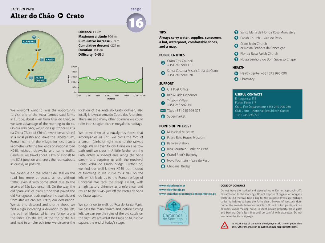
Distance 13 kmMaximum altitude 306 mCumulative increase 218 m Cumulative descent -221 mDuration 3h15mDifficulty (0-5) 2
Alter do Chão Crato 16stage
www.visitalentejo.ptwww.visitribatejo.ptwww.caminhosdesantiagoalentejoribatejo.pt
We wouldn't want to miss the opportunity to visit one of the most famous stud farms in Europe, about 4 km from Alter do Chão, so we take advantage of the morning to do so. On our way back, we enjoy a gluttonous Fatia da China ("Slice of China", sweet bread slices) in a local pastry and leave the "Abelterium", Roman name of the village, for less than a kilometre, until the trail ends on national road N245, without sidewalks and some traffic. Carefully, we travel about 2 km of asphalt to the IC13 junction and cross the roundabouts as quickly as possible.
We continue on the other side, still on the road but more at peace, almost without traffic, even if with some effort due to the ascent of São Lourenço hill. On the way, the old "parallels" of black stone that paved the old Portuguese roads replace the asphalt, and from afar we can see Crato, our destination. We start to descend and shortly ahead we find a sign indicating a deviation to the left, the path of Murtal, which we follow along the fence. On the left, at the top of the hill and next to a holm oak tree, we discover the
location of the Anta do Crato dolmen, also locally known as Anta do Couto dos Andreiros. There are also many other dolmens we could refer in this region rich in megalithic heritage.
We arrive then at a eucalyptus forest that accompanies us until we cross the ford of a stream (Linhais), right next to the railway bridge. We will then follow its line on a narrow path until we cross it. A little further on, the Path enters a shaded area along the Seda stream and surprises us with the medieval Ponte Velha do Prado bridge. Further on, we find our well-known N245 but, instead of following it, we curve to a trail on the left, which leads us to the Roman bridge of Chocanal. We face the steep ascent, with a high factory chimney as a reference, and return to the N245, just off the Portas de Seda do Crato square.
We continue to walk up Rua de Santa Maria, we pass the main church and, before turning left, we can see the ruins of the old castle on the right. We arrived at the Praça do Município square, the end of today's stage.
TIPSAlways carry water, supplies, sunscreen, a hat, waterproof, comfortable shoes, and a map.
PUBLIC ENTITIES
Crato City Council +351 245 990 110
Santa Casa da Misericórdia do Crato +351 245 990 070
SUPPORT
CTT Post Office
Bank/Cash Dispenser
Tourism Office +351 245 997 341
Táxis +351 245 996 375
Supermarket
POINTS OF INTEREST
Municipal Museum
Padre Belo House Museum
Railway Station
Bica Fountain – Vale do Peso
Grand Prior’s Balcony
Nova Fountain – Vale do Peso
Chocanal Bridge
Santa Maria de Flor da Rosa Monastery
Parish Church – Vale do Peso
Crato Main Church or Nossa Senhora da Conceição
Flor da Rosa Parish Church
Nossa Senhora do Bom Sucesso Chapel
HEALTH
Health Center +351 245 990 090
Pharmacy
USEFUL CONTACTSEmergency: 112Forest Fires: 117Crato Fire Department: +351 245 990 030GNR Crato − National Republican Guard: +351 245 996 275
500 m
400 m
300 m
200 m
100 m
0 m
0 km 2 km 4 km 6 km 8 km 10 km 12 km 13 km
ALTER DO CHÃO
13 km
19 km
CRATO
ALPALHÃO
EASTERN PATH
CODE OF CONDUCT
Do not leave the marked and signaled route. Do not approach cliffs. Pay attention to the markings. Do not dispose of organic or inorganic waste during the trail, take a bag for this purpose. If you see garbage, collect it, help us to keep the Paths clean. Beware of livestock, don't bother the animals. Leave Nature intact. Do not collect plants, animals or rocks. Avoid making noise. Respect private property, close gates and barriers. Don’t light fires and be careful with cigarettes. Do not vandalize the Paths signage.
In urban areas of the route, the signage marks are for pedestrians only. Other means, such as cycling, should respect traffic signs.
Elev
atio
n
Distance
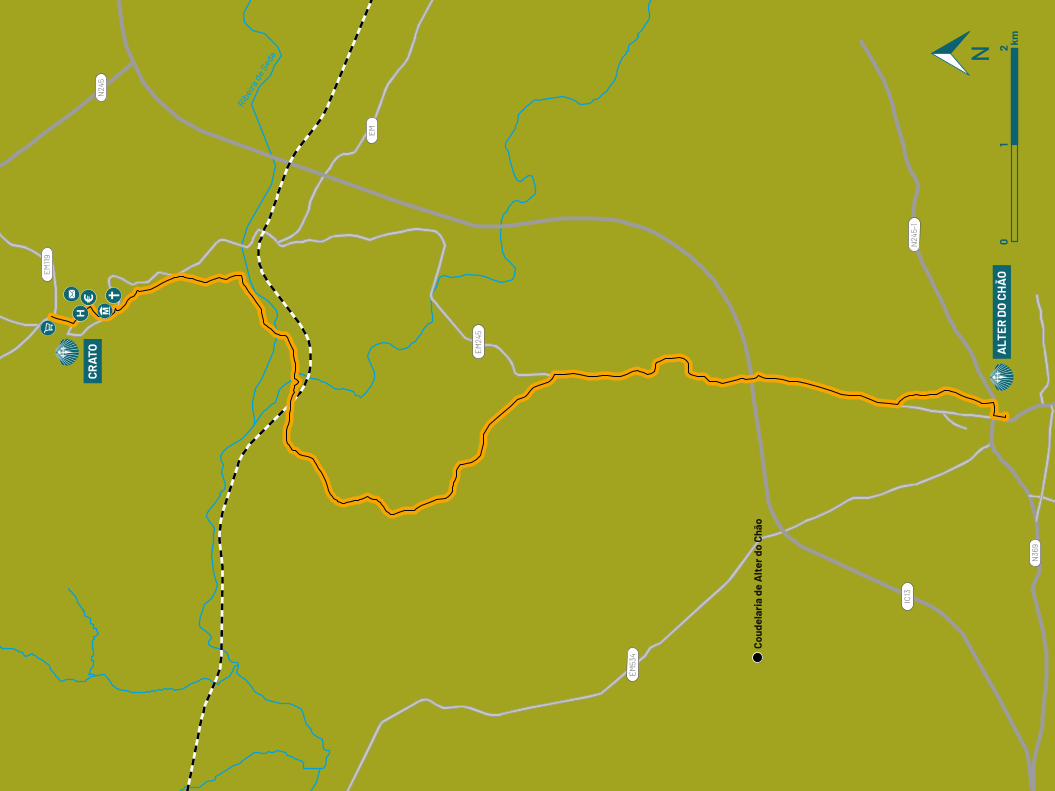
01
2 km
Ribei
ra d
e Sed
a
EM53
4
N24
5-1
EM24
5
EM
IC13
N36
9
EM119
N24
5CR
ATO ALT
ER D
O C
HÃ
O
Coud
elar
ia d
e A
lter
do
Chão
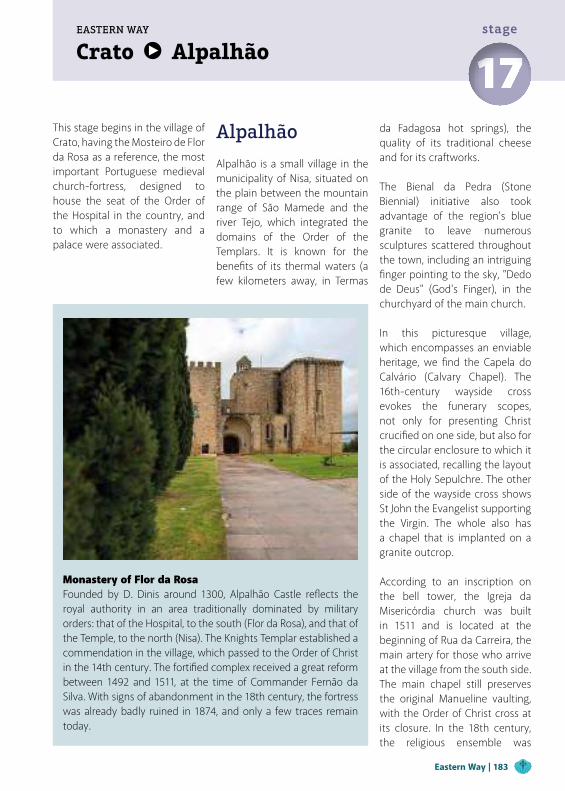
Crato AlpalhãoEASTERN WAY
17stage
This stage begins in the village of Crato, having the Mosteiro de Flor da Rosa as a reference, the most important Portuguese medieval church-fortress, designed to house the seat of the Order of the Hospital in the country, and to which a monastery and a palace were associated.
Alpalhão
Alpalhão is a small village in the municipality of Nisa, situated on the plain between the mountain range of São Mamede and the river Tejo, which integrated the domains of the Order of the Templars. It is known for the benefits of its thermal waters (a few kilometers away, in Termas
Monastery of Flor da RosaFounded by D. Dinis around 1300, Alpalhão Castle reflects the royal authority in an area traditionally dominated by military orders: that of the Hospital, to the south (Flor da Rosa), and that of the Temple, to the north (Nisa). The Knights Templar established a commendation in the village, which passed to the Order of Christ in the 14th century. The fortified complex received a great reform between 1492 and 1511, at the time of Commander Fernão da Silva. With signs of abandonment in the 18th century, the fortress was already badly ruined in 1874, and only a few traces remain today.
da Fadagosa hot springs), the quality of its traditional cheese and for its craftworks. The Bienal da Pedra (Stone Biennial) initiative also took advantage of the region's blue granite to leave numerous sculptures scattered throughout the town, including an intriguing finger pointing to the sky, "Dedo de Deus" (God's Finger), in the churchyard of the main church.
In this picturesque village, which encompasses an enviable heritage, we find the Capela do Calvário (Calvary Chapel). The 16th-century wayside cross evokes the funerary scopes, not only for presenting Christ crucified on one side, but also for the circular enclosure to which it is associated, recalling the layout of the Holy Sepulchre. The other side of the wayside cross shows St John the Evangelist supporting the Virgin. The whole also has a chapel that is implanted on a granite outcrop. According to an inscription on the bell tower, the Igreja da Misericórdia church was built in 1511 and is located at the beginning of Rua da Carreira, the main artery for those who arrive at the village from the south side. The main chapel still preserves the original Manueline vaulting, with the Order of Christ cross at its closure. In the 18th century, the religious ensemble was
Eastern Way | 183
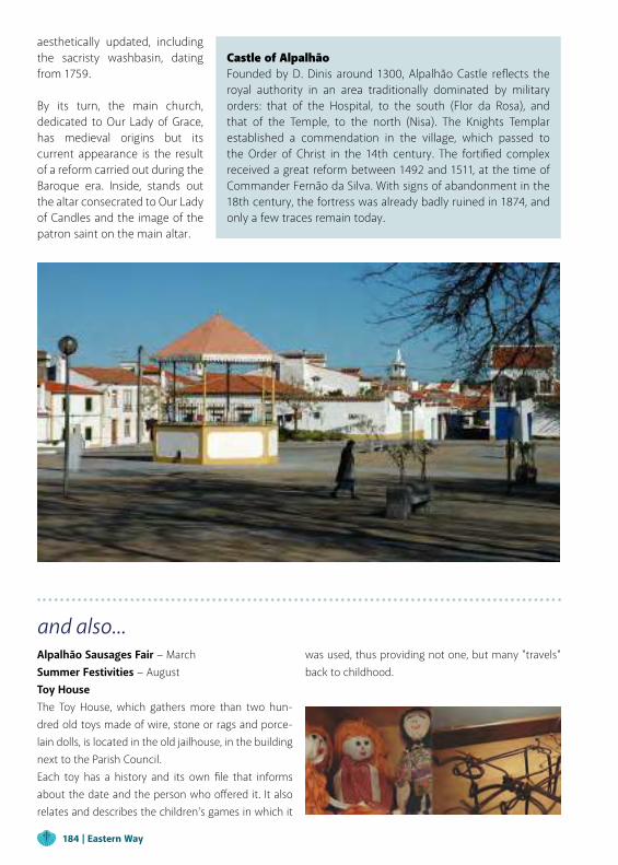
was used, thus providing not one, but many "travels" back to childhood.
Castle of AlpalhãoFounded by D. Dinis around 1300, Alpalhão Castle reflects the royal authority in an area traditionally dominated by military orders: that of the Hospital, to the south (Flor da Rosa), and that of the Temple, to the north (Nisa). The Knights Templar established a commendation in the village, which passed to the Order of Christ in the 14th century. The fortified complex received a great reform between 1492 and 1511, at the time of Commander Fernão da Silva. With signs of abandonment in the 18th century, the fortress was already badly ruined in 1874, and only a few traces remain today.
aesthetically updated, including the sacristy washbasin, dating from 1759.
By its turn, the main church, dedicated to Our Lady of Grace, has medieval origins but its current appearance is the result of a reform carried out during the Baroque era. Inside, stands out the altar consecrated to Our Lady of Candles and the image of the patron saint on the main altar.
and also...Alpalhão Sausages Fair − MarchSummer Festivities − AugustToy HouseThe Toy House, which gathers more than two hun-dred old toys made of wire, stone or rags and porce-lain dolls, is located in the old jailhouse, in the building next to the Parish Council.Each toy has a history and its own file that informs about the date and the person who offered it. It also relates and describes the children's games in which it
184 | Eastern Way
Figueiró Stream
Sor Stream
Vereda da Sardinheira (Footpath)
HEALTH
Alpalhão Health Extension +351 245 742 121
Pharmacy
We leave Crato by road towards Flor da Rosa, but the history of the “Santo Condestável” (Constable Saint) curses us... Turning to a trail within walls, the Path opens in the wide main square of the village, passing the Main Church (with a replica of its sword on the frontispiece) and facing the imposing Mosteiro of Santa Maria de Flor da Rosa monastery, which is now converted into an excellent Pousada hotel. It is worth taking some time to discover the most important fortress-church in Portugal and enjoy a coffee on the comfortable terrace of the hotel's garden, in case you haven't spent the night there.
We continue the Path accompanied by an extensive bucolic and rural landscape, crossed at some point by a seasonal stream that is overpassed through a rustic pedestrian bridge of very old construction. From there to Vale do Peso the walk is quiet, where the fields alternate with woods of pine and eucalyptus. In this village, take the opportunity to rest, visit Casa do Peso and stock up, as you won't have another opportunity until Alpalhão. After Fonte da Bica, the Path becomes more solitary, crossing the national road and the
railway line as the only distinct references from the surrounding forests, until you find the Ribeira de Sôr stream, which marks the entrance to Nisa municipality. Not far from Alpalhão, we cool off at Fonte da Feteira, a fountain adorned with the scallop identifying the Path, which is confirmed just ahead with the first red sign indicating the GR 40 “Caminho português Interior de Santiago – Etapa de Nisa” ("Portuguese Inner Path of Santiago - Nisa Stage").
We enter Alpalhão through Rua da Carreira (Carreira meaning path, from Santiago in this case), ending at Largo de Santiago. Here we find the Igreja do Espírito Santo church, also called da Misericórdia, whose interior has an image of the Apostle, which everything indicates to be that of "Santiago Peregrino do Manto" (St James Pilgrim of the Cloak).
From here we continue to the Igreja Matriz (Main Church) and at the end of our stage, through streets of typical Alentejo whitewashed houses , cheered by colorful bands that frame the windows and doors, in a rural or manorial style.
Distance 19 kmMaximum altitude 349 mCumulative increase 238 m Cumulative descent -183 mDuration 4h45mDifficulty (0-5) 3
Crato Alpalhão 17stage
TIPSAlways carry water, supplies, sunscreen, a hat, waterproof, comfortable shoes, and a map.
PUBLIC ENTITIES
Alpalhão Parish Council +351 245 742 154
SUPPORT
CTT Post Office
Nisa Taxi Rank +351 245 412 186
POINTS OF INTEREST
São Pedro Chapel
São Sebastião Chapel
Alpalhão Wayside Cross
Calvário Chapel
Nossa Senhora do Bom Despacho Chapel
Nossa Senhora de Redonda Chapel
Main Church
House Museum
Feteira Fountain
Nova Fountain
Baixo Fountain
Clock Tower
USEFUL CONTACTSEmergency: 112Forest Fires: 117Nisa Fire Department: +351 245 412 303GNR − National Republican Guard: +351 245 742 225
www.visitalentejo.ptwww.visitribatejo.ptwww.caminhosdesantiagoalentejoribatejo.pt
500 m
400 m
300 m
200 m
100 m
0 m
0 km 2 km 4 km 6 km 8 km 10 km 12 km 14 km 16 km 18 km 19 km
19 km
14 km
CRATO
NISA
ALPALHÃO
EASTERN PATH
CODE OF CONDUCT
Do not leave the marked and signaled route. Do not approach cliffs. Pay attention to the markings. Do not dispose of organic or inorganic waste during the trail, take a bag for this purpose. If you see garbage, collect it, help us to keep the Paths clean. Beware of livestock, don't bother the animals. Leave Nature intact. Do not collect plants, animals or rocks. Avoid making noise. Respect private property, close gates and barriers. Don’t light fires and be careful with cigarettes. Do not vandalize the Paths signage.
In urban areas of the route, the signage marks are for pedestrians only. Other means, such as cycling, should respect traffic signs.
Elev
atio
n
Distance
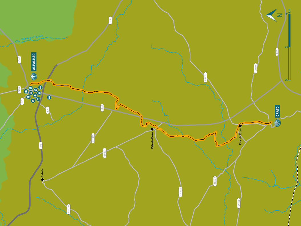
Ribeira de Figueiró
EM
EM
IP2
N24
6ER18
N18
N24
5
IC13
EM10
20
EM10
21
EM53
3
EM52
3-1
EM36
3
EM119
EM10
23
CM10
22
ALP
ALH
ÃO
CRAT
O
Flor
da
Rosa
Vale
do
Peso
Gafe
te
02
4 km
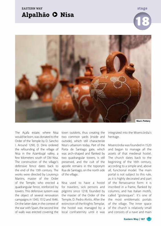
Alpalhão NisaEASTERN WAY
18stage
The Açafa estate, where Nisa would be born, was donated to the Order of the Temple by D. Sancho I. Around 1290, D. Dinis ordered the refounding of the village of Nisa in the Azambujal valley, a few kilometers south of Old Nisa. The construction of the village's defensive fence dates back to the end of the 13th century. The works were directed by Lourenço Martins, master of the Order of the Temple, who erected a quadrangular fence, reinforced by towers. This defensive system was the object of several renovation campaigns in 1343, 1512 and 1646. On the latter date, in the context of the war with Spain, the second line of walls was erected covering the
town outskirts, thus creating the two common yards (inside and outside), which still characterize Nisa's urbanism today. Part of the Porta de Santiago gate, which was arch-shaped and flanked by two quadrangular towers, is still preserved, and the cult of the apostle remains in the toponym Rua de Santiago, on the north side of the village. Nisa used to have a hostel for travelers, sick persons and pilgrims since 1218, founded by the master of the Order of the Temple, D. Pedro Alvitis. After the extinction of the Knights Templar, the hostel was managed by a local confraternity until it was
integrated into the Misericórdia’s heritage.
Misericórdia was founded in 1520 and began to manage all the assets of that medieval hostel. The church dates back to the beginning of the 16th century, according to a simple and, above all, functional model. The main portal is not subject to this rule, as it is highly decorated and part of the Renaissance form: it is inscribed in a frame, flanked by columns, and has Italian motifs, called "grotesques". It’s one of the most emblematic portals of the village. The inner space of the church is relatively small and consists of a nave and main
Nisa's Pottery
Eastern Way | 187
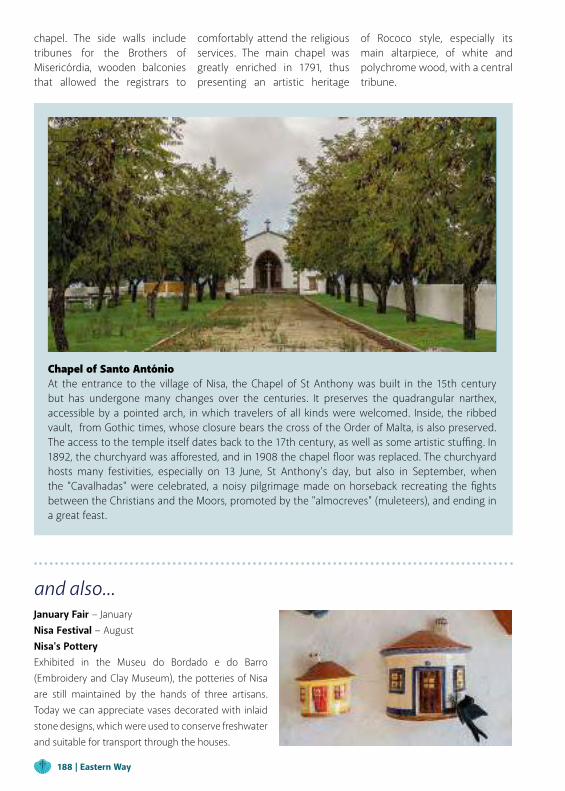
Chapel of Santo AntónioAt the entrance to the village of Nisa, the Chapel of St Anthony was built in the 15th century but has undergone many changes over the centuries. It preserves the quadrangular narthex, accessible by a pointed arch, in which travelers of all kinds were welcomed. Inside, the ribbed vault, from Gothic times, whose closure bears the cross of the Order of Malta, is also preserved. The access to the temple itself dates back to the 17th century, as well as some artistic stuffing. In 1892, the churchyard was afforested, and in 1908 the chapel floor was replaced. The churchyard hosts many festivities, especially on 13 June, St Anthony’s day, but also in September, when the "Cavalhadas" were celebrated, a noisy pilgrimage made on horseback recreating the fights between the Christians and the Moors, promoted by the "almocreves" (muleteers), and ending in a great feast.
and also...January Fair − JanuaryNisa Festival − AugustNisa's PotteryExhibited in the Museu do Bordado e do Barro (Embroidery and Clay Museum), the potteries of Nisa are still maintained by the hands of three artisans. Today we can appreciate vases decorated with inlaid stone designs, which were used to conserve freshwater and suitable for transport through the houses.
chapel. The side walls include tribunes for the Brothers of Misericórdia, wooden balconies that allowed the registrars to
comfortably attend the religious services. The main chapel was greatly enriched in 1791, thus presenting an artistic heritage
of Rococo style, especially its main altarpiece, of white and polychrome wood, with a central tribune.
188 | Eastern Way
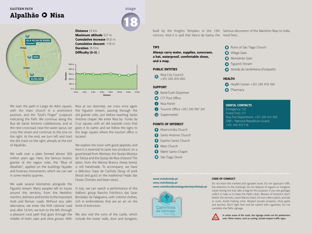
Distance 14 kmMaximum altitude 327 mCumulative increase 95,6 m Cumulative descent -118 mDuration 3h15mDifficulty (0-5) 2
Alpalhão Nisa 18stage
www.visitalentejo.ptwww.visitribatejo.ptwww.caminhosdesantiagoalentejoribatejo.pt
We start the path in Largo do Adro square, with the main church in a prominent position, and the “God’s Finger” sculpture indicating the Path. We continue along the Rua de Santo António cobblestone, and at the next crossroad, near the water spout, we cross the street and continue to the one on the right. At the end, we turn left and start the dirt track on the right, already at the exit of Alpalhão.
We walk over a plain formed almost 300 million years ago. Here, the famous biotitic granite of the region rules, the “Blue of Alpalhão", applied on the buildings façades and funerary monuments, which we can see in some nearby quarries.
We walk several kilometres alongside the Figueiró stream. Many peoples left its traces around this territory, from the Neolithic menhirs, dolmens and tombs to the important Arab and Roman roads. Without any safer alternative, we enter the N18 national road and, after 1.6 km, we turn to the left, through a pleasant rural path that goes through the middle of holm oaks and olive groves. With
Nisa at our doorstep, we cross once again the Figueiró stream, passing through the old granite colts, just before reaching Santo António chapel. We enter Nisa by Fonte da Cruz square, with an old wayside cross that gives it its name, and we follow the signs to the large square where the tourism office is located.
We explore the town with good appetite, and here it is essential to taste two products on a good bread from Alentejo: the Queijo Mestiço de Tolosa and the Queijo de Nisa cheeses! The latter, from the Merina Branca sheep breed, is still handmade. To accompany, we have a delicious Sopa de Cachola (Soup of pork blood and guts) or the traditional Feijão das Festas (Tomato and bean stew).
In July, we can watch a performance of the folkloric group Rancho Folclórico das Saias Bordadas da Falagueira, with colorful clothes, rich in embroideries that are an art on the brink of extinction.
We also visit the ruins of the castle, which include the tower walls, door and dungeon,
TIPSAlways carry water, supplies, sunscreen, a hat, waterproof, comfortable shoes, and a map.
PUBLIC ENTITIES
Nisa City Council +351 245 410 000
SUPPORT
Bank/Cash Dispenser
CTT Post Office
Nisa Parish
Tourism Office +351 245 997 341
Supermarket
POINTS OF INTEREST
Misericórdia Church
Santo António Church
Espírito Santo Church
Main Church
Mártir Santo Chapel
São Tiago Street
Ruins of São Tiago Church
Village Gate
Montalvão Gate
Figueiró Stream
Vereda da Sardinheira (Footpath)
HEALTH
Health Center +351 245 410 160
Pharmacy
USEFUL CONTACTSEmergency: 112Forest Fires: 117Nisa Fire Department: +351 245 412 303GNR − National Republican Guard: +351 245 410 116
500 m
400 m
300 m
200 m
100 m
0 m
0 km 2 km 4 km 10 km 12 km6 km 8 km 14 km
14 km
19 km
NISA
VILA VELHA DE RODÃO(Center)
ALPALHÃO
EASTERN PATH
CODE OF CONDUCT
Do not leave the marked and signaled route. Do not approach cliffs. Pay attention to the markings. Do not dispose of organic or inorganic waste during the trail, take a bag for this purpose. If you see garbage, collect it, help us to keep the Paths clean. Beware of livestock, don't bother the animals. Leave Nature intact. Do not collect plants, animals or rocks. Avoid making noise. Respect private property, close gates and barriers. Don’t light fires and be careful with cigarettes. Do not vandalize the Paths signage.
In urban areas of the route, the signage marks are for pedestrians only. Other means, such as cycling, should respect traffic signs.
Elev
atio
n
Distance
built by the Knights Templars in the 13th century. And it is said that Vasco da Gama, the
famous discoverer of the Maritime Way to India, lived here...
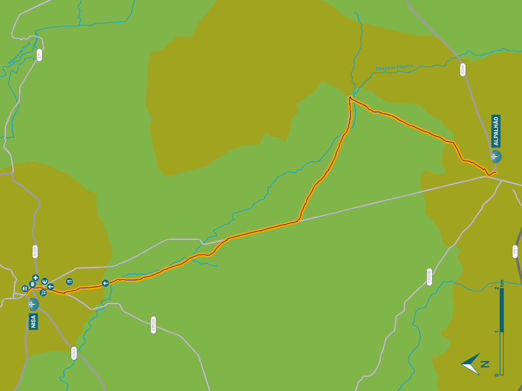
Ribeira de FigueiróRibeira de N
isa
EM
IP2
N35
9
N35
9
N24
6
EM1176
EM52
9
NIS
A
ALP
ALH
ÃO
01
2 km
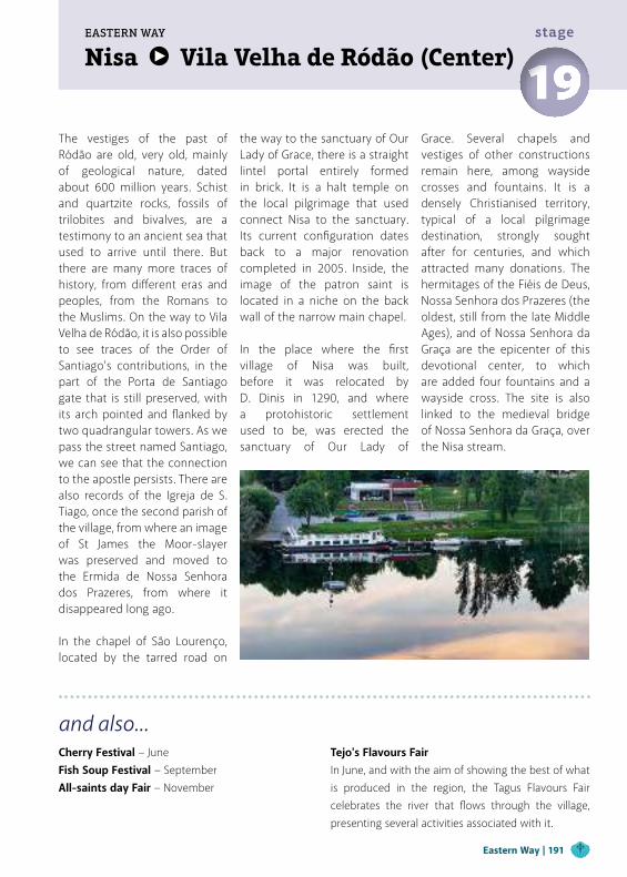
Nisa Vila Velha de Ródão (Center)EASTERN WAY
19stage
The vestiges of the past of Ródão are old, very old, mainly of geological nature, dated about 600 million years. Schist and quartzite rocks, fossils of trilobites and bivalves, are a testimony to an ancient sea that used to arrive until there. But there are many more traces of history, from different eras and peoples, from the Romans to the Muslims. On the way to Vila Velha de Ródão, it is also possible to see traces of the Order of Santiago’s contributions, in the part of the Porta de Santiago gate that is still preserved, with its arch pointed and flanked by two quadrangular towers. As we pass the street named Santiago, we can see that the connection to the apostle persists. There are also records of the Igreja de S. Tiago, once the second parish of the village, from where an image of St James the Moor-slayer was preserved and moved to the Ermida de Nossa Senhora dos Prazeres, from where it disappeared long ago.
In the chapel of São Lourenço, located by the tarred road on
the way to the sanctuary of Our Lady of Grace, there is a straight lintel portal entirely formed in brick. It is a halt temple on the local pilgrimage that used connect Nisa to the sanctuary. Its current configuration dates back to a major renovation completed in 2005. Inside, the image of the patron saint is located in a niche on the back wall of the narrow main chapel. In the place where the first village of Nisa was built, before it was relocated by D. Dinis in 1290, and where a protohistoric settlement used to be, was erected the sanctuary of Our Lady of
Grace. Several chapels and vestiges of other constructions remain here, among wayside crosses and fountains. It is a densely Christianised territory, typical of a local pilgrimage destination, strongly sought after for centuries, and which attracted many donations. The hermitages of the Fiéis de Deus, Nossa Senhora dos Prazeres (the oldest, still from the late Middle Ages), and of Nossa Senhora da Graça are the epicenter of this devotional center, to which are added four fountains and a wayside cross. The site is also linked to the medieval bridge of Nossa Senhora da Graça, over the Nisa stream.
Tejo's Flavours FairIn June, and with the aim of showing the best of what is produced in the region, the Tagus Flavours Fair celebrates the river that flows through the village, presenting several activities associated with it.
and also...Cherry Festival − June Fish Soup Festival − SeptemberAll-saints day Fair − November
Eastern Way | 191
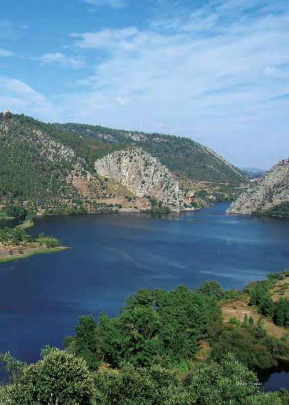
Credits: Pimpão
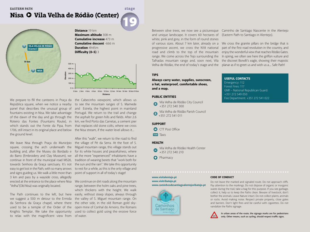
Distance 19 kmMaximum altitude 308 mCumulative increase 473 m Cumulative descent -666 mDuration 4h45mDifficulty (0-5) 3
Nisa Vila Velha de Ródão (Center) 19stage
www.visitalentejo.ptwww.visitribatejo.ptwww.caminhosdesantiagoalentejoribatejo.pt
We prepare to fill the canteens in Praça da República square, when we notice a nearby panel that describes the unusual group of fountains existing in Nisa. We take advantage of the dawn of the day and go through the Roteiro das Fontes (Fountains Route), in which stands out the Fonte da Pipa, from 1706, still intact in its original place and below the ground level.
We leave Nisa through Praça do Município square, crossing the arch underneath the building and, after the Museu do Bordado e do Barro (Embroidery and Clay Museum), we continue in front of the municipal road M526, towards Senhora da Graça sanctuary. It’s not easy to get lost in the Path, with so many arrows and signs guiding us. We walk a little more than 3 km and pass by a wayside cross, allegedly erected at the entrance to the place where Nisa "Velha"(Old Nisa) was originally located.
The Path continues to the left, but here we suggest a 500 m detour to the Ermida da Senhora da Graça chapel, where there used to be a temple of the Order of the Knights Templar. We take the opportunity to relax with the magnificent view from
the Cabecinho viewpoint, which allows us to see the mountain ranges of S. Mamede and Estrela, the highest point in mainland Portugal. We return to the trail and change the asphalt for green hills and fields. After 2.6 km, we find Porto das Carretas, a cement pier that replaces old stone colts, where we cross the Nisa stream, if the water level allows it...
After this "walk", we return to the road to find the village of Pé da Serra. At the foot of S. Miguel mountain range, this village stands out for its white houses and peacefulness, where all the more "experienced" inhabitants have a tradition of wearing berets that "work both for the sun and the rain". We take this opportunity to rest for a while, as this is the only village and point of support in all of today's stage!
We continue on dirt roads along the mountain range, between the holm oaks and pine trees, which thickens with the height. We walk easily, without steep slopes, always through the valley of S. Miguel mountain range. On the other side, in the old Roman gold sky-open mine of Conhal do Arneiro, the Romans used to collect gold using the erosive force of water.
TIPSAlways carry water, supplies, sunscreen, a hat, waterproof, comfortable shoes, and a map.
PUBLIC ENTITIES
Vila Velha de Ródão City Council +351 272 540 300
Vila Velha de Ródão Parish Council +351 272 541 011
SUPPORT
CTT Post Office
Táxis
HEALTH
Vila Velha de Ródão Health Center +351 272 540 210
Pharmacy
USEFUL CONTACTSEmergency: 112Forest Fires: 117GNR − National Republican Guard: +351 272 549 050Fire Department: +351 272 541 022
Between olive trees, we now see a picturesque and unique landscape. It covers 60 hectares of white, pink and grey, in the form of round stones of various sizes. About 7 km later, already on a progressive ascent, we cross the N18 national road and climb to the top of the mountain range. We come across the Tejo surrounding the Talhadas mountain range and, soon next, Vila Velha de Ródão, the end of today's stage and the
Caminho de Santiago Nascente in the Alentejo (Eastern Path to Santiago in Alentejo).
We cross the granite pillars on the bridge that is part of the first road revolution in the country, and enjoy the wonderful view that reaches Ródão Gates. In spring, we often see here the griffon vulture and the discreet Bonelli's eagle, showing their majestic planar as if to greet us and wish us a.... Safe Path!500 m
400 m
300 m
200 m
100 m
0 m
0 km 2 km 4 km 6 km 8 km 10 km 16 km14 km12 km 18 km19 km
19 km
NISA
VILA VELHA DE RÓDÃO(Center)
EASTERN PATH
CODE OF CONDUCT
Do not leave the marked and signaled route. Do not approach cliffs. Pay attention to the markings. Do not dispose of organic or inorganic waste during the trail, take a bag for this purpose. If you see garbage, collect it, help us to keep the Paths clean. Beware of livestock, don't bother the animals. Leave Nature intact. Do not collect plants, animals or rocks. Avoid making noise. Respect private property, close gates and barriers. Don’t light fires and be careful with cigarettes. Do not vandalize the Paths signage.
In urban areas of the route, the signage marks are for pedestrians only. Other means, such as cycling, should respect traffic signs.
Elev
atio
n
Distance
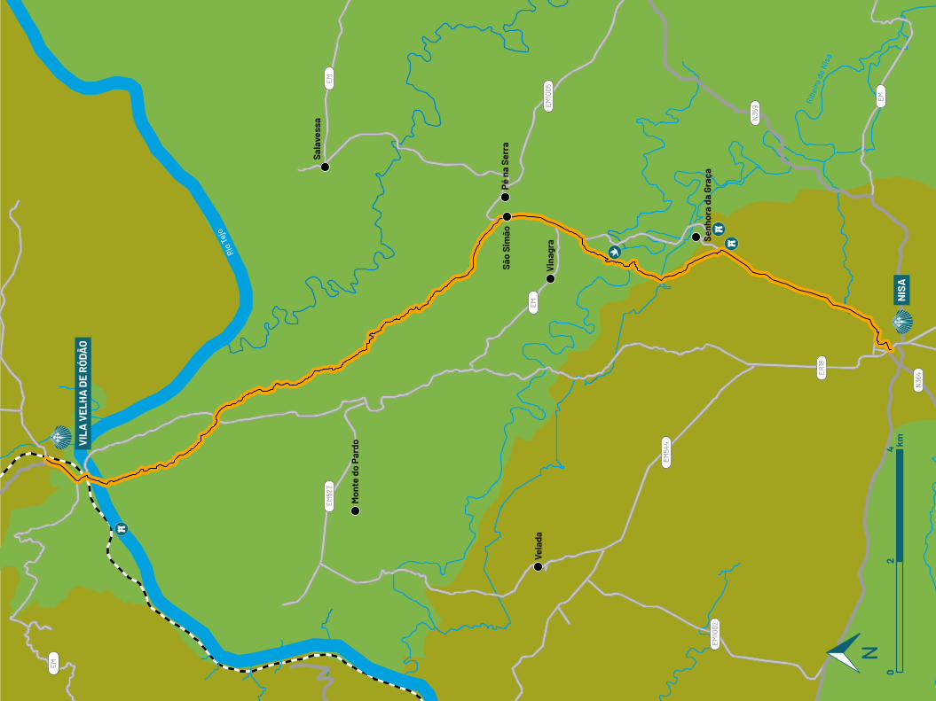
Ribe
ira d
e N
isa
EM
EM
EM
EM
N36
4
N35
9
ER18
EM10
02
EM54
4
EM10
05
EM52
7
Mon
te d
o Pa
rdo
Vela
da
Senh
ora
da G
raça
Vin
agra
Sala
vess
a
Pé n
a Se
rra
São
Sim
ão
VIL
A V
ELH
A D
E R
ÓDÃ
O
NIS
A0
24 km
Rio
Tejo
UNIÃO EUROPEIA
Fundo Europeude Desenvolvimento Regional
Alentejo e Ribatejo
Co-financed by: