HARMONIZAÇÃO DE DADOS: CARTOGRAFIA GEOLÓGICA · 2019-06-29 · • Permitir incorporar entidades...
13
HARMONIZAÇÃO DE DADOS: CARTOGRAFIA GEOLÓGICA Aurete Pereira DGT, 17 dezembro 2015
Transcript of HARMONIZAÇÃO DE DADOS: CARTOGRAFIA GEOLÓGICA · 2019-06-29 · • Permitir incorporar entidades...

HARMONIZAÇÃO DE DADOS: CARTOGRAFIA GEOLÓGICA
Aurete PereiraDGT, 17 dezembro 2015

Conteúdos
• Enquadramento• Objetivo• INSPIRE‐GE• Geodatabase• Harmonização semântica• Resultados• Desenvolvimentos futuros
2
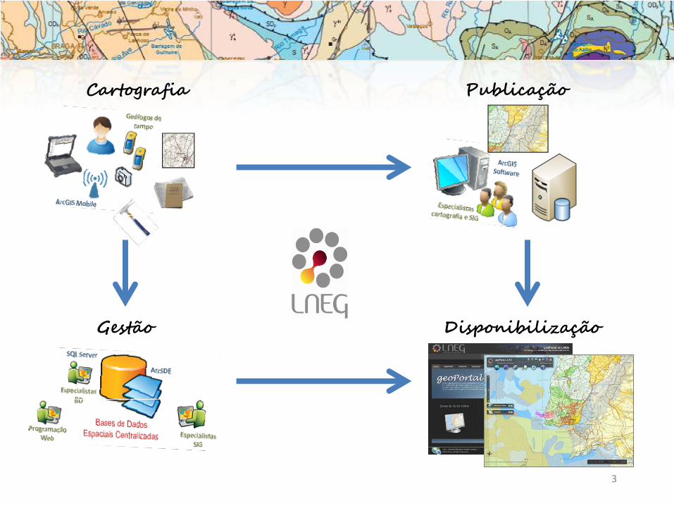
3
PublicaçãoCartografia
Gestão Disponibilização

Implementação do modelo de dados INSPIRE‐GE àcartografia geológica produzida no LNEG.
Objectivo
4
Presenter
Presentation Notes

Requisitos
5
• Permitir incorporar entidades relativas a outros temasnecessários à produção de cartografia geológica de basee temática;
• Suportar o SIG utilizado na produção de cartasgeológicas.

6
+ AnthropogenicGeomorphologicFeature+ AnthropogenicGeomorphologicFeatureTypeValue+ Borehole+ BoreholePurposeValue+ CollectionTypeValue+ CompositionPart+ CompositionPartRoleValue+ EventEnvironmentValue+ EventProcessValue+ FaultTypeValue+ Fold+ FoldProfileTypeValue+ GeneralTimeScaleValue+ GeochronologicEraValue+ GeologicCollection+ GeologicEvent+ GeologicFeature+ GeologicStructure+ GeologicUnit+ GeologicUnitTypeValue+ GeomorphologicActivityValue+ GeomorphologicFeature+ LithologyValue+ MappedFeature+ MappedInterval+ MappingFrameValue+ NaturalGeomorphologicFeature+ NaturalGeomorphologicFeatureTypeValue+ QuaternaryTimeScaleValue+ ShearDisplacementStructure+ ThematicClass
INSPIRE ‐ GE
Presenter
Presentation Notes

7
D2.8.II.4 INSPIRE Data Specification on Geology – Technical Guidelines(Inspire TWG Geology, 2013).
GeologicEvent
«voidable»+ name+ eventEnvironment+ eventProcess [1..*]+ olderNamedAge+ youngerNamedAge
GeologicFeature+ inspireId«voidable»+ name
GeologicUnit+ geologicUnitType
CompositionPart+ material+ role«voidable»+ proportion
MappedFeature+ shape+ mappingFrame
GeologicStructure
ShearDisplacementStructure
+ faultType
Fold
«voidable»+ profileType
GeomorphologicFeature
AnthropogenicGeomorphologicFeature+ anthropogenicGeomorphologicFeatureType
NaturalGeomorphologicFeature+ naturalGeomorphologicFeatureType«voidable»+ activity [0..1]
AnthropogenicGeomorphologicFeatureTypeValueCompositionPartRoleValue FaultTypeValue FoldProfileTypeValue
NaturalGeomorphologicFeatureTypeValue
+geologicHistory«voidable»
1..*
*
+specification
1
+composition«voidable» 1..*
INSPIRE ‐ GE

Geodatabase
«ObjectClass»GeologicUnit
«Field»+ geologicUnitType: esriFieldTypeString+ purpose: DescriptionPurposeValue+ name: esriFieldTypeString+ unitRuleId: esriFieldTypeInteger
«Polyline»Geology_Topology::
ShearDisplacementStructure
«Field»+ faultType: FaultTypeValue
«ObjectClass»CompositionPart
«Field»+ fatherId: esriFieldTypeInteger+ geologicUnitId: esriFieldTypeInteger+ lithologyRuleId: esriFieldTypeInteger+ material: LithologyValue+ proportion: ProportionValue+ role: CompositionPartRoleValue
«Polyline»Geology_Topology::Contact
«Field»+ contactType: ContactTypeValue
«ObjectClass»GeologicEvent
«Field»+ geologicUnitID: esriFieldTypeInteger+ olderNamedAge: GeochronologicEraValue+ youngerNamedAge: GeochronologicEraValue+ eventEnvironment: EventEnvironmentValue+ eventProcess: EventProcessValue+ ageRuleId: esriFieldTypeInteger
«Polyline»Geology::Fold
«Field»+ profileType: FoldProfileTypeValue
«Polygon»Geology_Topology::MappedUnit
«Field»+ geologicUnitId: esriFieldTypeInteger+ label: esriFieldTypeString
«Subtype»Subtypes::NaturalGeomorphologicFeature
«Field»+ type: NaturalGeomorphologicFeatureTypeValue
tagsSubtypeCode = 0
«Subtype»Subtypes::AnthropogenicGeomorphologicFeature
«Field»+ type: AnthropogenicGeomorphologicFeatureTypeValue
tagsSubtypeCode = 1
Geology::GeomorphologicFeature
«ObjectClass»ControlledConcept
«Field»+ geologicUnitId: esriFieldTypeInteger+ description: esriFieldTypeString+ location: esriFieldTypeString+ source: esriFieldTypeString+ URI: esriFieldTypeString
Geology::GeologicStructure
GeologicFeatureGeology::MappedFeature
«Field»+ inspireId: esriFieldTypeString+ mappingFrame: esriFieldTypeString
«Polygon»Geology::GeomorphologicUnit
«Field»+ type: esriFieldTypeString
«SubtypeField»+ subtypeCode: esriFieldTypeInteger = 0
«CodedValueDomain»Domains::
AnthropogenicGeomorphologicFeatureTypeValue
«CodedValueDomain»Domains::
NaturalGeomorphologicFeatureTypeValue
«CodedValueDomain»Domains::FaultTypeValue
«CodedValueDomain»Domains::GeologicUnitTypeValue
«CodedValueDomain»Domains::FoldProfileTypeValue
«CodedValueDomain»Domains::GeochronologicEraValue
«CodedValueDomain»Domains::CompositionPartRoleValue
«ObjectClass»Displacement
«Field»+ faultId: esriFieldTypeInteger+ movementType: FaultMovementTypeValue+ movementSense: FaultMovementSenseValue
«CodedValueDomain»Domains::ContactTypeValue
«CodedValueDomain»Domains::LithologyValue
«CodedValueDomain»Domains::DescriptionPurposeValue
«CodedValueDomain»Domains::ProportionValue
+composition
1..*
+displacement 0..1
+definition
1
+geologicHistory 1..*
1
+occurrence 0..*

9
Lista de 18 termos:
‐ Formação de Mértola
‐ Cherte
‐ Unidade dos Xistos Borra de Vinho
‐ Vulcanitos ácidos
‐ …
Litologia 1: riólito
Litologia 2: dacitoLITHOLOGY
Material‐ rhyolite‐ dacite‐ ….
ConstituentPart‐ proportion‐ role
MetamorphicDescrition‐metamorphicFacies‐metamorphicGrade‐ …
Litologia 1: uri: http://inspire.ec.europa.eu/codelist/LithologyValue/rhyolite
Litologia 2: uri: http://inspire.ec.europa.eu/codelist/LithologyValue/dacite
Exemplo Litologia
Harmonização semântica

Resultados
10
• Geodatabase (INSPIRE compliant)
• Harmonização das estruturas
• Harmonização semântica
Presenter
Presentation Notes
11
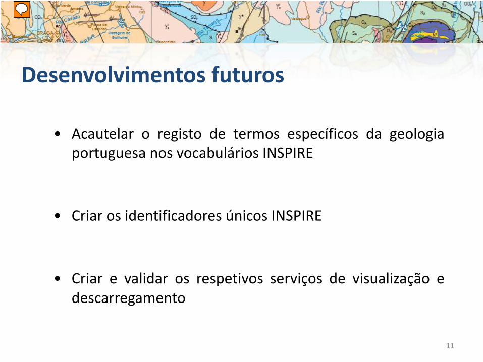
• Acautelar o registo de termos específicos da geologiaportuguesa nos vocabulários INSPIRE
• Criar os identificadores únicos INSPIRE
• Criar e validar os respetivos serviços de visualização edescarregamento
Desenvolvimentos futuros
Presenter
Presentation Notes
�

Anexo III.21 Recursos Minerais
http://geospatialworldforum.org/speaker/SpeakersImages/Lidia%20Quental.pdf
Modelo desenvolvido no âmbito de EuroGeoSurveys e submetido à aprovação INSPIRE baseado em:
a)documentos UE da Iniciativa Matérias Primas e Resíduos Mineiros, b)modelo de dados standard EarthResourceML para Recursos Minerais ec) trabalho desenvolvido no âmbito de projectos europeus
http://minerals4eu.brgm-rec.fr/minerals4EU/